
.gif.a8150e126cebc480193fad2934fe975c.gif)
Torch Tiger
-
Posts
16,347 -
Joined
-
Last visited
Content Type
Profiles
Blogs
Forums
American Weather
Media Demo
Store
Gallery
Everything posted by Torch Tiger
-
Yeah thankfully we've got months and months to go
-
wonder if we stay mostly dry right through the weekend
-
A few too many. Happens
-
Yeah the hubbub over a "ruined" weekend fell apart, looks okay. A few sprinkles/light showers possible but otw no complaints, normal stuff.
-
Heck of a recovery back to summer!
-
light showers quickly escaping east, nice morning underway
-
Holiday fight!!
-
We do need the rain witb potential Steiner summer headed in...take
-
SE MA crushed wow
-
yeah, next weekend cancel
-
soaking, drenching rain for all. congrats
-
Years later we still await Stein reaction emoji. Would save a bunch of posts
-
.jpeg.fc20e4d2bc70acffec95726f686ecc0f.jpeg)
-
Hopefully widespread hail next Friday or so
-
there would be some meltdowns if it were winter
-
Nice dry day. sucks to be southwest
-
Yeah nam drops like 3-6"+
-
wowzers
.thumb.png.298cd0d4143ed144b03788296842baa6.png)
-
Yeah, sounds nearly ideal for the calendar. We've had some terrible May/Junes ofc. July, I'd be a bit triggered with weeks of 70's and 80's.
-
September vibes but strong sun angle and long days. take
-
Endless Coc. Coc vibes
-
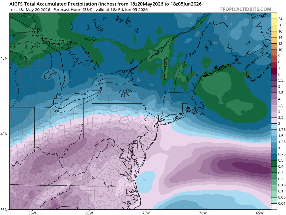
sheeeesh that 18z ai gfs was bone-dry
-
Only +8 higher than '05
-
Yeah maybe beyond that, too.
-
Yeah for sure. Exceeded my expectations a bit tbh
.thumb.gif.f92b16c631a1d15d405ed77b33f0710d.gif)


.png.eeaa849b768aaa97c6287b051f497520.png)
