.gif.a8150e126cebc480193fad2934fe975c.gif)
Torch Tiger
-
Posts
16,399 -
Joined
-
Last visited
Content Type
Profiles
Blogs
Forums
American Weather
Media Demo
Store
Gallery
Everything posted by Torch Tiger
-
stay safe!
-
Gonna be a lot of this

-
In a few short weeks, you'll be sweating to the oldies in that sweltering warehouse oven
-
Plenty of breaks on visible
-
Nice sun-drenched, mild day in Concord MA.
-
coastal
-
Zero coastals on the 6z gfs
-
Seemingly endless mild and dry.
-
much rather cad than coast
-
looks decent, but a few drunks or hookah hitters say it looks May 2005 horrible
-
Horrible
-
It's here! Severe season!!!
-
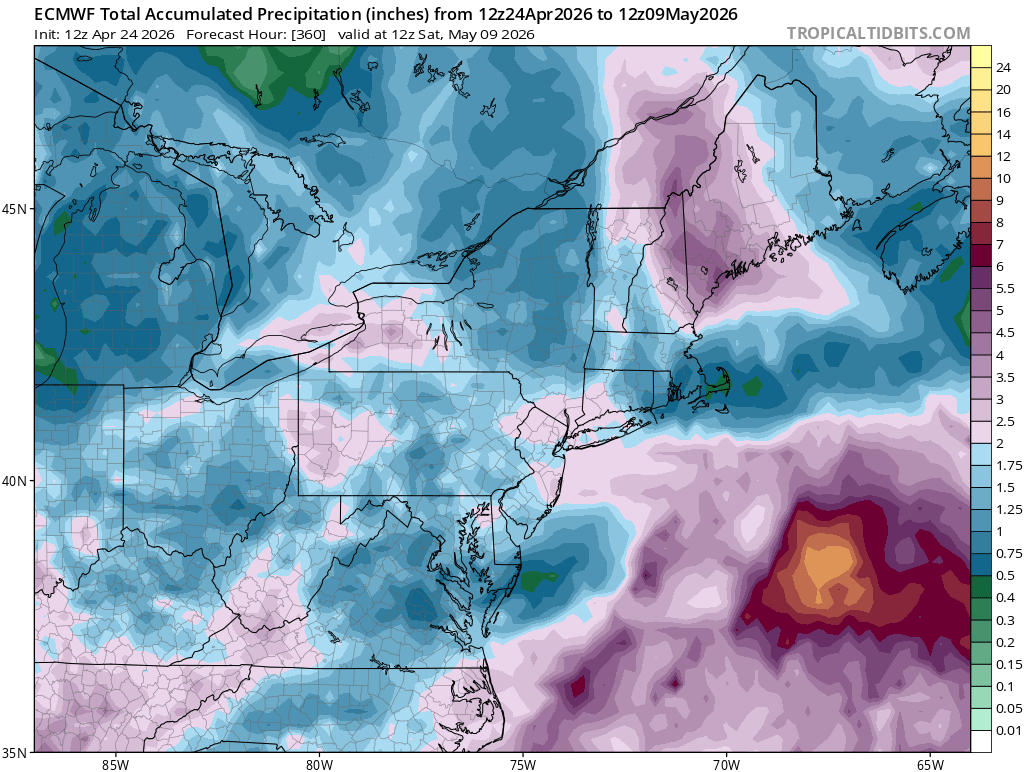
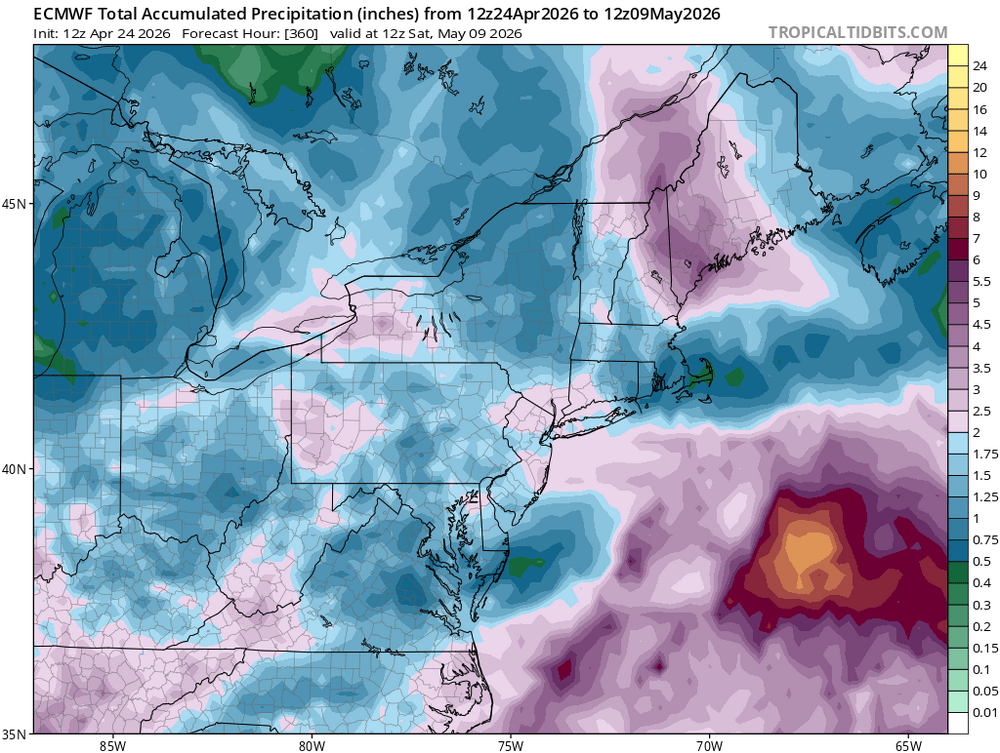
charts! lol
-
It's been nice slightly inland. Feels bad for the immediate coast but that is per usual
-
60's and 70's nearly every day in the "two weeks of rhea" can't make that stuff up
-
-
May looks to start near normal temps. Acatt reeling after last weeks hopes and even outright (reckless) calls for two weeks of rhea
-
remember these?
-
Average is generally low-mid 60's in early May
-
yep acatt way overblown with those death sentence calls and charts last week
-
What a great run of wx in the face of "weeks of crap". Winner day after day
-
What a massive bust by the acatt
-
-
-
Nice dry Sunday, we'll take that.
.thumb.gif.f92b16c631a1d15d405ed77b33f0710d.gif)