
Steve25
-
Posts
727 -
Joined
-
Last visited
Content Type
Profiles
Blogs
Forums
American Weather
Media Demo
Store
Gallery
Everything posted by Steve25
-

Jan 21 - 22 Weekend SE VA and Eastern Shore Snow
Steve25 replied to stormtracker's topic in Mid Atlantic
At least the GFS hasn't had 3 runs showing a monster coastal storm within the past two days lol -
Jan 21 - 22 Weekend SE VA and Eastern Shore Snow
Steve25 replied to stormtracker's topic in Mid Atlantic
- 633 replies
-
- 15
-

-

-
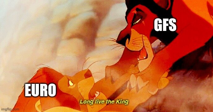
I've been putting it off and trying not to accept this new reality, but I'm officially on board with the GFS as our new king. Euro on its knees begging for the GFS to be merciful with him lol
-
I didn't even have anything left Monday morning lol.
-

-
A huge snowstorm with temperatures in the teens followed by deep winter cold...if this Euro doesn't calm down lol
-
So be it
-
I still don't want a thread until the GFS gets somewhat on board lol
-
Back and to the left
-
Thursday 1/20/22 Stat Padder Discussion and Observations
Steve25 replied to stormtracker's topic in Mid Atlantic
If it indeed did look terrible, there certainly seems to be a consistency between the models with a tad more juice for Thursday looking much worse for the weekend vs the models that look bad for Thursday being more promising for the weekend -
I'm not intelligent enough to understand the connection if there even is one but it does seem like the models that are juicier with the Thursday "threat" are much worse with the Saturday potential.
-
Oh absolutely. I've always kind of felt in the minority in here but I love if it gets just frigid for an extended period with no significant warm ups. I don't even need snow to be satisfied during a stretch like that. Give me some days that stay below 20 and I can go hike, check out frozen bodies of water. I'm all about it. Just when thinking about big snows, getting two 18+ inch storms within 5 days of each other around here is just mind blowing to this day for me.
-
Great stuff! What website is this by chance?
-
Anyone else just have random moments where you think about that week in February 2010 and just how unprecedented it was and how it's something we will almost certainly never experience again in our lifetime? There are so many things I'd trade off in order to experience that week again.
-
Not until the GFS gives a green light
-
Mid-Atlantic forum winter 2021/22 snow totals thread
Steve25 replied to North Balti Zen's topic in Mid Atlantic
Parkville: 01/16- 3" Total- 10.5" -
Do these snow totals get added to the official yearly totals? Or is it whatever's left on the ground at the end of the storm?
-
Genuinely unsure if I should shovel or not. Around 3 inches. If it's ultimately going to flip to rain and warm up significantly overnight, is it even necessary to shovel? Not sure what the morning is going to look like out there.
-
Enjoying every minute of the snow. I know the temp spike is inevitably coming, and that were all still itching for that big storm, but got to take in these experiences. It looks like a lot of you have today which is great! Only other thing, am I the only person that just refuses to measure in the middle of a storm? There's just something in me that makes it feel like cheating. I just have to wait until the end result.
-
At least it's going to be cold. I can always take comfort in that.
-
For me it has nothing to do with a jinx and everything to do with just being way too premature. I feel the storm threads should be there for when there's strong consensus between the models, or realistically around 3 days before a potential storm. With the way the posts fly in here, 3 days would give plenty of tracking and discussion. Like right now the discussion in here is that all possibilities are still very much on the table. Until that changes to something a little more concrete, I think the storm thread should hold off, just logically speaking.
-
What a weenie run. Massive storm and unreal cold! Fingers crossed!
-
The number of times the message in here has been that the long range looks bad and it turned out fine and vice versa is high. I wouldn't get all overwhelmed by the long range.
-
I can't be the only person in here that takes at least a little joy out of the fact that all the 95 cities are going to fail with this one. Seeing the mountains up to Buffalo get big snows is not anywhere near as painful as a storm skipping us over but then bombing out for Philly, NYC, and Boston.
-
Weather forecasting definitely is tough. The "wishcasters" and "hypecasters" make it look a lot tougher than it should be sometimes though. This storm is a perfect example. The models got a grip on this storm around Tuesday/Wednesday and really haven't changed course much at all. It's been plastered in front of us for several days, yet people have been clinging to the hope that favorable shifts would occur. By no means am I saying that's a bad thing. Things can always change, especially with the weather. The point is, one could've made a general "forecast" based on what the data was spitting out all the way back on Wednesday, and although not all details would be pinned down, you could've given a fairly accurate overview on what was coming. Getting twisted up between what looks like a realistic outcome and what you personally want can make any forecaster look bad. Good Meteorologists keep those two things seperate for the most part.


