SnowDreamer
-
Posts
451 -
Joined
-
Last visited
Content Type
Profiles
Blogs
Forums
American Weather
Media Demo
Store
Gallery
Everything posted by SnowDreamer
-
In Fairfax: 8.2” Up 1.2” in 30 mins. I might need an apostrophe at this rate…
-
In Fairfax near GMU… 7” on grass & car 4.5” on unplowed road LOTS of broken branches (one damn near hit me while I was measuring). Braddock is a disaster despite lots of plowing.
-
Snow in fairfax seems to be pretty thick, and is sticking to branches well. I’m thinking power outages in jackpot areas.
-
Snow slowly strengthening into the deathband in fairfax. Roads have powder coating
-
3k also shows slight bump NW, but it was farther NW than 12k last run, so that checks out.

-
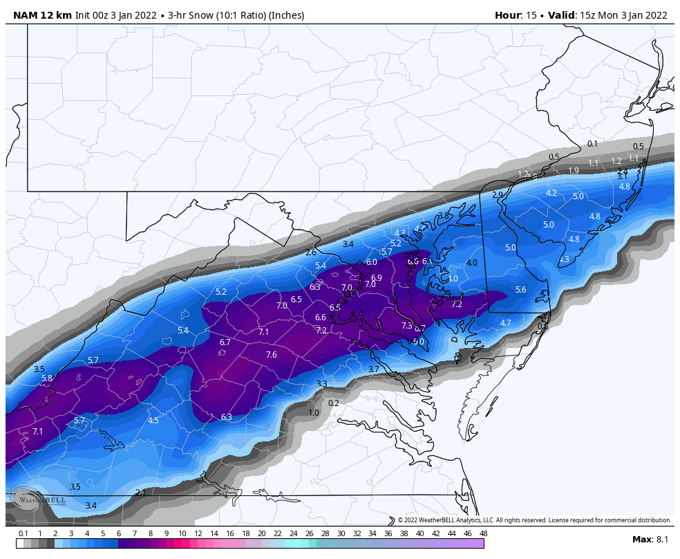
a 3 HOUR panel tomorrow morning. Implies widespread 2" rates
-
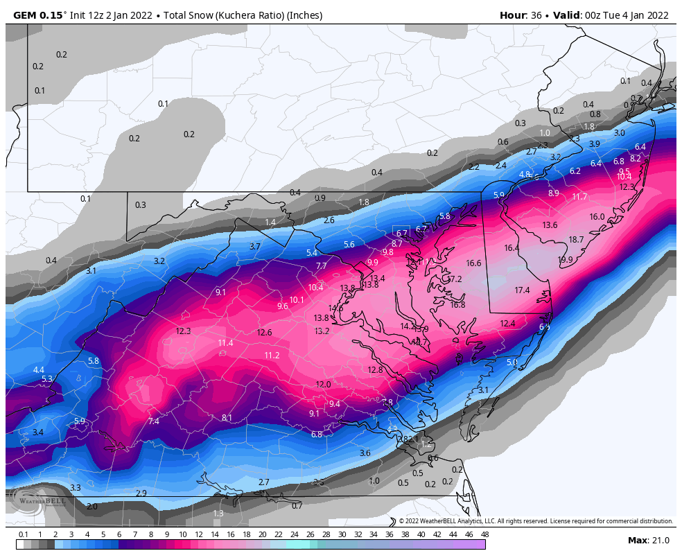
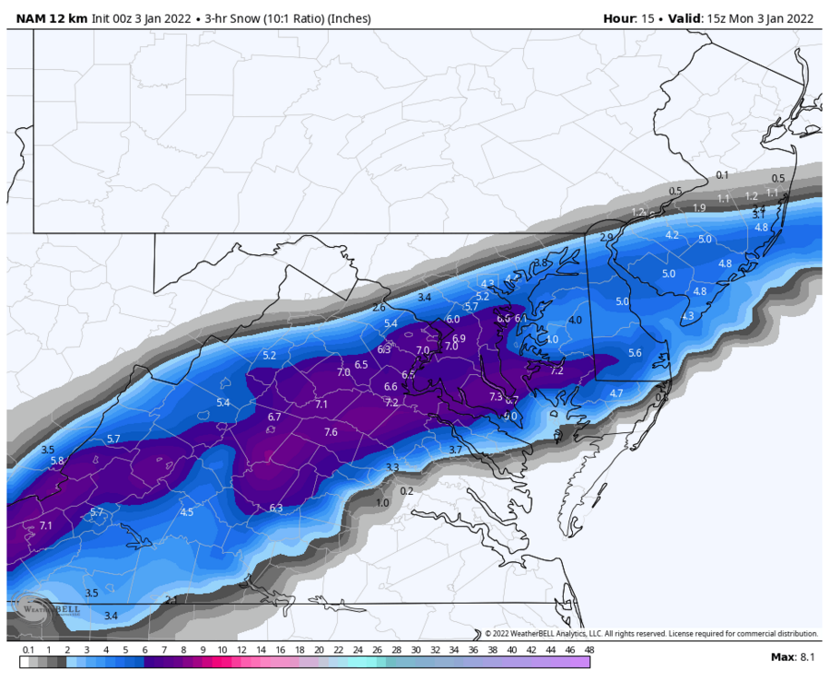
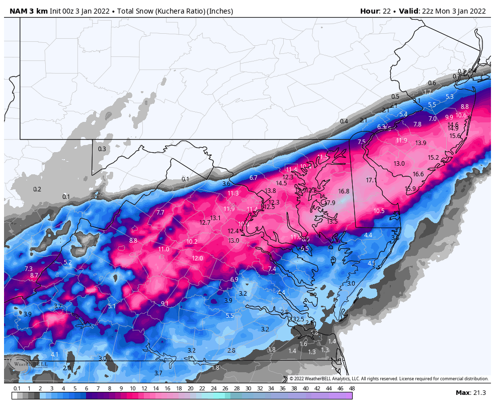
The NAM is CRUSHING central VA at 13hrs
-
I personally find the precip type probabilities plume to be useful in looking for transition times in coastals!
-
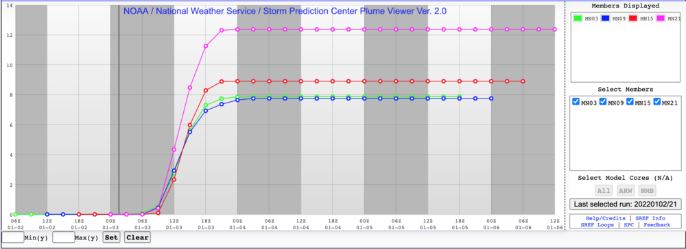
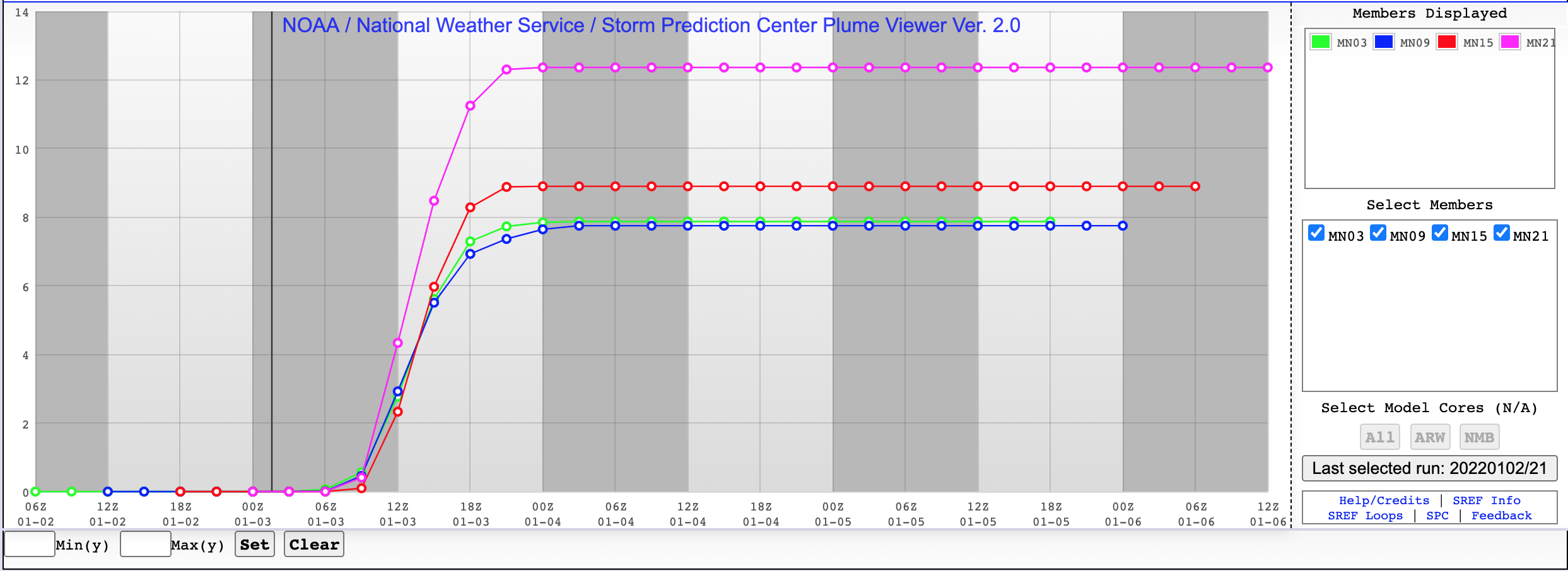
SREF mean over last 4 runs @ DCA. The pink line is most recent (21Z).
-
This is the 15Z SREF plume you're talking about, right?
-
06Z & 18Z don't run that far out. At least not on WxBell.
-
IMO if he’s riding the NAM hard (which isn’t his explanation), then the 1-3 is fine but a max of 5” anywhere in VA is a standout low against other Mets (and the guidance). The bigger issue some of these guys are taking is that his explanation of low totals due to poor snow:liquid ratio seems unlikely given forecast temps in many areas.
-
57/48… winds now from NNW… DP down 6 in the last hour!
-
A lot of this is known, but here's a CWG article that supports the idea. "Ken Kunkel, a senior scientist with the North Carolina Institute for Climate Studies, has been studying shifting extreme-precipitation trends in the United States for more than 20 years. A study he led in 2009 found an increasing trend of high snowfall seasons along the East Coast, as well as the emergence of a feast or famine pattern, where winters either over-deliver snow or underperform relative to the seasonal average. He said the physics involved in generating heavy snow suggest that climate change could be a factor in recent heavy snowstorms, given that the biggest snowfalls tend to occur when the air is near freezing, which enables the air to hold more moisture. A complicating factor, though, is that increasing air temperatures may be making what would’ve been a snowstorm 20 years ago into a cold rainstorm. Increasing sea-surface temperatures, Kunkel said, are boosting the snow potential of East Coast storms. “The oceans have been warming overall,” he said. “These storms are deriving their moisture from the Atlantic and more moisture is being brought into these storms. That certainly is a big component of it.”" https://www.washingtonpost.com/weather/2021/02/05/snowfall-records-climate-change-northeast/
-
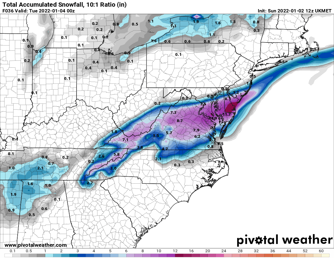
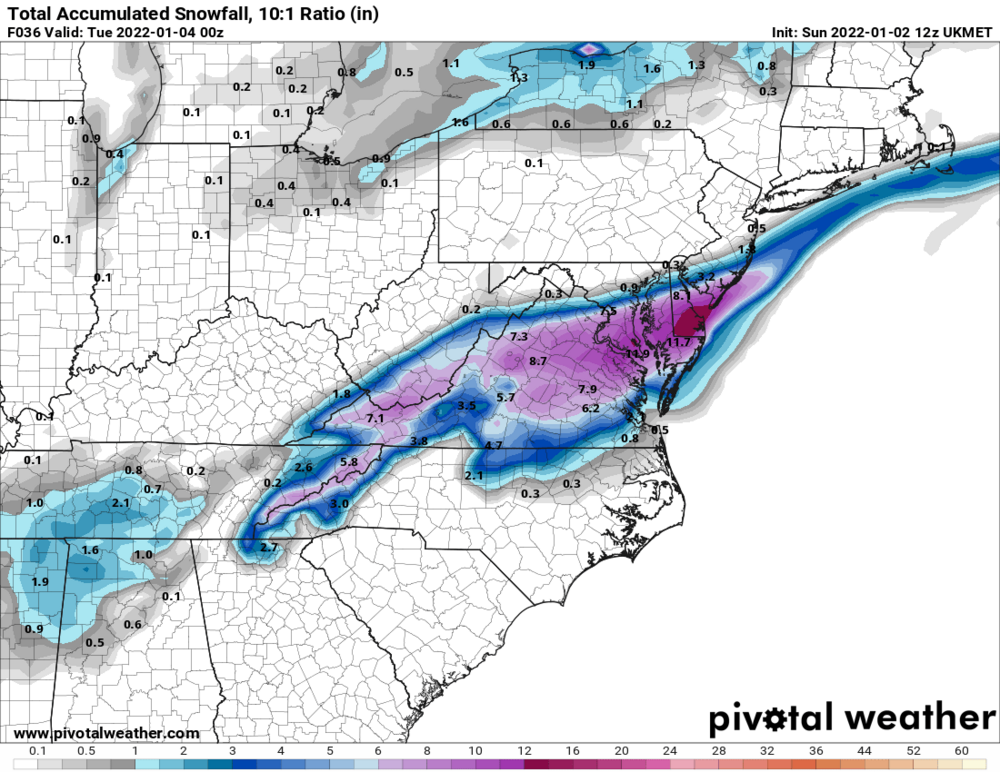
Overall axis of snowfall is quite consistent now across guidance... I'm happy for that! Even the difference between GFS and NAM is now quite small compared to 18 hours ago.
-
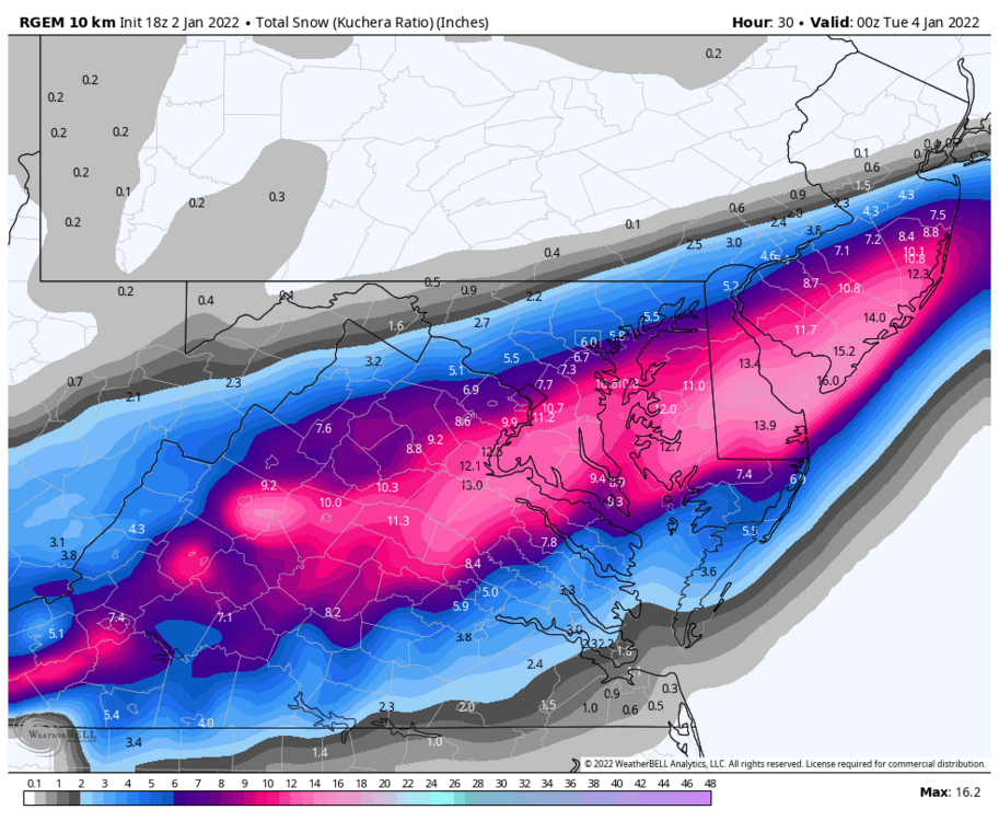
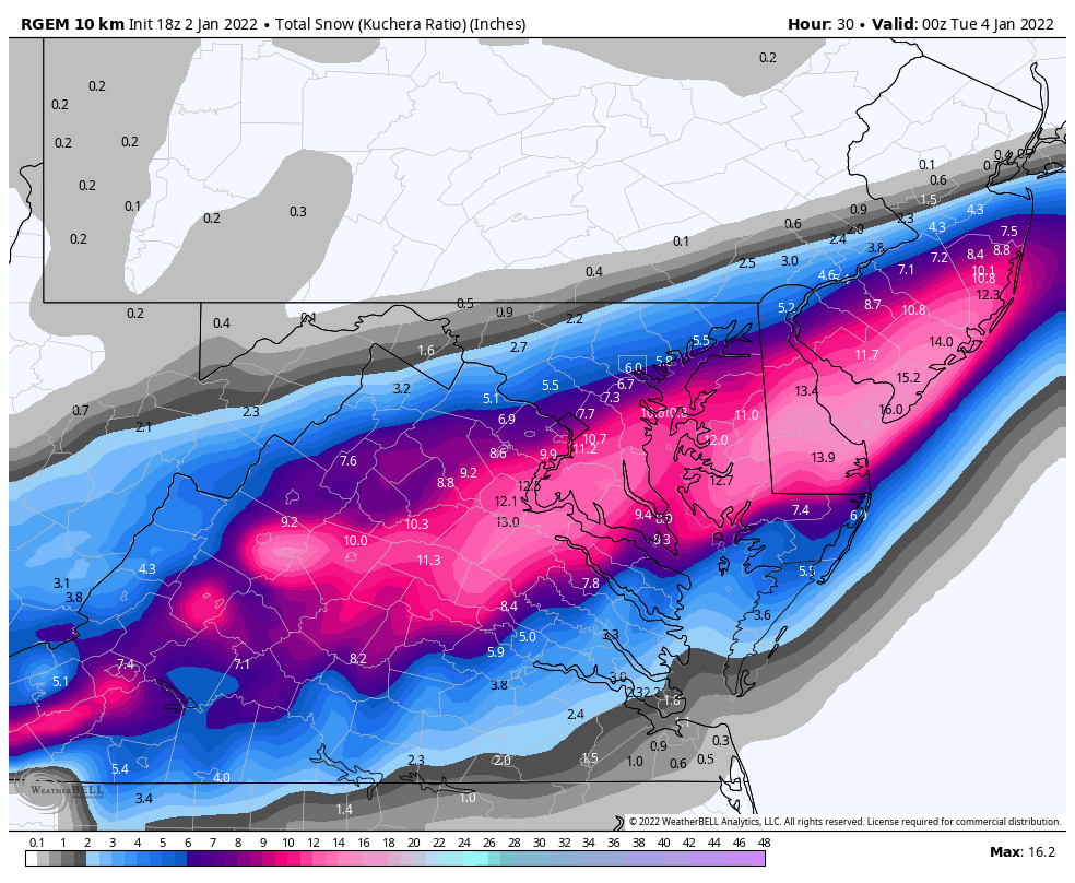
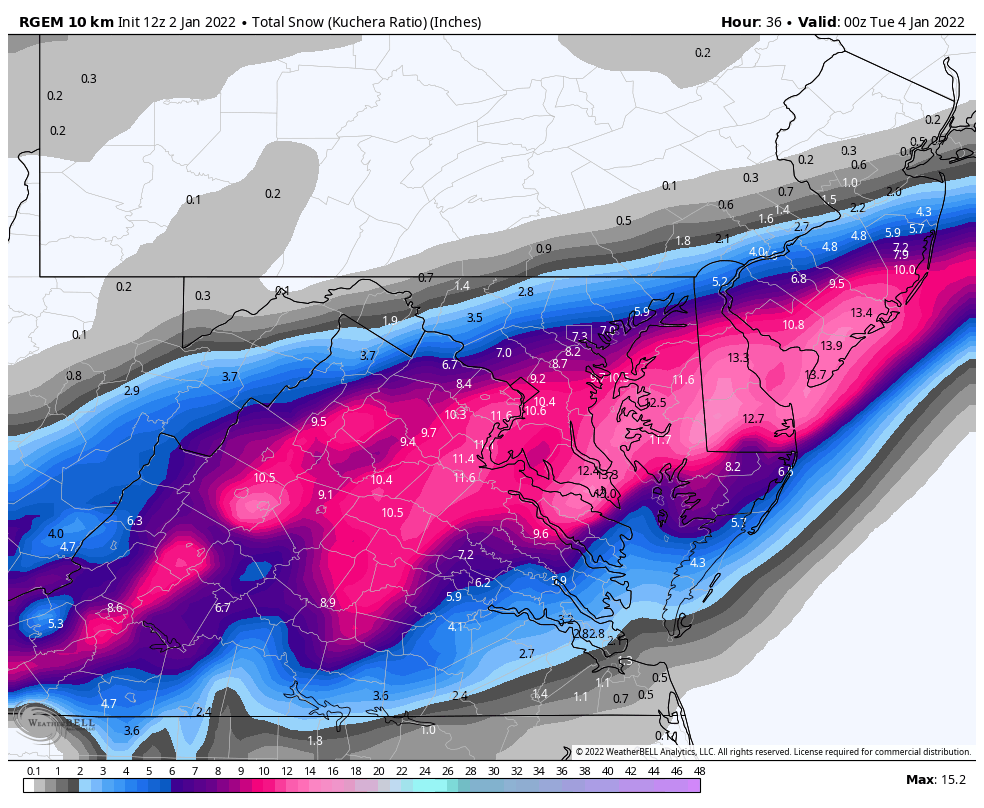
RGEM is pretty similar overall, narrows the jackpot zone on this map

-
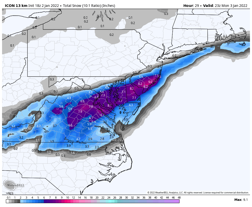
ICON is an improvement for all


-
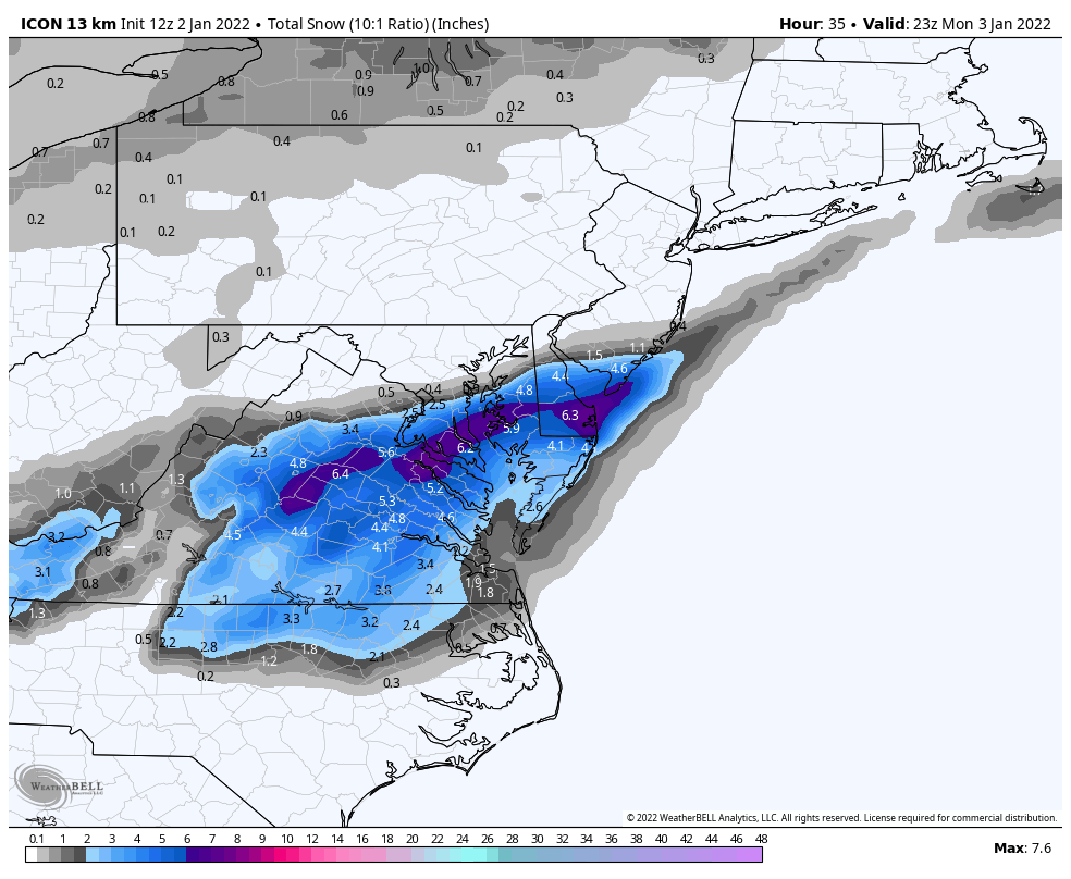
ICON still running but definitely going to have a NW tick to totals. A bit more than the NAMs it looks like through hr19
-
62/58 here in ffx and making a drink before the ICON starts...
-
8” as the “low end confident number” in South DC and DCA? That’s ballsy!
-
Yeah, it does a bit, but here's the 00Z for comparison on the big progress.
.thumb.png.828d56a843224a7095239ea428739f94.png)
-
A LOT better than 00Z but not there yet.
-
FWIW, 12ZGFS and 06ZEURO get DC up to ~65F today before the crash. So at least there's that.
-
It's conservative, but not an unfair play if you're willing to upgrade to warnings in 4 hours.
-
CMC takes another solid step NW, looks pretty close to GFS now with lower totals.


.png.77250381ae73d28d039c896176b8c901.png)