

cptcatz
-
Posts
875 -
Joined
-
Last visited
Content Type
Profiles
Blogs
Forums
American Weather
Media Demo
Store
Gallery
Posts posted by cptcatz
-
-
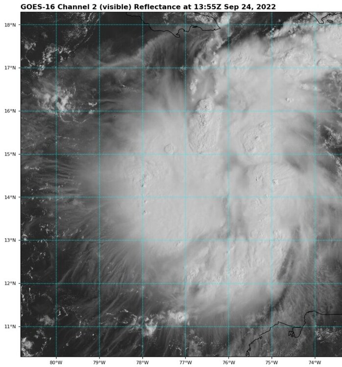
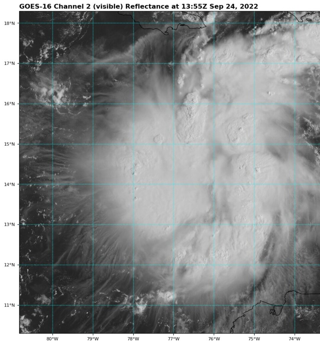
I mean is this even a cyclone?

-
 1
1
-
-
Looks like convection is trying to wrap around a center at 14.5N 76W. That would be a full degree north of what recon found.
-
2
-
-
Euro saying Miami gets hits, GFS saying Tallahassee gets hit. What a range.
-
1
-
-
9 minutes ago, Tezeta said:
The cone is always the same size, lil homie
No it's not, lil homie.
-
14 minutes ago, Normandy said:
You can see right now on satellite what the GFS is trying to do. There is an MLC further SW that is very apparent, however the current LLC ain't going away. Brand new convection already firing near it.
Agreed. That's a nice little pop of deep convection right next to the center while it looks like the convection to the southwest is fading away. Fiona did the same thing and ended up keeping its LLC. Wouldn't be surprised to see the southern Florida landfall like Icon is showing.
-
3 minutes ago, SnowGoose69 said:
He may have meant from the Atlantic side...after Betsy in 65 it seemed majors hitting FL from the Atlantic side became increasingly more infrequent outside of Andrew and 2004
It's nice to give him the benefit of the doubt but that makes no sense since he specifically said anywhere in Florida, plus this storm is coming from the Gulf side so if that's what he meant it doesn't apply to what we're dealing with here lol
-
1
-
-
1 minute ago, TPAwx said:
Interesting for sure. We’ve beaten the Tampa thing to death, but it’s pretty rare for a major to landfall anywhere in Florida.
Is it? Off the top of my head in the last 20 years there were Ivan, Charley, Jeanne, Wilma, Michael, and Irma all landfalling as majors in Florida.
-
 2
2
-
-
Four cyclones now in the basin. Anything from ldub?
Race is on between 9 and 10 for Hermine and Ian.
.png.1f76aea7728db1365ed43f4f89f4a6a5.png)
-
1
-
 1
1
-
-
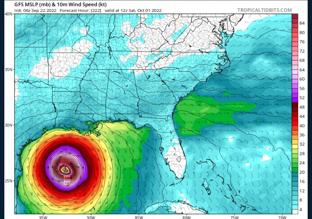
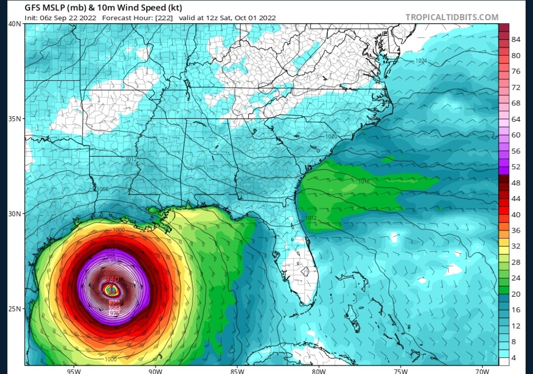
06z GFS with worst case scenario for Tampa. Good thing that won't happen since based on what I read here Tampa can't get hit?
-
2
-
-
3 minutes ago, StantonParkHoya said:
We’re gonna spend 100k words on a thread for a Cat 1 that barely makes landfall
Anyone know what the longest thread is for an invest prior to becoming a TD? Gotta think this is getting there.
-
1 hour ago, Ed, snow and hurricane fan said:
If any two models said I'd be paying the full deductible on my homeowners' insurance in 5 days, I want the German and Canadian models. Sort of pointless except for considering wide areas before a center forms and becomes dominant.
How about now that king euro shows the same thing...?
-
1
-
 1
1
-
-
CMC and Icon nearly identical with the eye sitting over my house in 136 hours and TS winds arriving in 120 hours. This could come as a fast surprise to people here in southeast Florida.
-
12z Icon making a sharp northeast curve and goes right through Miami/Broward County. Will be very interesting to see if the 12z GFS follows suit.
Edit: 66 hours in and GFS is also way more northeast than the last runs.
-
06z Euro stronger and a tad to the northeast vs 00z. Ends at 990 mb just west of Jamaica.
-
2
-
-
Regardless of where this goes, all models are showing this to be an enormous storm. The surge could be historic and possibly worse than Katrina, especially if it stalls in the gulf as the GFS is showing.
-
Recon recorded 119 knots in the SE eyewall and 933 mb. NE eyewall pass should be good.
-
Euro sticking to landfall around Ft. Meyers. This storm looks far bigger than Charley and impacts look to be throughout South Florida including Miami metro, similar to Irma.

-
2 hours ago, olafminesaw said:
That really is the norm for landfalling gulf storms. Particularly in October
2020 would like a word with you
-
1
-
-
58 minutes ago, jbenedet said:
The latest euro runs are just the next iteration of the pattern evolution we have seen over the past month. At a synoptic level, you have to benchmark this system accordingly. Sure it could end up quite different, but this makes the most sense right now; minus all the details.
The EPS shows the UL trough interaction by day 5, so a key feature is within model accuracy view
Do you think the trend is toward the southern Florida peninsula? That 00z Euro run hit my house bad in Palm Beach County. Same track through Florida as Wilma.
-
12 minutes ago, Normandy said:
Why would models be any good a predicting medium to long range cyclogenesis with accuracy? That's an extremely big ask, especially for something so small in scale like TCG. The best approach (which many DO NOT take) is to wait and see before making grand nonsensical statements calling a season dead. Not calling you out cptcatz at all, just saying a statement in general.
Oh and I'll also mention Idub should get the screename change to iWeenie.
It's an interesting conversation. Your question of why would models be any good a predicting medium to long range cyclogenesis with accuracy could be answered with "why shouldn't they?" These models are run on some of the largest supercomputers in the world using so many data points from satelites, balloons, airplanes, bouys, etc., and they still can't figure out what's happening in only a few days?
-
1
-
-
This second post just proves my first post so well. Only two days ago models were pointing at no more storms on the horizon and September ending with 0/3/3 (the 5am NHC forecast on Sunday did not forecast Fiona to be a MH).
Only two days later, we are sitting at 1/3/4, with another likely MH forming next week in the Caribbean, and possibly another TS forming near Africa, and could be ending the month at 2/4/6.
Just goes to show how crap the models are at medium/long range cyclogenesis.
-
2
-
-
1 hour ago, Normandy said:
One of the most threatening storms from a model perspective I can remember in the last five or ten years. Models forecasting a large and extremely intense recurving hurricane that would bring monster winds hundreds of miles inland.
Sorry to get off topic but I don't think anything will ever beat Irma from that perspective. That was consistent model runs for like a week all showing ~880 mb landfalls.
-
2
-
-
48 minutes ago, Superstorm93 said:
Massive spread on the 6z EPS.
May come down to just how quickly this can organize over the next 72 hours.
Seems euro has been too far west all season and is always correcting back east to align with the GFS. If that's the case here, looking like the eastern Gulf Coast or Florida peninsula would be the target zone.
-
1
-
-
3 hours ago, SnoSki14 said:
A combo of storm surge & inland flooding is what causes the most damage and kills the most people.
If you're interested in wind then look at tornadoes as only Cat 4-5 storms will produce anything close to an average twister.
I love watching tornado videos. But there's a big difference between tornado coverage and hurricane coverage. You can't get inside a tornado. You can get inside a hurricane.


Hurricane Ian
in Tropical Headquarters
Posted