

cptcatz
-
Posts
876 -
Joined
-
Last visited
Content Type
Profiles
Blogs
Forums
American Weather
Media Demo
Store
Gallery
Posts posted by cptcatz
-
-
20 hours ago, Hoosier said:
Puerto Rico getting hit with Fiona counts as uninteresting?
I don't mean to downplay the catastrophic flooding that is occuring in Puerto Rico but from an armchair meteorologist perspective, flooding isn't that interesting to me. Hurricanes interest me because of the wind. I eagerly await Josh's videos, but honestly an 85 mph cat 1 strike isn't the most interesting.
-
 1
1
-
 1
1
-
 1
1
-
 2
2
-
-
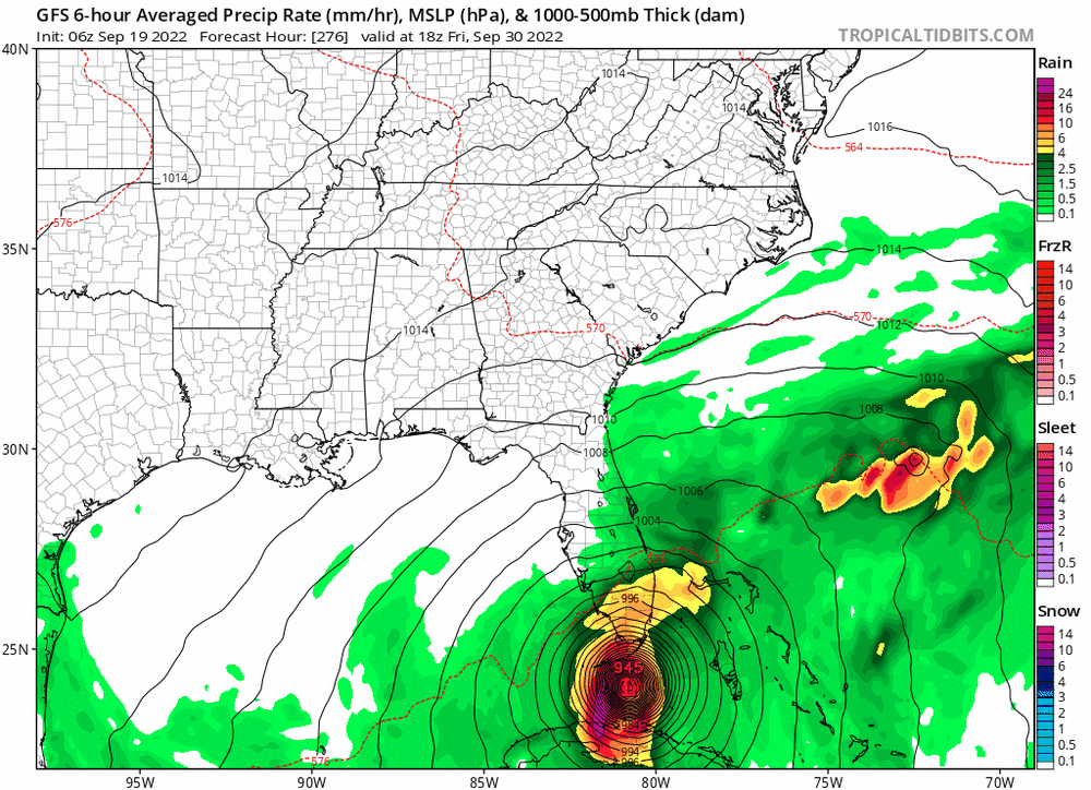
GFS showing Matthew 2.0 except this time riding up inside the coast instead of off the coast. A MH eye riding up through Dade, Broward, and Palm Beach counties would have to be one of the costliest and most destructive paths a storm could take.
-
1
-
 1
1
-
1
-
-
32 minutes ago, Hoosier said:
What are y'all talking about? It's been an active September.
0/3/3 on September 18 with nothing else on the models through the end of the month is a tad above average in number of hurricanes and a tad below average in number of named storms. I wouldn't call that "active". Not to mention the uninteresting paths of all three.
-
1
-
-
53 minutes ago, ldub23 said:
Boring this year for sure. Hurricane season 2023 will live on in peoples memories for years to come. Mark that down.
Seems like the active and quiet years go in cycles. We had a nice stretch of active years. This might be the start of a quiet stretch...
-
31 minutes ago, ldub23 said:
Here is a possible 1 storm season storm. Possibly another GFS phantom but its worth seeing if any other model will show this.

Yeah this Wilma/Matthew/Michael/Sandy track is what we're all looking to at the turn of the month. CV season was a flop, bring on the western Caribbean season!
-
1
-
-
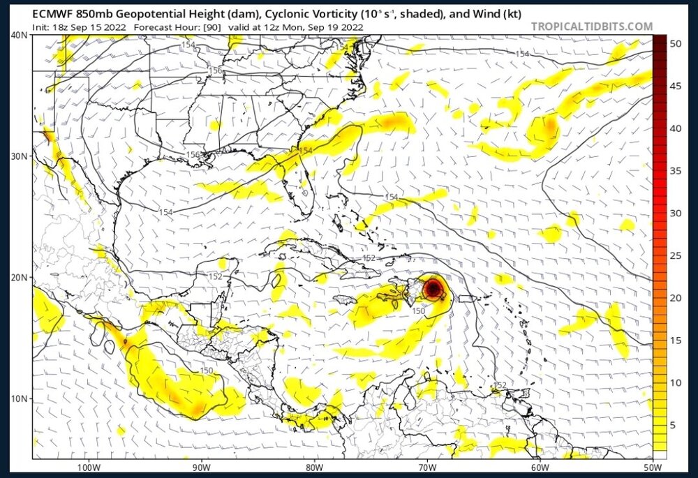
8 minutes ago, MANDA said:
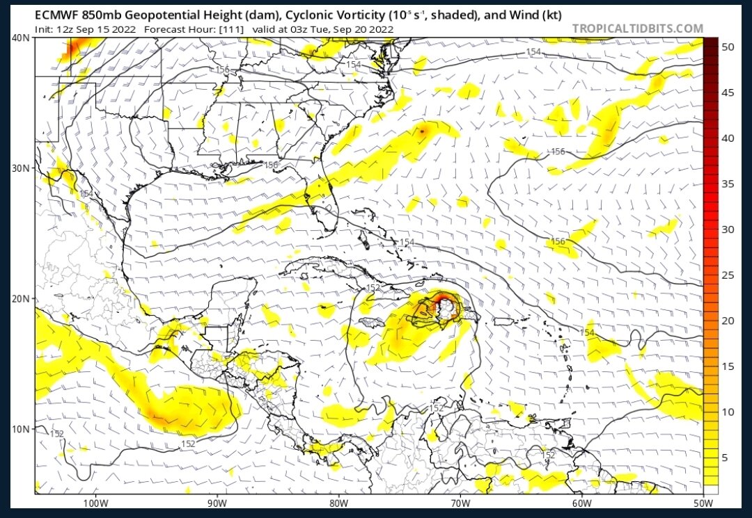
Watching satellite last few hours looks like outflow is becoming established, especially to the north and east. No doubt in my mind Fiona is getting better organized and aligned. Satellite shows a developing hurricane in my opinion.
It's interesting that it does like nice on satellite yet recon is finding a mess with high pressures and unimpressive winds. Maybe once it gets organized it will intensify quickly?
-
6 minutes ago, StantonParkHoya said:
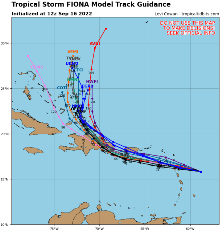
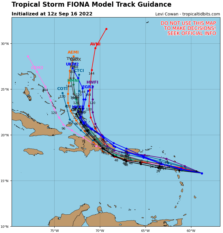
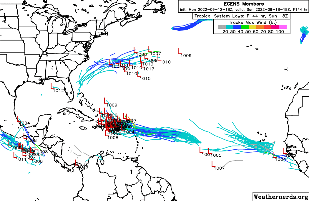
All of the Euro ensemble solutions that threaten US landfall basically dissipate Fiona over Hispaniola which allows it to survive and get caught up in the westerlies flow.
It still gets caught by the mega trough later on. Low probability outcome.
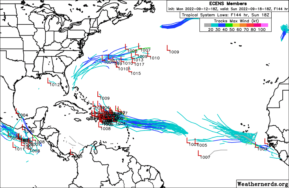
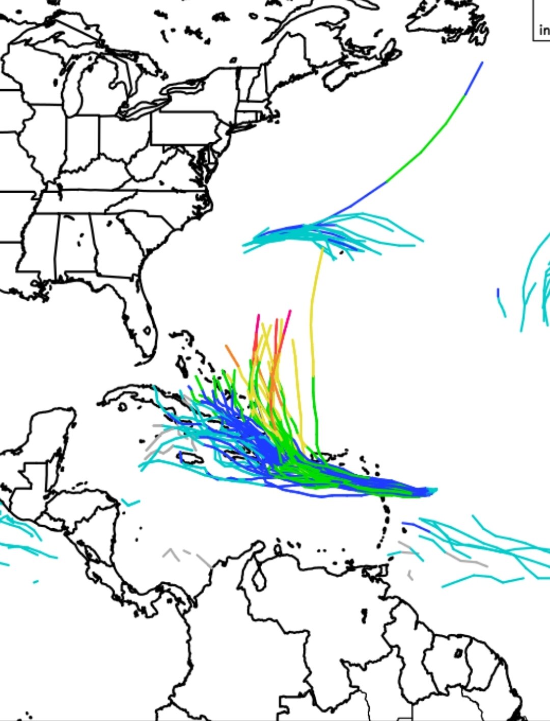
I don't think it's as low probability as you say. Fiona is a mess and significantly further south than models thought right now. It would need to make a big turn to the northwest right now if it's gonna miss the 10,000 foot mountains of Hispaniola. Most euro ensembles bring it right over the spine of the island as opposed to the GEFS members which bring it over the eastern lowlands or even the Mona Passage. On the nowcasting, I'd keep looking at how far south and west it gets before making the turn north towards Hispaniola. Could get interesting.
-
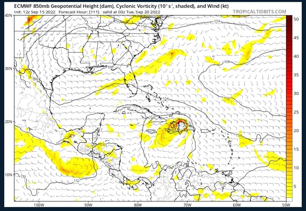
We really won't know the long term track until we know how it gets past Hispaniola. The models are pretty much all showing it sliding just east of the mountain range with minimal disruption. If these models were 20 miles west, it would mean an entirely different outcome.

-
Looks like more members of the 06z EPS stay weak after Hispaniola and continue northwest. Getting shredded by the mountains would be the best chance for a US strike...
-
06z Euro goes ham dropping the pressure from 990 to 979 in the last three hours right after coming off of Hispaniola. I assume this would shoot out to sea.
-
18z Euro ends with the center crossing Hispaniola on the eastern side of the island which is relatively flat, as opposed to 12z run which crossed right overv the mountains. If it can get through the Mona Passage or just skirt the lowlands of the island, that would make a huge difference in the outcome. You can see here what that tiny difference makes.
-
1
-
-
Euro and GFS both playing catchup to CMC lol
-
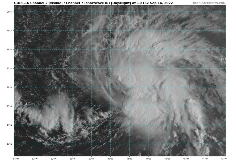
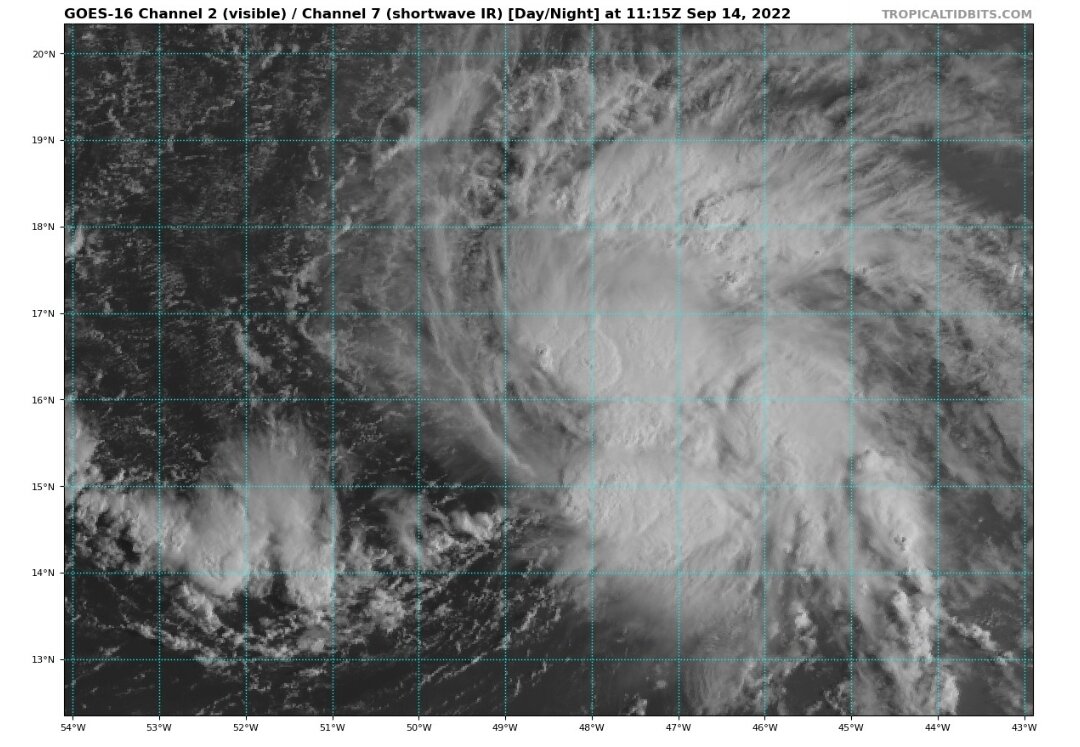
Not sure what difference this makes but the strongest convection has moved a full degree south over the last few hours. At the beginning of the TT loop (16:05z) the strongest convection was between 16-17°N. At the end of the loop (20:55z) the strongest convection was between 15-16°N.
-
I'll give models credit for telling us where an established storm will go in the short term. But it's pretty crazy how bad they are at forecasting cyclogenesis. I wonder what the scientists/programmers can do to help that.
-
2
-
-
Ok maybe I spoke too soon on GFS taking it OTS
-
12z runs we now have GFS and Icon curving OTS east of the Bahamas while CMC brings it south of Florida into the Gulf...
-
Should be an interesting forecast discussion with so much uncertainty in these models.
-
2
-
-
Looking really close to a TC if not there already
-
1
-
-
Upgraded to code orange.
P.s. for those that can't post files, you need to go into your settings, click attachments, and delete your old ones. You have a storage limit and have run out of space.
.png.e2baf9fdd5be50f378d3ab2d8cb92055.png)
-
3
-
-
18z Euro and EPS getting interesting
-
3
-
-
18z GFS is the first run in a while that actually produces a bonafide storm, and one that crosses over the Florida peninsula. We'll see if this sticks or was a one-off.
-
Today marks the peak of the season and the September 10 12z runs are in and GFS and Euro both show no cyclogenesis throughout their runs. I wonder how many other September 10 runs have shown nothing.
-
1 hour ago, Hoosier said:
That is somebody dying from the cold because the power went out.
Tell me how many people who stayed at home died from storm surge flooding in Katrina. Hint: it was a lot.
And the power went out because of the snowstorm...
It's really no different than saying the deaths from Katrina were because of the levee breaches and pump failures. Not sure how power going out in a snowstorm is any different than storm surge causing a levee breach.
-
8 minutes ago, yoda said:
Yes... but that usually means a mess of a system or just tropical storm stuff
Umm late season homebrew has produced some monster storms including the lowest pressure ever recorded in the basin (Wilma) and one of only four cat5 landfalls on the CONUS (Michael).


2022 Atlantic hurricane season whining/banter
in Tropical Headquarters
Posted
I love watching tornado videos. But there's a big difference between tornado coverage and hurricane coverage. You can't get inside a tornado. You can get inside a hurricane.