

cptcatz
-
Posts
876 -
Joined
-
Last visited
Content Type
Profiles
Blogs
Forums
American Weather
Media Demo
Store
Gallery
Posts posted by cptcatz
-
-
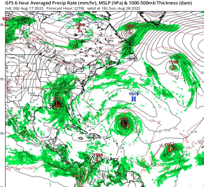
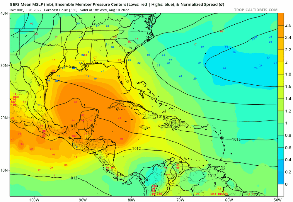
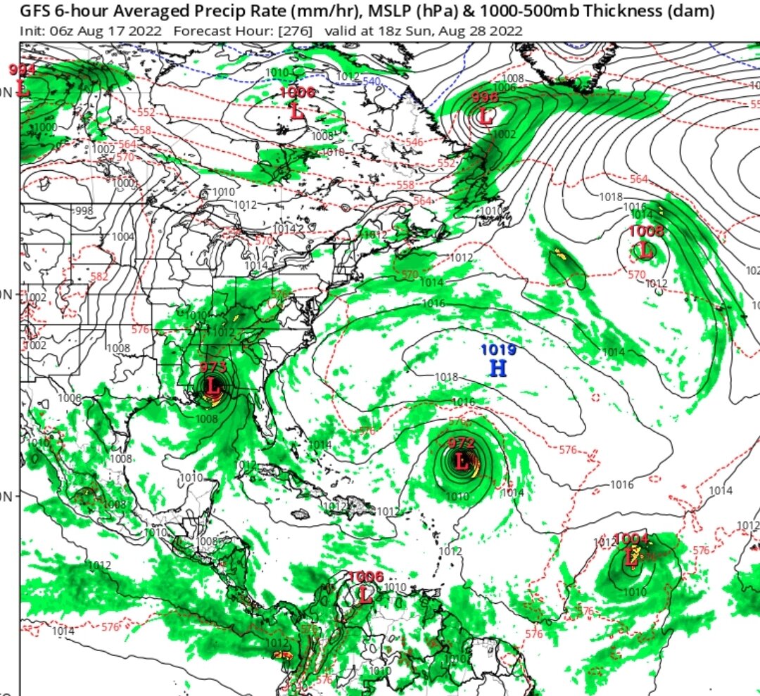
GFS operational may have eased up but the ensembles still rock Florida and the Gulf Coast in this mornings 06z run.

-
 4
4
-
-
^GEFS goes ham on south Florida. August 25 will mark the 17 year anniversary of Hurricane Katrina making landfall, the last time a hurricane has made landfall on the east coast of Florida...
-
1 hour ago, ldub23 said:
Lets see what it looks like at 06Z. Just need the wheel to be a bit stronger.
06z goes just as nuts
-
1 hour ago, ldub23 said:
12Z the major hurricane turned into a 1010mb nothing. 2 other weak lows. For peak season this is rather pathetic. There is also a potent TUTT which is no doubt why the monster cane turned into a tame teletubby.
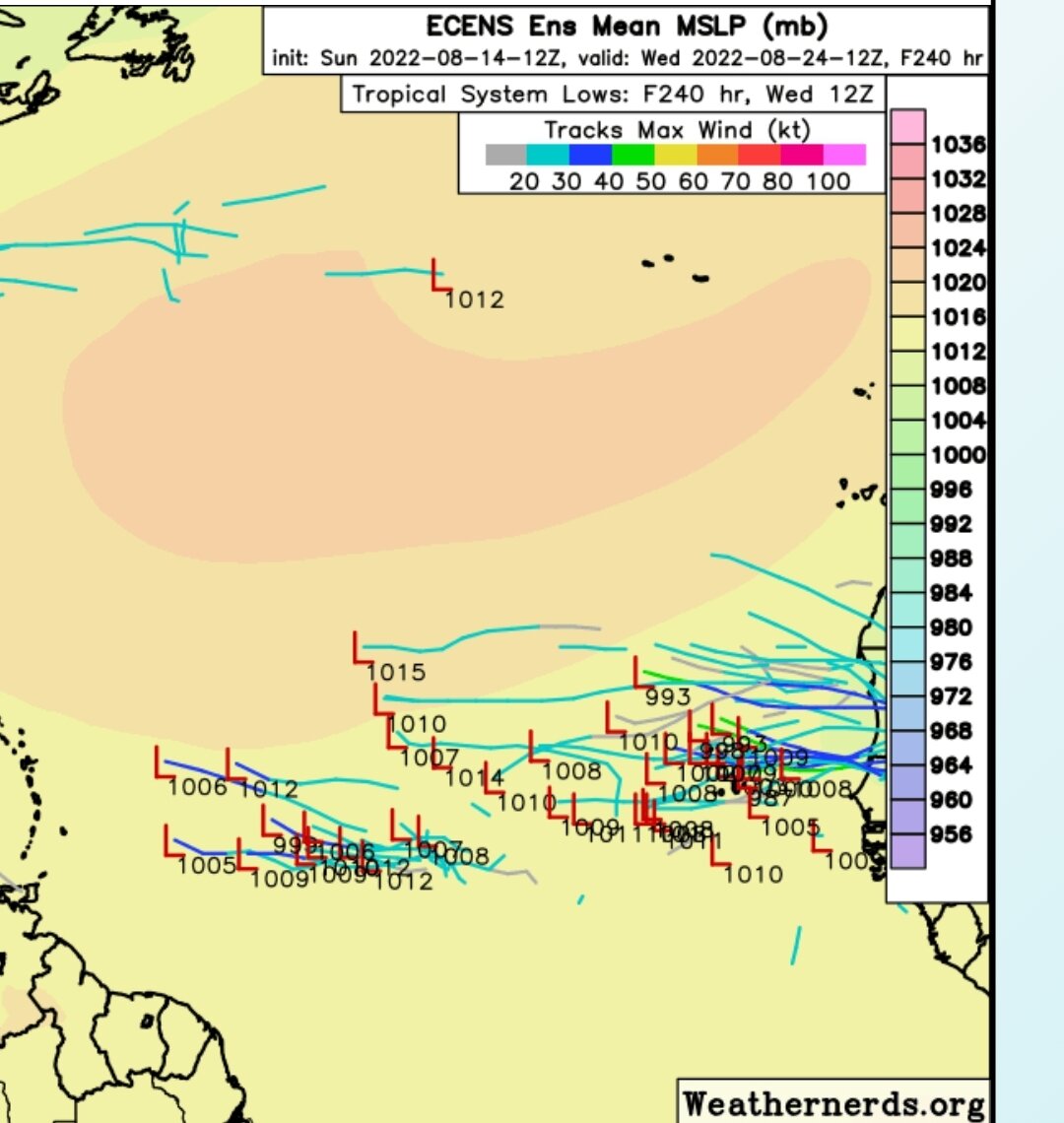
The 12Z GFS ensembles are still blasting the east coast...

-
1
-
-
2 hours ago, ldub23 said:
0Z not all that thrilling for phase 2 and season peak. Hints and signs though!!
Aaaand 06Z back to showing 3-1-1 in the MDR by end of August.
-
1
-
-
Looks like Euro/EPS and GFS/GFES are both in agreement that potentially three waves could develop by the end of August. Waves come off around Aug 20, 24, and another around the 29th that both models are seeing. I suppose we're gonna be sone quietness from ldub...
-
1
-
 1
1
-
-
Here we go, the MDR is waking up
-
1
-
-
12z euro sticking with that wave...
-
1
-
-
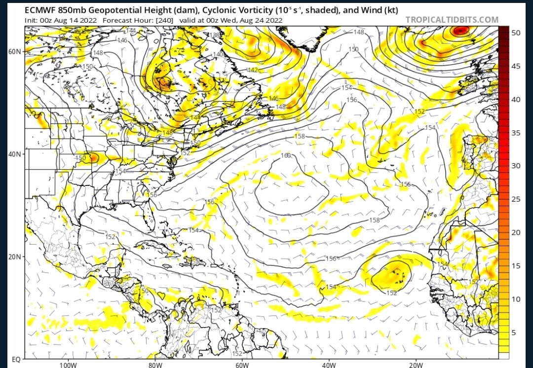
Euro/EPS and CMC both seeing a solid wave emerging Africa in 10 days. Gotta see if they stick with it and if GFS gets on board, maybe this will finally be the start of the season.
-
2
-
-
Now this might be the most interesting thing a model has shown this season, even if it may be 384 hours out...

-
1
-
-
1 hour ago, ldub23 said:
This is the peak of the season? Nothing?
No, August 8 is not the peak of the season. It's not even a month away from the peak of the season. Try again.
-
1
-
1
-
-
10 minutes ago, Ahoff said:
Rooting for hyperactive seasons is weird considering the increased risks for death if the storm hits land.
Why are any of us on this website if we don't enjoy watching the extremes of weather? The way I see it, it makes no difference what you root for since it has zero impact on what will happen.
-
2
-
 1
1
-
-
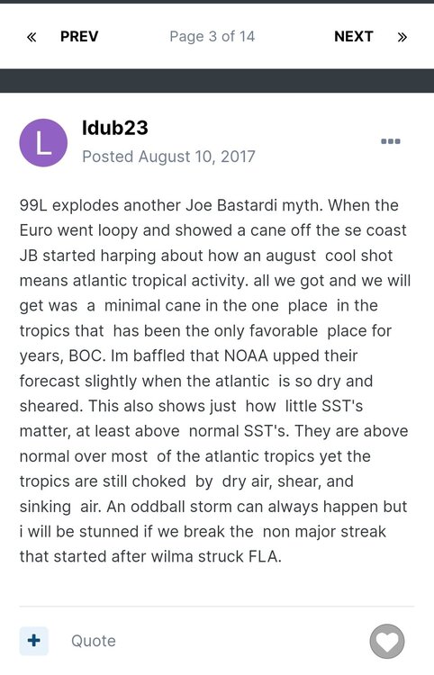
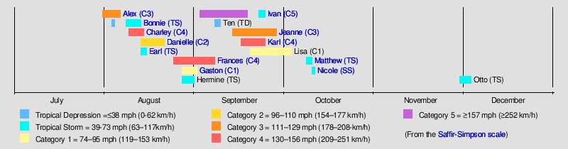
Can't wait til ldub eats his/her words. I'm just gonna leave this post here from August 10, 2017
-
8
-
-
7 hours ago, bigtenfan said:
Funny thing about this forum. I can always tell what the latest turn of events is with regard to the Atlantic Hurricane Season by who has the last post
If the last post is from IDUB then the latest thinking is bearish.
If the last post is from Cptcatz thanthe latest thinking is bullish
lol I didn't think I come across too bullish. But...
1 hour ago, ldub23 said:The good news and the bad news.

The good news is both the GFS and Euro develop a very weak low that might be a short lived TD/TS. But then they run into very unfavorable conditions in the west atl and poof. This overall pattern remains horrific for anything worth following. Gigantic low in the central ATL plunging more dry air into the tropics. Mega trof remains entrenched along and off the east coast. Nothing fast and furious about this pattern. If that low locks in then there is no hurricane season. Looks like the MJO and the moisture is still locked and loaded in the east pac. Not sure i have seen a worse looking map in mid AUG for tropical development. For whats its worth that super central atlantic low should cause additional warming in the tropical sst's.
I'll do my part with a bullish response here. Models are starting to come into agreement that cyclogenesis will occur in about 4-5 days. Then you're talking about what conditions might look like in 10+ days. Models have zero idea what conditions look like 10 days down the road. Whenever I think of that, I always go back to Dorian. Here were the EPS 10 day ensembles:

-
1 hour ago, ldub23 said:
This is 1954 like if it happens. JB-o-meter hasnt mentioned it yet and will need to see it on the Euro as well.

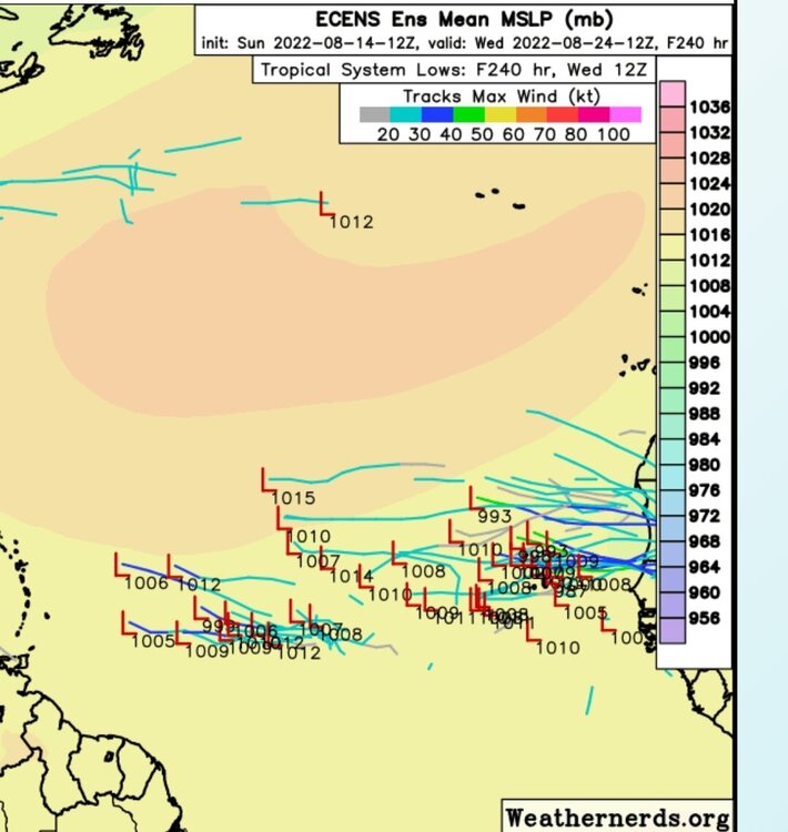
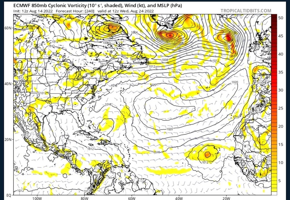
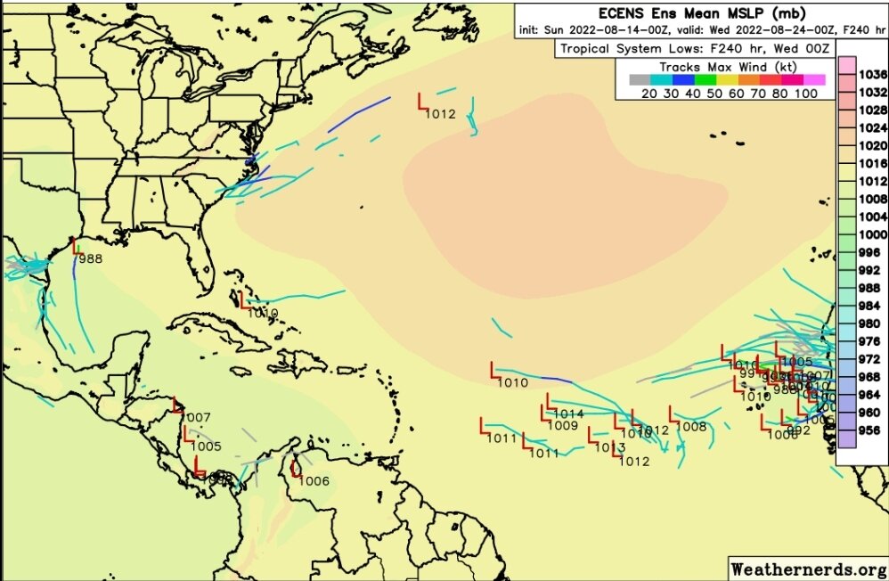
Euro ensembles are picking up on it:
GFS/CMC/Euro are all starting to pick up on the MDR wave as well. Could be tracking two systems next week. So much for your 0-0-0 August prediction.
-
3
-
2
-
-
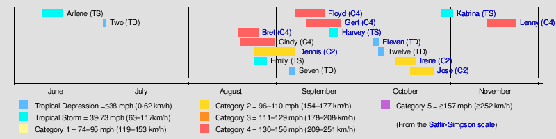
With the tropics quiet for now, it's fun to look back at the older thread posts...
August 10, 2017:
August 11, 2017:
-
2
-
1
-
-
Here we go! Major into Mexico and another little something into Florida...
-
What would (or did) ldub say at this point during the 1999 season?
-
GEFS is starting to hint at some Caribbean/Gulf action in mid August for a few runs now. How soon before ldub changes his 0-0-0 August predicition?
-
1
-
2
-
-
I'm not making any prediction here, but for those writing off the season on July 27 needs to remember there are three months of peak season ahead of us and it only takes two months of hurricanes to make a 226.9 ACE season:
-
2
-
-
5 minutes ago, ldub23 said:
My point would be 1975 and 2000 werent what was advertised by most if not all the seasonal forecasters. If we do have another 1975 or 2000 then i will feel vindicated im my ideas.
I wasn't following hurricanes back then but just taking a look at the wikipedia page, the 2000 season lived up to or outdid the forecasts.
https://en.wikipedia.org/wiki/2000_Atlantic_hurricane_season#Pre-season_outlooks
-
1
-
-
11 hours ago, ldub23 said:
Right now the MJO is supposedly favorable yet nothing is happening. The MJO isnt going to stay favorable and if it goes negative in mid aug the season might not start till mid sept.
Logic not even once.
Statement #1 implies that MJO doesn't have as much bearing as people may think.
Statement #2 implies that the MJO going negative will have a large bearing on the season.
-
1
-
1
-
-
For those responding to ldub, just remember he posted these posts in July/August 2020:
-
2
-
3
-
-
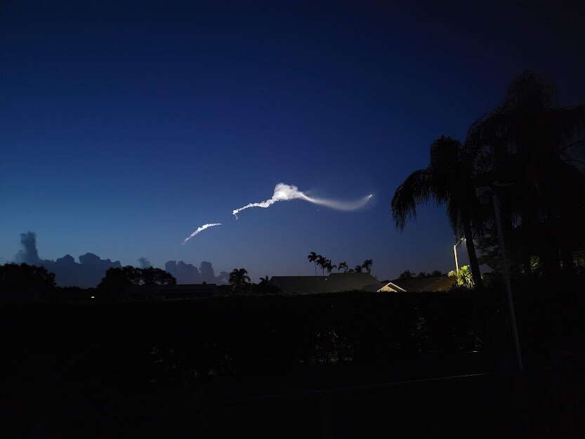
Yep, those Falcon9 launches at twilight are amazing. This was the view from my backyard.
-
1
-


2022 Atlantic Hurricane season
in Tropical Headquarters
Posted
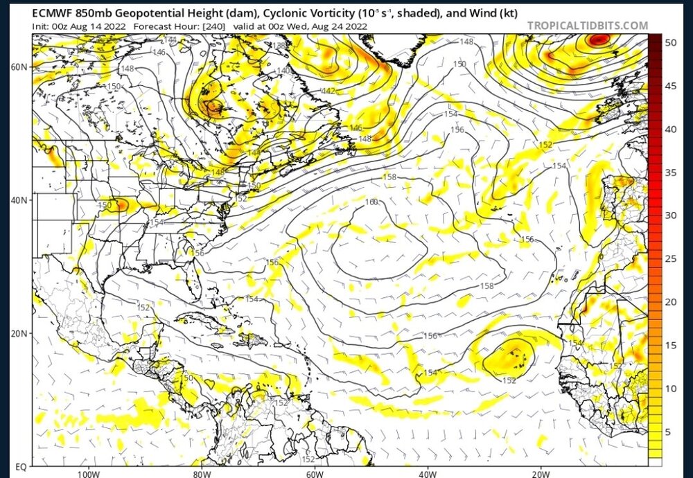
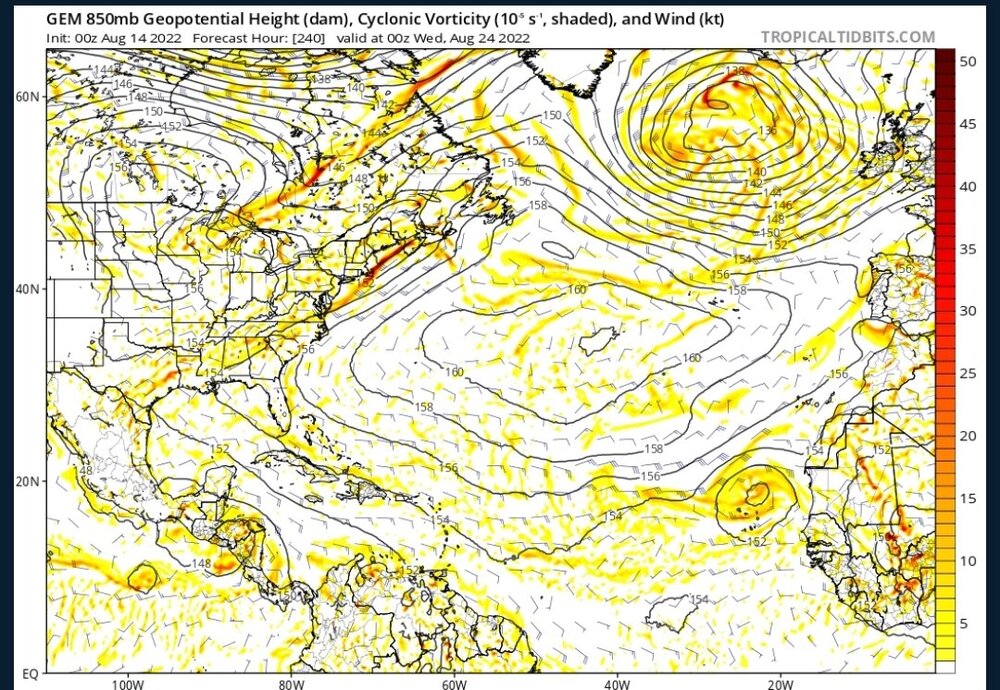
Overnight Euro, ICON and CMC are all back with developing the second wave leaving Africa on 8/24. Now the GFS is alone not developing that one...