

cptcatz
-
Posts
1,031 -
Joined
-
Last visited
Content Type
Profiles
Blogs
Forums
American Weather
Media Demo
Store
Gallery
Posts posted by cptcatz
-
-
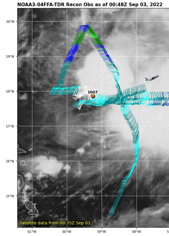
56 knot wind and 998 mb on this pass. Really outperforming what every model has been showing.
-
Just a little note: recon found the center south of 18N while the NHC and all the models had at north of 18N. Wonder if that will change anything.
-
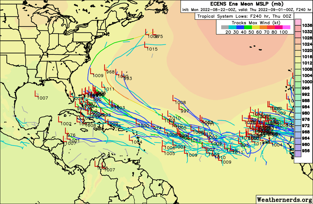
Euro coming in still further to the south. Will be interesting to see where it ends up on this run.
-
 1
1
-
-
25 minutes ago, shaggy said:
Cmc with a 3000 mile shift. What a crap model.
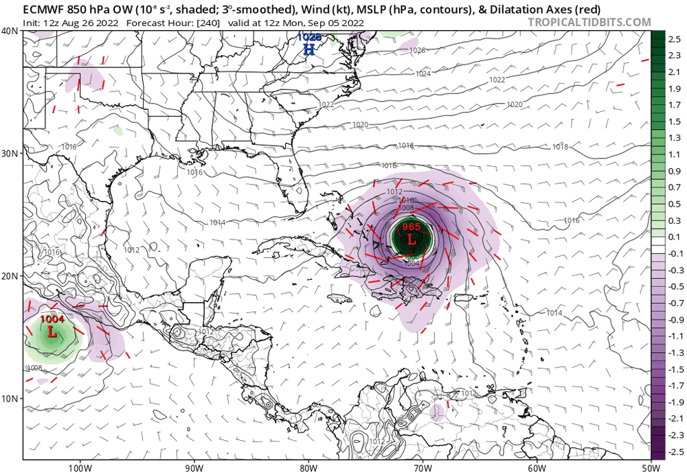
CMC is getting on board with Euro/EPS and UKMET. Maybe it's just my wishcasting but if this thing stays a mess until the Bahamas, it could come close to CONUS. This could actually be a very similar origin story as Katrina.
-
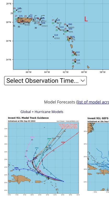
5 hours ago, GaWx said:
There are a couple. However, even those couple are well over 100 miles E of the 12Z UKMET position at hour 144. So, UK remains a pretty extreme left outlier as of now.
Looks like there a couple that do loops ala Jeanne or Betsy.
-
2
-
-
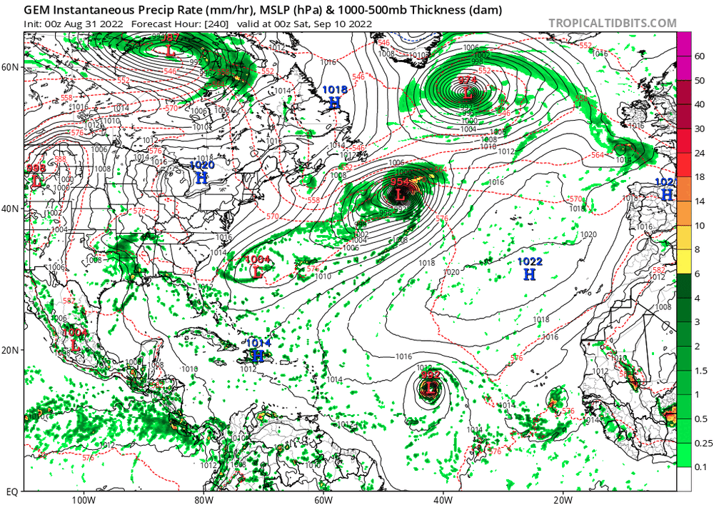
00z Euro and CMC both with a hurri
 cane in the central MDR at day 10. Maybe this will be the one?
-
It's not looking terrible on satellite and 18z Euro/EPS did track a bit more southward...
-
1
-
-
50 minutes ago, ldub23 said:
JB comes to the rescue. No commentary from me except i hope he is right and we still can salvage some kind of season.
Yeah we're still over a month away from the Wilma-Matthew-Michael-Sandy tracks. No reason to think we can't get one or more of those tracked storms.
-
1
-
-
38 minutes ago, Floydbuster said:
Getting out to sea vibes, but I've also seen invest models like this wind up in Veracruz.
Hurricane Grace just last year. Big miss by the early models.


-
1
-
-
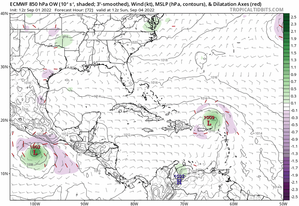
Very interesting last frame of the Euro model... intensifies from 986 to 973 while moving southwest.
-
2
-
-
4 minutes ago, Modfan2 said:
Lots of hooks right in that suite
Most models were also showing Irma hooking right while it was in the middle of the Atlantic as well...
-
1
-
-
It looks like on visible that's it's trying to tighten up a low level spin...

-
21 minutes ago, yoda said:
Um, I would take the GFS before the ICON in the tropics
Sure, when it's head to head. But now 12z CMC also is showing the same thing, so the competition is Euro/CMC/Icon vs GFS. Who ya got now?
-
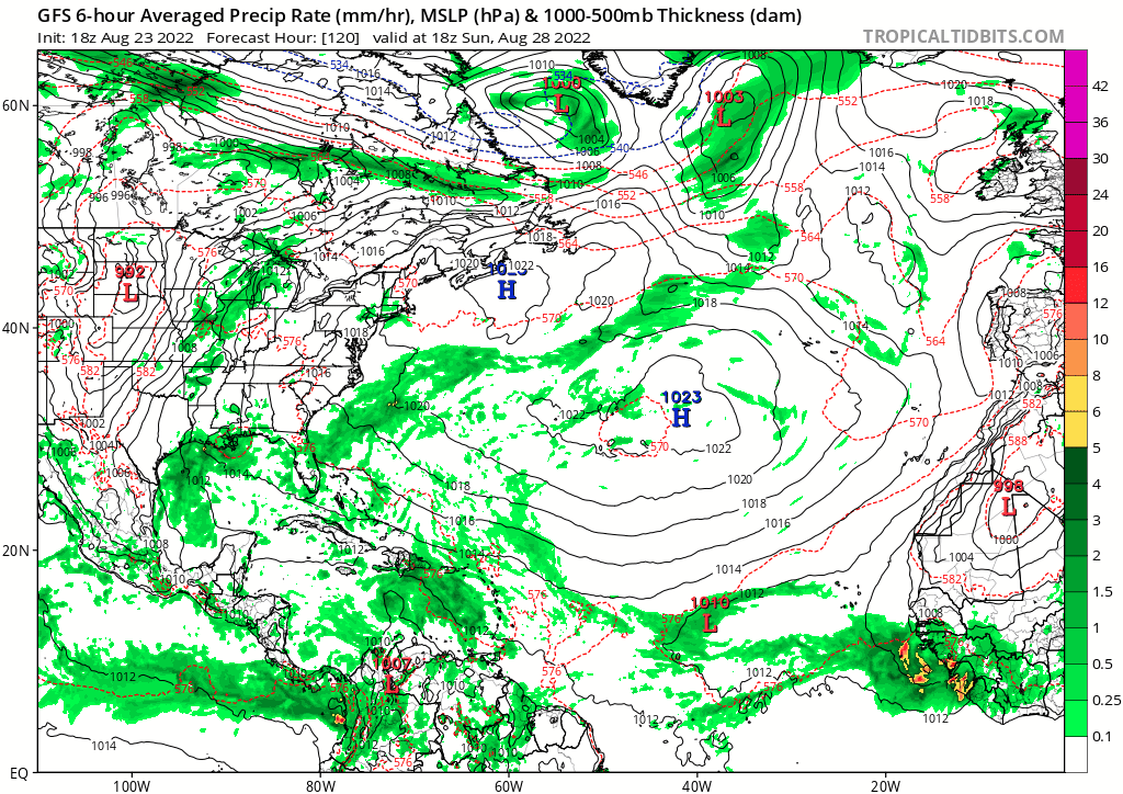
Impressive band of convection forming in the northeast side which is where the wave is merging. I could see this outperforming the models.
-
1
-
-
40 minutes ago, Ed, snow and hurricane fan said:
The GFS has a bad habit of over-developing in the SW Caribbean, but I think the Euro system is the real deal. Look at the other models. Look at the TPW, the now strung out system is moistening the atmosphere. Do you really think the lead disturbance in the MDR looks like it is dying of thirst?
Yeah, I mean GFS is all alone with the Caribbean system but every single model has been showing the lead Atlantic system developing for a couple days now. I'd be really surprised if NHC doesn't bump it up to at least 50-60% at 8pm.
-
1
-
-
Euro going all in
-
2
-
-
36 minutes ago, bigtenfan said:
Me as well
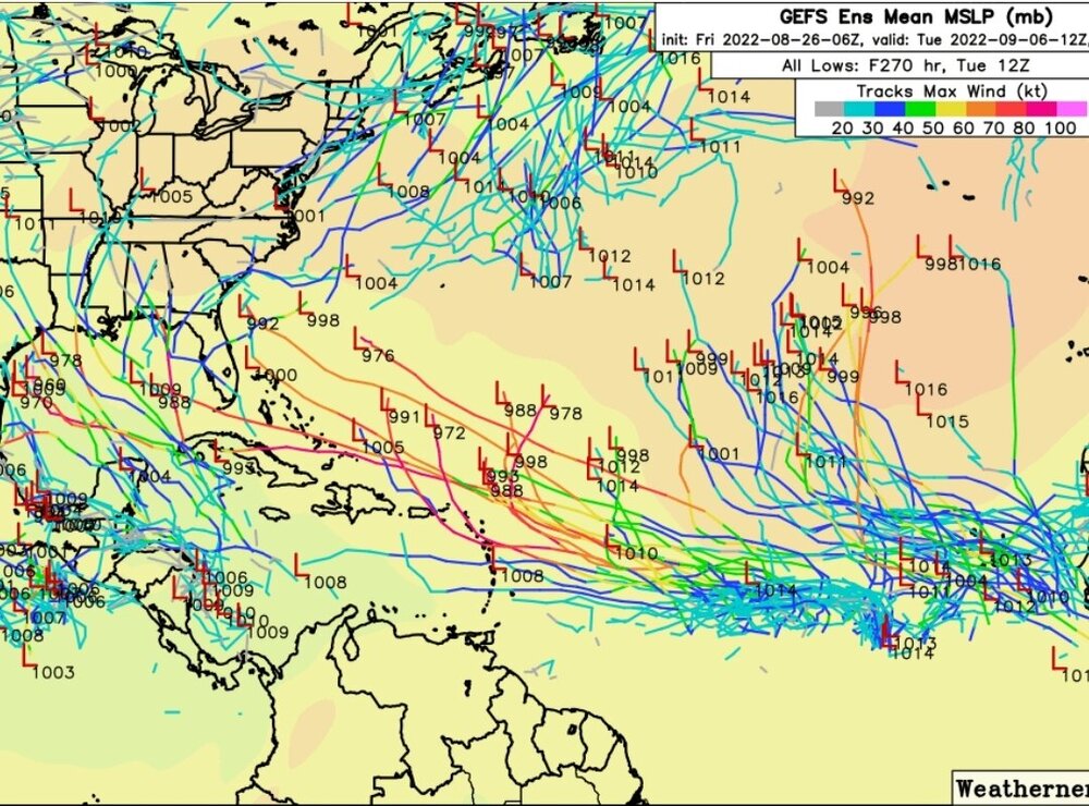
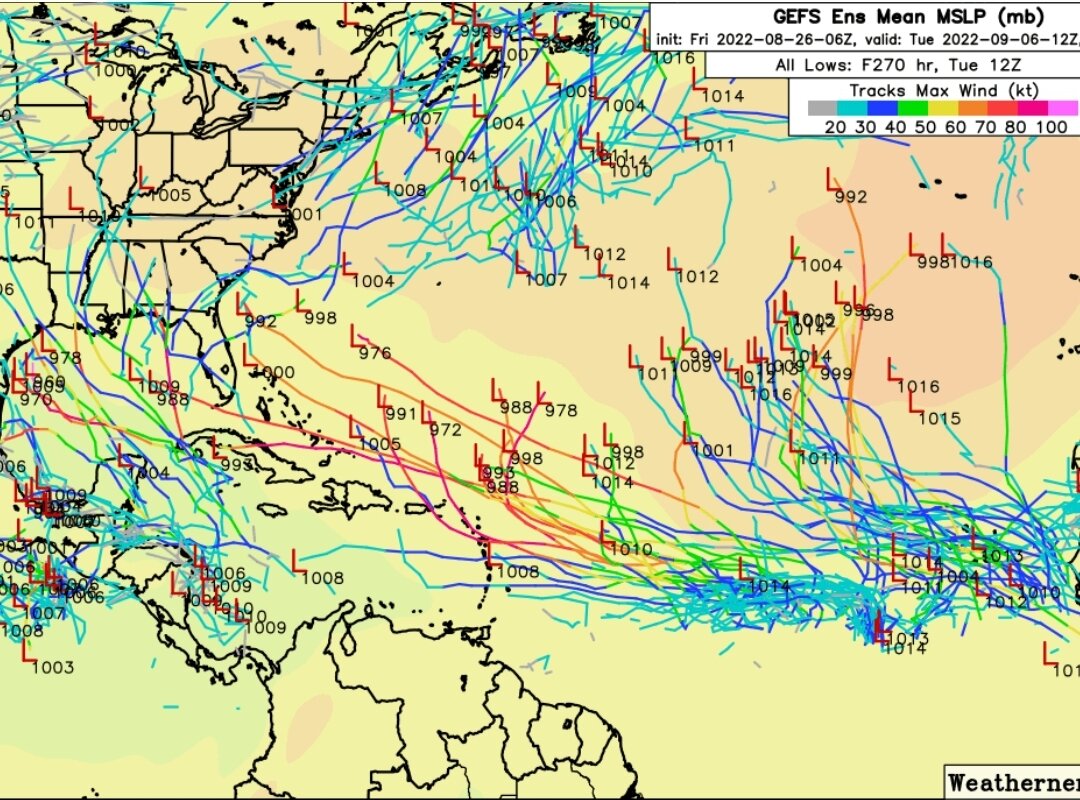
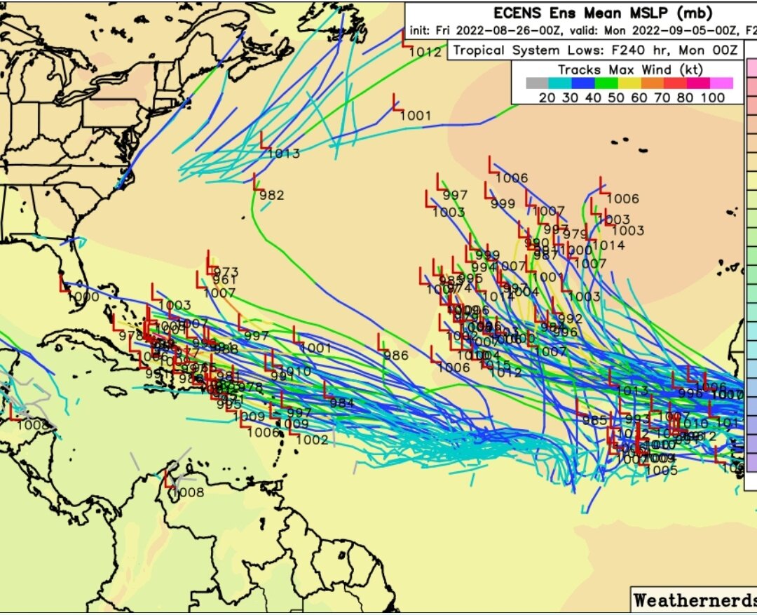
It is hard to tell especially on the EPS which only goes out to 240hr but it looks like the projected trajectory of the vast majority of the members is suggesting recurve.
The EPS model on Tropical Tidbits go out further than 240hr and show South Florida is in play bigtime...

-
I'm watching this closely from Boca Raton...
-
1
-
-
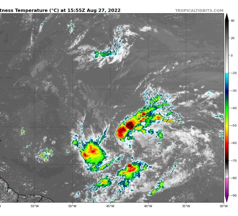
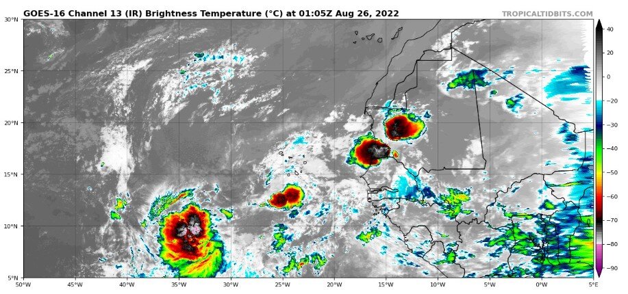
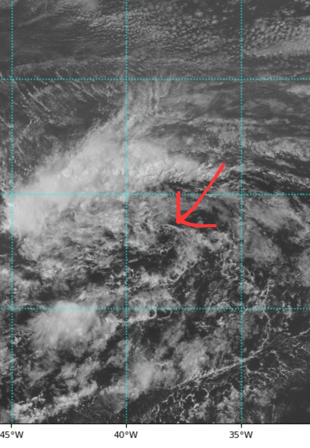
Can anyone explain what this system is at 10N,35W? It's the most impressive area of convection I've seen all season, so why don't models have it developing?
-
2
-
-
Yeah this is definitely the most interesting euro run in a while. I still don't trust anything beyond 5 days any more than I can throw them.
-
I'm no meteorologist, I'm just a guy with logic, but I think a big problem with the seasonal forecasts is it seems that they pretty much only take two things into account: water temp of the Pacific, and water temp of the Atlantic, and spit out numbers based solely on that. And yet what we're seeing is there are so many other environmental factors besides it being La Nina with a warm Atlantic.
But I'm ready to throw my towel to ldub. I'm getting tired of watching the models keep dropping the storms at the 5 day mark. What a borefest.
-
19 minutes ago, MJO812 said:
Uh ? Gfs still showing the tropics getting really active
At the 5 day mark, there is zilch happening in the tropics...

-
 1
1
-
-
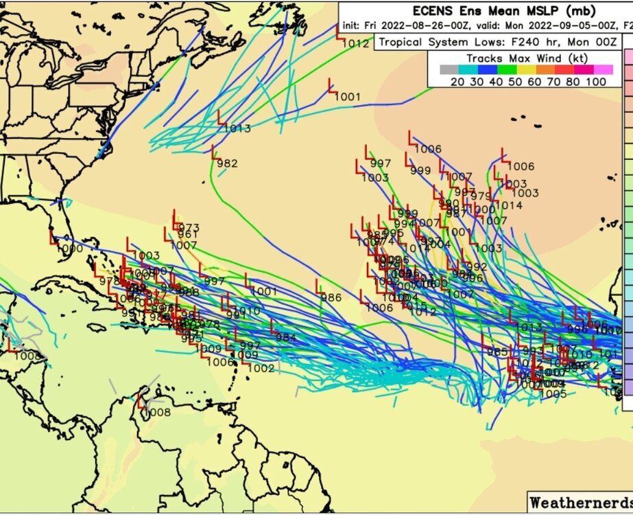
The 0z EPS is pretty bullish with three waves in the next 10 days: it starts to develop the current 20% lemon just north of the Caribbean and ends the run with it on a crash course into Florida. The next wave seems a bit messy in the central Atlantic but the third wave looks to be a vigorous one. Looks like the main story of the models is they have no idea how to handle this monsoon trough.

-
2
-
-
3 hours ago, ldub23 said:
Everytime i get mocked the tropical Gods respond, lol. Im declaring victory. The season isnt going to be hyper active or even "active". Normal at best at this point. As far as the rest of the season lets hope we can get 6 canes and 2 majors.
*Hopefully 06Z will be back to showing a few clumps of clouds at least. Even in dead seasons we used to get waves with showers. Yesterday i was skeptical because right after the twin super canes the models went back to nothing and bone dry air after the 2 canes.
*As far as the ensembles go the euro also shows nothing and its now very realistic we go 0/0/0 thru Aug.
*****2 important records within reach now. Tying the least active Aug and longest period between named storms.
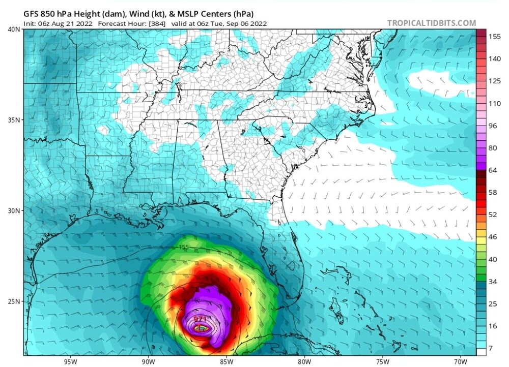
And then every time you declare victory, the GFS comes back to mock you once again, this time with the 06z bringing a major through the Lesser Antilles, direct hit onto Puerto Rico, then bringing the monster into the Gulf...
-
3
-


2022 Atlantic Hurricane season
in Tropical Headquarters
Posted
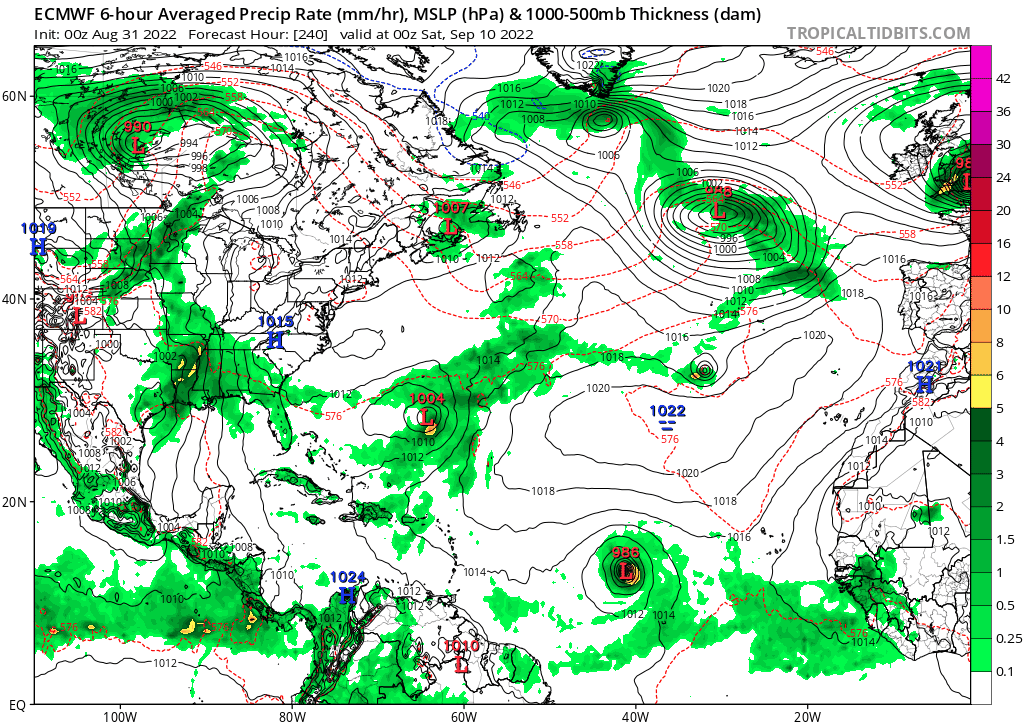
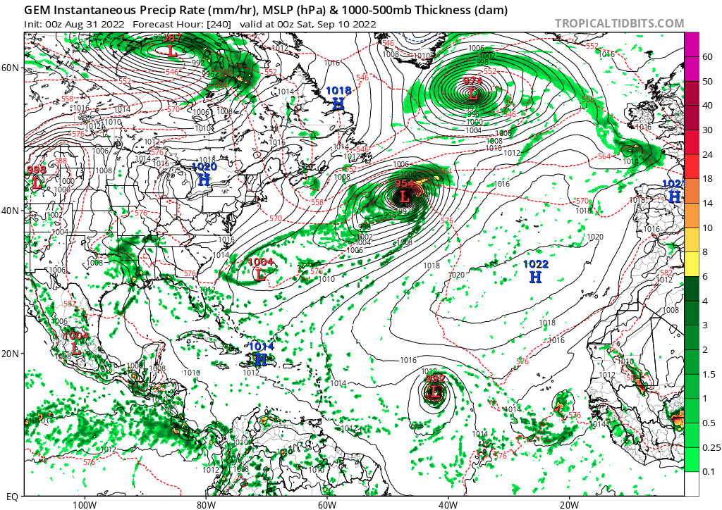
Maybe the most interesting thing that happens in the Atlantic this season will be Earl's impact on Europe...