

cptcatz
-
Posts
877 -
Joined
-
Last visited
Content Type
Profiles
Blogs
Forums
American Weather
Media Demo
Store
Gallery
Posts posted by cptcatz
-
-
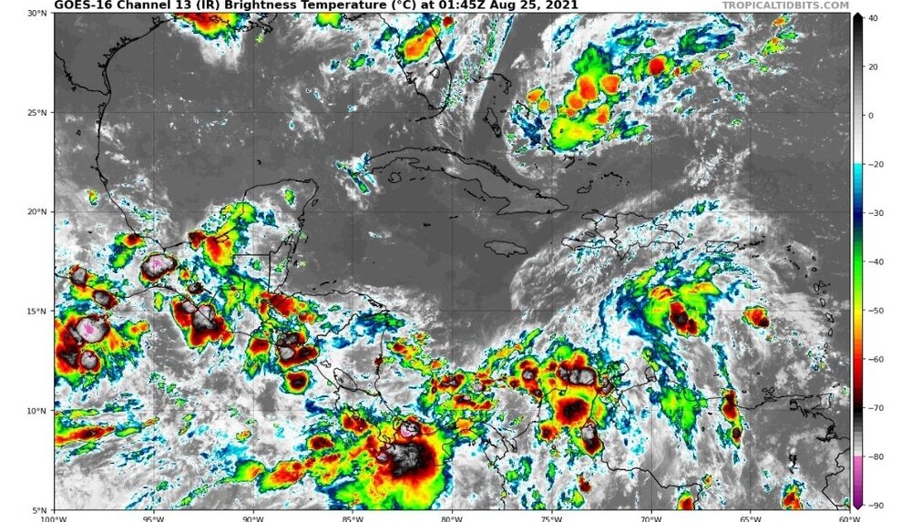
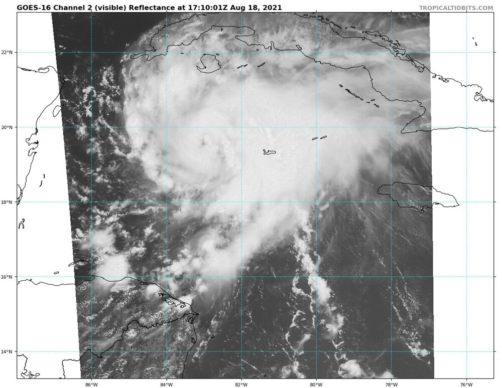
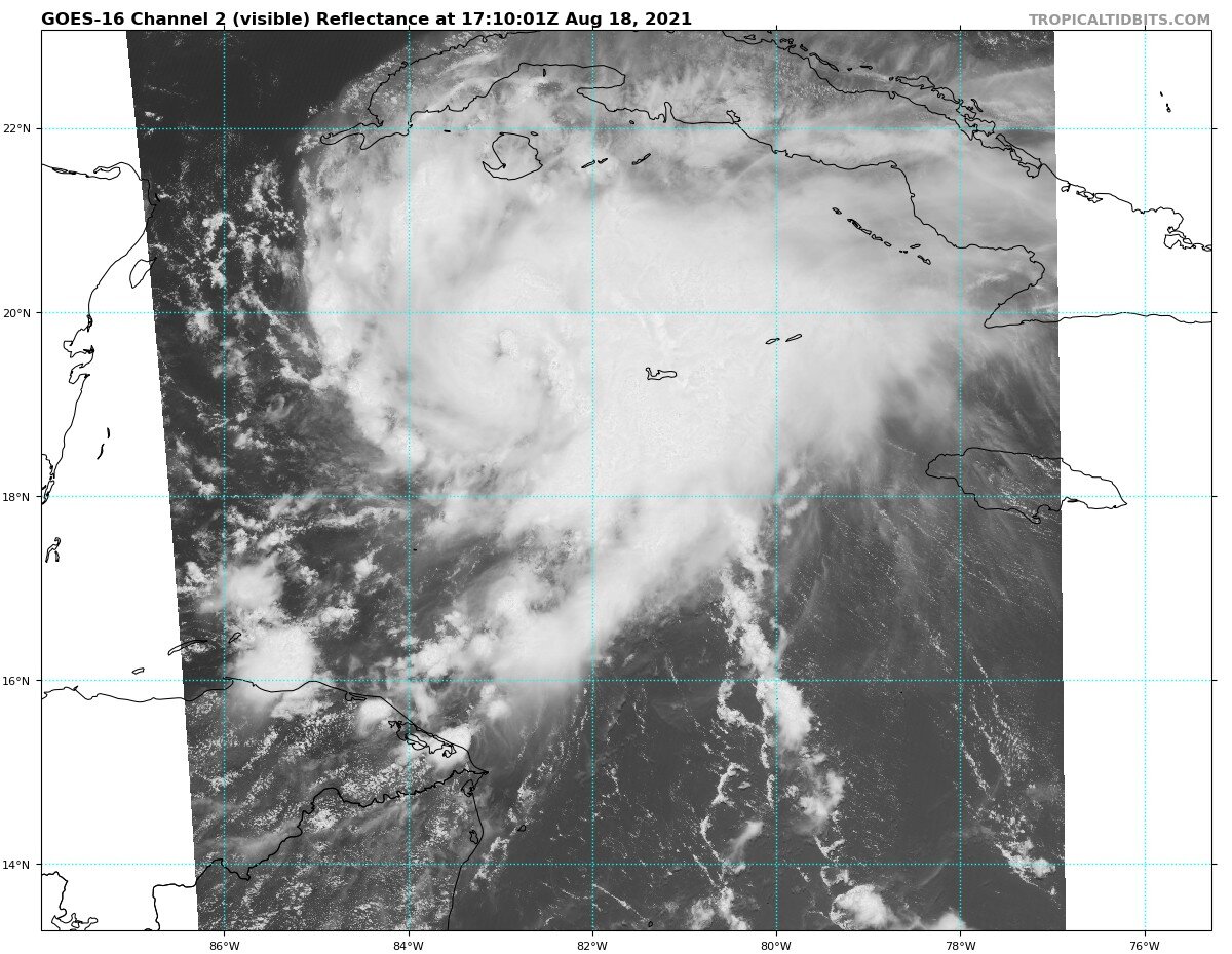
Ridiculous amount of convection over Central America. I suppose the invest is in there somewhere?
-
 1
1
-
-

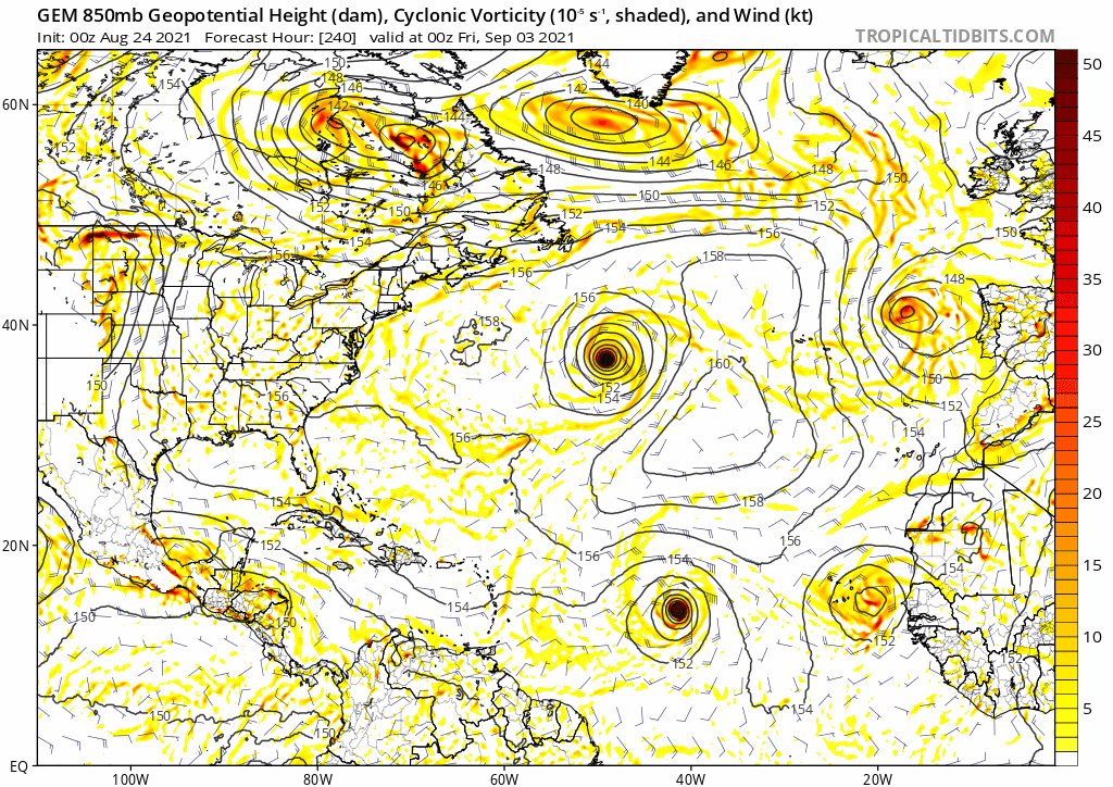
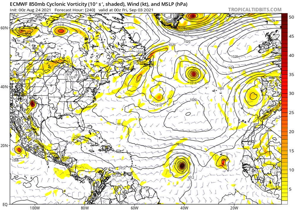 Euro and CMC almost exactly the same with a nice sized MDR storm with a developing wave trailing right behind. Both models have been bullish on this for a number of runs, GFS still not sure.
-
7
-
-
1 hour ago, Windspeed said:
While we're all going to be looking to the NW Caribbean and GOM for potential development into the weekend, currently there is a nice AEW south of the Cabo Verdes forecast to make its way across the MDR this week. It's not in a horrible environment at the moment, but conditions are only marginal across the MDR. Some SAL and stable air mass to contend, but it bears watching.

Hard to tell but looks like that may be the wave that makes it into the Caribbean which the GFS has been trying to develop next week.
After that, Euro, GFS, and CMC are all pointing to a long tracker MDR storm moving off Africa next week.
-
1
-
-
9 minutes ago, TheSnowman said:
If Anyone can tell me where Jim Cantore is Exactly, I could get an EPIC video of me Playing with him.
I saw him at Sunbelt Rentals getting some industrial sized fans.
-
 5
5
-
-
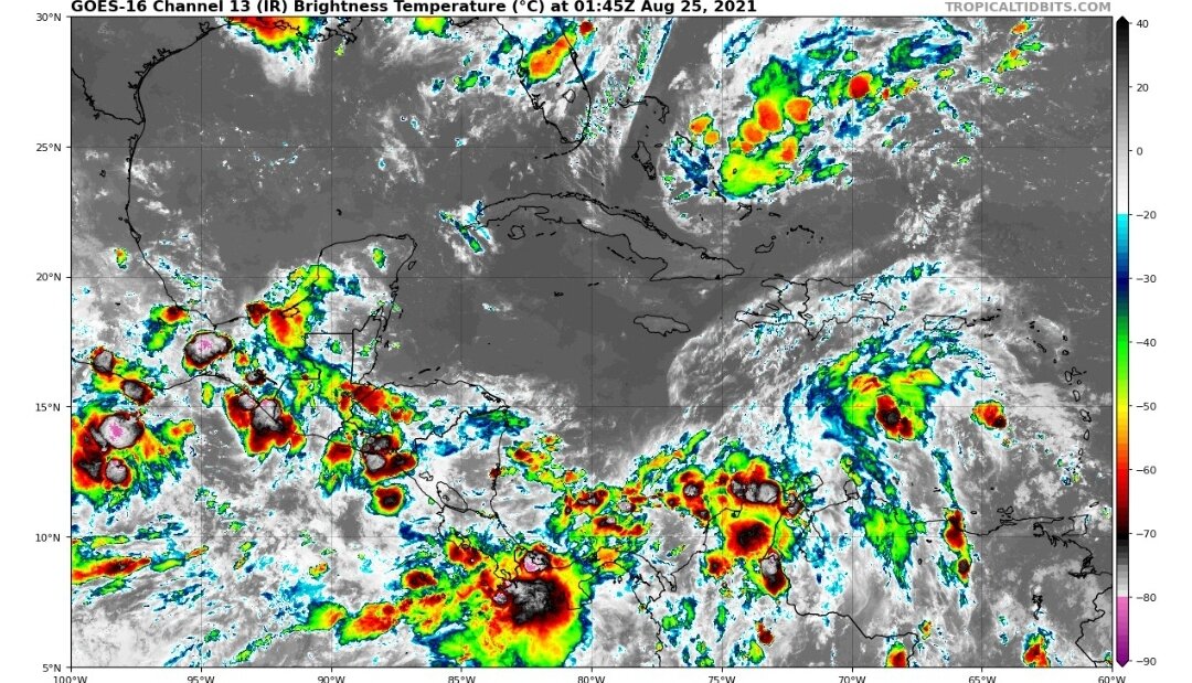
Long range GFS has continually showed a system forming in the central Caribbean and moving north across Cuba towards Florida. This would coincide with peak climo season as well as the strong CCKW expected to be overhead.
-
2 minutes ago, IowaStorm05 said:
I wonder if it will just be similar to last years tropical twisty twist that came onshore with like 80 minutes of moderately heavy rain, and some 30 mph gusts.
I don’t want to undersell or underestimate though
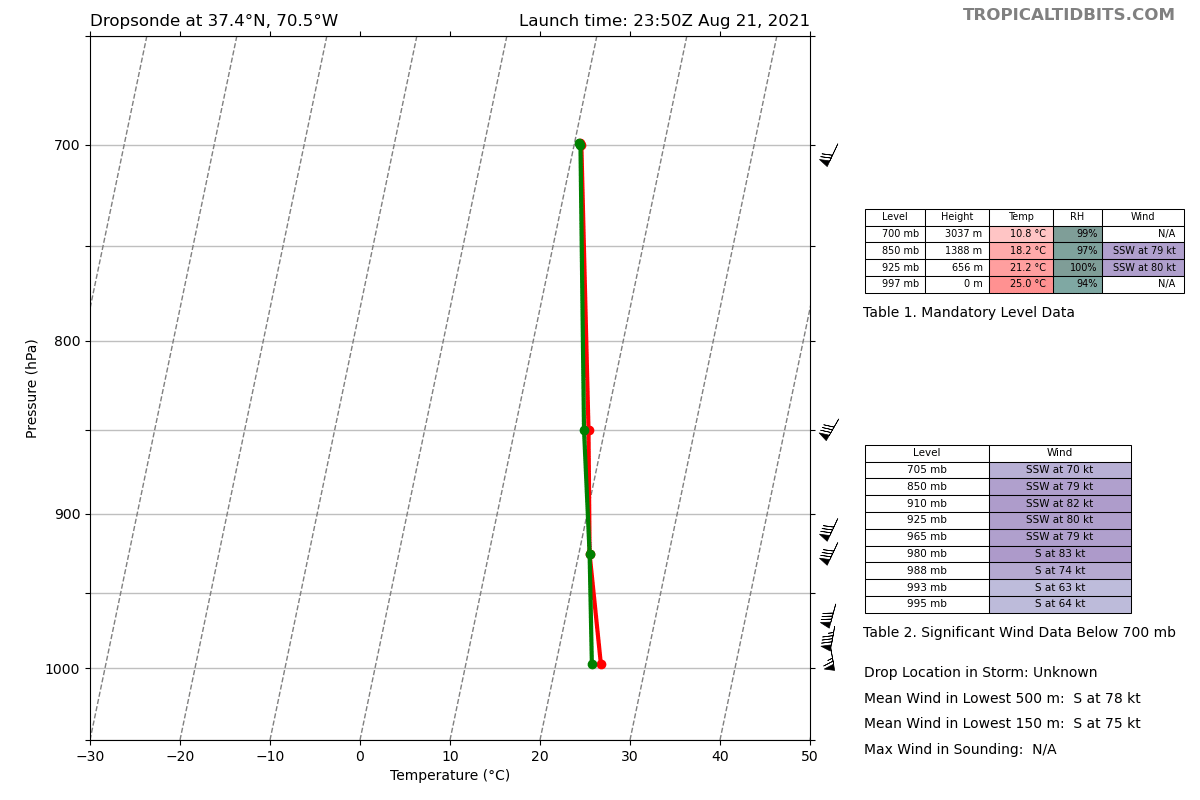
Whatever gets the east side of this storm is gonna get some really nasty winds. 64 knots at the surface is no joke.
-
1
-
-
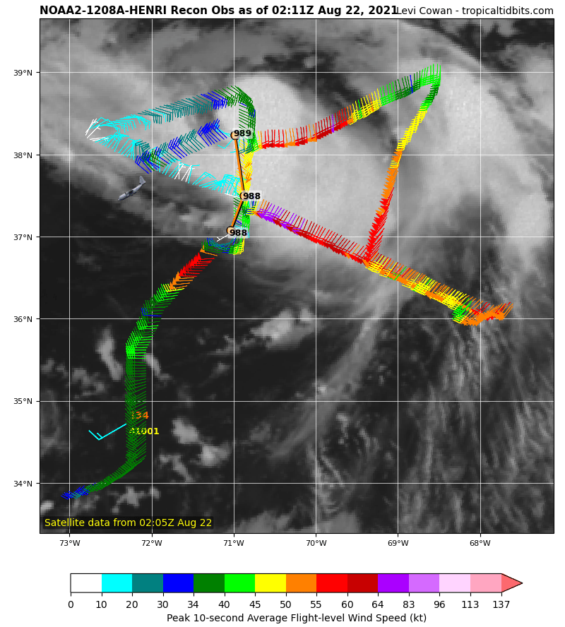
Henri has started it's slight turn west of due north

-
7 minutes ago, dryslot said:
Henri looks like sh it, Looks like its ingesting some dry air on its northern flank.
It's trying to wrap convection around the northeast side of the center. If it can wrap around, it can be in good shape. Only problem is it's running out of warm water.
-
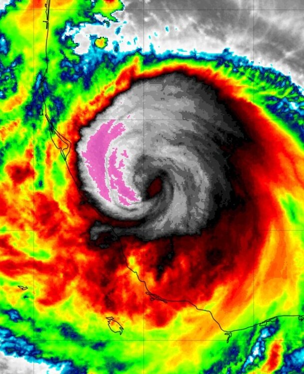
21 minutes ago, eyewall said:
https://www.tropicaltidbits.com/sat/satlooper.php?region=08L&product=vis
You can see a decent sized eye trying to clear just a bit on the vis. Outflow is improving on the NW side as well.
I don't think that's an eye... I think that's the convection eroding and exposing the LLC, which if that's the case is not a good sign for intensification.
-
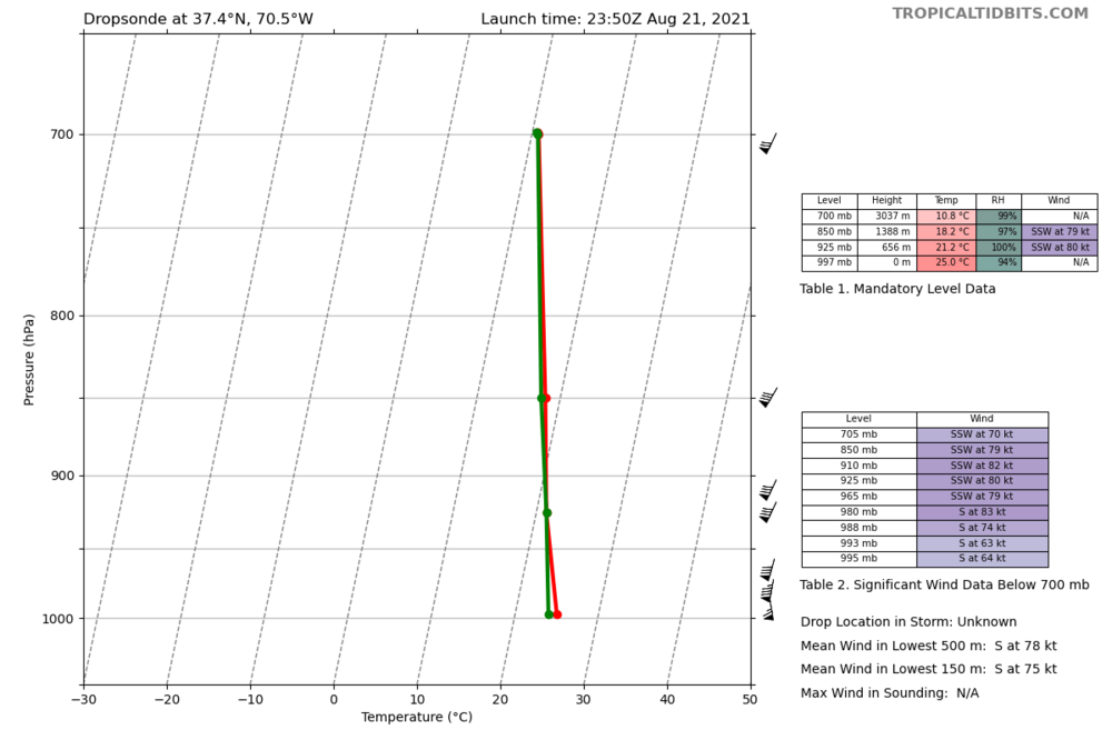
Hot damn, 115 knots at the surface. We got a full fledged cat 4.

-
Recon just recorded 115 kt flight level wind. Does NHC upgrade it to cat 3 at 11pm?
-
12 minutes ago, ineedsnow said:
almost positive its a eye forming
Can't see an eye like that forming in a not-even-hurricane.
-
1
-
 2
2
-
-
Finally about to get the first real eye of the Atlantic season
-
4
-
-
Oof that HMON run brings worst case scenario surge into NY harbor...
-
1 minute ago, wkd said:
Seems billion dollar disasters are a dime a dozen nowdays.
With the rate of inflation and prices of materials, a couple collapsed decks makes for a billion dollar disaster.
-
3
-
 1
1
-
1
-
-
Lots of 18z euro ensembles now show a NYC metro strike. Now that would be something
-
27 minutes ago, David-LI said:
What's the best website to track live hurricane data, winds etc, if such site exists?
TropicalTidbits
-
1
-
-
 Is that an eye I see right next to the new hot tower popping up?
-
Not even a fantasy cane going into September on the GFS? Pretty weak first half of the season.
-
1
-
-
68 knots FL winds, I'm pretty surprised NHC isn't putting out a special statement with at least a hurricane watch. With landfall hours away, seems like it's a good time now to warn the coast of possible hurricane conditions.
-
3
-
-
Have we had a storm this season where the NHC didn't highlight the uncertainty of the forecast?
-
3
-
-
Interesting geography note: if Fred goes due north it would hit the piece of land jutting out. But the models all show it making a slight turn to the northwest bringing it into the bend between Destin and Panama City. This track would give it another good hour or more of intensification.
-
5
-
-
Haiti is very prone to earthquakes and to tropical cyclones. Eventually you'll get them occurring close together. I can't see how one would cause the other to happen.
-
3
-
3
-
-
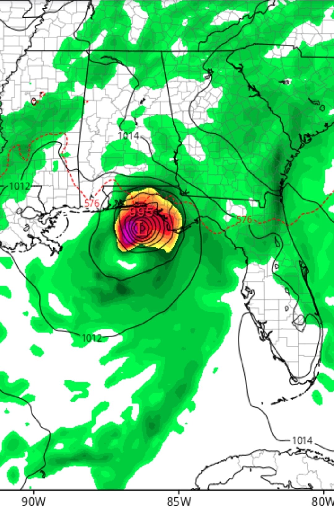
Recon found 52 knot flight winds and GFS is now showing a 995 mb landfall. I think the panhandle is gonna be in for a surprise.


Major Hurricane Ida
in Tropical Headquarters
Posted
Not sure I've ever seen NHC talk about potential dangerous hurricane impacts from a wave during a TWO: