

cptcatz
-
Posts
875 -
Joined
-
Last visited
Content Type
Profiles
Blogs
Forums
American Weather
Media Demo
Store
Gallery
Posts posted by cptcatz
-
-
Best looking invest I've seen in a while. This thing could already be a tropical cyclone.
-
 1
1
-
-
2 minutes ago, BooneWX said:
Thank you. That’s it. The forgotten 5. I recall Michael not earning much attention early on and then absolutely going nuclear in the last 24 hrs when things the shear was in a more favorable orientation.
Yep, modeling totally blew the initial intensity forecast...
-
 1
1
-
-
2 minutes ago, BooneWX said:
Yea not sure which storm I’m thinking of. The setup is giving me deja vu and not in a good way for some reason.
Michael?
-
1
-
1
-
-
12 minutes ago, BooneWX said:
Someone correct me if I’m wrong but is the synoptic setup eerily similar to Ian? If I remember correctly, we spent a day or two projecting a modest storm with Ian at best and then it became clear that it would tap into a jet streak and warm waters.
Ian had the biggest lead up since Irma. Go check out the Ian thread again... we were discussing a major hurricane in the Gulf while it was still an invest over a week before landfall.
-
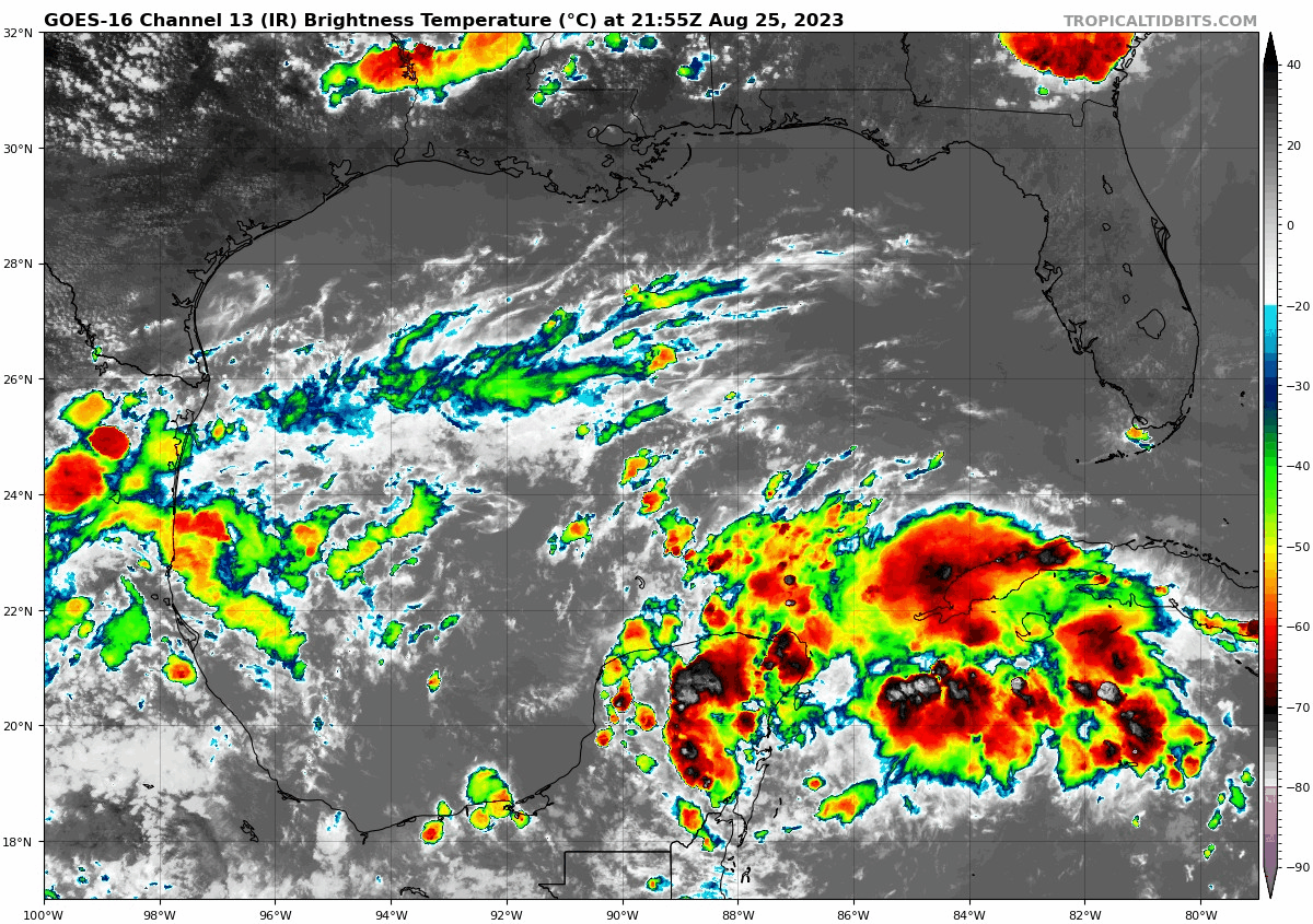
The convection is quite impressive and much further east than models had been showing. Watching these trends closely here in south Florida.

-
Recon and visual satellite both showing the center is a full 2 degrees west of where NHC has it...
-
1
-
-
Interesting little shift west on the 18z EPS...

-
1
-
-
90L is looking nice this morning. Will be interesting to see how far west it tracks. I feel like models don't have a good handle on it.

-
1
-
-
3 hours ago, GaWx said:
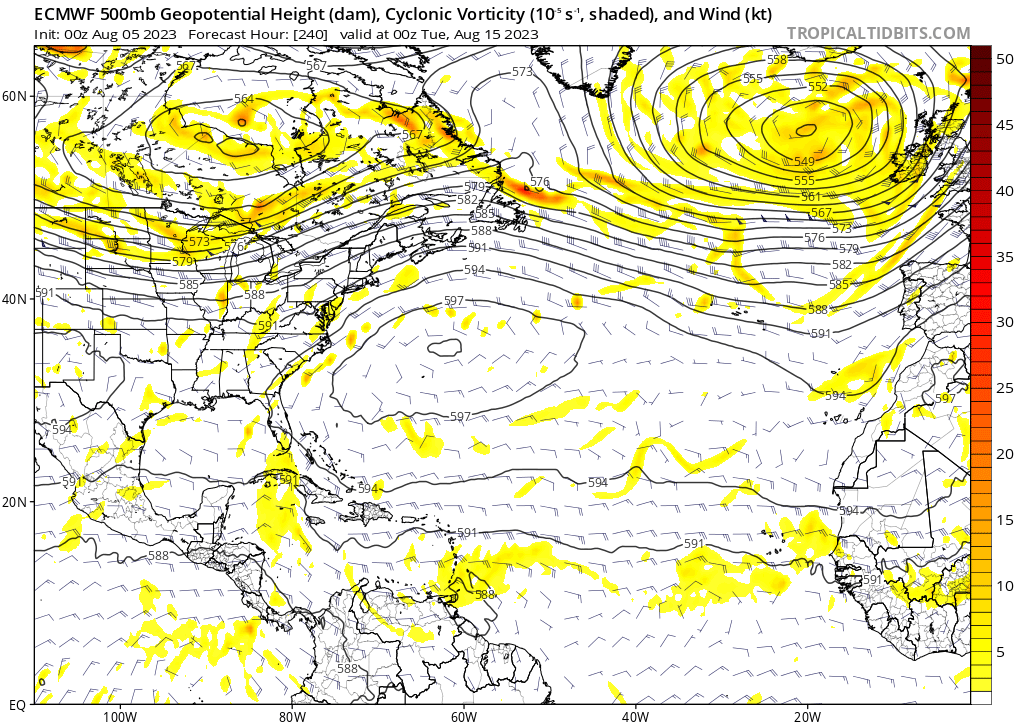
Although I'm not saying they can't end up with a dangerous situation then, I'd say that the worry regarding the 12Z GFS would be the case for folks not realizing that the exact 10 day position on the GFS or really on any operational for that matter is of very limited forecasting value since they jump around a lot that far out from run to run. Regarding GFS runs over the last 5 days, only the 0Z 8/16 run has anything similar.
Quite a few of the GFS runs have been showing a CAG like storm forming in the western Caribbean. CMC has been showing it a lot too and now EPS is hinting it at. Where it goes from there is a toss up but the fact that it forms on many models is what's important.
-
Anyone know if recon will be flying into it?
-
12z GFS, CMC, and Euro are basically telling us we have no idea what's gonna happen. Jeez can we get some model consistency here please?
-
18z EPS still showing four distinct clusters within 144 hours

-
1
-
-
10 hours ago, Ed, snow and hurricane fan said:
The op Euro is well supported by its ensembles (and has less smoothing than a mean at 10 days). If there is something there, there will be a US landfall threat. There are some storms on the GFS and Euro ensembles, but not enough to convince me there is more than a low chance of a TC occurring with no operational support when the pattern favors US landfall.
Maybe OT, looking at ensemble chi forecasts, and the Canadian, GFS and Euro forecasts are rather divergent. Canadian has pretty decent upward forcing around this time the other models don't predict.
Nice post as right after that the 12z EPS blew up. We'll see if it sticks
https://twitter.com/HurricaneManWx/status/1687931125040070656
-
1
-
-
Structure looks nice but all models have it go poof as soon as it enters the Caribbean. If the NHC is right and it maintains at a 75-80 mph hurricane through the Caribbean, they would get mad respect.
-
2
-
-
This system in the western Caribbean is what the GFS has been saying hits Florida as a hurricane for the last 2 weeks. It certainly looks impressive right now. It'll be interesting to watch in real time.

-
1
-
-
That's quite a look for June 11. This is gonna be an interesting season...

-
1 hour ago, Roger Smith said:
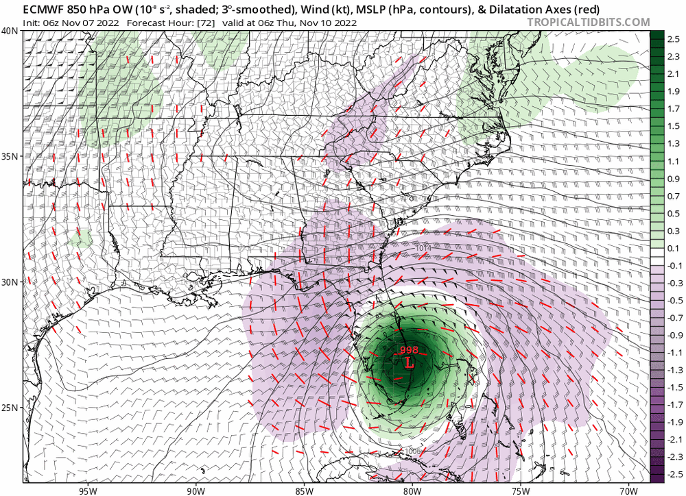
Just starting to cross the warmer core of Gulf stream, I would say Nicole reaches at least low end cat-2 at some point tonight, possibly mid-range cat-2, and also performs more of a curve north than model consensus, earlier was asking people what they thought of a grazing coastal track, possibly some inland movement now probable, but I think Nicole will try to stay over warm water as long as it can, could mean a landfall Jupiter to Melbourne. Never all that far inland, heads up NNW with enough of circulation over water to retain cat-1 intensity for quite a while, strong TS near Georgia coast in 36-42h. Long duration fetch means storm surge issues must be taken very seriously. This is now almost as strong as Sandy approaching NJ and Staten Island comes to mind. Were not the storm surge forecasts lowballed there? Or did people not take accurate warnings seriously? One or other as I recall.
1) Sandy made landfall at 945 mb
2) Sandy was 1,100 miles wide
3) Sandy pushed the surge into New York Bay which is one of the largest bays in the world and naturally incredibly surge prone. There is nothing like that around where Nicole is going.
To sum it up, this is nothing like Sandy.
-
6
-
-
Looks like it's trying to pop some convection on the western eyewall. Needs it to stick if it's gonna intensify some more.
-
Wow that recon pass really just ramped things up quick. On the verge of being a hurricane now.
-
1
-
-
Anyone know when the next low level recon is?
-
Someone tell me if I'm crazy but I'm seeing the LLC now moving just EAST of due south...
-
The last few frames of satellite looks like the center is moving due south and convection is trying to pop right there.
-
1
-
-
3 minutes ago, NJsnow89 said:
Looks like my trip to Orlando should be ok with the recent south trend?
It's going to be a top heavy storm with all the bad weather to the north. Regardless of what happens Orlando is gonna get some nasty weather. Canceling your trip depends on what you plan on doing there.
-
3
-
-
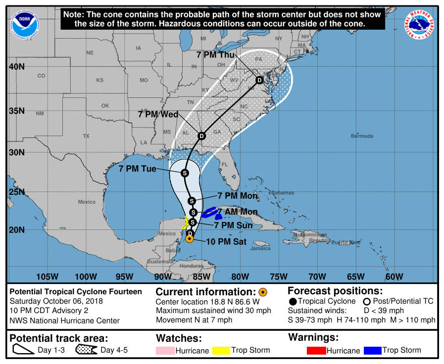
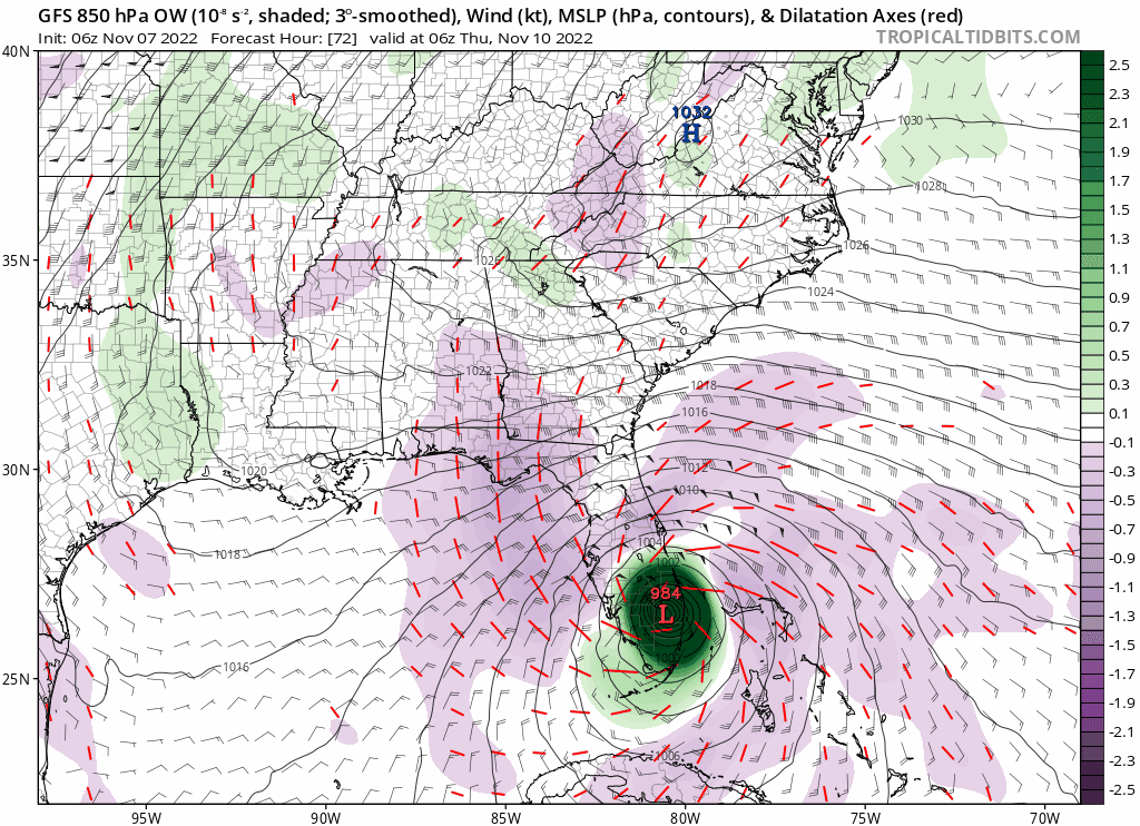
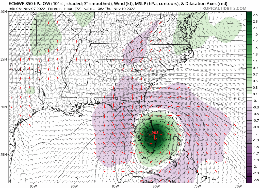
06Z GFS shows landfall in Boca Raton (where I live) at 984mb vs Euro shows landfall in West Palm Beach at 998mb. If you split the difference you get landfall in Boynton Beach at 991mb.

-
1
-


Hurricane Idalia
in Tropical Headquarters
Posted
I don't know something seems fishy to me about these model runs. Looking at how it looks on satellite right now, are we really supposed to believe it will look like this on Monday morning?