largetornado
-
Posts
163 -
Joined
-
Last visited
Content Type
Profiles
Blogs
Forums
American Weather
Media Demo
Store
Gallery
Everything posted by largetornado
-
Interestingly, the SPC had a SCTD risk for d1 convective outlook which translates to moderate todays
-
Found this on Twitter. WRF simulation of 4/3/74. thought it would be interesting to post this and see how a thread would go based on this model output. https://www.goldenhorseshoewx.ca/case_studies/SuperOutbreak1974/ another model https://x.com/jacob_feuer/status/1775667383816143284?s=46
-
4/1-4/2 severe threat (southern portion of subforum)
largetornado replied to largetornado's topic in Lakes/Ohio Valley
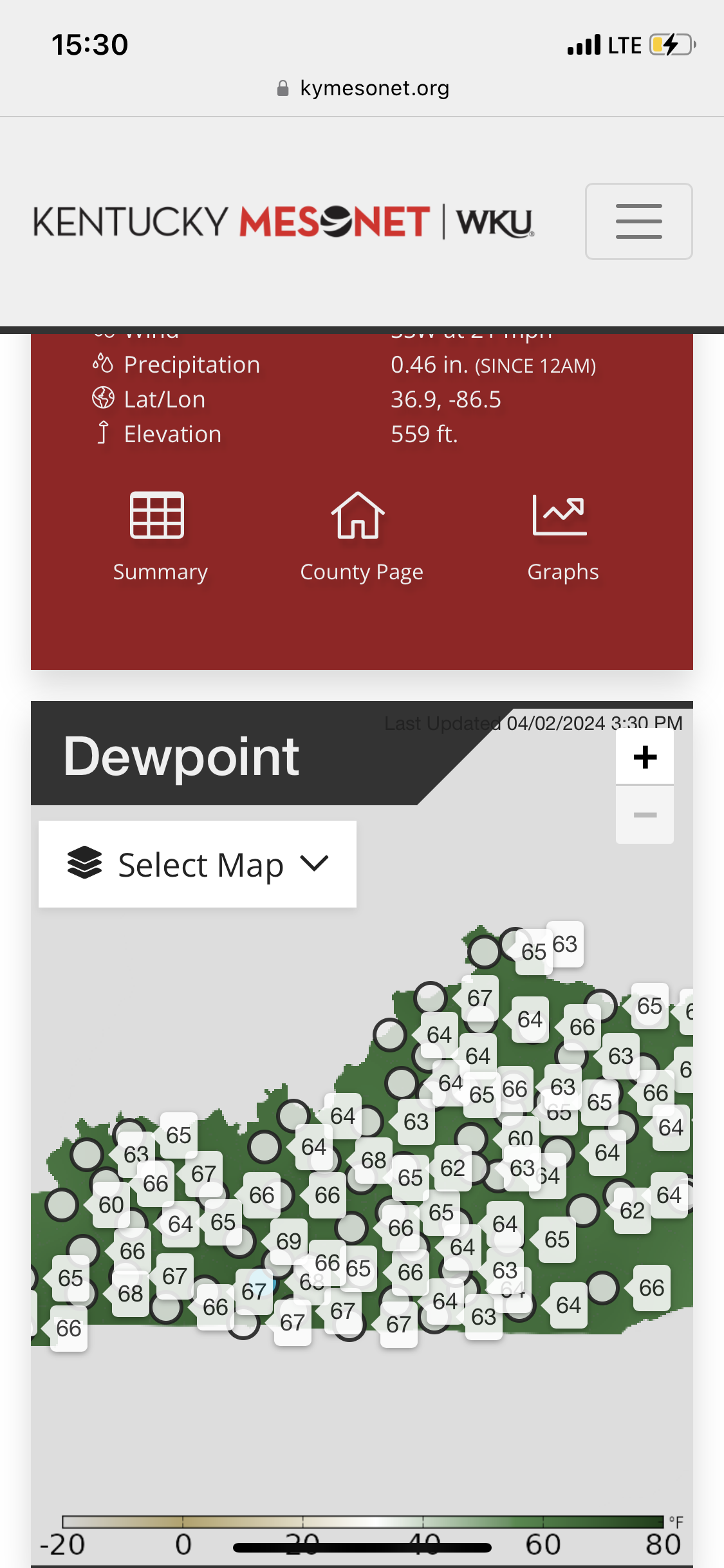
Dew points rebounding in ky nicely. Winds are pretty veered though.
-
4/1-4/2 severe threat (southern portion of subforum)
largetornado replied to largetornado's topic in Lakes/Ohio Valley
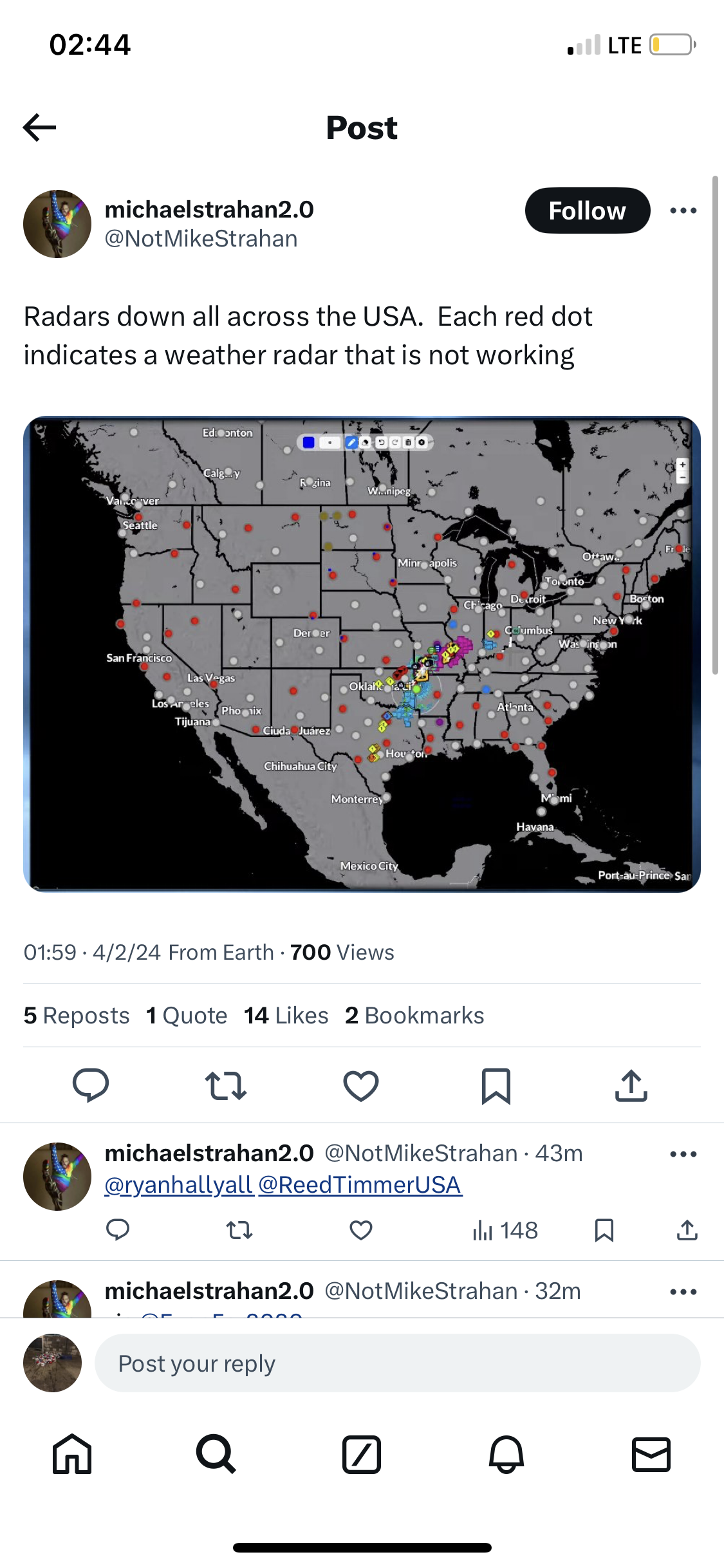
Anyone know if the radars being down affect model inputs? (From my understanding, NWS offices can still see their radars but the feed is down.)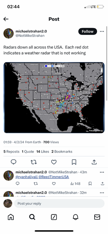
-
4/1-4/2 severe threat (southern portion of subforum)
largetornado replied to largetornado's topic in Lakes/Ohio Valley
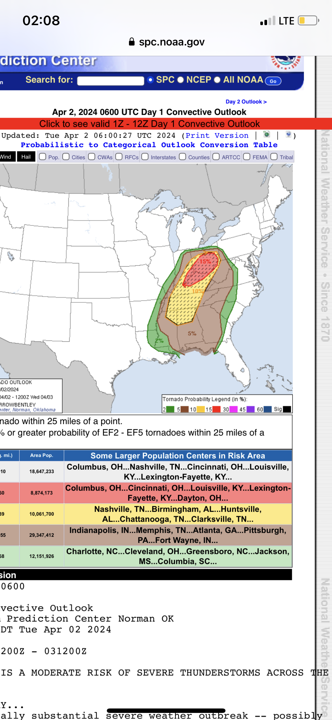
SPC sticking with the moderate with a massive hatched tornado risk Spc basically said ignore the nam .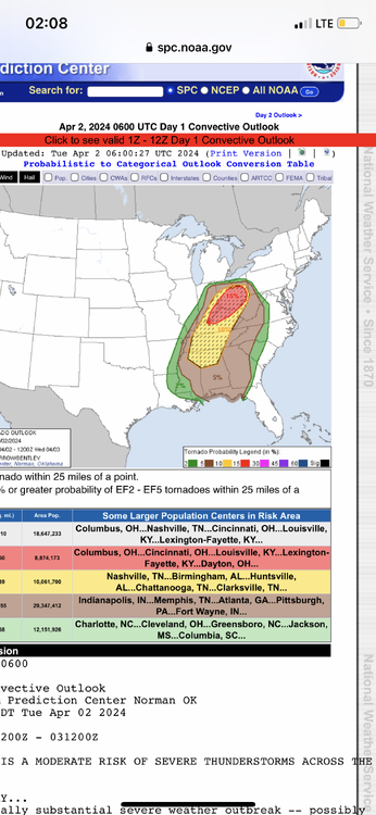
-
4/1-4/2 severe threat (southern portion of subforum)
largetornado replied to largetornado's topic in Lakes/Ohio Valley
03z HRRR takes the pressure down to 987. Time for bed and we shall see tomorrow..thumb.png.e8dac992c2652e532f5f0eeaead9c334.png)
-
4/1-4/2 severe threat (southern portion of subforum)
largetornado replied to largetornado's topic in Lakes/Ohio Valley
At this point, will the EML in Arkansas/Southern MO/TN be eroded by that ongoing convection or will it inhibit it?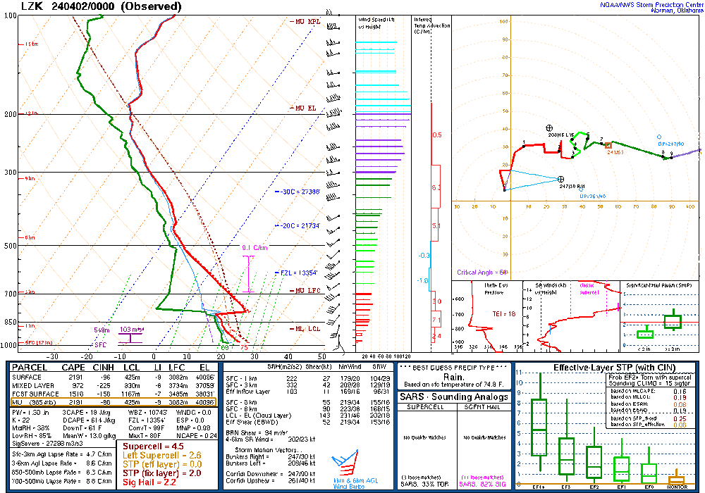
-
4/1-4/2 severe threat (southern portion of subforum)
largetornado replied to largetornado's topic in Lakes/Ohio Valley
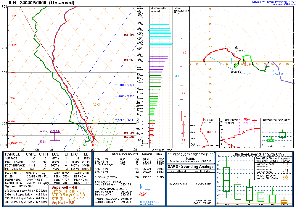
Yes from a messaging standpoint, this could be a mess. The miss earlier this month may or may not have played a part with the 15%. I would assume the afternoon outlook was late because there was a significant amount of discussion around the 15%. Realistically I think it’s a good forecast if the area circled in red does not materialize. If it does, the threat for Ohio would likely be significantly degraded. 0z sounding from ILN shows a minor inversion. Might prohibit some early morning convection?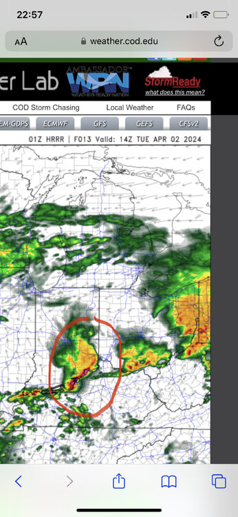
-
4/1-4/2 severe threat (southern portion of subforum)
largetornado replied to largetornado's topic in Lakes/Ohio Valley
Some disagreement between rap, hrrr, nam, and nam3k. It’s a wake up and see kind oF a day which is typical for the OV. -
4/1-4/2 severe threat (southern portion of subforum)
largetornado replied to largetornado's topic in Lakes/Ohio Valley
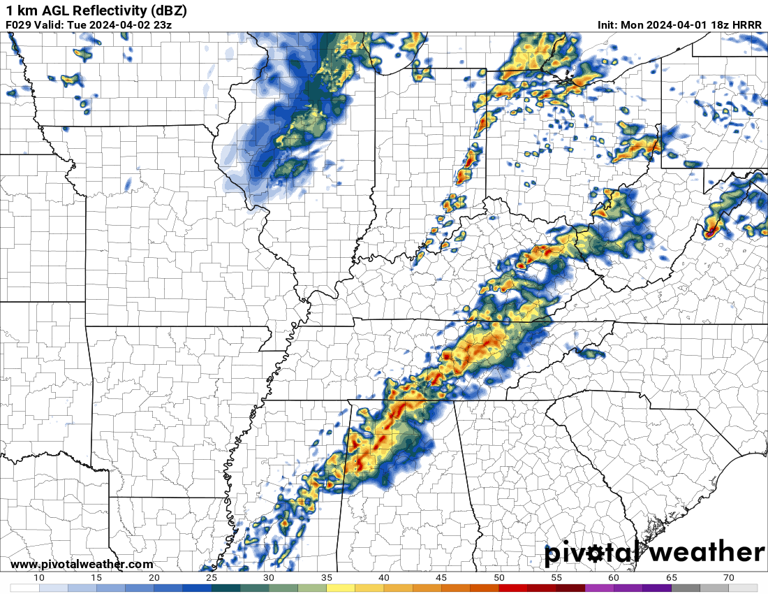
18z HRRR isnt backing down. Brings the threat more towards indy and reflectivity is showing a more discrete environment, with cells starting to grow upscale after crossing into ohio.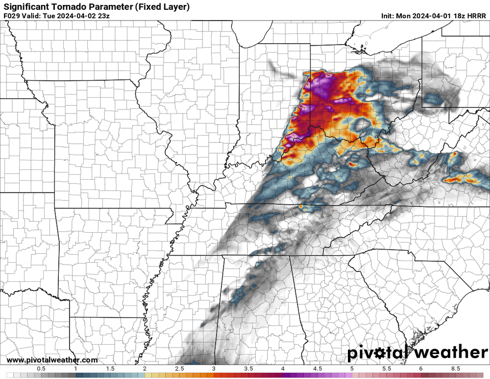

-
4/1-4/2 severe threat (southern portion of subforum)
largetornado replied to largetornado's topic in Lakes/Ohio Valley
11/17/13 is only event i recall but the tor risk only extended into western ohio. 3/2/12 was mainly kentucky and SW ohio. For the entirety of ohio, nothing comes to mind. -
4/1-4/2 severe threat (southern portion of subforum)
largetornado replied to largetornado's topic in Lakes/Ohio Valley
An impressive run for sigtor ingredients
-
4/1-4/2 severe threat (southern portion of subforum)
largetornado replied to largetornado's topic in Lakes/Ohio Valley
While tomorrow is looking very volatile, the nocturnal threat tonight is not something to sleep on..png.917ef8b93f22b6d71881a898adc03be7.png)
.png.d4c19350c94098561aab8bef8623dfa1.png)
.png.075f76e8aff43237c616f2f65960014d.png)
-
4/1-4/2 severe threat (southern portion of subforum)
largetornado replied to largetornado's topic in Lakes/Ohio Valley
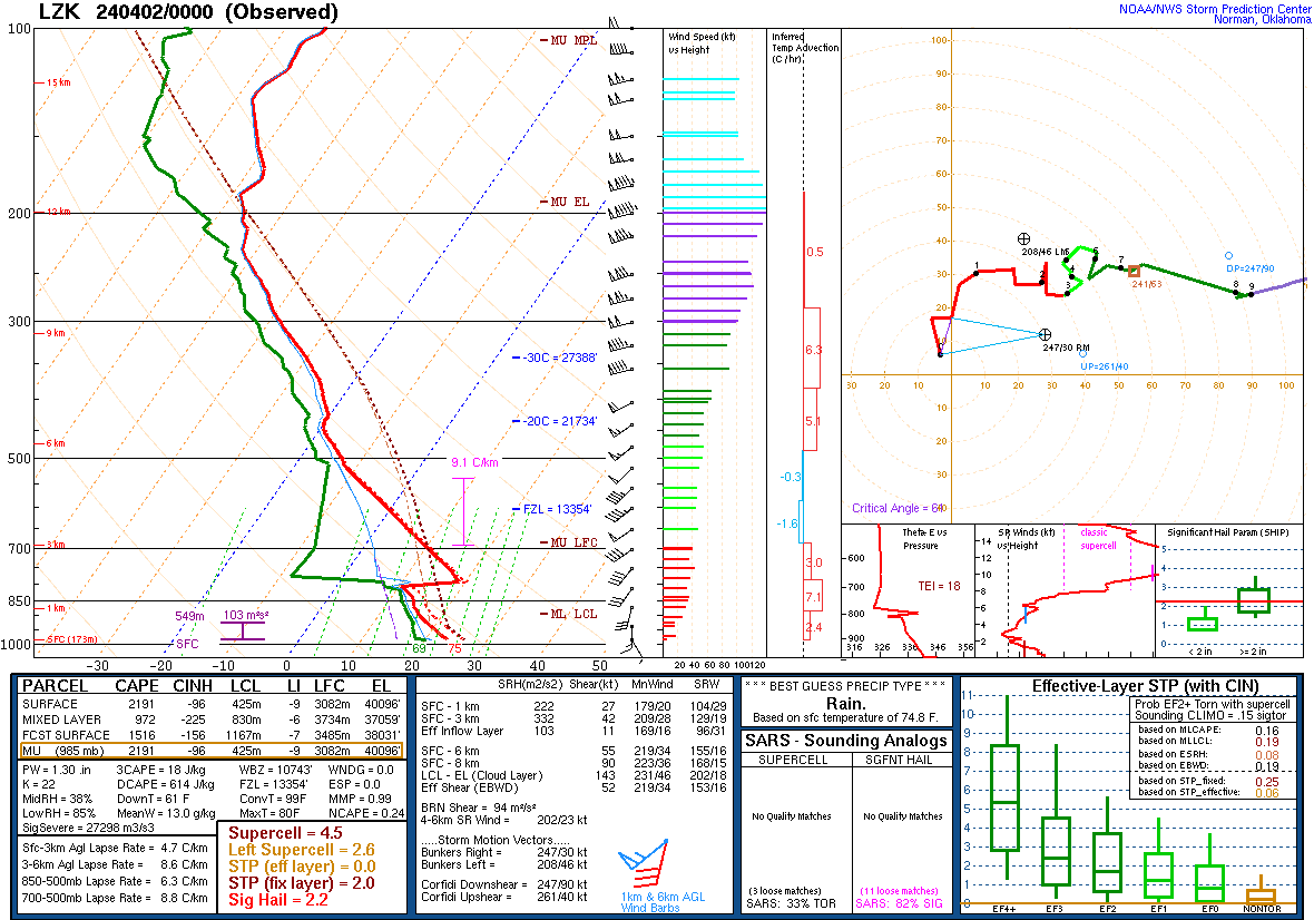
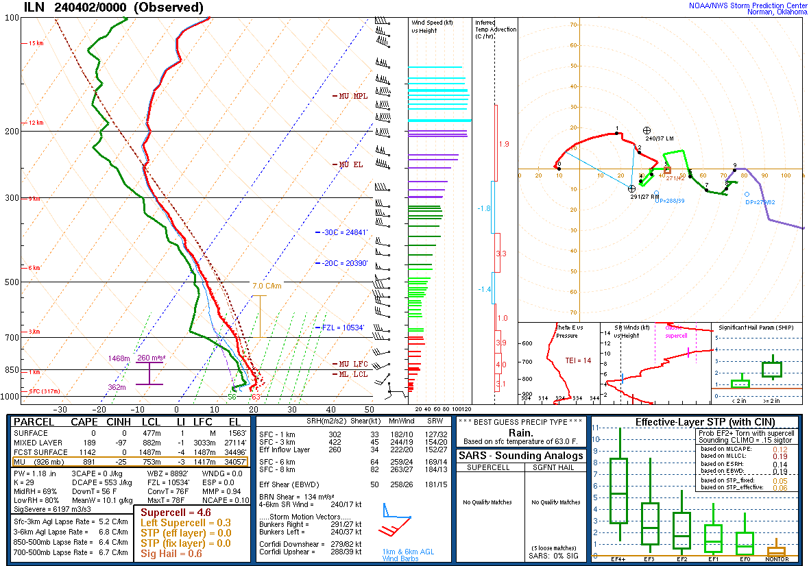
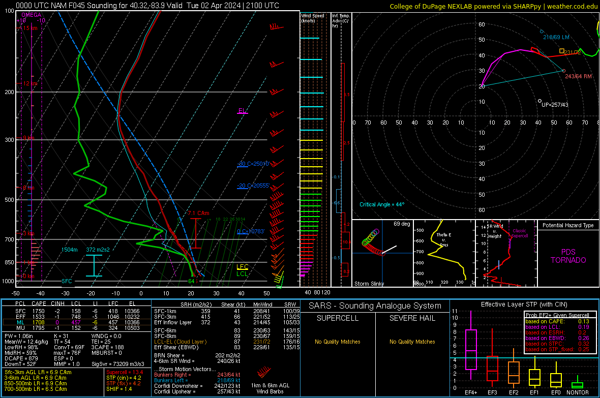
0z HRRR keeps the biggest threats south of the Ohio river. 0z nam brings the threat basically to Michigan. Either way, the hires models are trending towards a significant severe threat on Tuesday. Sounding is north central ohio NWS ILN current thinking:
-
4/1-4/2 severe threat (southern portion of subforum)
largetornado replied to largetornado's topic in Lakes/Ohio Valley
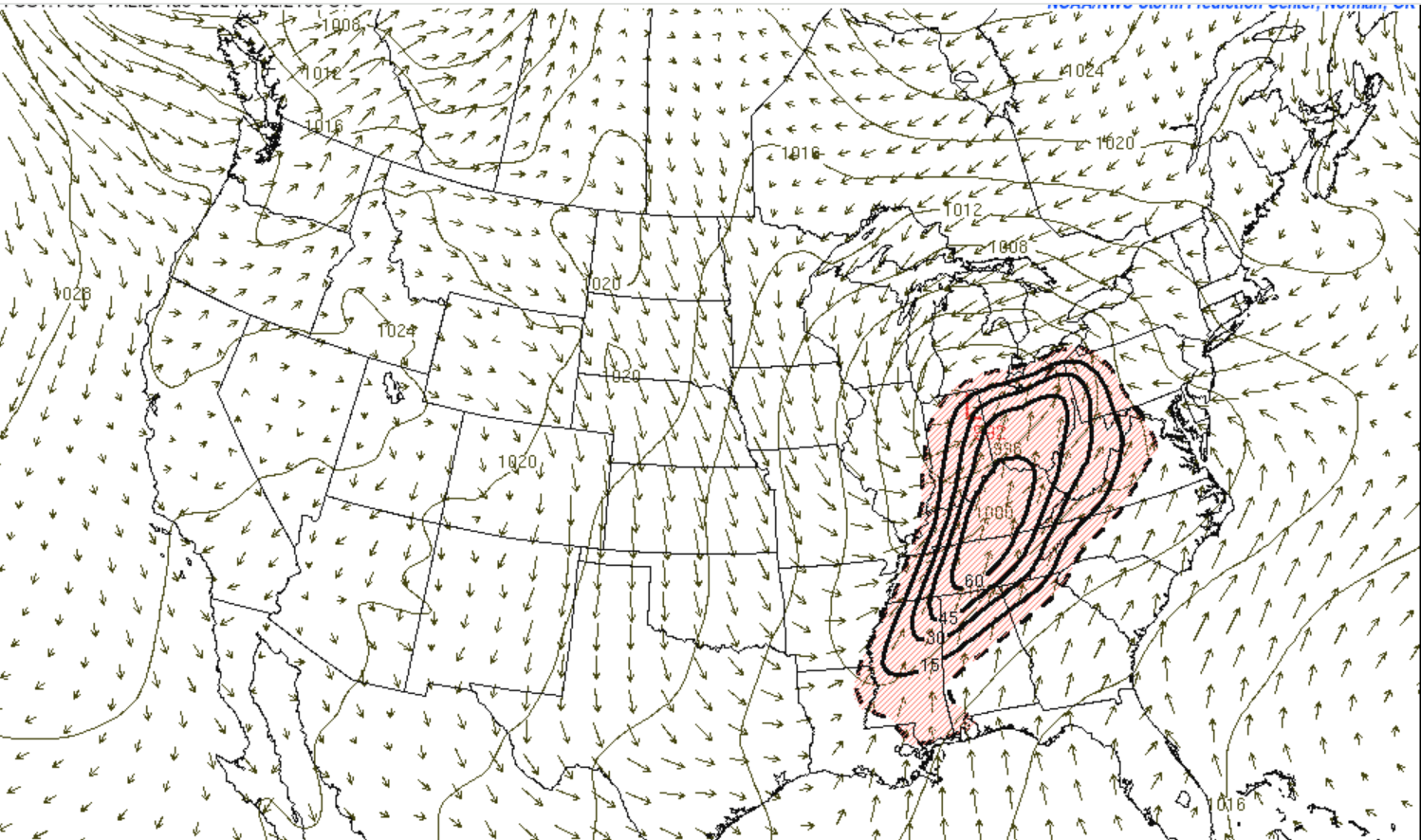
18z suite continues trend of 12z. Large area of substantial STP.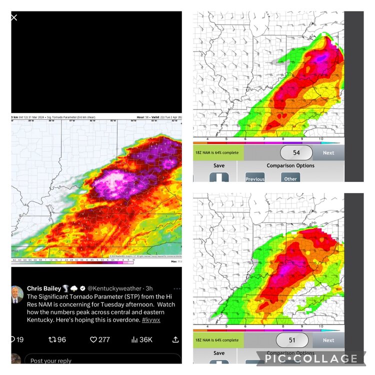
-
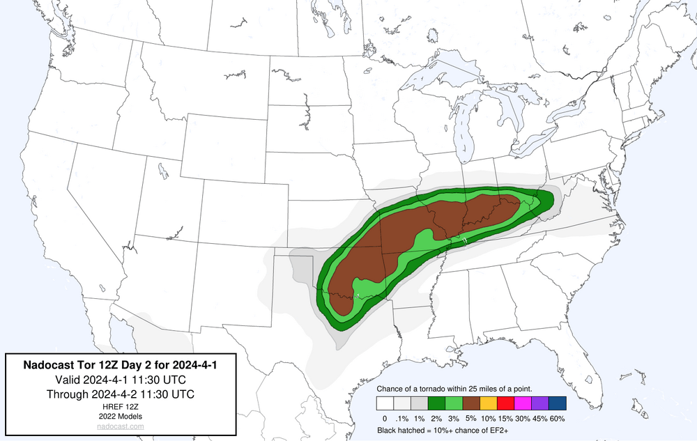
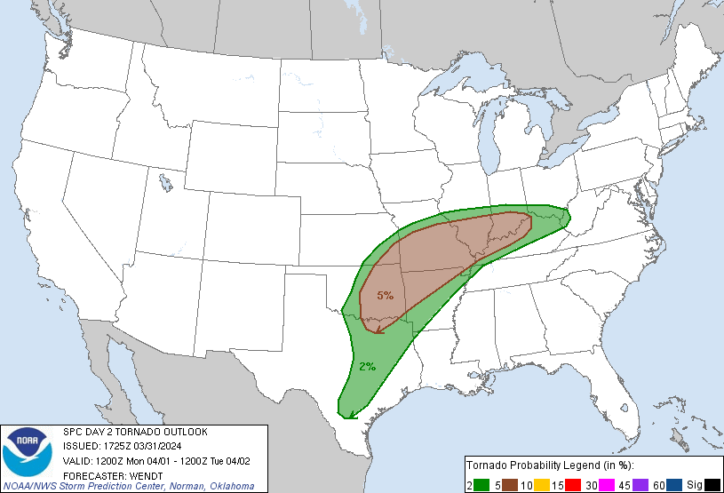
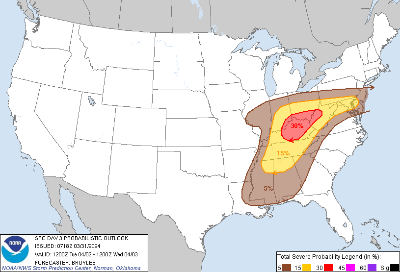
Multi day severe threat expected for southern portion of subforum 4/1-4/2. As of now, the SPC a 5% risk of tornadoes along I64 for Monday and a 30% general risk for Tuesday. Most concerning to me is the nocturnal threat monday into Tuesday. Biggest question that remains is how veered winds are.
-
2024 Short/Medium Range Severe Weather Discussion
largetornado replied to Chicago Storm's topic in Lakes/Ohio Valley
yep, didnt hold in the 0Z suite. However, the warm front on Monday has that look to me and the D2 outlook hits on that. -
2024 Short/Medium Range Severe Weather Discussion
largetornado replied to Chicago Storm's topic in Lakes/Ohio Valley
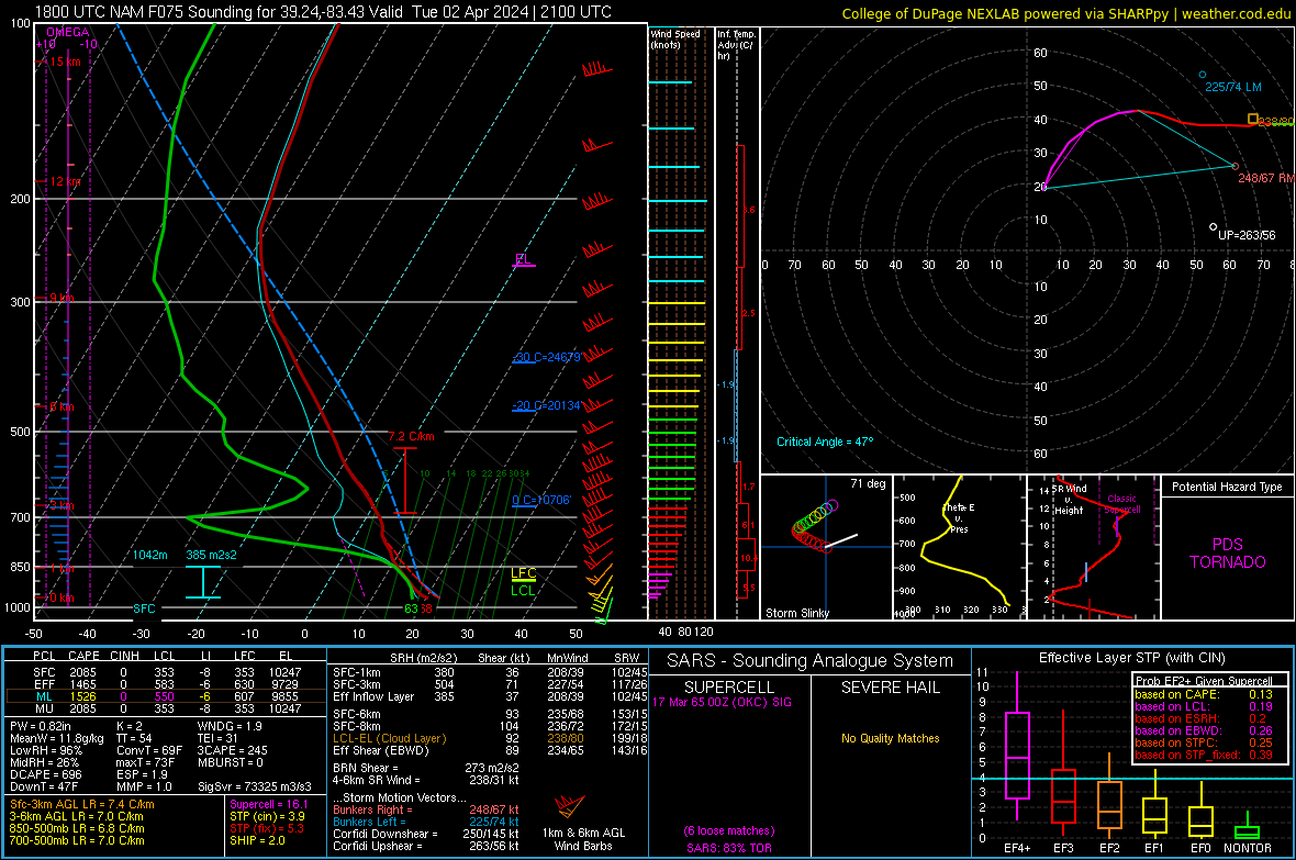
NAM not as veered. Sounding from southern Ohio on tuesday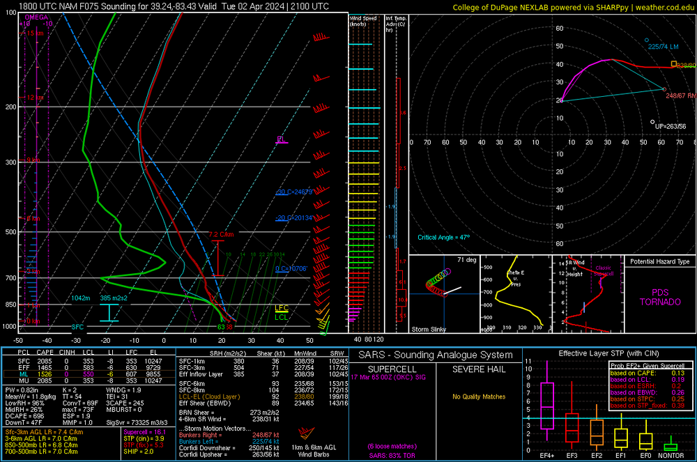
-
2024 Short/Medium Range Severe Weather Discussion
largetornado replied to Chicago Storm's topic in Lakes/Ohio Valley
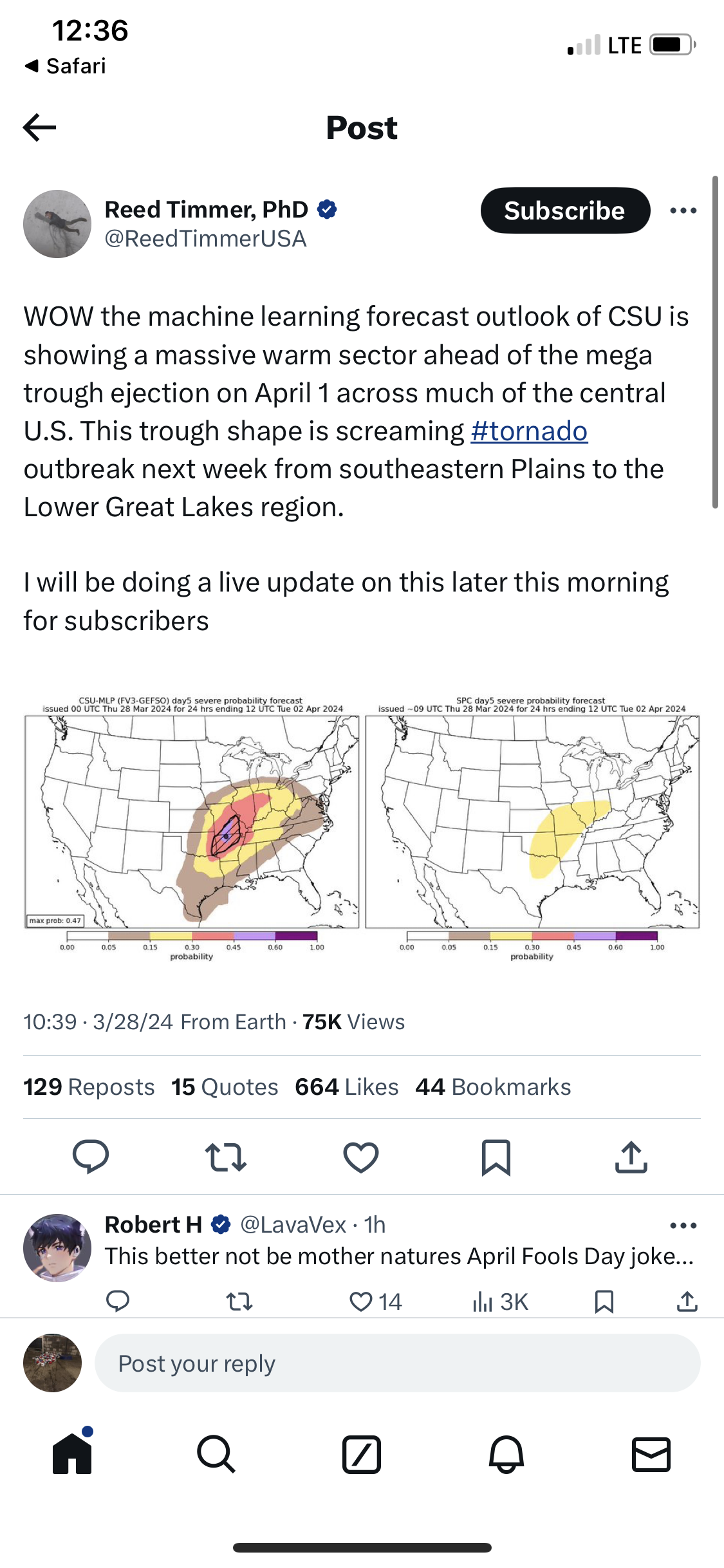
https://x.com/reedtimmerusa/status/1773359186484601075?s=46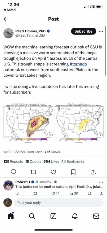
-
2024 Short/Medium Range Severe Weather Discussion
largetornado replied to Chicago Storm's topic in Lakes/Ohio Valley
Based on the GFS over the past 4-5 days, looks like our next chance of severe is going to be 3/28-4/3. -
2024 Short/Medium Range Severe Weather Discussion
largetornado replied to Chicago Storm's topic in Lakes/Ohio Valley
ILN was on it. Give them props. There will be time for airmass recovery in western Ohio/eastern Indiana later this afternoon and evening, with model consensus of lower 60s dewpoints advecting in along and south. A pretty concerning supercell environment is depicted with a mid level jet streak providing ample deep layer shear, low level curvature in the hodographs, and deep instability. Supercell mode is possible if not likely, thus threats in terms of impact seem to maximize in the 5P-11P timeframe in southeast Indiana, western Ohio possibly as far east as central Ohio with large hail and a a tornado or two. -
2024 Short/Medium Range Severe Weather Discussion
largetornado replied to Chicago Storm's topic in Lakes/Ohio Valley
Minimum ef4 damage right? Swept off slab? -
2024 Short/Medium Range Severe Weather Discussion
largetornado replied to Chicago Storm's topic in Lakes/Ohio Valley
by my latest count, 4 killed in Winchester and at least 6 killed in Ohio. -
2024 Short/Medium Range Severe Weather Discussion
largetornado replied to Chicago Storm's topic in Lakes/Ohio Valley
Look at the STP Map from the 18z HRRR. And the mesoscale analysis had STP of 3+ for a lot of Ohio throughout the day that could have been caught by the 4pm update. Additionally effective SRH(IMO the signal biggest predictor of strong/violent tornadoes) was 300+ on the Mesoanalysis. I’m just saying to not raise to an enhanced, was a mistake based on the signals I saw. My guess is the SPC was thinking veering would tamper any threats which veering was specifically mentioned in the 4pm update


.png.c8d86572ac1324c76d72b49a4ead0b7f.png)