largetornado
-
Posts
163 -
Joined
-
Last visited
Content Type
Profiles
Blogs
Forums
American Weather
Media Demo
Store
Gallery
Everything posted by largetornado
-
2024 Short/Medium Range Severe Weather Discussion
largetornado replied to Chicago Storm's topic in Lakes/Ohio Valley
Agreed. There was a clear signal a 10% was justified by noon. -
2024 Short/Medium Range Severe Weather Discussion
largetornado replied to Chicago Storm's topic in Lakes/Ohio Valley
At least 3 killed in winchester per Jenny dressier on twittter . Mobile homes hit -
2024 Short/Medium Range Severe Weather Discussion
largetornado replied to Chicago Storm's topic in Lakes/Ohio Valley
Ok then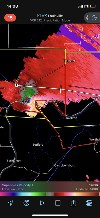
-
2024 Short/Medium Range Severe Weather Discussion
largetornado replied to Chicago Storm's topic in Lakes/Ohio Valley
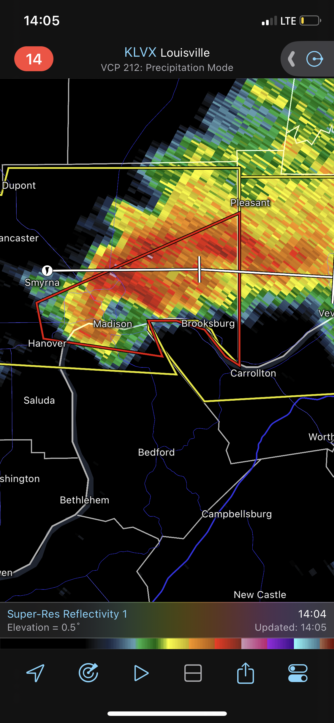
SE Indiana tornado warning. Confirmed
-
2024 Short/Medium Range Severe Weather Discussion
largetornado replied to Chicago Storm's topic in Lakes/Ohio Valley
Unusually bullish from ILN. -
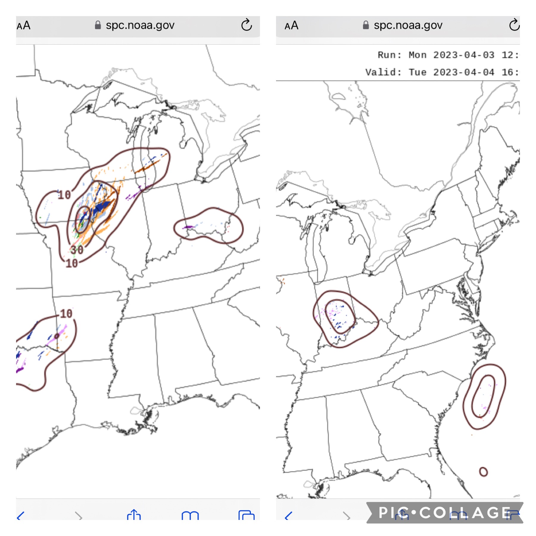
60/40 tor probs issued for Ohio valley.
-
Strong strong tornado right there. Damn
-
Was the random kokomo wedge in 2015?
-
Silly hobby
-
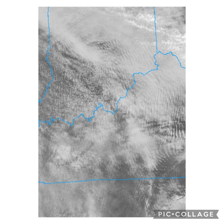
Look at all the gravity waves
-
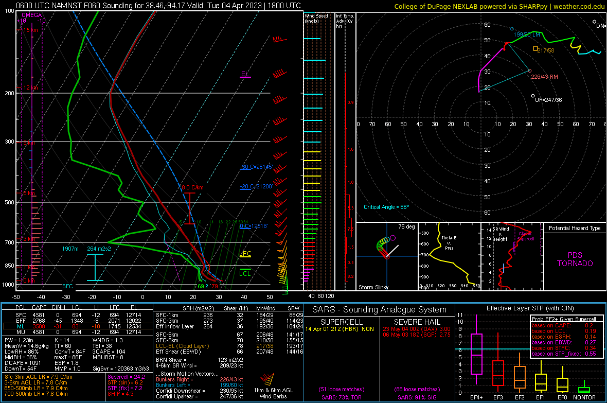
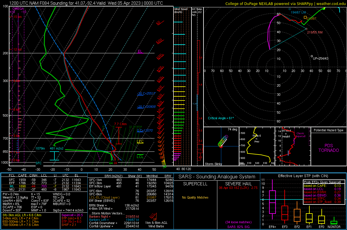
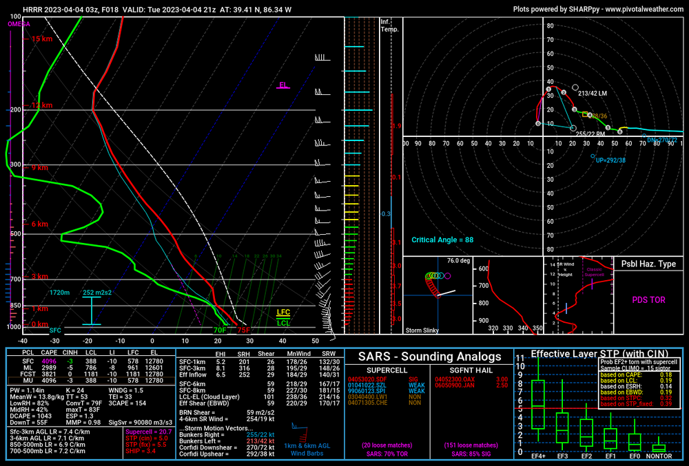
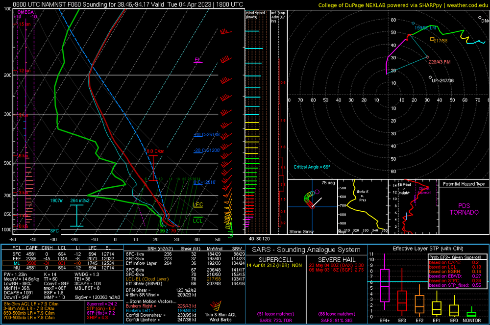
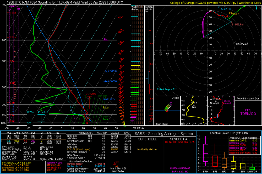
For whatever reason, the warm front, as it lifts over central Indiana has me really intrigued . (also I think I found the tightest hodo for a PDS TOR Sounding)
-
These storms around 12z…any chance they lay a boundary that interacts with the warm front as it lifts north and fire storms?
-
Bingo. What makes sense to us can and often times confuses the general public. IE, watch vs warnings.
-
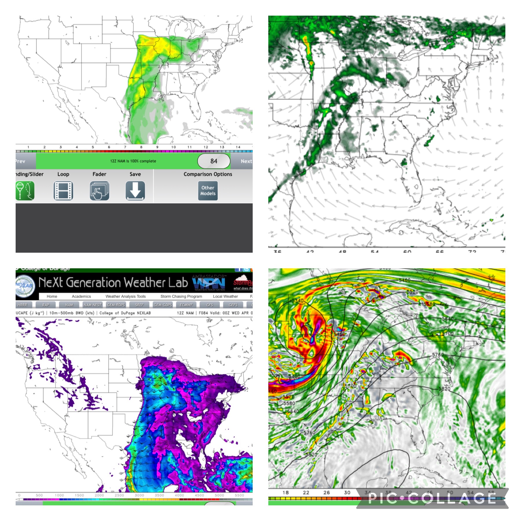
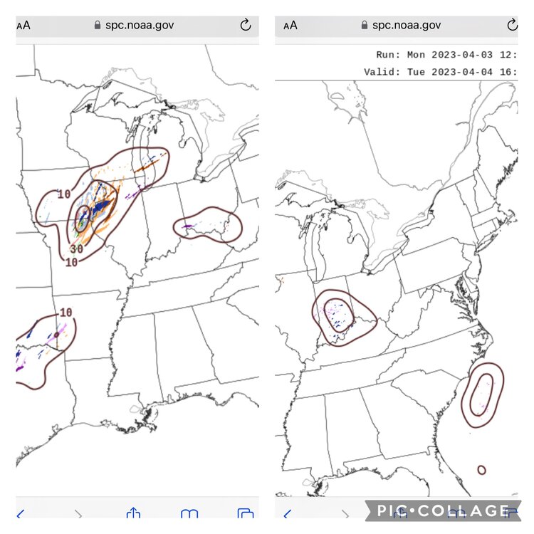
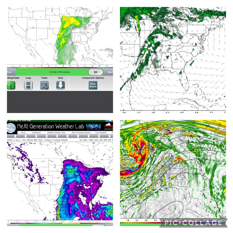
After looking at 18z, HRRR would have me chasing wednesday. If i went off the nam suite, i would not chase at all but its apparently been having problems this year. At this point, any storms that can become surface based will have a top tier environment to work with. I wish the SPC had a outlook that conveyed spatial coverage as well as potential intensity. Tomorrow would be a slight risk for storm coverage and a moderate risk for intensity IMO.
-
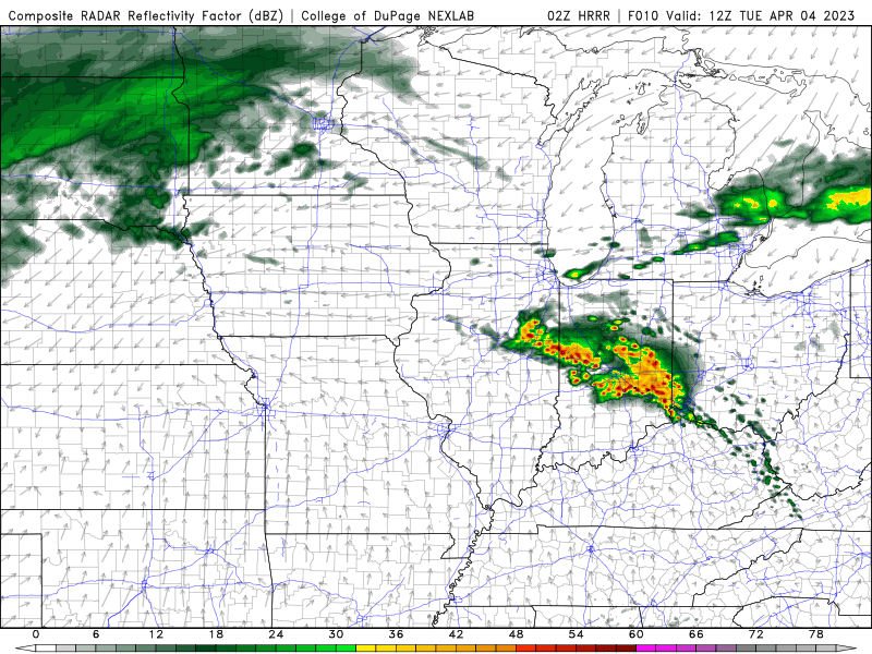
FWIW, the HREF has a pretty bullish convective signal for Iowa/mo/ill area. Secondary, hinting at some early activity in Indiana south of i70
-
Yep. Warm front or very close to the triple point. Unless some subtle forcing mechanism occurs in the warm sector, it looks like it will be capped.
-
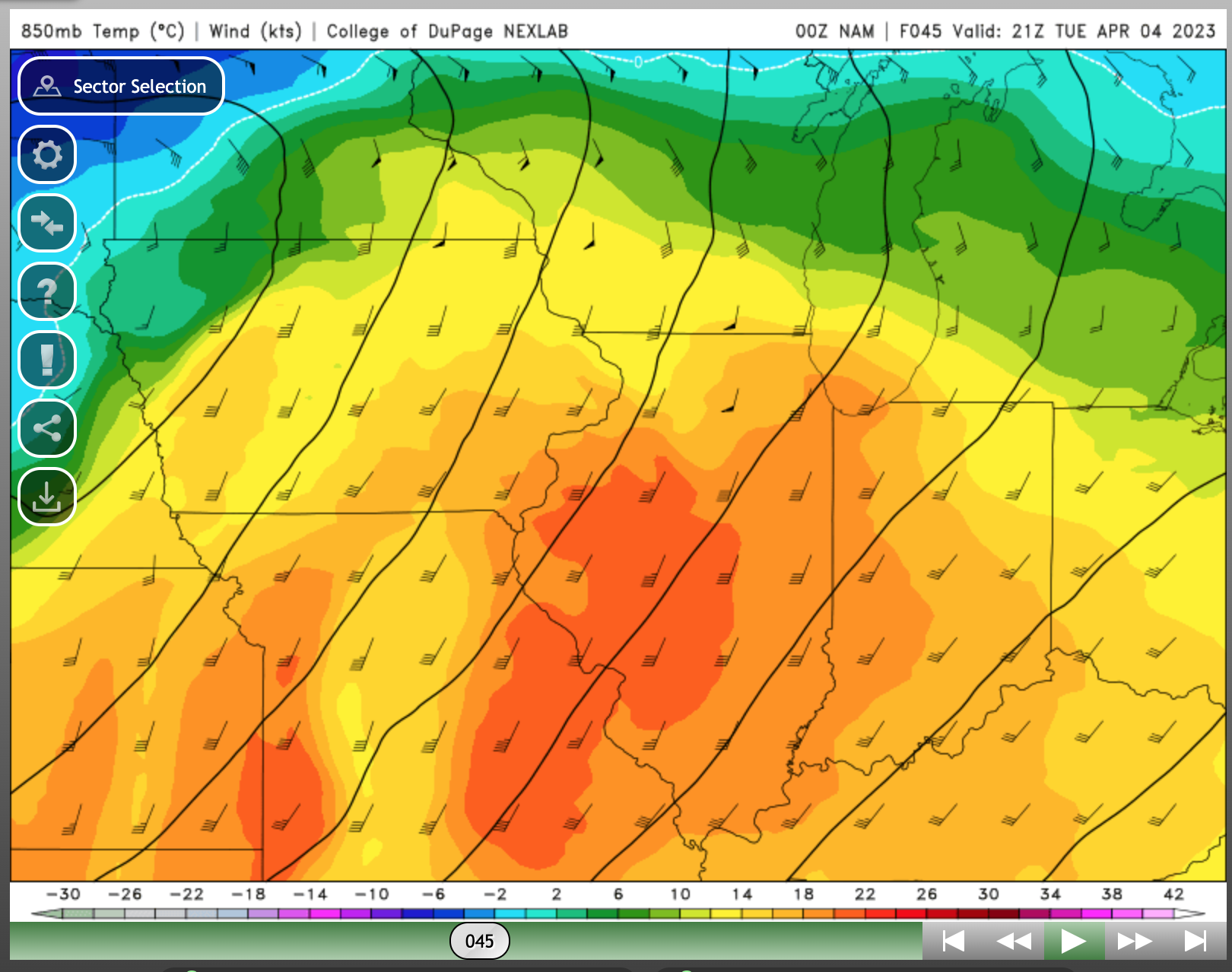
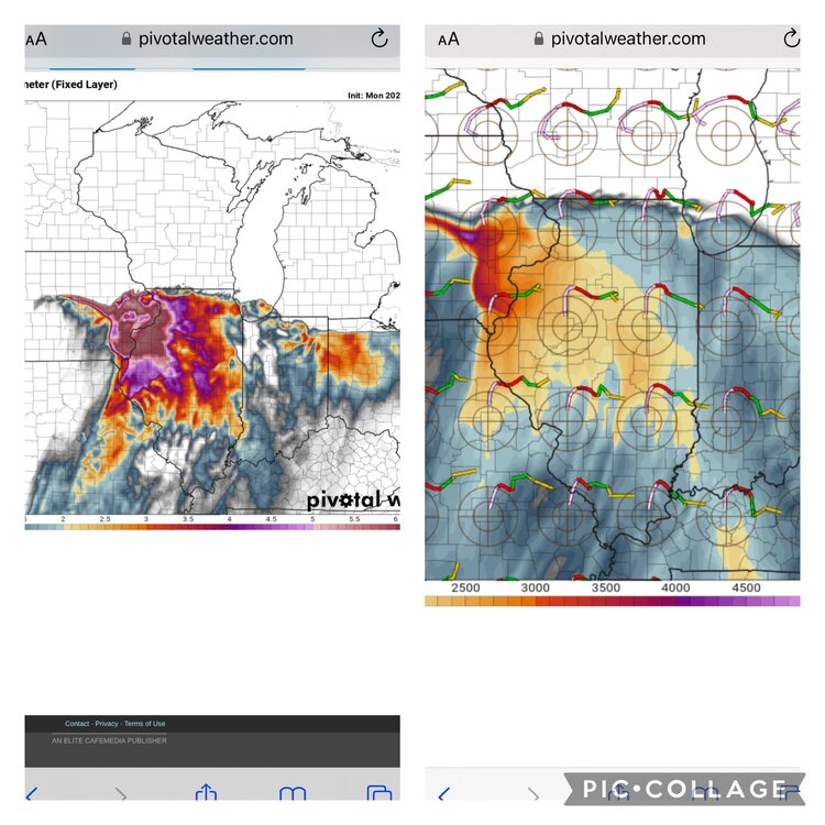
NAM has some ridiculous 850 temps. In my untrained eye, NAM favors cap bust. Nam 3km points to a cap bust/nocturnal threat, as someone pointed out HRRR is trending towards mixing issues.

-
HRRR isn’t shy
-
MUCAPE of 4500 per nam 3k at 18z tuesday. Lmao
-
0z nam rolling in. Looks like a shift west
-
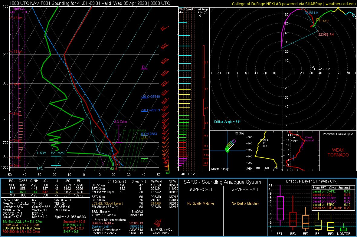
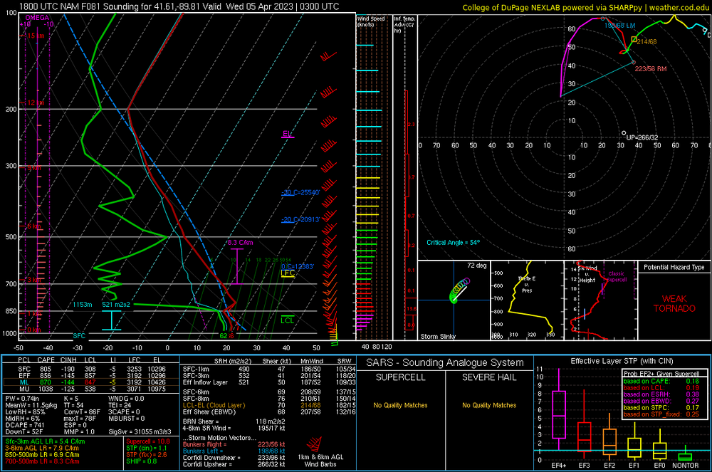
Looking through some soundings. Looks to be a fairly stout inversion right above 850. Failure mode?
-
Had some more time to look at the models. The warm sector is enormous with favorable parameters throughout. If the nam has its way, the warm sector is going to be relatively free of contaminating crapvection. (GFS and euro agree with the minimal rainfall in the warm sector as well) Good forcing throughout the warm sector…it certainly seems this could be a very high end event over a widespread area.
-
First sounding I picked from the NAM.
-
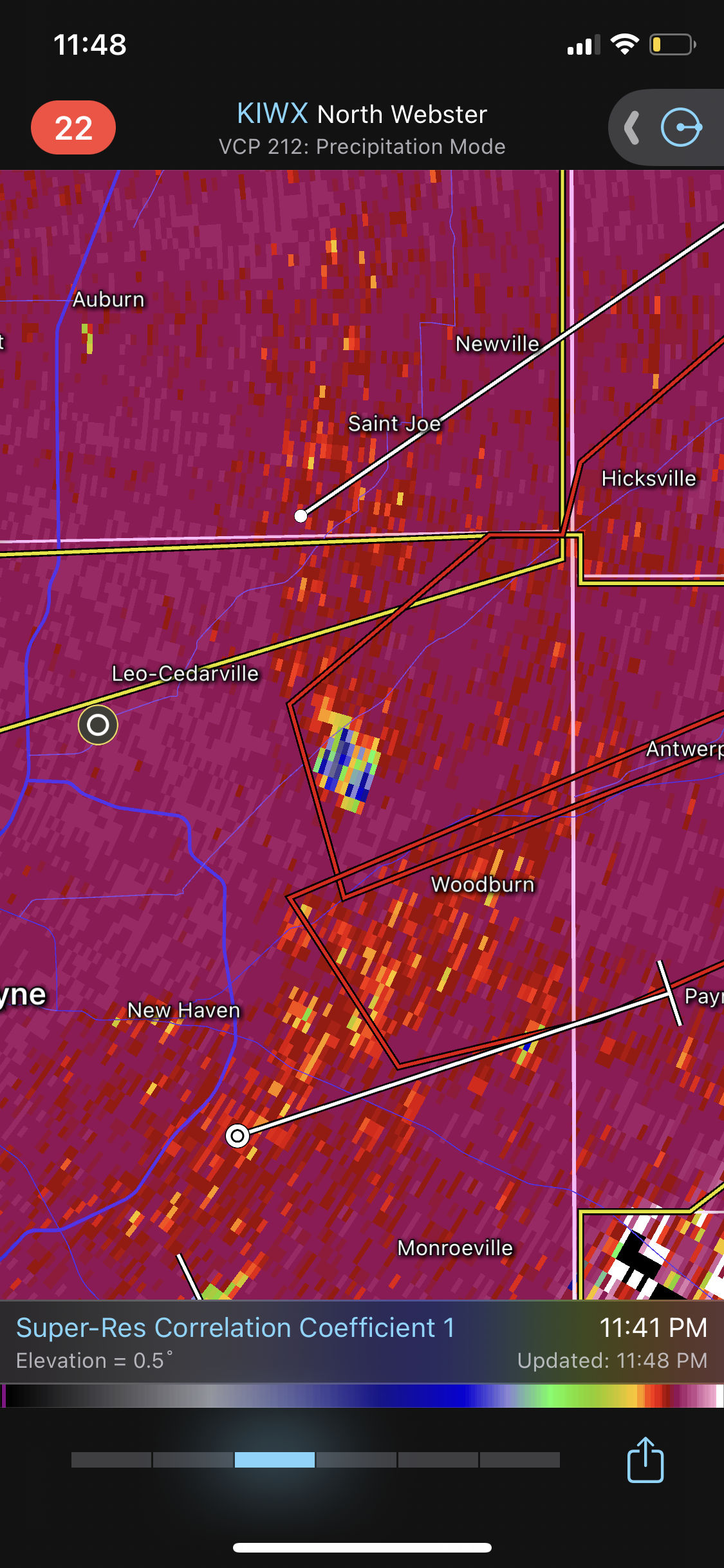
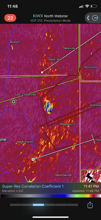
Tornado just dropped NE of Fort Wayne. Good debris ball
-
Where is McCarthy when you need him?