Jump to content

Holston_River_Rambler

Members
  • Posts

    5,107
  • Joined

  • Last visited

Everything posted by Holston_River_Rambler

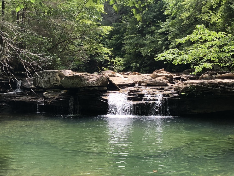
  1. Mt. Leconte kicked my butt today! Special thank you to @Hvward from the Foothills/ Mountains subforum of the SE for helping me decide what time to start. Glad for that info, since earlier was better. The original plan was to go up Alum Cave, but 411 was already closed, so I decided to try Rainbow Falls. When I got to that trailhead I saw a sign that said "high water makes Rainbow Falls trail unpassable" so I decided to try Bullhead trail. Never been on that one before and after trying it out, I bet it has some amazing views. Unfortunately most of those are from the burn scars of 2016. Here are my pics: https://imgur.com/a/zqe33M4 From about 3000-4000 feet it went from heavy snow, to heavy rain, to heavy mix. After 4000 feet, it was all snow. I'd say at least 8-12" at the top. One drift was probably 2 feet. I made it to about 6100 feet, but that last bit of the trail was on the exposed top of Leconte and I was soaked from rain, snow, and sweat. I had all waterproof outer layers/ boots/ but apparently I needed more base layers because for the first time in doing something like this I was scared of hypothermia. My core started to get cold and I said, time to go back. Maybe I'm just getting older. Here is what it was like where I stopped: The snow was really fine, but everywhere. It was like being in a sand storm. Here is the best video I could get of the snow type: It was wet. Not just from snow melt, but from recent rains. I had to cross 4 creeks that had turned into little waterfalls. It wasn't too big of a deal, but all that water is running off and if you look at the last of my images on imgur, there's already a minor flood situation in Sevier county. There were some roads just outside of Gatlinburg that were about to be covered by streams. Waterfall in the snow: All in all a fun day, but glad to be home!
  2. I always feel like I'm going to jinx it though. Maybe this will offset it (just for my mind) Not that I believe the 3k NAM verbatim, but I may not make it home... That is Kuchera by the way.
  3. At Carver's request here is the EPS weekly snowfall: I feel like I have to say a caveat for anyone who might be lurking. This is the mean snowfall of 50 or 51 versions of the Euro run out 45 days. There's reason to be excited because it at least shows a good chance that there is cold and a southern storm track. Numbers aren't as important in this as the overall pattern represented in the mean. Get the cold, get the storm track, and then roll the dice. Off to Mt. LeConte this AM. Hopefully some pictures later.
  4. Just going to throw this in banter and go hide somewhere. (I................... borrowed it....................from another place).
  5. A collection of realtime charts, some hard to find like AAM and GWO: http://atlas.niu.edu/ I'm not sure how to read some of this yet, but thought some might find it useful.
  6. Normally not one to ask for IMBY info, but any thoughts on when the transition occurs tomorrow for a place like Mt Leconte (approx. 6600 ft)? I'm going to head up there to try and get in on the action. My guess was that the change over would happen around 11 AM, so hoping to start hiking around 10 or so, but don't have much experience figuring out timing with what models show at elevation. Trying to time things so that I get back to my car afterwards just as the snow level gets to around 4000 feet (hopefully by 3 PM or so).
  7. Flash, I feel you in the Strat dept. Each evening for me = "it's here, it's there, it's everywhere! when will it end??!!", but then I wake up the next morning and there's some new detail (Masiello, Butler, et al. posts), that makes me think about some new aspect. And then I'm like: I wasn't going to post today about it, but..... then I do it anyway and second guess it for 12 hours. As an aside, I do think hype on social media (and soon mainstream news I suspect) is going to get worse before it gets better. By worse I mean more people/ irresponsible journalists (not saying all journalists are, but hype and controversy sells and gets clicks) will be using not even real time data, but modeled data at fairly long leads to make claims that the data wasn't really meant to support. Example: I was driving home from Kingsport today and my wife showed me an article on social media that was titled "Polar Vortex to make a Visit" or some such. I basically told her what I just said above and.......... I don't think that was the answer she was looking for. I don't know about y'all, but every time people I know who are not weather nerds/ weenies like me start talking about something like this, it seems to end badly in the sense that the hype dies a painful death. I don't want that for this one, but 'tis out of my control. For other folks reading this and thinking: "Well, where do you stand and what does this mean for me?" I really am, like I suspect anyone who knows enough about SSWEs to understand that so much is very uncertain, in a wait-and-see mode. We call it a sudden stratospheric warming, but the warming only helps induce what can benefit us. The warming itself does us no good. As I understand it, the main event is the reversal of winds aloft at high latitudes. In fact that is how SSWs are measured. Heat flux poleward is an indicator, but that heat is a an indicator for the trigger that slows the flow and causes the blocking down the road. Energy waves heading poleward carrying relative heat from the equator break into the circulation of the SPV and if it is weakened enough, it shifts, or splits and breaks down. The highest parts of the upper air flow slow and meander near the pole, while increasing and sharpening in lower latitudes. Maybe one way to visualize this is that it's like dipping a paddle into a river running one direction, and paddling it in the opposite direction?? If you've ever done that and watched the swirls and eddies, you know how chaotic it is. Imagine that on a planetary scale! That's where the uncertainty lies. Even if it seems like the result is bad for us at first, it can change and vice versa. I think Carver/ Flash's posts above pretty much summed up how I feel about it as of now. Cautiously optimistic? Optimistically cautious? Happy happy, joy joy? Murphy's Law? I wrote about a Rube-Goldberg machine earlier and I think the SSW (if a major one happens) will be like the last piece of the machine, the one that kicks it all off. Even without a SSW things are lining up, to paraphrase a poster from the MA forum, in a way people have been waiting for, well, years. The much-anticipated (and prognosticated by JB) Modoki El Nino, a Madden-Julien Oscillation that has thus far this fall favored the cooler phases, overall cool and wet pattern in fall (and not just wet, but record wet across the E and S !), low solar cycle, and probably other factors I can't think of right now. Yet it is the South, even if the upper/ mid South for some and in others at decent elevation. Murphy's Law gnaws at the back of my mind. Maybe it's just my superstitious side? Maybe this sums it up for me: https://tenor.com/view/indiana-jones-drink-gif-10683045
  8. Interestingly the Euro and EPS want the larger SPV from the projected split to end up more over the Davis Straits. Opposite of what the GFS is showing (larger SPV after split ends up over N. Eurasia) and the GEFS isn't even all in on a split. Not in any way trying to promote this person, but including the tweet because you can see both EPS and EURO in the link. (Saves me image space too) Images for future comparisons for how all this plays out. EPS/ Euro images are always hard to find.
  9. One of the other things I'm interested in is the 3D structure maps some people are posting these days. The reason I think it matters is that the split isn't of a flat circulation, but almost like a big old tornado at the pole. The analogy is not quit accurate and not meant to freak anyone out, but it's the best image I can think of. Do parts of it split at different levels in the atmosphere? Example: As Ventrice states, it is just one model, and as in my above post, probably not exactly what happens in the end, but for the purpose of asking how it all works, see how the whole thing is deformed and the little vortexes seem to extend down not quite as far as the larger one. Here's an image from Masiello this AM that I think shows how this plays out through the entire troposphere: It looks at first like he is only talking about 500 mb, but if you look at the second map, you can see how that weakness extends up to the tropopause and how the SSW is impacting the highest levels more, tilting the overall vortex into almost one side of a triangle. Again not trying to say it will result in this or that, but if we can better understand how these things work, maybe it can start to take some of the uncertainty out of the equation. Especially with how the effects trickle (or rush?) down to 500 mb, a level from which that is easier to see local impacts.
  10. While we are waiting to see how everything plays out, I thought I'd try to dig around and find some images of the last SPV split and it's results, so we could use it to compare to what is projected to happen. Again, I'm not trying to forecast any particular result. I don't think anyone can say one way or the other what or when the result will be, but maybe something to be learned as it unfolds by comparing it directly to what happened earlier this year: Image/ animation 1: projection of the SPV split this past February: Image 2, results of that split at 500 mb (taken from Todd Crawford on twitter): In some ways, as it's being modeled now, the upcoming one looks a little opposite? (not sure that's the right word here, but can't think of a better one) of the one from last Feb, in that the smaller vortex from the split takes aim at NA while the larger one stays in N. Eurasia.
  11. Euro is even stronger with the surface low than the NAM at 12z. 990mb in GA. I plan on going up to Mt. Leconte, but that plan is based on the idea that snow levels won't drop below 4000 feet until maybe 3 PM or so. Don't think my little car can make it down Newfound Gap in more than 3 inches of snow. Euro is also now introducing the idea of rain/ snow mix over areas like High Knob as soon as noon Friday.
  12. Triplets? Just one run of the GFS, but I never thought there could be three. Take it for what it's worth, but I guess a possibility. And here's an interesting thought, would three be inherently more stable than 2? A triangle of little SPVs to keep the wind reversal in place over the pole?
  13. Here's hoping for an awesome January! There's already a nice fantasy storm on the Fv3 and we are in MJO phase 4, heading toward warmer phases:
  14. Note much of this is not in direct response to you Coach B, but that post kind of gave me a kick start for something I've been thinking about. I'm a fan of Cranky (I like his approach of looking at overall N. hemisphere flow) and think what he's saying (strat. aside) pretty much lines up with what most are thinking in terms of the overall pattern progression. RE: isotherm (not quite biting on a full SPV split); griteater, posted above; Carver's; Jeff, etc..., I say "strat aside" because not everyone is gung ho about the real time results of the strat. It still is a big question for me, as much as I post about it. The strat. stuff can be controversial because I think some (not Cranky and no one in our forum) use it or have used it as a "hail mary" type event for past winters that were looking bleak. The word "unicorn" has been used a couple of times today in the MA and SE regions. They are tough to predict but I think this one is more in folks' minds since last year's SSW. It eventually created a nice pattern from many in the east, but alas, too late in the season for our area (although Olhausen got a nice late season snow). I think they are also poorly understood but are starting to be understood more by scientists like Amy Butler (mentioned by Carver's earlier in this thread). With all that in mind, one thing that I worry about is, let's say best case scenario based on last year, we get a split and a major warming. Now, the pattern was pretty dismal last year with a mega ridge in Feb. Ninas are usually front loaded and one would normally expect an early spring. The MJO was in record territory in phase 6 when the GFS first sniffed the SSW out and in phase 7 when it happened. But as soon as the SSW happened and it's responses were felt, the weeklies/ other models did a big turnaround. Examples from Carver's much appreciated rundown of the weeklies taken from last February: "When we began talking about a return of winter w the SSW being part of the equation, I can think of no model that showed a return to cold as the Weeklies completely abandoned any 500 pattern that would support it." -Feb 18, 2018 "Nice to see the Weeklies retrograde the trough into the EC. And honestly, the 12z run was faster and would likely have produced a colder Weeklies run." -Feb 19, 2018 This year, leaving aside for a moment any dramatic SSW or SPV splits, the Euro weeklies/ CFS weeklies are still looking not too shabby from mid-Jan on. Yeah we're in phase 5 of the MJO now and relaxing, but seems like it is a pretty typical Nino progression. What would unfold without a SSW? 2014 - 15 looks pretty similar as a recent analogue, but slightly better so far I would say based solely on the Dec 8 -10 storm. So, does any potential SSW destructively interfere with what was going to unfold? In other words, do we get a worse pattern in the long run because of the SSW? On the other hand, does it constructively help it along even more? Butler's research has shown that El Nino SSWs are associated with blocking in the AO and NAO regions. Maybe my "wait and see" from earlier in this thread could have covered all the above but sometimes writing it out helps me refine what I think. Maybe this is just an attempt at reverse psychologizing the weather? Also, since there isn't much else right now, anyone got any links to info on Mountain Torque as it relates to overall patterns? Last year the buzz word seemed to be GLAAM, this year I keep seeing Mountain Torque (MT).
  15. Speaking of 2014. I went back and read through that Dec. thread and it is eerie how similar some of the progression was. Chance at a storm mid month (didn't materialize that time, unlike our Dec. 8-10 storm did for some) then relax in the pattern. MJO was pretty similar, but seems to have been a little behind this year (i.e. progression into and through 4-5-6 came a little later that year, thus the storm chance when we were in 3 was slightly later than this year's, which was, oddly enough, just as we transitioned from 2 to 3).
  16. I'm hopeful for above 5000 feet Friday PM. Heading up Leconte to see what I can see. Late edit: And for what it's worth (probably not much below 5000 feet) the 12z NAM and 0z Euro are currently agreeing on the energy being much further south than the GFS or Fv3.
  17. I think that's (Wayne Browning?) High Knob Landform (https://www.highknoblandform.com/) guy. I love his blog. Based on topography I could see how High Knob could kill Big Stone Gap's snow. Still unbelievable how "microclimate" that must have been if Wise got snow and BSG did not. Wise ought to be downsloped too, I think. I guess there is that big hill between the two on hwy 58. Awesome that a local paper is publishing info about things like ageostrophic forcing. Is "Thermally Indirect Mesoscale (TIM) Circulation" a thing? Works for me, but haven't heard it before. AND High Knob got 40" !!!!! amazing.
  18. Found a new toy for past MJO( some of you may already have this) : http://www.bom.gov.au/climate/mjo/graphics/rmm.74toRealtime.txt
  19. Just realized I forgot to include the day/ time on the image on the right. I think I was so worked up about getting a side-by-side I cut it off. 12z March 13, 1993 So close yet so far away.
  20. I put this in banter for a reason. Many things regarding the set up look very different, but the look of the energy at H5 isn't necessarily one of the more different ones: Regardless of final outcome, I'm invested now in seeing how strong this one can get.
  21. If this was all I had, I would l would think it was a great look. Where is the even marginally cold air when you need it?
×
×
  • Create New...