Sw NC weather
-
Posts
629 -
Joined
-
Last visited
Content Type
Profiles
Blogs
Forums
American Weather
Media Demo
Store
Gallery
Everything posted by Sw NC weather
-

2021 Spring/ Summer Mountains thread
Sw NC weather replied to Met1985's topic in Southeastern States
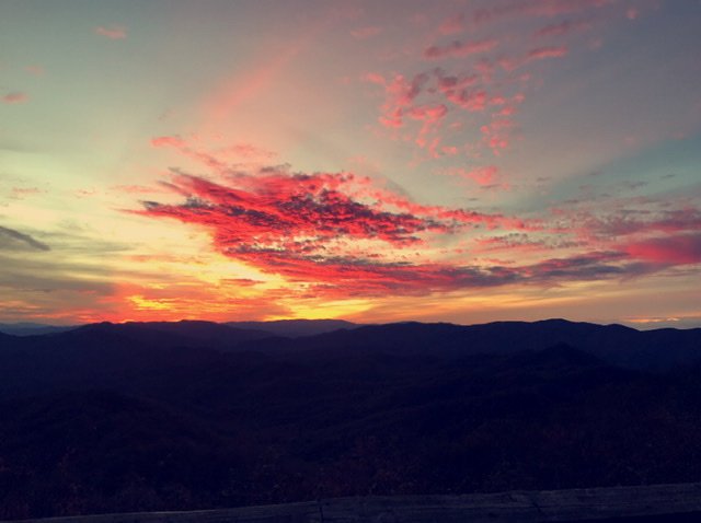
It has poured the rain all morning surprised I’m not under a flash flood warning.- 310 replies
-
- 1
-

-
- late freeze
- warm
- (and 3 more)
-
2021 Spring/ Summer Mountains thread
Sw NC weather replied to Met1985's topic in Southeastern States
Clouds rolled in and keep it from dropping to low here this morning. Was 29 at 5:30 up to 35 now.- 310 replies
-
- 1
-
-
- late freeze
- warm
- (and 3 more)
-
2021 Spring/ Summer Mountains thread
Sw NC weather replied to Met1985's topic in Southeastern States
Dropped to 25 this morning. Looks like we’re headed for another freeze tomorrow morning.- 310 replies
-
- 1
-
-
- late freeze
- warm
- (and 3 more)
-
2021 Spring/ Summer Mountains thread
Sw NC weather replied to Met1985's topic in Southeastern States
33.7 here this morning. -
2020/2021 Fall/Winter Mountain thread
Sw NC weather replied to Met1985's topic in Southeastern States
Starting out the morning with a nice crisp 21*. Thank God there’s no wind though, it was brutal yesterday. -
2020/2021 Fall/Winter Mountain thread
Sw NC weather replied to Met1985's topic in Southeastern States
NWS just issued a flash flood warning for Macon. It seems like we’ve been under a warning more in the last 2 years then the past 4 or 5 years before that. -
2020/2021 Fall/Winter Mountain thread
Sw NC weather replied to Met1985's topic in Southeastern States
Had a low of 27 this morning. Looks to be the start of a chilly week ahead. -
2020/2021 Fall/Winter Mountain thread
Sw NC weather replied to Met1985's topic in Southeastern States
-
2020/2021 Fall/Winter Mountain thread
Sw NC weather replied to Met1985's topic in Southeastern States
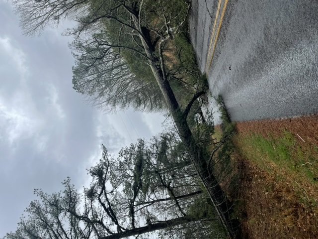
This line means business. It blew over a huge pine tree below my house. Has the road blocked and tore down the power lines. -
2020/2021 Fall/Winter Mountain thread
Sw NC weather replied to Met1985's topic in Southeastern States
Just had a storm roll thru here. Lots of wind and torrential rain. Acted like a summertime storm. -
2020/2021 Fall/Winter Mountain thread
Sw NC weather replied to Met1985's topic in Southeastern States
Quite a bit of river flooding ongoing here in Macon county. -
2020/2021 Fall/Winter Mountain thread
Sw NC weather replied to Met1985's topic in Southeastern States
I think we’re heading for some impressive flooding overnight latest hrrr brings the second band right over us before the squall line. It advertises and additional 2-4”. -
2020/2021 Fall/Winter Mountain thread
Sw NC weather replied to Met1985's topic in Southeastern States
I’m gonna try to get outside and enjoy this weather a little bit tomorrow because it looks like Friday through next week is just pure miserable. -
2020/2021 Fall/Winter Mountain thread
Sw NC weather replied to Met1985's topic in Southeastern States
I’m down to 32.7. Y’all that are already below me might be in for a little snow/sleet overnight. -
2020/2021 Fall/Winter Mountain thread
Sw NC weather replied to Met1985's topic in Southeastern States
Dropping rapidly here as well. Down to 36 with a forecast low of 37. -
2020/2021 Fall/Winter Mountain thread
Sw NC weather replied to Met1985's topic in Southeastern States
Woke at 5:30 and there was about 1/2” of sleet outside but it’s all gone now. Like Franklin said we need a flood watch in Macon county the creek below the house is out in multiple places. -
2020/2021 Fall/Winter Mountain thread
Sw NC weather replied to Met1985's topic in Southeastern States
I’ve had a light snow shower here for the past 15 minutes temps at 36. -
2020/2021 Fall/Winter Mountain thread
Sw NC weather replied to Met1985's topic in Southeastern States
A lot of models want to drop some ice down in Macon county and I don’t see it happening either maybe will be surprised. -
2020/2021 Fall/Winter Mountain thread
Sw NC weather replied to Met1985's topic in Southeastern States
First day with sunshine in a while. Also had a few flurries down this way. -
2020/2021 Fall/Winter Mountain thread
Sw NC weather replied to Met1985's topic in Southeastern States
Looks like we might not see the sun for a week. Gotta love wnc. -
2020/2021 Fall/Winter Mountain thread
Sw NC weather replied to Met1985's topic in Southeastern States
I took a ride towards Franklin and there is a huge difference in totals. There might be 2 inches around the Macon county airport. -
2020/2021 Fall/Winter Mountain thread
Sw NC weather replied to Met1985's topic in Southeastern States
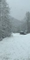
I would say I’m right around 5” here In Cowee north of Franklin. It’s a true paste, trees are absolutely full of snow! -
2020/2021 Fall/Winter Mountain thread
Sw NC weather replied to Met1985's topic in Southeastern States
Starting to really come down again. Temps held steady all night at 30-31. -
2020/2021 Fall/Winter Mountain thread
Sw NC weather replied to Met1985's topic in Southeastern States
Flake size has really decreased here. Looks to be 4 or so inches. Maybe another couple on the backside and I can hit 6. -
2020/2021 Fall/Winter Mountain thread
Sw NC weather replied to Met1985's topic in Southeastern States
Crazy what a few miles will do it’s snowing the hardest it has the whole time the last 10 minutes.
