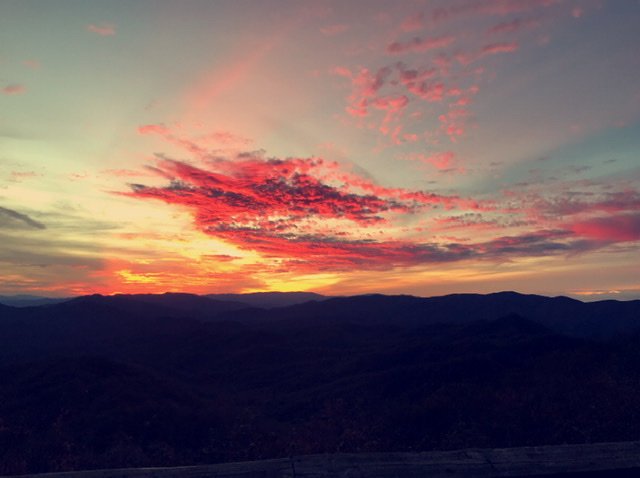
Sw NC weather
-
Posts
629 -
Joined
-
Last visited
Content Type
Profiles
Blogs
Forums
American Weather
Media Demo
Store
Gallery
Everything posted by Sw NC weather
-

2020/2021 Fall/Winter Mountain thread
Sw NC weather replied to Met1985's topic in Southeastern States
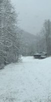
Grounds getting frosty again been snowing decently for past 45 minutes. -
2020/2021 Fall/Winter Mountain thread
Sw NC weather replied to Met1985's topic in Southeastern States
Finally starting to snow lightly again here the dusting this morning melted off. -
2020/2021 Fall/Winter Mountain thread
Sw NC weather replied to Met1985's topic in Southeastern States
I think it’s completely stoped here now. -
2020/2021 Fall/Winter Mountain thread
Sw NC weather replied to Met1985's topic in Southeastern States
Light snow here with temp of 30* vehicles are dusted up and grass is starting to look frosty! -
2020/2021 Fall/Winter Mountain thread
Sw NC weather replied to Met1985's topic in Southeastern States
I can’t remember the last time gsp showed me over and inch for a flow snow and I’ve surpassed that twice already this year. -
2020/2021 Fall/Winter Mountain thread
Sw NC weather replied to Met1985's topic in Southeastern States
Man oh man that was some euro run 6-12” with the 7 day storm and a huge storm setting up for day 11. I’m probably done for looking at models for the next couple days and enjoy watching snow fall. -
2020/2021 Fall/Winter Mountain thread
Sw NC weather replied to Met1985's topic in Southeastern States
I don’t think the trajectory of this flow is the best for my area but with such a strong push maybe I can get a couple inches. -
2020/2021 Fall/Winter Mountain thread
Sw NC weather replied to Met1985's topic in Southeastern States
Looks like we had a complete mix bag over night. There about an inch or snow/ ice on ground and the tress are weighted down with just ice. I am totally shocked this might be the most ice I’ve seen here we don’t do well with cads it’s either snow or rain 99% of the time -
2020/2021 Fall/Winter Mountain thread
Sw NC weather replied to Met1985's topic in Southeastern States
Wow you might be in for a surprise overnight. I’ve got down to 29 with no signs of steadying. I read somewhere that the primary low was in southern Mo and all models had it in northern Mo. -
2020/2021 Fall/Winter Mountain thread
Sw NC weather replied to Met1985's topic in Southeastern States
Temp has fell back to 30 here we were 32 about an hour ago. I wasn’t expecting it to fall back down. -
2020/2021 Fall/Winter Mountain thread
Sw NC weather replied to Met1985's topic in Southeastern States
I’m up in cashiers working today and there’s a few flakes starting to fly around. -
2020/2021 Fall/Winter Mountain thread
Sw NC weather replied to Met1985's topic in Southeastern States
The foothills can have there ice, I’d rather have the chance of snow on the flow. -
2020/2021 Fall/Winter Mountain thread
Sw NC weather replied to Met1985's topic in Southeastern States
Have a light dusting down this way this morning. I’m pleased because I wasn’t expecting anything but a few flurries. -
2020/2021 Fall/Winter Mountain thread
Sw NC weather replied to Met1985's topic in Southeastern States
Just had a decent size storm roll through quite a bit of lighting and heavy rain. -
2020/2021 Fall/Winter Mountain thread
Sw NC weather replied to Met1985's topic in Southeastern States
Around a inch here this morning. It don’t look like it snowed much after midnight. -
2020/2021 Fall/Winter Mountain thread
Sw NC weather replied to Met1985's topic in Southeastern States
Putting it down right now everything’s turning white. -
2020/2021 Fall/Winter Mountain thread
Sw NC weather replied to Met1985's topic in Southeastern States
Flurries flying here. -
2020/2021 Fall/Winter Mountain thread
Sw NC weather replied to Met1985's topic in Southeastern States
High resolution models wanna develop a line of heavy snow through the sw mnts tonight. -
2020/2021 Fall/Winter Mountain thread
Sw NC weather replied to Met1985's topic in Southeastern States
Just had a heavy band move through here too. Probably picked up 1/2” in 15-20 minutes. -
2020/2021 Fall/Winter Mountain thread
Sw NC weather replied to Met1985's topic in Southeastern States
Light snow here with a dusting on everything. -
2020/2021 Fall/Winter Mountain thread
Sw NC weather replied to Met1985's topic in Southeastern States
Light snow falling here with a temp of 34. -
2020/2021 Fall/Winter Mountain thread
Sw NC weather replied to Met1985's topic in Southeastern States
Snowing the heaviest it has all day atm. Grounds getting white again it’s been white twice and melted off. -
2020/2021 Fall/Winter Mountain thread
Sw NC weather replied to Met1985's topic in Southeastern States
Looks like we will have some flakes flying in the morning with a dusting possible. -
2020/2021 Fall/Winter Mountain thread
Sw NC weather replied to Met1985's topic in Southeastern States
I got called into work and there’s close to 3 inches here in yellow mnt community of cashiers. -
2020/2021 Fall/Winter Mountain thread
Sw NC weather replied to Met1985's topic in Southeastern States
Light snow here atm with a dusting on grass and vehicles.
