

midatlanticweather
-
Posts
4,928 -
Joined
-
Last visited
Content Type
Profiles
Blogs
Forums
American Weather
Media Demo
Store
Gallery
Everything posted by midatlanticweather
-
47.1 for a high today. Coldest high temp of the fall.
-
Would be cool. Moderating it could be a huge challenge!
-

Winter 2021-2022 Digital Snow Thread
midatlanticweather replied to NorthArlington101's topic in Mid Atlantic
-
The Thursday system seems less and less exciting or even possible. Is this short-range stuff by now.. Probably.
-
6Z GFS with a SW VA Jackpot! You really think the snow will not cross into NC? LOL! (NC - NO SNOW FOR YOU!)
-
May be banter, but this video cracks me up! https://fb.watch/8-DeqVvhG3/
-
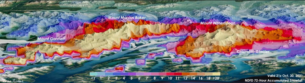
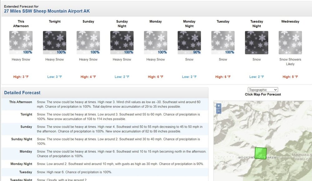
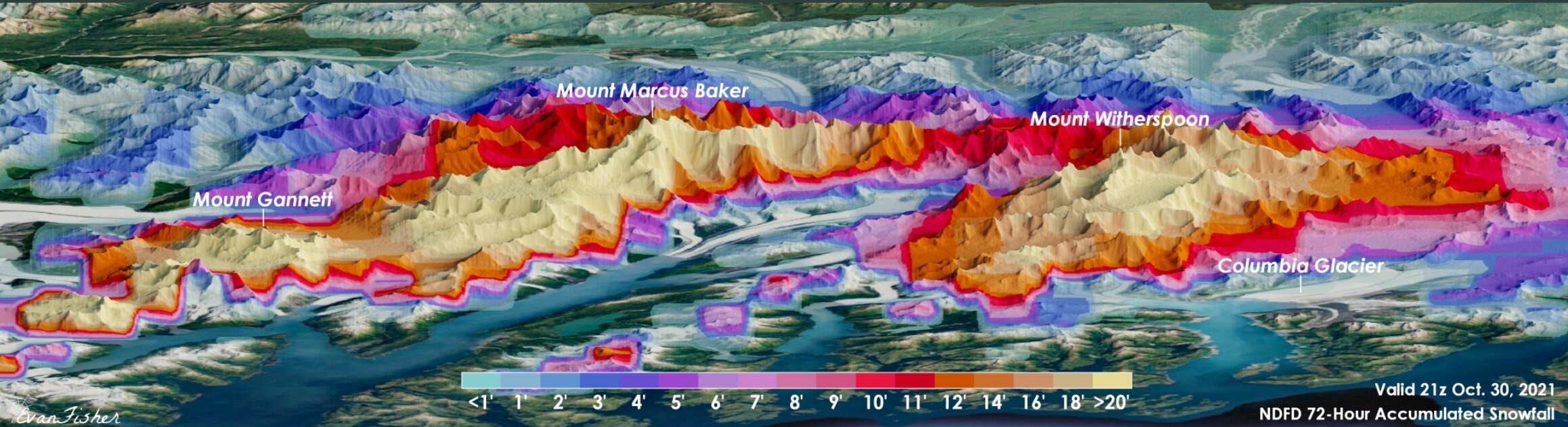
Alaska and snow!!! That map legend is in feet!
-
Started seeing the same yesterday. We will see if that continues. Seems possible in La Nina and the fact it has been a big player this fall.
-
-
2021 Mid-Atlantic Severe Weather - General Discussion
midatlanticweather replied to Kmlwx's topic in Mid Atlantic
-
Yep. Get to day 6+ and you can pretty much call it speculation! The long range looks nice and super cold on the GFS.. but do you trust it? Well do ya? NOPE!
-
Winter 2021-2022 Digital Snow Thread
midatlanticweather replied to NorthArlington101's topic in Mid Atlantic
Shifting north! -
I think Snowverboard Blizzard in Feb 09 - 10 2010 put down 50 inches in parts of Maryland! someone would have to confirm.. Maybe that was together with Snowmaggeden from a few days earlier, but I do not think so.
-
Ended up with 0.81 for rain yesterday.
-
2021 Mid-Atlantic Severe Weather - General Discussion
midatlanticweather replied to Kmlwx's topic in Mid Atlantic
-
2021 Mid-Atlantic Severe Weather - General Discussion
midatlanticweather replied to Kmlwx's topic in Mid Atlantic
-
2021 Mid-Atlantic Severe Weather - General Discussion
midatlanticweather replied to Kmlwx's topic in Mid Atlantic
75/58 here in Purcellville. -
Winter 2021-2022 Digital Snow Thread
midatlanticweather replied to NorthArlington101's topic in Mid Atlantic
Euro, gets kind of close too! -
Winter 2021-2022 Digital Snow Thread
midatlanticweather replied to NorthArlington101's topic in Mid Atlantic

-
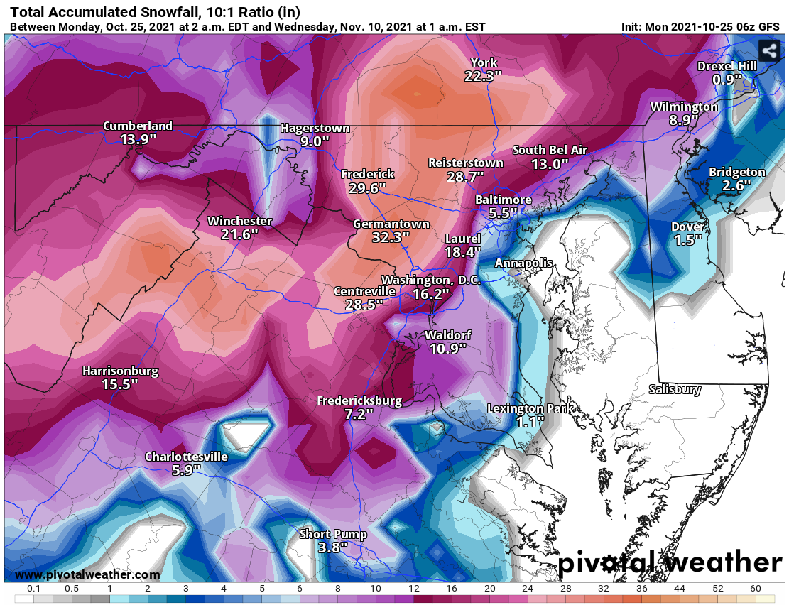
See Digital Snow Thread for the ridiculous Snow Output in GFS Long Range! Maybe getting chilly, at least, in the long-range models!
-
Winter 2021-2022 Digital Snow Thread
midatlanticweather replied to NorthArlington101's topic in Mid Atlantic

-
2021 Mid-Atlantic Severe Weather - General Discussion
midatlanticweather replied to Kmlwx's topic in Mid Atlantic
Slight area expanded a bit for tomorrow.thumb.png.ef8267a801ea07717a65e754f7d5a847.png)
-
-
Winter 2021-2022 Digital Snow Thread
midatlanticweather replied to NorthArlington101's topic in Mid Atlantic


.png.b495231bda5e12940e81a14dc5f442df.png)