Albedoman
-
Posts
1,333 -
Joined
-
Last visited
Content Type
Profiles
Blogs
Forums
American Weather
Media Demo
Store
Gallery
Everything posted by Albedoman
-

Central PA Winter 2022/2023
Albedoman replied to Blizzard of 93's topic in Upstate New York/Pennsylvania
that was a huge mistake. Groundwater/streamlevels will be at record lows by May in this crappy but weak La Nina pattern. No snow base for available soil moisture recovery and maintaining base flows plus the ground is not frozen. Warm sunny days in March- April above 80 degrees will teach those hydrologists. I guess they forgot to look at 2001 to 2002 analogs for the transition period from a weak La Nina to an El Nino year. The setup is almost identical to this year. Allentown only received 26 in of snow in 2002 before going into the worst drought for the area. We stand at one inch of snow now with some areas of the Lehigh Valley seeing nothing. I have not more than one inch of rain since early december in any event. By the way, have there been any years where there were no Nor'easters in the winter? We are heading in that direction too. -
E PA/NJ/DE Winter 2022-2023 OBS Thread
Albedoman replied to Ralph Wiggum's topic in Philadelphia Region
wrong on both counts. I bet it was for his leaf blower. Those dam leaves have not been pushed down on the surface by the the lack of a snow pack and are still blowing everywhere. They using the blower for cleaning up mulch after spreading too. This is the first time that I have ever seen mulch being spread in January in the LV These landscapers are really hurting as their off season plowing is shot to hell. -
E PA/NJ/DE Winter 2022-2023 OBS Thread
Albedoman replied to Ralph Wiggum's topic in Philadelphia Region
these models are useless- rain rain and more rain. Even the NAM is throwing in the towel for Sunday. Well bring on Spring. I will make a million dollar bet that the first snow, someone on this board will call it an over performer because there is not one model that is performing correctly LOL -
Central PA Winter 2022/2023
Albedoman replied to Blizzard of 93's topic in Upstate New York/Pennsylvania
That secondary precip field off Hatteras will tend to pull the LP 985 SE closer to the coast in future runs---Chesapeake Crabber to me. Almost in the sweet spot for E PA That looks to be the best shot for me for some snow in a long time. -
E PA/NJ/DE Winter 2022-2023 OBS Thread
Albedoman replied to Ralph Wiggum's topic in Philadelphia Region
Take your choice of which video clip matches the euro, GFS, CMC or Icon at this time. The official outcome will be called by our umpire/ref (NAM)on the field during the instant replay at the OZ Sunday night model run. Do not be surprised if the play is called back by the NAM for an illegal block from the SE ridge downfield. LMAO https://www.youtube.com/watch?v=3KP4CDS0eVk -
And this what the models are showing
-
E PA/NJ/DE Winter 2022-2023 OBS Thread
Albedoman replied to Ralph Wiggum's topic in Philadelphia Region
wow, the planet Mars had a sunny day too. Its a shame we are now comparing the two for the amount of sun we have received this month a rarity indeed. https://www.itemfix.com/v?t=5e0ewn -
E PA/NJ/DE Winter 2022-2023 OBS Thread
Albedoman replied to Ralph Wiggum's topic in Philadelphia Region
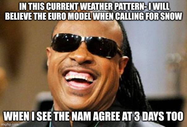
every GFS model run fakes this or that. This afternoons Euro run is trying to spit out something but it cannot get its act together. Lets face it, when the Euro and Nam both agree at 3-5 days, then we have something, otherwise every model run fits this meme in this shitty pattern. -
E PA/NJ/DE Winter 2022-2023 OBS Thread
Albedoman replied to Ralph Wiggum's topic in Philadelphia Region
this what I really think how the pattern will develop -
E PA/NJ/DE Winter 2022-2023 OBS Thread
Albedoman replied to Ralph Wiggum's topic in Philadelphia Region

-
E PA/NJ/DE Winter 2022-2023 OBS Thread
Albedoman replied to Ralph Wiggum's topic in Philadelphia Region
In all my years 15-20 yrs tracking models on the internet, I have never seen the GFSGEm and even the Euro so screwed up as it is right now in showing snow totals for our area at the end of the runs. Absolutely no confidence in anything over 5 days. The last 2-5 days model runs , the 12Z says 12+ and then the 18Z comes back and says zippo. Then the 0Z says 4" and the 6Z comes back with zilcho again. Yes I like snow but I also like rain. The primary rain events appear to be doing the same thing as well now. I guess I would say if nothing pans out between the 23rd and the end of the month for a major snow event, I will be writing off this winter. Yes I know Feb is our snowiest month but I cannot possibly see any consistent pattern developing on the LR in Feb with these models so wishy washy. I want to be optimistic but dam GFS/GEM and Euro throw me a bone and show me 6+ inches of snow in at least 48 hours worth of runs. Sorry for the rant guys but this is getting plain ridiculous to even look at the models over three days looking for LR patterns to develop when we cannot even get consistency from run to run. -
E PA/NJ/DE Winter 2022-2023 OBS Thread
Albedoman replied to Ralph Wiggum's topic in Philadelphia Region
-
Central PA Winter 2022/2023
Albedoman replied to Blizzard of 93's topic in Upstate New York/Pennsylvania
this is a better way of saying it -
thanks Don. Nice to see in the philly forum. This what i think of the current pattern for the next few weeks but I am sure sometime after the 22-24 period something will give to break it.
-
E PA/NJ/DE Winter 2022-2023 OBS Thread
Albedoman replied to Ralph Wiggum's topic in Philadelphia Region
I absolutely agree. The window opening is very short and every chance of a storm will be thread the needle in our pattern. The only barn burner for this current crappy pattern is a Mardi Gras special LP forming and riding the southern Apps and then along the coast for true Miller A. Until the LPs form in the southern Miss Valley/GOM, nothing good will come our way according to the Mardi Gras cat
-
E PA/NJ/DE Winter 2022-2023 OBS Thread
Albedoman replied to Ralph Wiggum's topic in Philadelphia Region
this is how I feel right now:
-
E PA/NJ/DE Winter 2022-2023 OBS Thread
Albedoman replied to Ralph Wiggum's topic in Philadelphia Region
went washed my car FWIW. Usually its salt, bird crap from the geese flying over. Only 1-2 days of nice full sunshine a week is far worse than no snow right now. This mornings mangled flakes were a joke. I saw more bird crap on my car. -
E PA/NJ/DE Winter 2022-2023 OBS Thread
Albedoman replied to Ralph Wiggum's topic in Philadelphia Region
to last nights big snow event -Kahn(Dr No. ) says: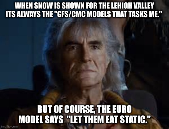
-
E PA/NJ/DE Winter 2022-2023 OBS Thread
Albedoman replied to Ralph Wiggum's topic in Philadelphia Region
for all the snow weenies out there, its not a woosh you hear, it comes from Khan himself when demanding a nice snow event for our area. LMAO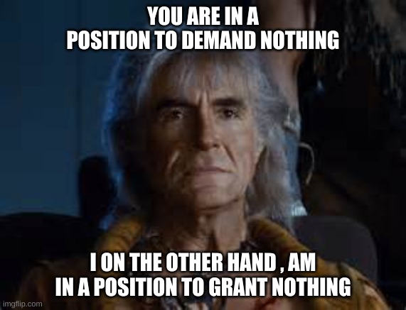

-
E PA/NJ/DE Winter 2022-2023 OBS Thread
Albedoman replied to Ralph Wiggum's topic in Philadelphia Region
not much better here. At least here, the hair dryer cord will not be plugged in. If you were looking for a ray of sunshine, you might as well go to Texas. We have seen so many cloudy days in the LV the past month, Allentown is now known as Seattle 2. -
E PA/NJ/DE Winter 2022-2023 OBS Thread
Albedoman replied to Ralph Wiggum's topic in Philadelphia Region
Jeez, Have to bring out my broom or leaf blower on this heavy hitter on Sunday night. This event will be all melted and gone before sunset on Monday afternoon and we return back into our dull weather pattern for the rest of the week. The only good thing next week - sunny skies for three days in a row, something we sure did NOT see the last few weeks. -
E PA/NJ/DE Winter 2022-2023 OBS Thread
Albedoman replied to Ralph Wiggum's topic in Philadelphia Region
to this crappy and hopeful snow event on Monday- this how we all feel about a measly 1-2 in event https://getyarn.io/yarn-clip/9907ef03-de46-4bb2-b1e8-b745a53eaa34 -
E PA/NJ/DE Winter 2022-2023 OBS Thread
Albedoman replied to Ralph Wiggum's topic in Philadelphia Region
same in Macungie PA downpour but no thunder. Nam is spitting out a chance for snow event for Monday. This is what I think about it -
until the LP's hit the western coast, everything in the LR is a crap shoot in this trifecta La Nina pattern. Just keep looking at 3-5 days models out only. It will brighten your outlook. Analog year 49-50 where the temps and the precip were nearly the same as this year thus far. That was a La Nina year too. This means snow will be hard to come by this year any way we look at it. January 1950 Allentown Weather Day High (°F) Low (°F) Precip. (inches) Snow (inches) January 1 41 27 0.00 0.0 January 2 42 34 0.00 0.0 January 3 57 37 0.09 0.0 January 4 66 51 0.00 0.0 January 5 59 45 0.03 0.0 January 6 50 40 0.19 0.0 January 7 47 28 0.19 0.0 January 8 29 14 0.00 0.0 January 9 36 13 0.00 0.0 January 10 45 34 0.89 0.0 January 11 47 24 0.00 0.0 January 12 32 21 0.03 0.0 January 13 38 29 0.05 0.0 January 14 57 36 0.02 0.0 January 15 38 24 0.00 0.0 January 16 45 30 0.00 0.0 January 17 38 25 0.00 0.0 January 18 51 28 0.13 0.3 January 19 29 19 0.00 0.0 January 20 30 14 0.00 0.0 January 21 37 23 0.00 0.0 January 22 42 31 0.01 0.0 January 23 46 34 0.00 0.0 January 24 44 38 0.11 0.0 January 25 44 40 0.00 0.0 January 26 72 41 0.05 0.0 January 27 48 22 0.08 0.0 January 28 34 18 0.10 0.0 January 29 46 33 0.19 0.0 January 30 45 31 0.05 0.0 January 31 35 27 0.45 0.5 February 1950 Allentown Weather Day High (°F) Low (°F) Precip. (inches) Snow (inches) February 1 32 27 0.13 1.8 February 2 38 30 0.51 0.4 February 3 38 24 0.00 0.0 February 4 39 22 0.00 0.0 February 5 37 21 0.00 0.0 February 6 35 24 0.15 0.3 February 7 39 20 0.00 0.0 February 8 33 7 0.00 0.0 February 9 46 27 0.67 0.2 February 10 39 29 0.13 0.2 February 11 49 29 0.00 0.0 February 12 49 25 0.00 0.0 February 13 37 30 0.85 3.3 February 14 34 31 0.57 0.2 February 15 39 34 0.16 0.0 February 16 42 30 0.00 0.0 February 17 41 30 0.00 0.0 February 18 43 30 0.00 0.0 February 19 42 23 0.01 0.1 February 20 24 6 0.00 0.0 February 21 24 3 0.00 0.0 February 22 27 20 0.21 0.1 February 23 34 23 0.18 0.2 February 24 45 21 0.00 0.0 February 25 29 18 0.00 0.0 February 26 26 11 0.00 0.0 February 27 24 8 0.00 0.0 February 28 34 10 0.01 0.0 March 1950 Allentown Weather Day High (°F) Low (°F) Precip. (inches) Snow (inches) March 1 45 25 0.00 0.0 March 2 26 11 0.00 0.0 March 3 27 8 0.00 0.0 March 4 35 7 0.00 0.0 March 5 57 15 0.00 0.0 March 6 44 23 0.00 0.0 March 7 42 15 0.00 0.0 March 8 64 32 1.01 0.0 March 9 35 20 0.00 0.0 March 10 35 20 0.00 0.0 March 11 42 20 0.14 0.3 March 12 50 32 0.01 0.0 March 13 35 30 0.31 0.0 March 14 38 23 0.00 0.0 March 15 49 24 0.00 0.0 March 16 33 22 0.00 0.0 March 17 44 25 0.00 0.0 March 18 40 22 0.02 0.0 March 19 44 17 0.00 0.0 March 20 47 19 0.01 0.0 March 21 43 33 1.06 0.0 March 22 40 34 0.44 0.0 March 23 39 34 0.68 0.0 March 24 50 34 0.00 0.0 March 25 47 30 0.04 0.0 March 26 50 31 0.58 0.0 March 27 48 35 0.01 0.0 March 28 72 48 0.18 0.0 March 29 56 30 0.09 0.0 March 30 42 27 0.00 0.0 March 31 48 22 0.00 0.0