HeadInTheClouds
-
Posts
1,691 -
Joined
-
Last visited
Content Type
Profiles
Blogs
Forums
American Weather
Media Demo
Store
Gallery
Everything posted by HeadInTheClouds
-
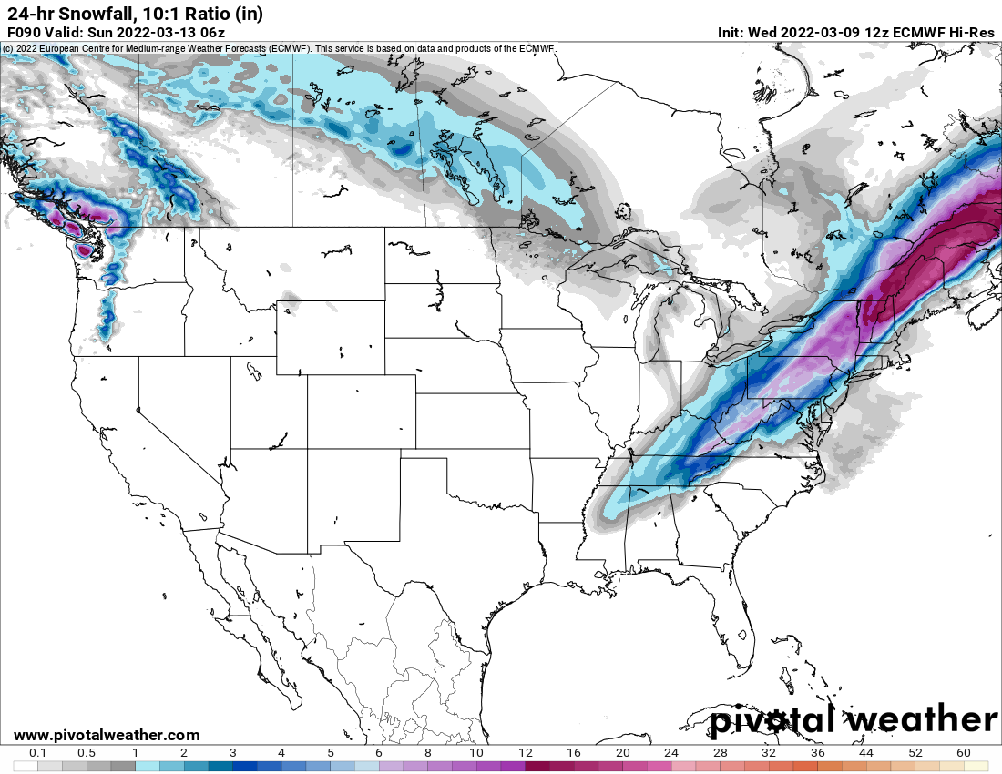
 Not as much QPF this run. It's done this before though.
.thumb.png.861ced09fb6703cc50646a04283c71e3.png)
-
It's still a very dynamic system with a surface low that deepens 25mb in 12 hours from 12z Saturday to 00z Sunday and it's still not done. I will also take snow any day over rain and severe weather, thank you.
-
For me it will and CMC was more than slightly east.
-
And you shouldn't because it's 48 hours out with multiple solutions. There has been an east trend though and the CMC coming east is huge.
-
From another board explaining why models may be trending slightly east. If you look west there are two things that may lend credence to the eastern soln. First is the pna ridge. It’s axis of over Nevada would allow for that eastern more soln. Going to have to watch that. Second is the energy crashing the W coast near Canada CONUs. This progressive Atlantic and Pac pattern tells me it will likely continue to push the entire mean trough complex along. This problem, energy crashing the west coast, has been a theme all winter so no reason to believe it won’t be a factor this time. In this situation it may lend a helping rather than hurting hand it pushing the entire this further east as we get in right if the timing is right.
-
It was cooler than 6z but still warmer than other models. It's a little wonky though with thermals. Later Saturday afternoon it has my area well below freezing at 850 and 700 yet my surface is at 33 with a NW wind and the low well east, and I'm getting sleet. Im not buying that right now.
-
Yup. Cmc has been the best with last several storms.
-
Rgem says hold on. It has been a little warmer than CMC.
.thumb.png.e087feb42f20830d7ab83b8386b7feae.png)
-
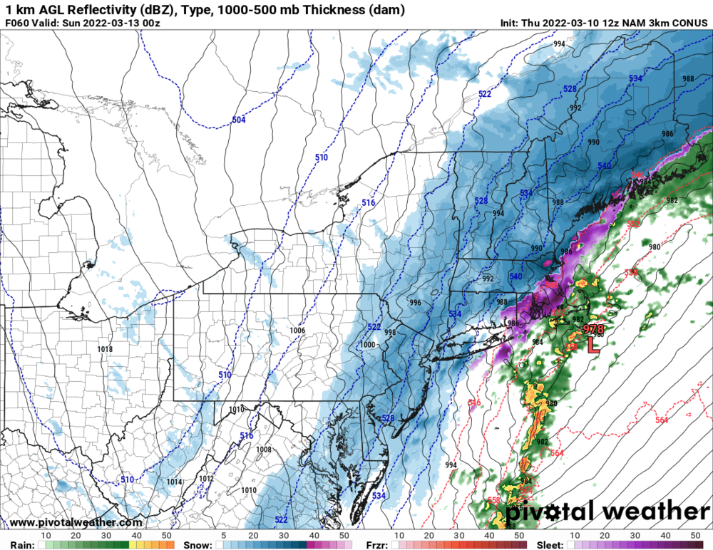
N and W gets Nam'd. Still snowing at 60 hours on 3k.
.thumb.png.a255613af4ef3c35353555459111db35.png)
-
I think they are going to do well. Traveling on Saturday could be a problem though.
-
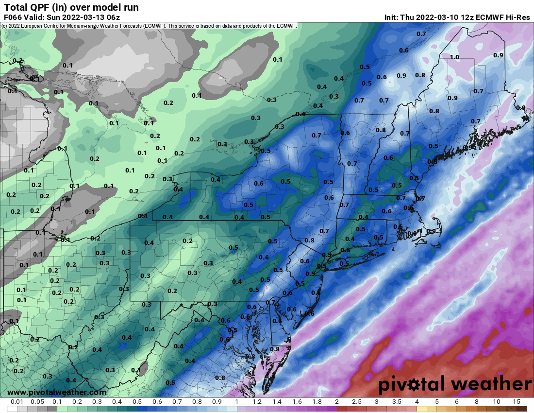
This was 00z Euro last night. I think it's a little aggressive but would love for it to be right. Can you post 6z?
.thumb.png.3eeb82f7cbf0455ff302f26004847a00.png)
-
Im not sure why you ever had 8+. That's not likely to happen but the system is trending a little east on latest guidance so I do think we see a little snow Saturday afternoon as low moves NE and colder air filters in. My forecast high went from 40 to 36. Euro is the most aggressive with the cold air and gives us 6 but not sure about that. Most models give us 1-3. Lets see what 12z's do.
-
There is no question the CMC has been better. It had this event nailed days before any other model. It was the best with the previous storm as well. All hail the new king.
-
CMC/RGEM did really well with this one. They had this for several days before any of the other models jumped onboard. Go Canada.
-
Finished with 3 inches. 22 for the season.
-
33 with moderate snow continuing. A little over 2 OTG.
-
I wouldn't count on it especially for you in Lagrange area. Maybe rain changing to snow for a little while as storm moves east. I think we have to be farther N and W than we are to see heavy snows but we will see.
-
No, accumulation on grass counts.
-
It could be a few hours of the good stuff as the low moves east and cold air rushes in. Euro gives me 6 but CMC and GFS only 1-2. Central NYS and Albany on north are the place to be with this one.
-
32 with moderate snow. Have almost an inch on grass and starting to stick to pavement.
-
33 and moderate snow. Coating on non paved surfaces.
.png.28ec791591a84947ecf3e0fc6605b0a2.png)

.png.503614261cf5f9d62c5461987fb22c09.png)

.png.4b276d9583cf0889e755387aa9aba794.png)
.png.f3f2f812373d0ba87bb48d2de516a66b.png)
.png.19e18518fa9904c26957f88e7169caa9.png)
.png.c3e6ab2330918350096e4dc5ba8c4e4f.png)
.png.9cc02f5c4b2b2fd1080dc15bc758b56a.png)
.png.7e57582da312613f831e6f95b317378c.png)
.png.0578a99a354f66fd958ccdf29a80f5f7.png)