OrdIowPitMsp
-
Posts
2,819 -
Joined
-
Last visited
Content Type
Profiles
Blogs
Forums
American Weather
Media Demo
Store
Gallery
Everything posted by OrdIowPitMsp
-
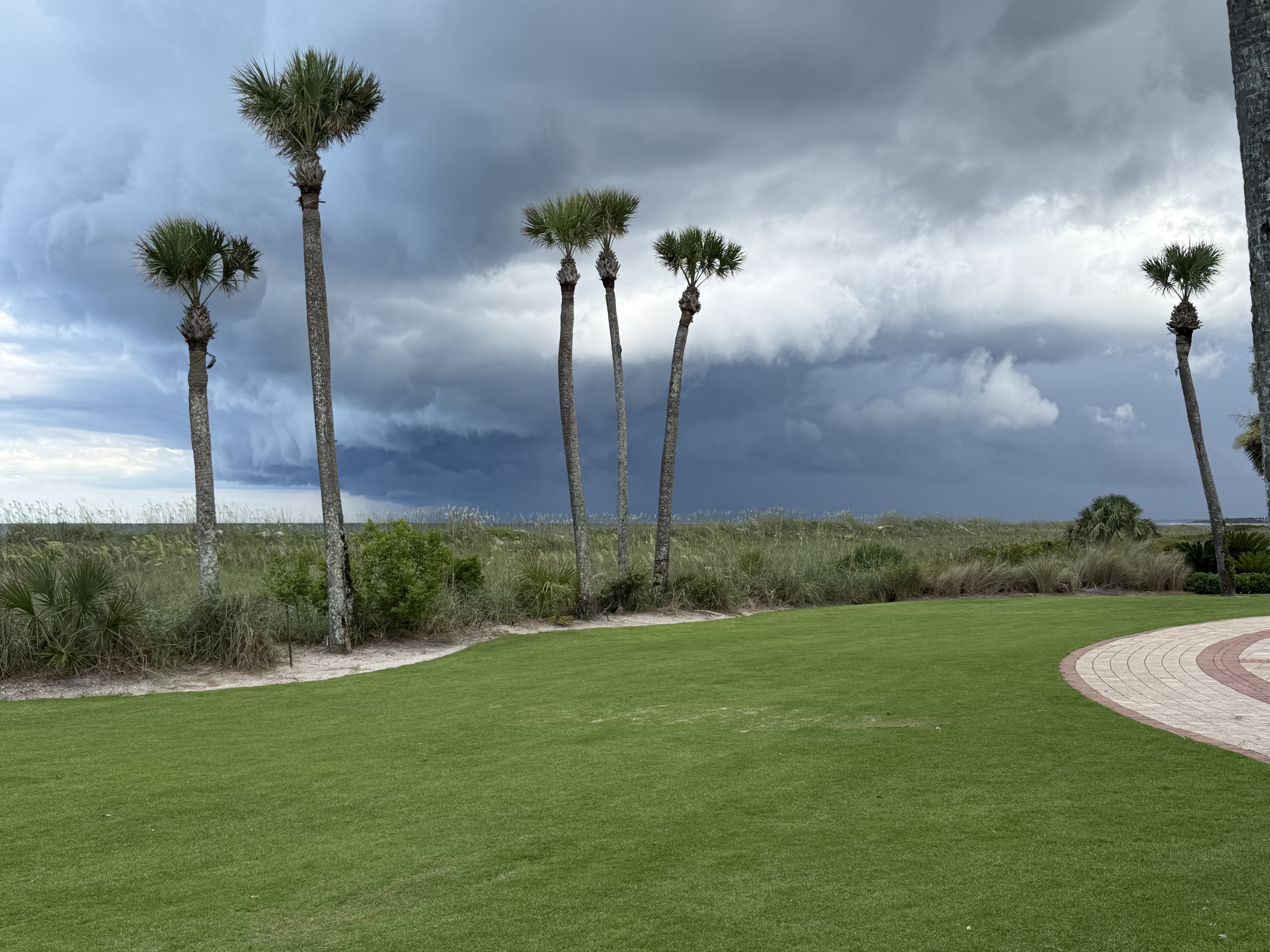
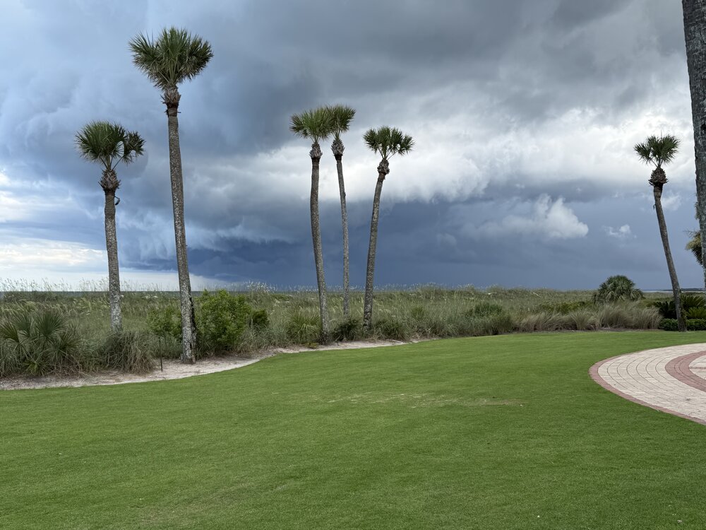
Golden Isles of Georgia for a wedding. Cool watching storms roll in and interact with the sea breeze
-
It’s a good thing we went there before the prevalence of AI, because nobody would believe the scenery in my photos is real.
-
Tropical downpour and constant lightning in this band moving through. Nice to get a little garden variety action.
-
80% of my 2026 total in June. Congrats This recent stretch has alleviated drought concerns locally
-
I’m a broken record from the above posts but you can’t script it any better.
-
72/37 Perfecto
-
Dews have crashed to the low 40s. Love this dry summer air.
-
0.21” of rain last evening. This wetter stretch combined with slightly below average temperatures has been great to temper the drought worries . 9.98” of precipitation since January 1st. Almost at double digits!
-
Picked up another 0.11” so far today. Quite a different atmosphere compared to yesterday. It was 91/68 yesterday, right now it’s 63/50.
-
Missed a bunch of overnight rainfall on the obs. We’ve had 0.57” today
-
0.17” of precipitation is all we could muster from the overnight cluster. Storms fired east of town today. Can’t reel one in this year. At least we got our first 90 of the year as a consolation prize, endless 70s in the extended.
-
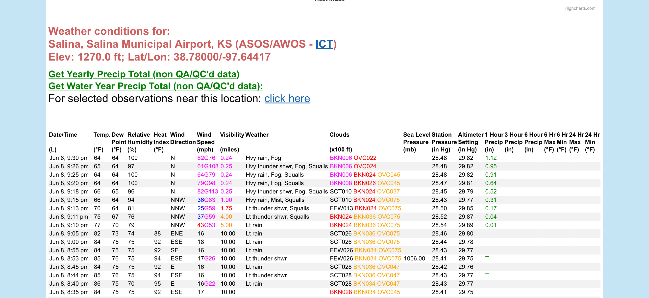
Is the anemeter tuned correctly at Salina KS? If so, they are having some incredible wind gusts in that line of storms right now. 82mph gusting to 113!

-
Meager 0.04” is all we could muster in Minneapolis. Almost comical how all this precipitation keeps missing us. At least there is active wx in the region to look at.
-
Going to get hot and steamy these next several days. Grad party for my sister-in-laws kid today at a lake in the western suburbs. Already been watching my kids chase each other around with a garden hose this morning
-
Miss north and south with storms today. Officially picked up 0.09” last night at the airport but less imby. Dews crept up into the mid 60s today. First truly muggy day of the year here.
-
Promising squall line collapsed and dissipated over the western metro. Barely wet the sidewalk here.
-
82/45 is tops when you are sitting outside with a book.
-
June begins with a high temperature of 80. Dews have crashed into the upper 40s this evening.
-

-
May 2026 finished exactly 1.0F above the long term average in Minneapolis. 2.24” of precipitation which is -1.67” below average. There was a late freeze on May 6th. The somewhat surprising 0.37” we received yesterday couldn’t have been timed better.
-
It worked
-
Couldn’t script it better here. 81 with a 45 degree dew point. Beach weather.
-
87 today. Going to have my Anishinaabe coworkers teach me a rain dance soon.
-
Preliminary data suggested MSP was 89’d today so the elusive first 90 waits another day. Average first 90 here is fast approaching on May 30th.
-
Broiling in Minneapolis under the Omega. Send rain please