OrdIowPitMsp
-
Posts
2,629 -
Joined
-
Last visited
Content Type
Profiles
Blogs
Forums
American Weather
Media Demo
Store
Gallery
Everything posted by OrdIowPitMsp
-

Winter 2025-26 Medium/Long Range Discussion
OrdIowPitMsp replied to michsnowfreak's topic in Lakes/Ohio Valley
MSP is 1.6” below average and nothing on the horizon. March will be ours. -
The next week is going to feel fantastic, and likely obliterate our meager snowpack.
-
1.4” of snow at MSP today. 29.3” season to date.
-
January 2026 at MSP: Average temp 13.7F (2.5F below average) 12 lows below zero (2 at zero) 2 daily highs below zero. 4.1” of snow - 28 days of at least 1” snowcover at the airport. (Mby had continuous snowcover)
-
Little bit less then an inch here this morning to cover up the frozen dog turds and freshen up the pack. Best action here in weeks
-
Down to 0 at MSP this morning.
-
MSP eeked out a low of -1 this morning. We’ve now had a low temperature at or below zero for 14 of the past 15 days.
-
Winter 2025-26 Medium/Long Range Discussion
OrdIowPitMsp replied to michsnowfreak's topic in Lakes/Ohio Valley
I’ll bite. I enjoy it immensely. I would much rather work outside in a week of -10/+10 temps then 90+ with 70+ dews. I’m outside 80% of the time with my job so I have experience in all weather Minnesota can throw at me. I’m a diehard skier too so that’s an added reason I love deep winter. I’m ready for a pattern shakeup so we can get some fresh snow. There has only been one calendar day snowfall of 1” this month at MSP. I think it’s kinda strange how much you bitch and moan about the weather in a region you don’t frequently visit, but hey it’s a free country. -
Got a little windy in La Crosse last evening.
-
MSP got to -13 last night.
-
Temp has risen to 0 at MSP. The airport was below zero for 67 hours.
-
1/24-1/25 Major Winter Storm - S. IL, IN, and OH
OrdIowPitMsp replied to A-L-E-K's topic in Lakes/Ohio Valley
MSP crew joining the fun.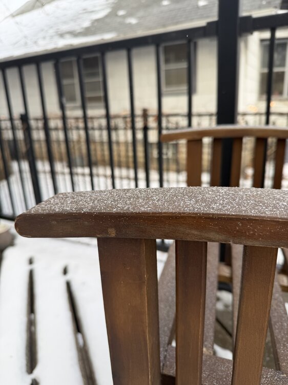
-
Getting some light pixie dust. It’s warmed up to -4 so the atmosphere is primed.
-
MSP only dropped to -9 overnight. We should pop above zero today after ~65-70 hours below zero.
-
High of -2 at MSP today.
-
-15 at MSP
-
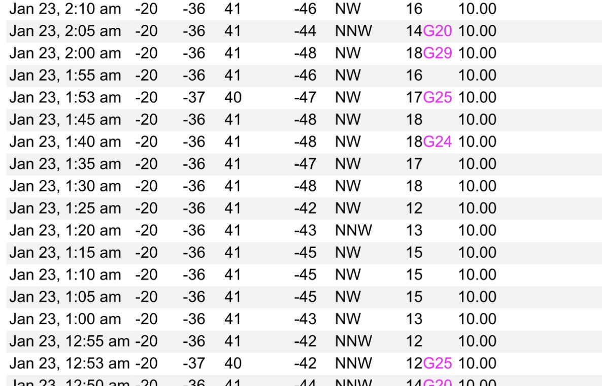
Four instances on the non-hourly 5min obs.
-
Minneapolis had a high of -9 today.
-
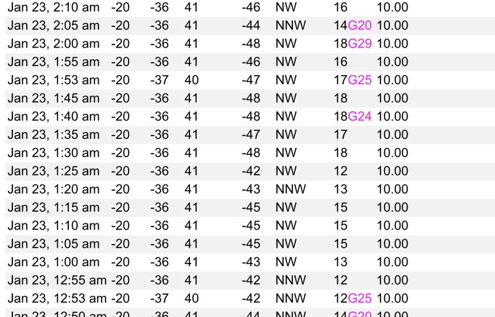
Coldest windchill at MSP was -48 overnight.
-
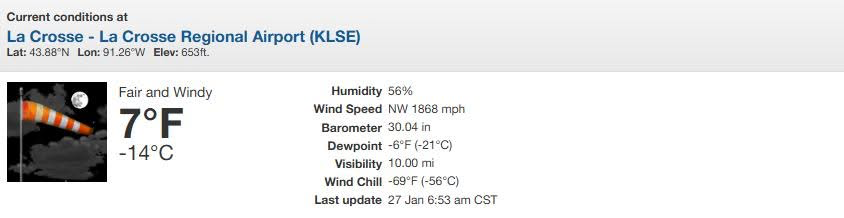
-21 Coldest morning at MSP since January 2019
-
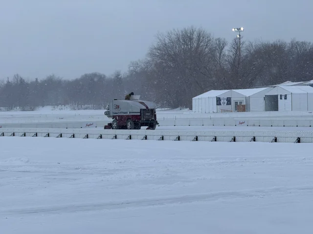
There’s now 16.5” of ice on Lake Nokomis. The U.S. Pond Hockey Championships were supposed to kick off today but are postponed due to the cold. Not my photo but here is a Zamboni getting the numerous rinks ready in the snow yesterday.
-
Windchill values have reached -40 here
-
The further north track of this winter storm will allow a thick layer of cloud cover to build in throughout the night that will keep us much warmer than we thought 2 or 3 days ago. Lows will be in the -10Fs but with no wind we`ll just be uncomfortably cold versus dangerously cold
-
The sun sets and it’s -6 with a WC of -31. Tundra vibes

-
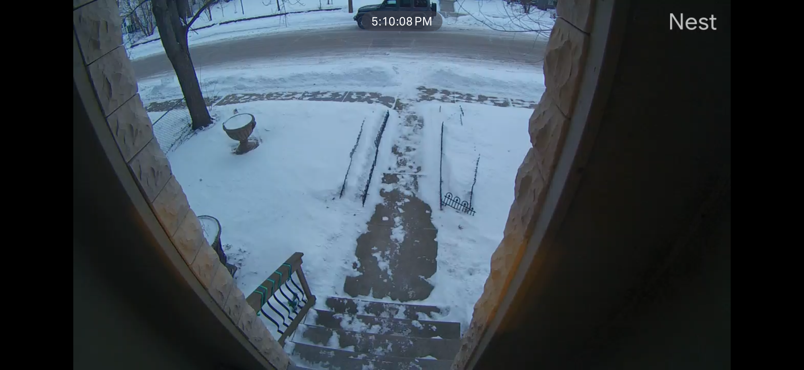
MSP fell below zero at 3:45pm dropping to -2 with WNW winds at 25 gusting to 37. Significant drifting over the road on the east side of the lake in my neighborhood.