RevWarReenactor
-
Posts
4,453 -
Joined
-
Last visited
Content Type
Profiles
Blogs
Forums
American Weather
Media Demo
Store
Gallery
Everything posted by RevWarReenactor
-
In other news; 60 on Saturday?! That will probably feel hot to us. I’m looking forward to the spring fever.
-
Is it lack of optimism or just what climo dictates? Honestly I am surprised we've even stayed in an okay pattern this long. No SE ridge or torch most of January? Like how rare is that?
-
Again; if you have both a temp and precip issue; unlikely. fwiw DT said we have a window around v day. After that probably SE ridge stuffs. Bad nao, pna, ao etc.
-
It is kind of funny how the very last bit of precip is just enough for a couple of pity flakes.
-
This is reminding me a lot of last winter. Kind of average to just below average winter with the potential to be a lot more. Not an ideal pattern but also not a shutout pattern….a lot of close calls and much failure as we watch a good portion of the country cash in.
-
I have a very non scientific rule. Two basic things needed for snow: temps and precip. If one is a lock it’s okay to root for the other. When both are a concern; move along. Tuesdays event falls under that category where both things need to break right. Unlikely
-
It kind of looks like rain though…. Doesn’t it?
-
It’s been active. So a break makes sense. It’s just a tougher pill to swallow because most people didn’t score during the active period. I personally suggest the armorycam app in Syracuse. Good webcam for both day and night. rain is just changing to snow now. They are getting 12-18 inches. Put it on your tv, make some hot cocoa. Watch the radar up there. You can almost trick your brain into thinking you are there.
-
Considering what the gfs showed a few days ago; it most definitely folded to the Euro
-
I am so excited. Chasing the boundary. Heading north to Syracuse for this storm. 3 night at the Super 8 with Mcdonalds. Perfect! My goal is a foot of snow, although I will be okay with 8 inches.
-
Late January and February Medium/Long Range Discussion
RevWarReenactor replied to WinterWxLuvr's topic in Mid Atlantic
It’s been advertised on the gfs in some form or another for awhile now. I’ve been saying it should be our focus not this “ice storm” that probably won’t happen. -
Late January and February Medium/Long Range Discussion
RevWarReenactor replied to WinterWxLuvr's topic in Mid Atlantic
Still not buying what the gfs is selling. No other model support. The idea that it’s the new king is overdone just like the models desire to overdo the cold chasing precip. Wouldn’t rule out some icy conditions; but what’s depicted on the gfs doesn’t look likely. Nws isn’t buying it either.- 4,130 replies
-
- 3
-

-

-

-
- prime climo
- cold canada
- (and 1 more)
-
Late January and February Medium/Long Range Discussion
RevWarReenactor replied to WinterWxLuvr's topic in Mid Atlantic
No. But I don't need to find the jackpot. Just be the snow side. Which will still do well during this long duration event. -
Late January and February Medium/Long Range Discussion
RevWarReenactor replied to WinterWxLuvr's topic in Mid Atlantic
I am not buying what the GFS is selling. Didn't it do poorly on that cold chasing precip storm a couple weeks ago? Don't ice storms around here usually underperform? No other model support. Ya figure too, temps crash and its not just going to magically ice over. Thats going to take a bit. So its got to be overdone in my opinion. Maybe I have no dog in this fight. I am chasing this and will be on the snow side of the boundary where ever that ends up being. -
Model Mayhem Snowstorm! 2/2-2/4
RevWarReenactor replied to BuffaloWeather's topic in Upstate New York/Pennsylvania
Delaware guy looking to chase this one into NY state. Was thinking Albany, Euro is telling me thats not even close to far enough North. GFS is telling me its way too far north. Model mayhem continues. -
Late January and February Medium/Long Range Discussion
RevWarReenactor replied to WinterWxLuvr's topic in Mid Atlantic
- 4,130 replies
-
- 1
-
-
- prime climo
- cold canada
- (and 1 more)
-
Late January and February Medium/Long Range Discussion
RevWarReenactor replied to WinterWxLuvr's topic in Mid Atlantic
I am more interested in the wave the GFS is advertising for Sunday night into Monday. Has more promise? If I was a bit north I'd be giddy. Barely get a breather and here it comes again. -
Late January and February Medium/Long Range Discussion
RevWarReenactor replied to WinterWxLuvr's topic in Mid Atlantic
Ice storms haven't really panned out in this area recently. 29 degrees and rain, is rain. Power outages and stuff aren't fun either. Sleet is so boring. Its like snow but accumulates at 1/8th the speed. So Ill pass. -
Late January and February Medium/Long Range Discussion
RevWarReenactor replied to WinterWxLuvr's topic in Mid Atlantic
My best moment was conference 2009 when we all stood out in some mediocre T-Storm and later at the hotel desk the employee said to her coworkers "Yeah, a bunch of these weirdos just gathered in the lobby and went out and stood in a thunderstorm". She had no clue I was one of them.- 4,130 replies
-
- 2
-
-
-
- prime climo
- cold canada
- (and 1 more)
-
Late January and February Medium/Long Range Discussion
RevWarReenactor replied to WinterWxLuvr's topic in Mid Atlantic
I don't think there is any chance we get on the right side of that boundary. Right now Lake George NY has mixing issues according to the GFS. That would have to be one heck of an adjustment. -
January 28-29 2022 Miller abcdefu Storm Obs/Discussion
RevWarReenactor replied to mappy's topic in Mid Atlantic
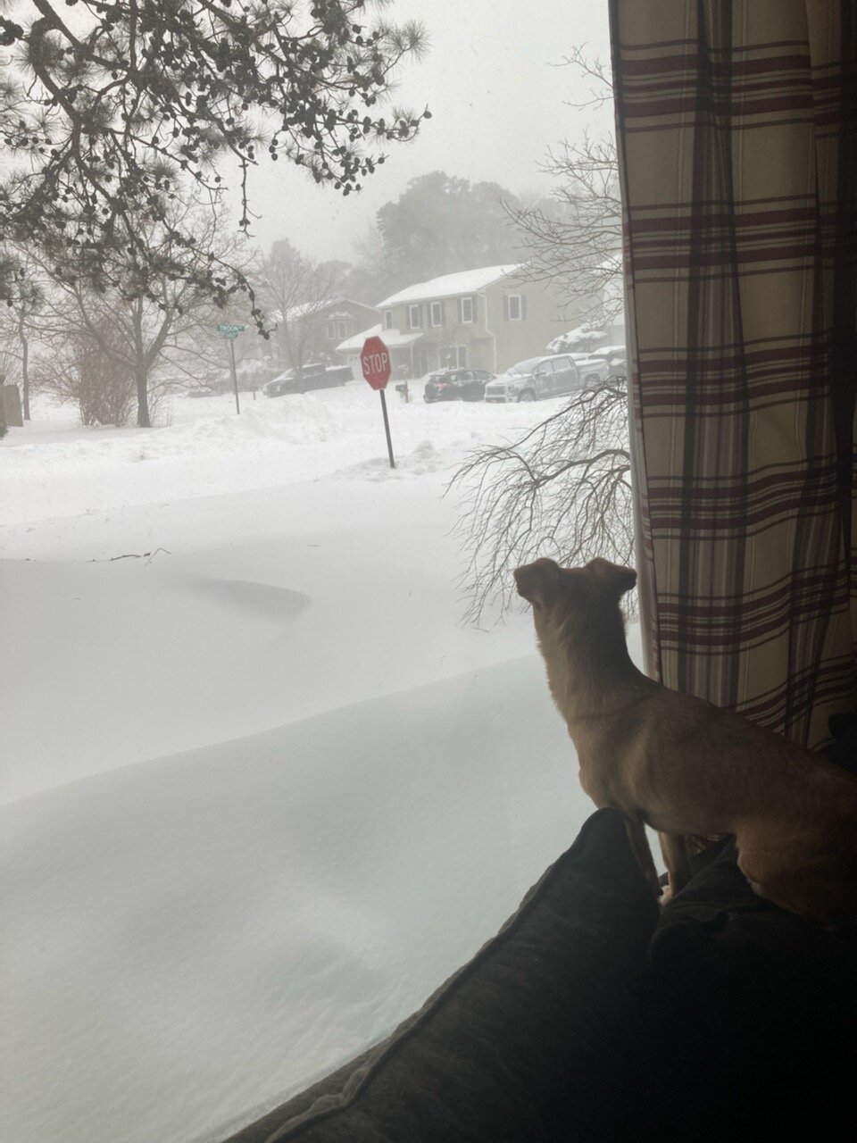
Pic from my parents house in Monmouth county NJ. The dog is like; what the heck?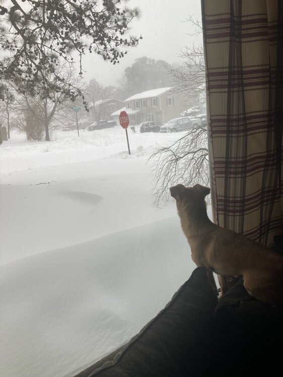
-
January 28-29 2022 Miller abcdefu Storm Obs/Discussion
RevWarReenactor replied to mappy's topic in Mid Atlantic
I’d estimate we got about 6 inches here in Newark Delaware. Super happy to finally get a legit storm here. First one since 2018. I missed or was nickle and dimed on all others. I almost forgot what this looks like imby.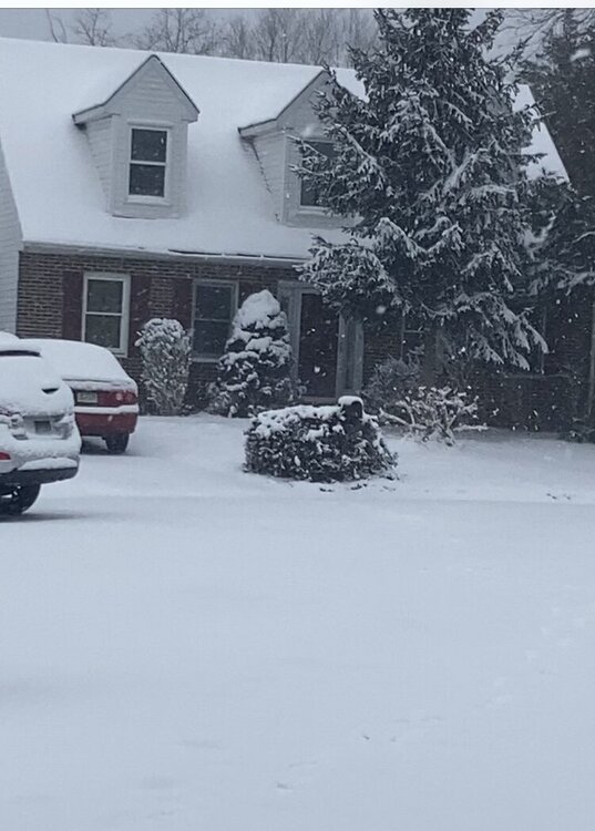
-
January 28-29 2022 Miller abcdefu Storm Obs/Discussion
RevWarReenactor replied to mappy's topic in Mid Atlantic
I have wondered the last few years why snow here refuses to stick to the street. Dark/32/ moderate snow. Wet streets. And it’s not like it has been warm out. -
January 28-29 2022 Miller abcdefu Storm Obs/Discussion
RevWarReenactor replied to mappy's topic in Mid Atlantic
The snow has stopped. Good. I'd rather have no snow than white rain. It is free to start snowing again when its the kind that sticks. -
Late January and February Medium/Long Range Discussion
RevWarReenactor replied to WinterWxLuvr's topic in Mid Atlantic
Yeah, last year for example was an average winter that had the chance to be a blockbuster as well.- 4,130 replies
-
- 2
-
-
-
- prime climo
- cold canada
- (and 1 more)