KoalaBeer
-
Posts
636 -
Joined
-
Last visited
Content Type
Profiles
Blogs
Forums
American Weather
Media Demo
Store
Gallery
Everything posted by KoalaBeer
-

With a last gasp effort, winter 20-21 refuses to give up the ghost
KoalaBeer replied to moneypitmike's topic in New England
Choo choo the tornado train. F having this aimed down your doorstep.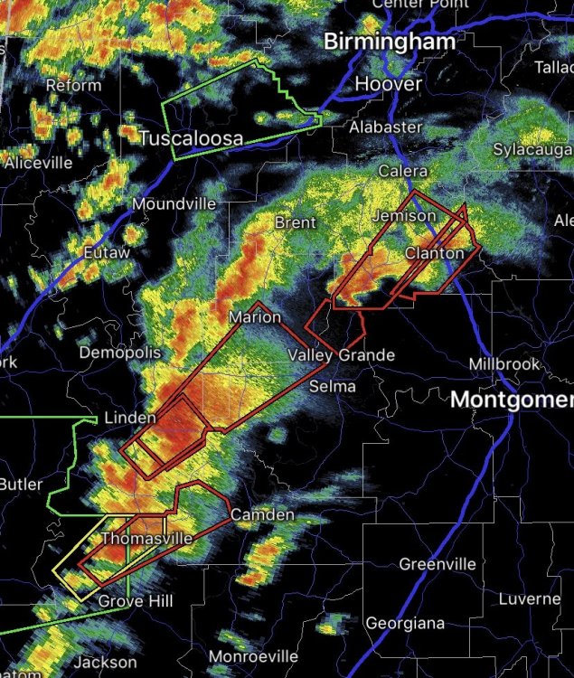
-
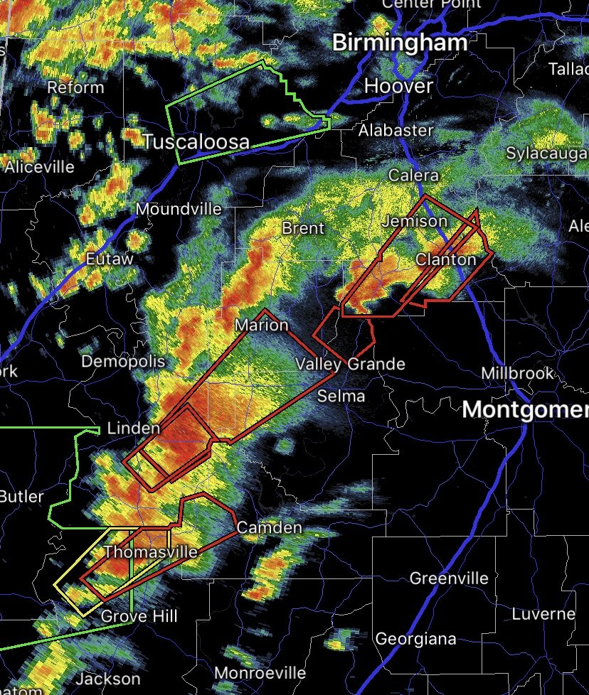
Ya bad choice of words on my part, but looks like Jackson area could be good once the line passes through. One TOR warned cell on that line but not to impressive on velocity scans.
-
From earlier today. Looks pretty big but the base is obscured by the hill...from what I’m seeing these tornadoes don’t look super intense but there’s sure as hell a lot of touchdowns. That’s obviously a premature observation with a long way to go, hopefully it stays that way. Anyone else think MS might of kinda dodge a bullet as well? The main line of storms is getting ready to move through Jackson. https://mobile.twitter.com/meteodon/status/1372299928018558980
-
With a last gasp effort, winter 20-21 refuses to give up the ghost
KoalaBeer replied to moneypitmike's topic in New England
Yup, that’s all I’ve been watching from this system. Going to be a long evening down south and tomorrow looks nasty as well. I don’t give a crap about this storm here...screws over any of the ski areas from late season snow which is all I care about this time of year. -
Damn, first time checking in today, real busy day at work but wow this is shaping up nasty. Some of those cells popping in MS are looking no bueno...won’t be surprised if the cell approaching mount olive produces soon.
-
Yup pretty much my point and like jpeters said Moore and Joplin weren’t exactly screaming Ef5 potential on those days.
-
Don’t really ever post in this forum, just the New England one or Tropical weather ones. However with this set up tomorrow anyone saying there WILL or WILL NOT be ef4 + tornadoes tomorrow need to check themselves. I understand this is a forum for discussing weather but definitive statements either way aren’t going to hold much weight. What was it the Ef-3 Nashville tornado that hit on a slight risk day during nighttime? This environment is much more volatile, but doesn’t mean it actually produces. End of the day tornados are a process on such a micro basis no one should be using a model run to assess the intensity of future tornadoes tomorrow. Just my two cents, I hope everyone stays safe tomorrow.
-
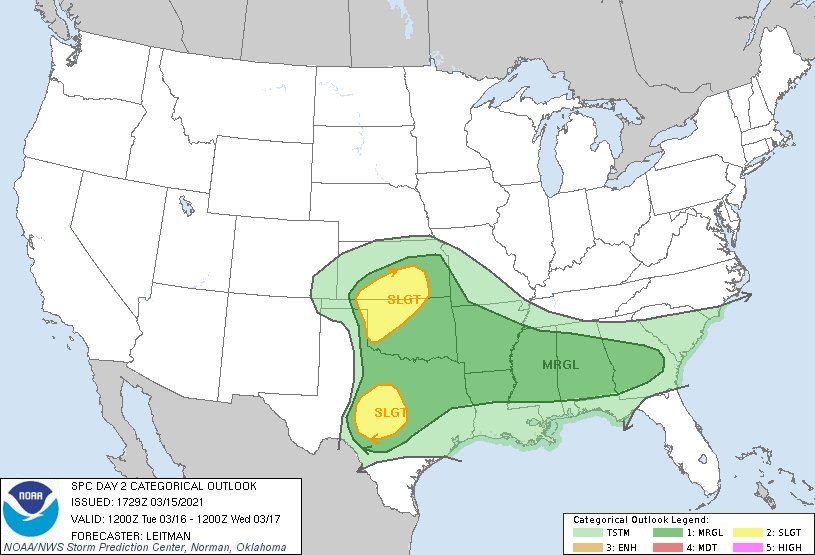
SPC having some fun with the drawings today.
-
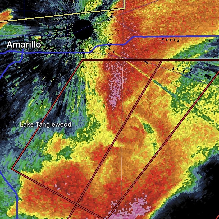
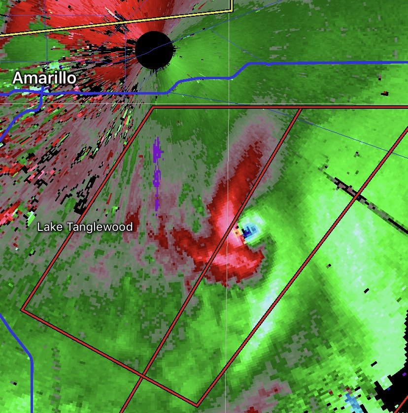
What a boring stretch of weather. I was at least enjoying the spring conditions on the slopes, but looks like it’s going to be brick up in the mountains after the cold front. At least it’s fun to track the cutoff low in the west right now. PDS TOR warnings for the panhandle. That’s one violent TOR by Amarillo. Where’s @weatherwiz !?


-
OT but what I would give to live back in Boulder CO this weekend. I rented a house there with some buddies right at the base of the hill were NCAR is located. Unfortunately in my time there we never got smoked by a real big upslope storm and I moved back east a week before the 2013 epic flooding. Should be some good severe wx to track on the plains for the first time in what seems like forever as well.
-
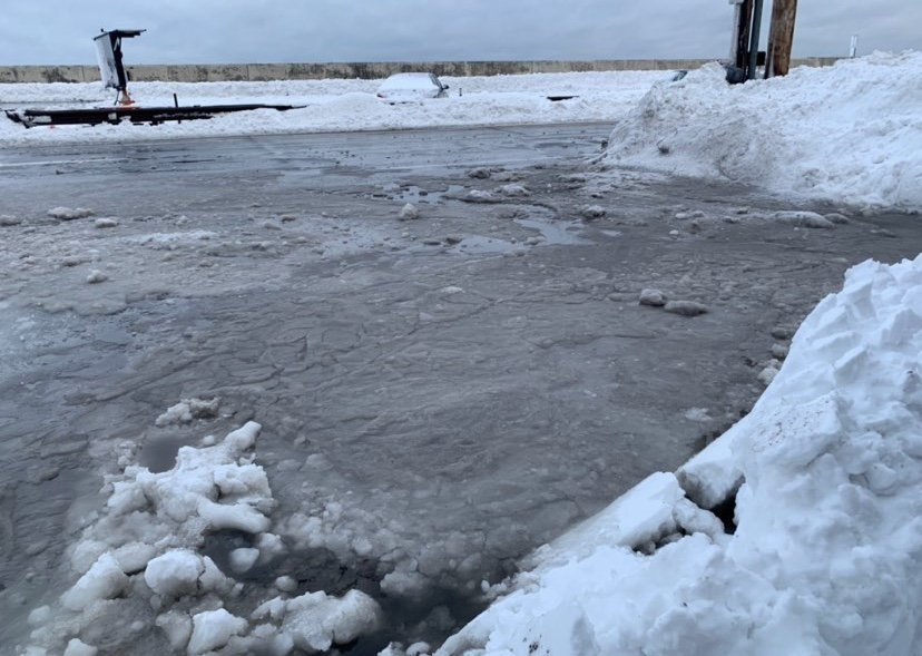
Hovering around 29-30f on the coast here with a thin sheet of ice on most everything. Roads are fine however. I’m not sure the WWA is warranted here for coastal Rockingham county. Expecting this to flip over to all rain quickly when it begins in earnest.
-
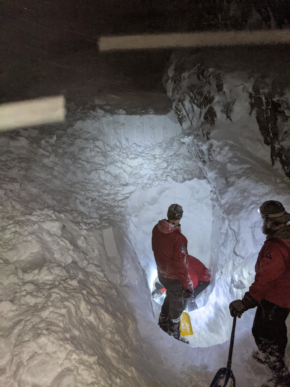
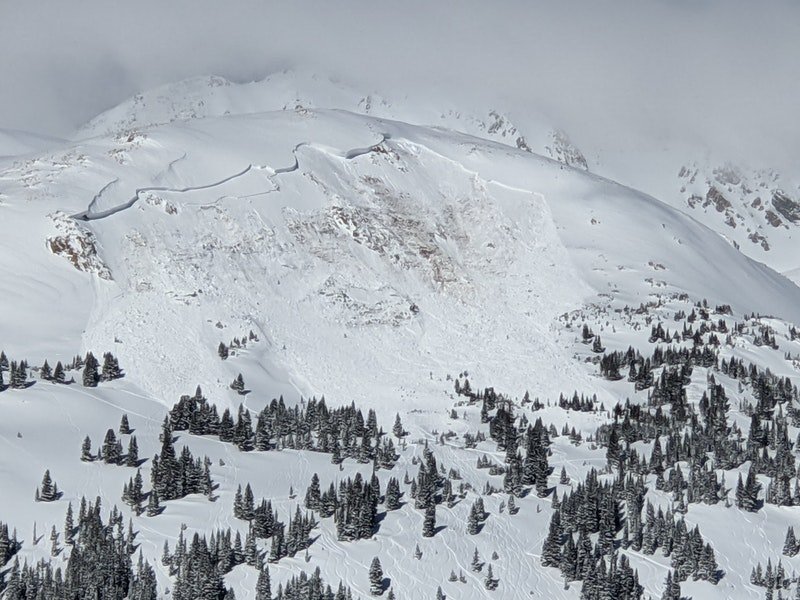
And the Avalanche calamity continues, pretty much at a loss for words. East facing slope which is exactly what the highest danger was on the rose, and riding alone. WTF is it going to take...and it wasn’t even the only avalanche fatality in CO today. Some very close friends have pretty much hung up there backcountry gear until spring out in CO. Edit: I want to point out I don’t think this rider was actually riding the slope that slid, it probably came down on top of him, and with it being a partial critical bury it was possibly survivable with a partner present. https://avalanche.state.co.us/caic/acc/acc_report.php?acc_id=780&accfm=rep&view=public
-
Nice that’s awesome. Weenies across the whole US rejoice.
-
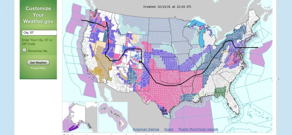
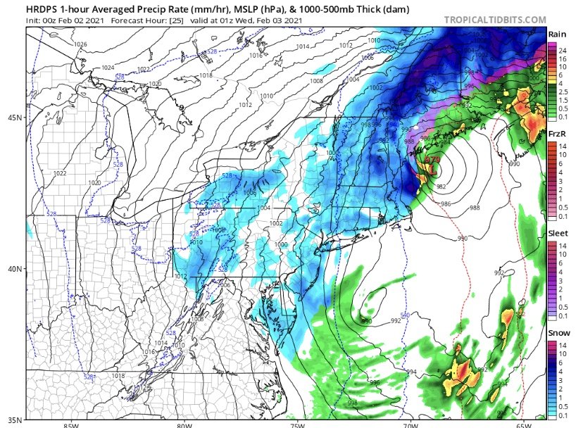
You can almost connect winter weather headlines coast to coast right now in the US. Only break I can find is on the front range of CO. Sorry for the crude line drew it with my finger on my phone.
-
Can confirm. West side of Methuen bordering Dracut/Pelham NH was a disaster. I don’t remember exactly but it was 10+ days of no power. I was home from colorado for the holidays and pretty much had no power the full two weeks I was here. Still the most impactful weather event I’ve been a part of.
-
Possibly. I’ve had some deep conversations with friends about how much of it is covid related. Pretty much every fatality has been someone with a good amount of experience in the backcountry. These victims didn’t just start touring this year because of covid. I still primarily blame the extremely fragile snowpack out west this year, there is just a nasty weak layer, but I can’t discount covid having an impact. One good point I was told was the experienced riders are rolling the dice more to beat the new backcountry users to the spots they have been riding for decades, and then there spot slides on them when they’ve never seen that slope slide before, and welp look what happens
-
I figured that video would pop up here at some point, and I know this isn’t the thread for it but this is the worst week for winter backcountry enthusiasts in a long time. I believe the toll was 15 dead last week (the worst since 1910) including one in NH up at Washington, and then the two notable tragic incidents that took the lives of 3 and 4 people in CO and UT. The incident in Utah... I have some close friends who knew them and they are hurting. Bright young people all in there 20s. If you are spending time in the winter backcountry this year, please please be extra careful. The slide on Washington was pretty small and buried the victim 13ft deep... https://mountwashingtonavalanchecenter.org/avalanche-fatality-ammonoosuc-ravine/

-
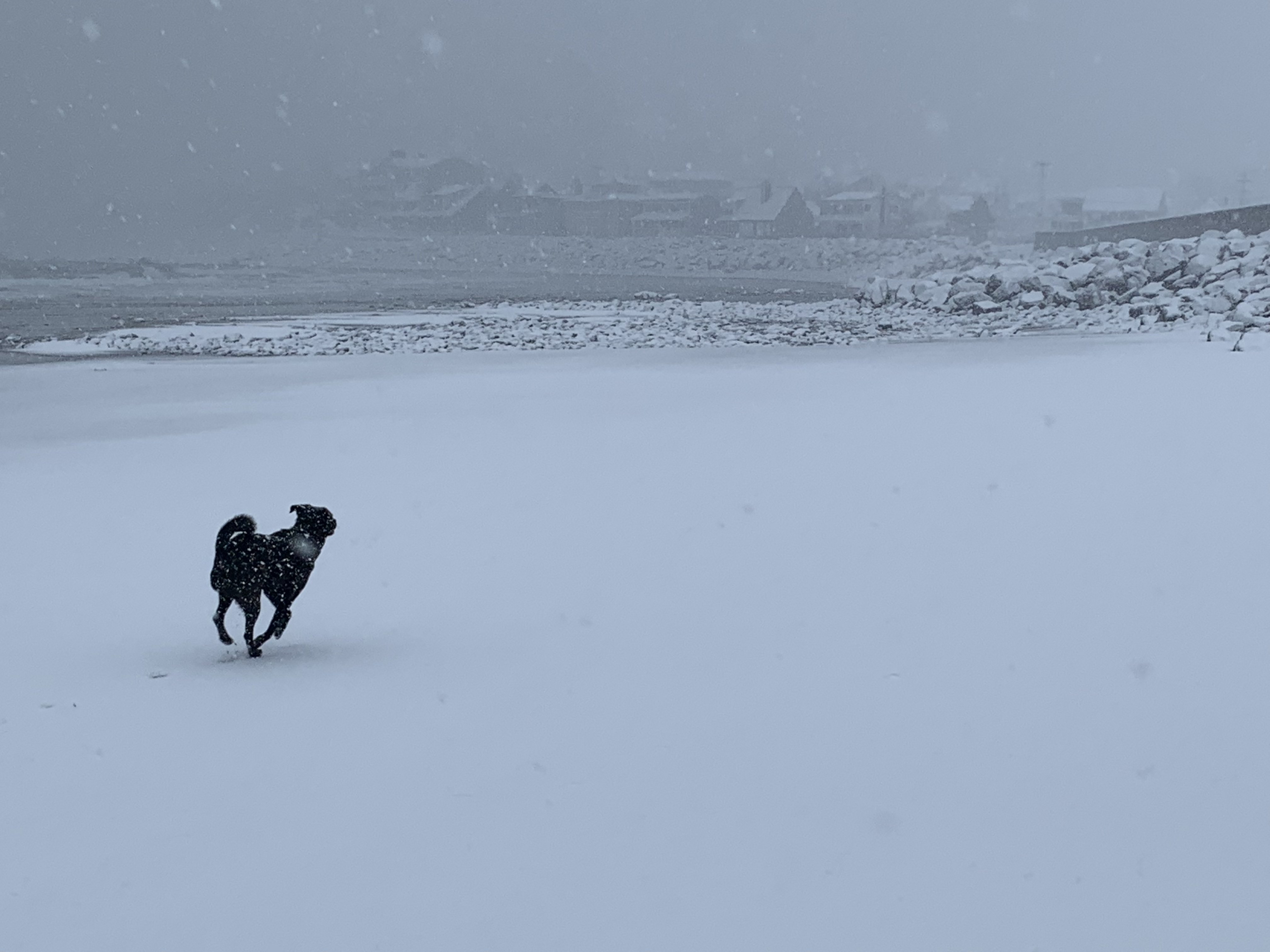
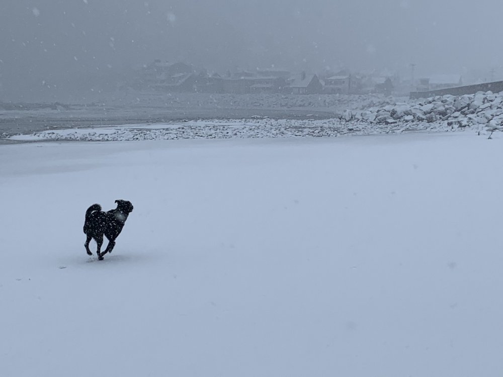
Wow what a band that is down south. Congrats. It’s coming down nicely in Hampton Beach now. The dog is happy we got the whole damn beach to ourselves!
-
Should have came to the NH seacoast! We didn’t jack but conditions here were awesome. 12” of paste, blizzard conditions on the immediate coast (Porstmouth was close, I bet I met criteria here) and the waves slamming over the Hampton wall made quite the show. Trying to decide what to do with the foot of icy seawater that’s found it’s way into my driveway courtesy of NHDOT plows with the snow banks acting like a nice soup bowl...
-
Haha imagine this! Edit: delete if necessary I know this an obs thread my bad the weenie in me is exited for a Maine trip.
-
Little old Ski Nashoba is going to be happy with this one. They’ve been having a tough year.
-
Still having a lot of fun here in Hampton. Probably only got 8” roughly so far, but the conditions overall have been wild. Been borderline blizzard conditions for several hours now. Roads are getting buried with the wind just blowing any snow removed right back on.
-
Is it really raining on cape Ann? It’s absol nuking out in Hampton NH right on the coast. That’s only ~ 20 miles as the crow flies. I feel bad for the weenies out there.
-
Quick view out my front door. Not really accumulating with the snow just going sideways. It’s pretty sweet out there though.
-
Just a wall of white blowing down ocean blvd here in Hampton, no way I’m going to get an accurate measurement if things keep up this way.