KoalaBeer
-
Posts
636 -
Joined
-
Last visited
Content Type
Profiles
Blogs
Forums
American Weather
Media Demo
Store
Gallery
Everything posted by KoalaBeer
-

December 5-6, 2020 Storm Observations and Nowcast
KoalaBeer replied to Baroclinic Zone's topic in New England
Haha I never noticed a difference in snow totals elevation wise in my 20+ years of living in Methuen. Every once in a while there was a pretty sick gradient between the west side of town bordering Dracut and the east side bordering Haverhill though. I used to always take the dog up old Methuen ski hill during some marginal storms looking for a difference in snow with a little elevation but never found it. -
December 5-6, 2020 Storm Observations and Nowcast
KoalaBeer replied to Baroclinic Zone's topic in New England
Absolutely ripping snow on the coast in Hampton now and is sticking to the grass and cars. Wasn’t expecting that so soon let’s go! -
December 5-6, 2020 Storm Observations and Nowcast
KoalaBeer replied to Baroclinic Zone's topic in New England
Flipping over now to snow in Hampton quite a bit ahead of schedule. I have to think that’s pretty good news for folks in the Merrimack valley and interior Rockingham county if I’m switching already. -
December 5-6, 2020 Storm Observations and Nowcast
KoalaBeer replied to Baroclinic Zone's topic in New England
Friend in Westford basically said the same thing. Said it was absolutely pounding out but little in the way of new accumulation. Got to think that changes quick as the sun sets as well. -
December 5-6, 2020 Storm Observations and Nowcast
KoalaBeer replied to Baroclinic Zone's topic in New England
Speaking from experience patience can be key there. It’s tough to watch everyone rip to your SW but the best is yet to come for SE NH. -
December 5-6, 2020 Storm Observations and Nowcast
KoalaBeer replied to Baroclinic Zone's topic in New England
What an absolute paste job on the Wachusett cam. Looks like an easy 1-2"hr type stuff. https://www.wachusett.com/The-Mountain/Media-Center/Web-Cams.aspx -
December 5-6, 2020 Storm Observations and Nowcast
KoalaBeer replied to Baroclinic Zone's topic in New England
There’s some great little breweries in Londonderry you could probably kill some time in if you wanted to and are a craft beer guy. From the Barrel is the one I recommend. Good luck though! I’m very familiar with the area and you should do just fine there with snow totals. That area often does very well. -
December 5-6, 2020 Storm Observations and Nowcast
KoalaBeer replied to Baroclinic Zone's topic in New England
That’s an easy little 20 minute drive for me. Love that place and the beer selection on tap is always good. i wonder what I end up pulling on the immediate coast from this. That gradient on the GYX map looks like it goes from 6” to Portsmouth to 1” on the coastline. -
Dec 5/6th major coastal/ west Atlantic cyclogenesis ...?
KoalaBeer replied to Typhoon Tip's topic in New England
Oh ya! I told one of my best friends in Westford to be prepared for a paste job with no power. He's in the woods on a little lake house surrounded by massive pines as well...if not for Covid I'd be asking him to stay the night. -
Dec 5/6th major coastal/ west Atlantic cyclogenesis ...?
KoalaBeer replied to Typhoon Tip's topic in New England
Jackman Jackpot. You won’t hear me complain one bit if NNE gets 2ft and we are the sacrificial lamb in SNE. I just want to ride and hopefully do some backcountry stiff soon with all the COVID restrictions at resorts. Still a wild amount of solutions on the table this far out. -
Dec 5/6th major coastal/ west Atlantic cyclogenesis ...?
KoalaBeer replied to Typhoon Tip's topic in New England
Wonder what happened to NH in there high end map . -
Dec 5/6th major coastal/ west Atlantic cyclogenesis ...?
KoalaBeer replied to Typhoon Tip's topic in New England
Haha it's kind of always funny seeing the local news a step behind the forum. They are going to use this mornings and afternoon model runs to hype up the potential for a significant warning criteria storm in NH, while we watch this evenings model runs live shunt this east and possibly give more significant impacts to SNE. Not that I'm ready to jump ship for CNE or NNE on this as I alluded to in my last post....I just get a chuckle watching the local news rely on previous runs while mets on here are starting to discuss entirely different scenarios. Showing old data certainly adds to the "weatherman get paid to be wrong" mentality I hear the general public gripe about all the time but I also get why showing the most recent model runs on such short notice on a live broadcast is problematic especially before the meteorologist on staff hasn't had the time to fully analyze those said model runs. -
Dec 5/6th major coastal/ west Atlantic cyclogenesis ...?
KoalaBeer replied to Typhoon Tip's topic in New England
I'm certainly going to trust the 12z Euro solution and consensus of the globals over one run of 18z NAM....especially at the time frame we are talking (~48-60hrs out) but a weaker and more east solution would certainly suck. I'd rather the system be amped and more west drenching me with two inches of rain if that means ski country gets crushed. I'm going to be pissed if the major mountains in NH and ME smoke cirrus on this one. This is a big opportunity for resorts to be able to expand terrain and spread everyone out before the holiday rush, something that could prove vital to them saying open with recent COVID statistics. -
Dec 5/6th major coastal/ west Atlantic cyclogenesis ...?
KoalaBeer replied to Typhoon Tip's topic in New England
I’m having a hard time believing I might be abandoning my plans to head to Ossipee for this and staying in Hampton....but if these runs continue that just may be the case. Either way I’m getting the splitboard waxed up and hoping the mountains of Maine at least get nailed if the Whites don’t. -
Dec 5/6th major coastal/ west Atlantic cyclogenesis ...?
KoalaBeer replied to Typhoon Tip's topic in New England
I think I'm going to head up to my parents cabin in Freedom, NH tomorrow and take my chances there. Could end up being decent there if it's cold enough but the elevation there is only about 400' so that's not helping....and man those euro ensembles are a pretty insane range of solutions. But screw it, beats sticking around here and getting blasted by 36F rain and 50mph winds in Hampton....I do miss living in my old Methuen jackpot spot a little although that looks no good for this storm either. The most I've measured here since moving last Dec was 5 inches of cement. -
Not much happening on the NH seacoast. I doubt I barely even gusted to 45 right on the water and this line off Cape Ann that has some higher winds looks to miss to the east.
-
Starting to pick up here on the NH seacoast. Gusting to 45 on Isle of Shoals. I've had some decent events since moving here last December but nothing that's wowed me. Only thing between me and the ocean is "The Wall" so I figured I'd see some higher winds by now. Maybe this evening will impress. Speaking of wind events I still hold Oct 2017 as the strongest I've witnessed around here but it seldom gets talked about which is weird considering Maine and NH had just about as many outages as the 2008 ice storm....but if I remember correctly areas closer to Boston didn't get hit nearly as bad. I'm guessing we hit 75-80mph where I lived in Methuen at the time but unfortunately LWM airport lost power and stopped transmitting. Never seen 5 utility poles snapped like twigs from any other wind event in the Merrimack valley.
-
About to pour a collab they did with Vitamin Sea. Can’t wait to try it.
-
Ditto this. I've only ever been on a board my whole life but managed a ski/snowboard shop for 5 years before getting out of retail. I would really push the customers to budget out most of there money on boots first whether on skis or a board. You could have the best skis and bindings on the market but if your boots suck you're going to have a bad time. Although I got to say 400-500 days on those boots!? I hope you changed out the toe and heel lugs man those wear down and cause bindings to not release properly. Snowboard boots are 100 days max in my experience but they also aren't made up of hard plastic. Damn I can't wait for the season to get here....
-
Pretty excited to see the surf here in Hampton tomorrow. Should be pretty sweet to watch the surfers at the wall in the afternoon. I sure as hell won't be paddling out there tomorrow in those conditions.
-
Haha oh man I happily forgot Big Joe even existed. I remember 16 year old me tracking hurricanes and I thought that dude was the GOAT of forecasting tropical systems....ohh how much I've learned. But anyways, when should I start boarding up in Hampton?
-
Tropics looking pretty open for business as the AEW starts cranking come early August in addition to what's already out there now. ECMWF spaghettios is pretty eye opening for the first week of next month. Things are shaping up to be a pretty wild year, lets see if we can get a storm to finally swing up our way.
-
Might as well revive this thread as it looks like the tropics briefly turn active in the WPAC and BOB. TD 01 in the looks like it should make landfall in the Philippines as typhoon as conditions look quite favorable ahead of it as it tracks around the subtropical ridge. The ECMWF solution in the BOB is what really grabs my attention however. It's never a good thing when the Euro is showing a storm as such in this region. Long ways out on that one so things will most definitely change, but the potential is there.
-
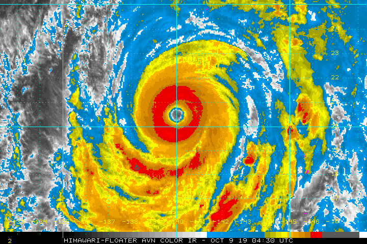
Cat 5 landfall imminent? Waiting to see if it clears out that eye completely.