
BNAwx
-
Posts
317 -
Joined
-
Last visited
Content Type
Profiles
Blogs
Forums
American Weather
Media Demo
Store
Gallery
Everything posted by BNAwx
-

February/March 2021 - Frigid or Flop? Pattern/Longterm Forecast Thread.
BNAwx replied to John1122's topic in Tennessee Valley
Great example. And depending how cold the upper levels are, that could mean the difference between ice, sleet or snow...or just plain rain. -
February/March 2021 - Frigid or Flop? Pattern/Longterm Forecast Thread.
BNAwx replied to John1122's topic in Tennessee Valley
Interesting tweet from Anthony Masiello this morning....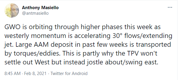
-
February/March 2021 - Frigid or Flop? Pattern/Longterm Forecast Thread.
BNAwx replied to John1122's topic in Tennessee Valley
I also like to keep in mind the seasonal trend. Thanks to the -NAO, the SER has been beaten back after showing up strongly on modeling in long lead times. I think persistence is the key here. I guess "dance with the one that brung ya'" is my way of looking at it. -
It’s still a slight mix but it’s coming down at a moderate clip. Might get a coating if we can hold on for a bit longer. I’ll consider that a win so far this year...
-
Biggest flakes I’ve seen in quite a while...
-
Finally got some fatties coming down in Hermitage, TN!
-
February/March 2021 - Frigid or Flop? Pattern/Longterm Forecast Thread.
BNAwx replied to John1122's topic in Tennessee Valley
Can you imagine what the old DGEX would look like? -
February/March 2021 - Frigid or Flop? Pattern/Longterm Forecast Thread.
BNAwx replied to John1122's topic in Tennessee Valley
To be on the safe side, I’ll prolly go today to make sure I’ve got gas for the generator... -
February/March 2021 - Frigid or Flop? Pattern/Longterm Forecast Thread.
BNAwx replied to John1122's topic in Tennessee Valley
It’s always possible but take these outputs with a grain of salt. It’s simply going to depend where the arctic boundary sets up shop. Ice for someone is almost a given. Models will struggle until we get much closer. -
February/March 2021 - Frigid or Flop? Pattern/Longterm Forecast Thread.
BNAwx replied to John1122's topic in Tennessee Valley
Yeah. Not a good look. Might need to gas up the generator we got after the tornadoes last March... -
February/March 2021 - Frigid or Flop? Pattern/Longterm Forecast Thread.
BNAwx replied to John1122's topic in Tennessee Valley
With that flow, it might not be done with the mischief yet... -
I wouldn’t be surprised if this system ticks further west still.
-
I believe there could be even more changes with this one...even though we’re now in the mesoscale model range.
-
February/March 2021 - Frigid or Flop? Pattern/Longterm Forecast Thread.
BNAwx replied to John1122's topic in Tennessee Valley
My favorite look is an arctic boundary with that WSW orientation...as long as it’s far enough south to allow a deeper penetration of an arctic air mass. -
February/March 2021 - Frigid or Flop? Pattern/Longterm Forecast Thread.
BNAwx replied to John1122's topic in Tennessee Valley
There’s gonna be lots of ups and downs over the next week. It’s all gonna depend on where the arctic boundary sets up shop. Fun times ahead. -
February/March 2021 - Frigid or Flop? Pattern/Longterm Forecast Thread.
BNAwx replied to John1122's topic in Tennessee Valley
Those were the days. I remember in 77-78 it would snow and we’d go back to school for a couple days and then it would snow again and we’d be out another week or so. I’d love to have another winter like that again someday. -
February/March 2021 - Frigid or Flop? Pattern/Longterm Forecast Thread.
BNAwx replied to John1122's topic in Tennessee Valley
I lived in Cookeville at the time and I believe we hit either -23 or -24. Our pipes had frozen up and my mom went under the house with a hair dryer in an attempt to thaw them out. Well, it was so cold that the extension cord froze and just crumbled up. Good times.. -
February/March 2021 - Frigid or Flop? Pattern/Longterm Forecast Thread.
BNAwx replied to John1122's topic in Tennessee Valley
Would love to see some snow on snow in the parts. Hasn’t happened in quite a while... -
February/March 2021 - Frigid or Flop? Pattern/Longterm Forecast Thread.
BNAwx replied to John1122's topic in Tennessee Valley
That’s pretty amazing actually. You don’t see that much consensus very often..even if it’s just the ensembles of 1 global model. -
February/March 2021 - Frigid or Flop? Pattern/Longterm Forecast Thread.
BNAwx replied to John1122's topic in Tennessee Valley
Is Para Spanish for DGEX? -
East TN, SWVA, E KY, and Plateau NW flow obs. Feb 1 - 2
BNAwx replied to Holston_River_Rambler's topic in Tennessee Valley
I’ve determined if I want to see good snow that I need to have a cabin in the mountains or at the least a little house in Fentress County if I want to be closer...- 195 replies
-
- 1
-

-
- upslope
- may the flow be with you
- (and 1 more)
-
January 2021 Medium/Longterm Pattern Discussion.
BNAwx replied to AMZ8990's topic in Tennessee Valley
The Euro depiction of how things evolve looks like good overrunning potential. -
January 2021 Medium/Longterm Pattern Discussion.
BNAwx replied to AMZ8990's topic in Tennessee Valley
Is that due to some sort of deformation band coming through? I remember the same type of output from the Christmas event. -
January 2021 Medium/Longterm Pattern Discussion.
BNAwx replied to AMZ8990's topic in Tennessee Valley
Maybe we’ll buck the Nina trend and have a decent 2nd half of the winter. If the Nina is weakening, maybe that’ll help as well.