

CheeselandSkies
-
Posts
2,961 -
Joined
-
Last visited
Content Type
Profiles
Blogs
Forums
American Weather
Media Demo
Store
Gallery
Posts posted by CheeselandSkies
-
-
Special Marine Warnings out for the entirety of Lake Erie for winds and potential waterspouts.
-
Looks like there's a number of other trailer parks and housing developments of likely suspect construction quality along I-96 between Webberville and Fowlerville.

-
Hope it didn't hit this place:
https://goo.gl/maps/oqEJKbukDMSav2eB6 -
Tornado could be heading for Howell if it stays down (they're in the polygon). @Jonger
-
They just went to "large and extremely dangerous" PDS wording.
BULLETIN - EAS ACTIVATION REQUESTED
Tornado Warning
National Weather Service Detroit/Pontiac MI
937 PM EDT Thu Aug 24 2023The National Weather Service in Detroit/Pontiac has issued a
* Tornado Warning for...
Central Livingston County in southeastern Michigan...* Until 1015 PM EDT.
* At 937 PM EDT, a confirmed large and extremely dangerous tornado
was located near Williamston, or near Fowlerville, moving east at
40 mph.This is a PARTICULARLY DANGEROUS SITUATION. TAKE COVER NOW!
HAZARD...Damaging tornado.
SOURCE...Radar confirmed tornado.
IMPACT...You are in a life-threatening situation. Flying debris
may be deadly to those caught without shelter. Mobile
homes will be destroyed. Considerable damage to homes,
businesses, and vehicles is likely and complete
destruction is possible.* The tornado will be near...
Fowlerville around 945 PM EDT.
Howell and Oak Grove around 955 PM EDT.
Brighton around 1010 PM EDT.Other locations impacted by this tornadic thunderstorm include
Parkers Corners, Conway Township and Deerfield Township.This includes the following highways...
I-96 between mile markers 125 and 146.
US-23 near mile marker 60.PRECAUTIONARY/PREPAREDNESS ACTIONS...
To repeat, a large, extremely dangerous and potentially deadly
tornado is on the ground. To protect your life, TAKE COVER NOW! Move
to a basement or an interior room on the lowest floor of a sturdy
building. Avoid windows. If you are outdoors, in a mobile home, or in
a vehicle, move to the closest substantial shelter and protect
yourself from flying debris.&&
LAT...LON 4276 8402 4276 8377 4253 8375 4257 8414
4275 8416
TIME...MOT...LOC 0137Z 277DEG 35KT 4266 8419TORNADO...OBSERVED
TORNADO DAMAGE THREAT...CONSIDERABLE
MAX HAIL SIZE...<.75 IN$$
KDK
-
-
36 minutes ago, CheeselandSkies said:
Wasn't expecting it to be this close. Outflow bout to knock the heat down a peg or three.

This outflow boundary seems to have stalled about 2 miles east of me, lol. Still feels like a sauna out there.
Again, much closer than I expected but still not a drop for Madison.
-
Speaking of which, possible TDS near Northview, MI. I can't attach both images but it is (or was, as of this scan) colocated with an apparent couplet on velocity.

-
1 hour ago, TheNiño said:
View over the lake. Love standing in the rain during such warm temps. “Marble size” hail being reported over skywarn in Racine. Nothing much here I’m just south of it. Constant thunder but unfortunately it’s mostly hidden cloud to cloud.
Edit: Racine Airport reported 54mph wind gust.
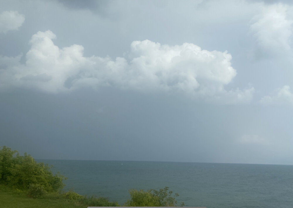
That storm out east had legit supercell structure on radar for a while, even a distinct velocity couplet as it moved out over the lake just north of Kenosha. SMW for waterspouts was put out for it, even though no tornado warning over land.
-
Wasn't expecting it to be this close. Outflow bout to knock the heat down a peg or three.
-
7 minutes ago, hawkeye_wx said:
Cedar Rapids has stalled at 95º over the last hour. Combined with a lower dew point, the heat index is 12º less than at this time yesterday.

-
 1
1
-
-
48 minutes ago, Powerball said:
Southern MI nto NE Ohio has been upgraded to an Enhanced Risk by the SPC.
Should be fun to watch on radar. If only this pattern could have set up six weeks ago and stuck around a while, giving everyone in the sub a chance to be in line for some dome riders. #1995ing.
-
2 hours ago, A-L-E-K said:
Riding the nest obv
Riding the edge of SPC's marginal here but even the nest keeps us dry.
-
 1
1
-
-
That's what I'm saying. A lot of the recent ones we've seen that have survived (Isaias, Laura in particular) have been a situation where the decoupled "center" kind of skirts around the mountains and re-forms on the other side. Franklin just plowed straight across.
-
 1
1
-
-
4 hours ago, MANDA said:
Franklin looking very healthy as it crosses DR/Haiti. Nice outflow and banding. Low shear and warm water ahead should get Franklin to Hurricane status with not much trouble.
Kinda surprised an already struggling moderate TS wasn't absolutely destroyed by the (in)famous Shredderola.
-
49 minutes ago, hardypalmguy said:
September got cold quick with MKE hitting 32 in the third week of the month.
I think I remember that, too. One of those years in the mid-'90s (so probably that one), early in the school year, waiting for the bus in the cold rain. I think that's when it got in my head that Septembers get cooler much faster than they actually do most years.
-
Yeah, unless prolonged, temperature extremes (at either end of the spectrum) aren't really that remarkable for most people. That's why 1995 was one of my favorite summers. Hot but stormy for what seemed like weeks on end. That's why even though I was only 9, it still stands out in my memory.heat exposure is so cumulative, these brief 1-2 day shots are nbd imo
Sent from my Pixel 4a using Tapatalk
-
17 minutes ago, hlcater said:
This is pretty neat
Wasn't this seen with the (unexpectedly disrupted, I was sure it was going full Wilma) bomb-out of Hurricane Delta in 2020?
-
1
-
-
Flash Flood Statement
National Weather Service Los Angeles/Oxnard CA
650 PM PDT Sun Aug 20 2023CAC037-211000-
/O.CON.KLOX.FF.W.0024.000000T0000Z-230821T1000Z/
/00000.0.ER.000000T0000Z.000000T0000Z.000000T0000Z.OO/
Los Angeles CA-
650 PM PDT Sun Aug 20 2023...FLASH FLOOD WARNING REMAINS IN EFFECT UNTIL 3 AM PDT MONDAY FOR
LOS ANGELES COUNTY...At 650 PM PDT, a DANGEROUS AND LIFE THREATENING FLASH FLOODING
SITUATION is developing from Point Mugu and Camarillo eastward
through Thousand Oaks and Woodland Hills area and across the
mountains of Los Angeles County. Local law enforcement reported
flash flooding across the warned area, vehicles have been stranded.
Between 1 and 4 inches of rain have fallen, except 3 to 6 inches in
the mountains. Additional rainfall amounts of 1 to 4 inches are
possible in the warned area.HAZARD...Life threatening flash flooding. Heavy rain from
Tropical Storm Hilary is producing flash flooding.SOURCE...Law enforcement reported.
IMPACT...Life threatening flash flooding of creeks and streams,
urban areas, highways, streets and underpasses.Some locations that will experience flash flooding include...
Thousand Oaks, Malibu, Lake Los Angeles, Acton, Wrightwood,
Burbank, Palmdale, Mount Wilson, Pasadena, North Hollywood,
Griffith Park, Santa Clarita, Universal City, Van Nuys, Lancaster,
Hollywood, Alhambra, Northridge, Downtown Los Angeles and Beverly
Hills.PRECAUTIONARY/PREPAREDNESS ACTIONS...
Turn around, don't drown when encountering flooded roads. Most flood
deaths occur in vehicles.Be especially cautious at night when it is harder to recognize the
dangers of flooding.&&
LAT...LON 3405 11894 3408 11894 3417 11879 3417 11867
3424 11867 3424 11863 3482 11889 3482 11767
3429 11765 3402 11773 3402 11777 3398 11780
3395 11778 3397 11871 3402 11903 3408 11903FLASH FLOOD...OBSERVED
FLASH FLOOD DAMAGE THREAT...CONSIDERABLE-
 2
2
-
-
1 hour ago, madwx said:
The last Excessive Heat Watch for us was July 21-22, 2016 but that was only for 31 hours.
July 17-20, 2011 we were under an EH Watch for 81 hours that was the last one longer than this.
Those have been our only two in the past 15 years.
Kinda surprised there wasn't one in 2012, but other than that year 1995 is the only one that sticks out in my mind for heat.
-
1
-
-
I'm usually not too impressed by "heatwaves," especially in recent years, but if the forecast for midweek verifies it'll be getting into some rarefied territory for this neck of the woods, for anytime really but especially this late in the summer. Been kinda rolling my eyes at all the media blather about record-shattering heat all around the world while we've been locked in this relatively mild summer pattern in the western Great Lakes, but it looks like it's finally our turn to pay the piper.
Excessive Heat Watch now hoisted for Dane County Tuesday-Thursday.For our resident southern Wisconsin climo expert @madwx, when was the last time we were under one for that long a duration?
-
18 hours ago, hawkeye_wx said:
By the end of the month, the average-wet first half of August will be a distant memory. There is little, if any, rain in sight.
Had hoped the slug of Pacific moisture from Hilary would kick-start something but it appears its mostly going to get wrung out over the west and anything left will go over the ridge way to the north.
-
Never really followed weather in the far SW US before...just thought it was stupid that it has so many NEXRAD sites so close to each other when there are such huge gaps in tornado-prone areas of the Plains, Midwest and South...then I realized that KNKX and KSOX can't even see all the rain that is prompting the flash flood warning from just north of Calipatria to I-10 that KYUX can, because of the Peninsular Ranges.
-
3
-
-
On 8/17/2023 at 5:24 PM, Scott747 said:
Those posts have gone away because it's the same schtick as it always is.
In a nutshell that poster has cancelled the rest of August and September. Also October will be cancelled along with 2024, 2025 and beyond.
I was relatively new to the forum then but I thought that poster might have learned some humility after making a post essentially cancelling 2017 mere days before Harvey regenerated, to be quickly followed by Irma, Jose, Maria, etc. Little did I know how wrong I was.
-
1
-


Hurricane Idalia
in Tropical Headquarters
Posted
Somebody gets it.