George BM
-
Posts
3,048 -
Joined
-
Last visited
Content Type
Profiles
Blogs
Forums
American Weather
Media Demo
Store
Gallery
Everything posted by George BM
-
If you squint closely enough you can see the sun's path slowly starting to creep higher in the sky.
-
Congratulations to you getting married! And good luck to your father. I wish him a speedy recovery.
-
URGENT - WEATHER MESSAGE National Weather Service Baltimore MD/Washington DC 1117 AM EST Fri Dec 10 2021 DCZ001-MDZ003>006-008-011-013-014-502>508-VAZ026>031-038>040- 051>054-501-502-504>508-WVZ050>053-055-502-504-506-110030- /O.CON.KLWX.WI.Y.0015.211211T2100Z-211212T0600Z/ District of Columbia-Washington-Frederick MD-Carroll- Northern Baltimore-Cecil-Southern Baltimore-Prince Georges- Anne Arundel-Central and Eastern Allegany-Northwest Montgomery- Central and Southeast Montgomery-Northwest Howard- Central and Southeast Howard-Northwest Harford-Southeast Harford- Rockingham-Shenandoah-Frederick VA-Page-Warren-Clarke-Greene- Madison-Rappahannock-Culpeper- Prince William/Manassas/Manassas Park-Fairfax- Arlington/Falls Church/Alexandria-Northern Fauquier- Southern Fauquier-Eastern Highland-Western Loudoun- Eastern Loudoun-Northern Virginia Blue Ridge- Central Virginia Blue Ridge-Hampshire-Morgan-Berkeley-Jefferson- Hardy-Eastern Grant-Eastern Mineral-Eastern Pendleton-... 1117 AM EST Fri Dec 10 2021 ...WIND ADVISORY REMAINS IN EFFECT FROM 4 PM SATURDAY TO 1 AM EST SUNDAY... * WHAT...West winds 15 to 25 mph with gusts up to 55 mph expected. * WHERE...Portions of The District of Columbia, central, north central, northeast, northern and western Maryland, central, northern, northwest and western Virginia and eastern and panhandle West Virginia. * WHEN...From 4 PM Saturday to 1 AM EST Sunday. * IMPACTS...Gusty winds could blow around unsecured objects. Tree limbs could be blown down and a few power outages may result. * ADDITIONAL DETAILS...The highest gusts are most likely between 6 pm and Midnight Saturday evening. PRECAUTIONARY/PREPAREDNESS ACTIONS... Use extra caution when driving, especially if operating a high profile vehicle. Secure outdoor objects. && $$
-
December 2021 Medium/Long Range Discussion Thread
George BM replied to North Balti Zen's topic in Mid Atlantic
Yeap. PD1 was actually immediately preceded by a super cold airmass. There was a morning low of -14F at IAD on 2/18/1979 with the temp only maxing out at 8F before midnight. 2.5" of snow had already fallen by then. -
Bringing out my inner @yoda below. .LONG TERM /SATURDAY THROUGH TUESDAY/... An upper trough axis will become more neutrally tilted over our region on Saturday leading to strengthening of the baroclinic zone. Surface low pressure over eastern Canada will become positioned in the left exit of a strong upper-level jet streak leading to favorable upper-level lift and strengthening of the low. A strong cold front and upper-level trough associated with the low in Canada will be driven eastward through our region from Ohio on Saturday. This system is forecast to have a strong wind field, with winds in the 45 to 55 knot range progged at 850 mb. Forecast soundings suggest close to 50 knots will be possible within the mixed layer which may lead to strong winds gusts along and behind the frontal passage. Wind Advisories and/or High Wind Warnings will be possible on Saturday. Ahead of the frontal passage, strong warm air advection will lead to temperatures peaking in the upper 60s to mid 70s on Saturday. Strong winds aloft along with CAPE up to around 500 J/kg likely leads to a high shear/low CAPE environment which will be capable of producing an organized line of showers or a few storms that may produce strong to damaging winds. PWs remain 2+ standard deviations above normal, but a strong flow perpendicular to the front should make the frontal passage progressive and limit the threat for flooding. The cold front should exit the region by early Sunday morning.
-
Gust to 51 at IAD.
-
Mid-Atlantic winter 2021-22 snowfall contest
George BM replied to AnEndlessMaze's topic in Mid Atlantic
-
Happy December 5th Day!
-
December 2021 Medium/Long Range Discussion Thread
George BM replied to North Balti Zen's topic in Mid Atlantic
All snow talk aside the 18z gfs verbatim would make for a fun Sunday next weekend for many. Quite the wind event. Of course, it's a model run for 8 days out so it won't go down exactly like that. (I know. Good job Sherlock Holmes. ) But it just shows that we are going to be in an active pattern for a bit. -
Skies have been clear in VA allowing for radiational cooling while MD was under the clouds all night.
-
December 2021 Medium/Long Range Discussion Thread
George BM replied to North Balti Zen's topic in Mid Atlantic
Yeap. I've definitely noticed this looking back at records since 1950. Fun fact: The three least snowy winters in DC: 1.) 1973 (T) 2.) 1998 (T) 3.) 2020 (0.6") were all warm enso years. IIRC even the Super La Nina of 1916-17 (ONI peaking around -2.3C) wasn't anywhere near as snowless as the winters you mentioned above. -
Yes. That's indeed graupel. Water droplets have supercooled on the snowflake (rimming).
-
Meteorological Winter welcomes us.
-
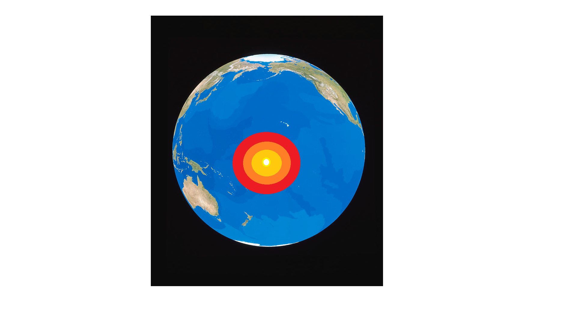
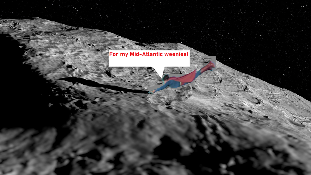
1: You sure about this? 2: Yeah. We don’t even know what the extent of the consequences across the globe that will result from this. George BM: You called me… practically begged me to come here because you promised me that you would help me and the Mid-Atlantic weenies this winter. Are you chickening out now? 1: And suppose a climate disaster results from this?! What then?! George BM: Then at least the weather will finally be interesting for once. I’ve watched too many storms from the outside looking in over the past decades! Heat makes everything more interesting. Besides, don’t you all have the top-secret global cooling technology that you brought up earlier in case things get a bit too heated on the earth? 2: Can’t confirm or deny. Top-secret. George BM: Jebman: Alright! I’m ready up here when you all are! 1: And you’ve confirmed that there’s no one within 1,500 miles of our target zone? X: Affirmative! George BM: Go for it, Jebman. BREAKING: The 250-meter diameter meteor that struck early this morning along the equilateral Pacific is expected to cause extreme and dangerous weather patterns as a result of ‘Extremely high SST anomalies’ near the impact location. George BM: Great job, Jebman! Let us leave this base and go home and enjoy the show. Jebman: You all will get annihilated by extreme El Nino thundersnow blizzards to the point that you will beg for it to stop. ‘Oh please oh please oh please stop burying us!’ But it won’t stop. You will get buried alive singing ‘Sweet Home Alabama!’ until you see the light and get taken by it… into MORE El Nino blizzards! George BM: Yeah. I just hope that we didn’t make the world too warm. BTW, how did you learn how to fly… let alone stay alive in space? Jebman: When you’re a veteran weenie the weenies just flow through your vains. George BM: ……………………… Okie dokie. You and MillvilleWx should hangout and visit the DMV region when we get crushed. J Jebman: Do you think the Area 51 personnel will wipe our memory of us doing this? George BM: Nah. You’re too powerful for them.

-
Just had light graupel here in Herndon.
-
22F for the low at IAD.
-
I really appreciate your dedication though. You're a true weenie. Perhaps you can get us another December 19th HECS with a moderate event to top it off from Christmas Eve into Christmas Day? I know that that will make a certain emergency manager's Christmas. You still have nearly a full month to up your skills. Good luck!
-
December 2021 Medium/Long Range Discussion Thread
George BM replied to North Balti Zen's topic in Mid Atlantic
Is the lightinthestorm guy not making a winter forecast this year? I haven't seen anything from him yet. -
How many emails have you gotten so far?
-
Down to 24F at IAD. DCA... lol.
-
Four 27" HECSs this winter! I may have to up my snow totals.
-
Be well prepared and may we make it to the other side... Good luck my friend.
-
Just noticed your signature below: Winter 2009-10 Snow: 89.6" ; December 18-19 2009: 22.0", February 5-6, 2010: 32.0", February 9-10, 2010: 16.5" Three HECS one winter. Insanity.
-
Could you be talking about this link? http://www.greatlakes.salsite.com/Phasing_Storms.html
-
Yeap. The 12z GFS verbatim would actually be some big time wind Tuesday next week with 60-70kt winds at 1km with decent CCA.