klw
-
Posts
4,999 -
Joined
-
Last visited
Content Type
Profiles
Blogs
Forums
American Weather
Media Demo
Store
Gallery
Everything posted by klw
-
I have had snow on Memorial Day weekend twice in the past 12 or 13 years. I have had snow every month but July and August. Granted the Brattleboro climate is much less harsh than here and at my prior home in Peacham but the traditional "safe date" for planting out tender plants is the end of May. I am not saying that it will snow this Memorial Day this year, just that it has recently done so.
-
You are in Vermont. Just wait until you get snow on Memorial Day,
-
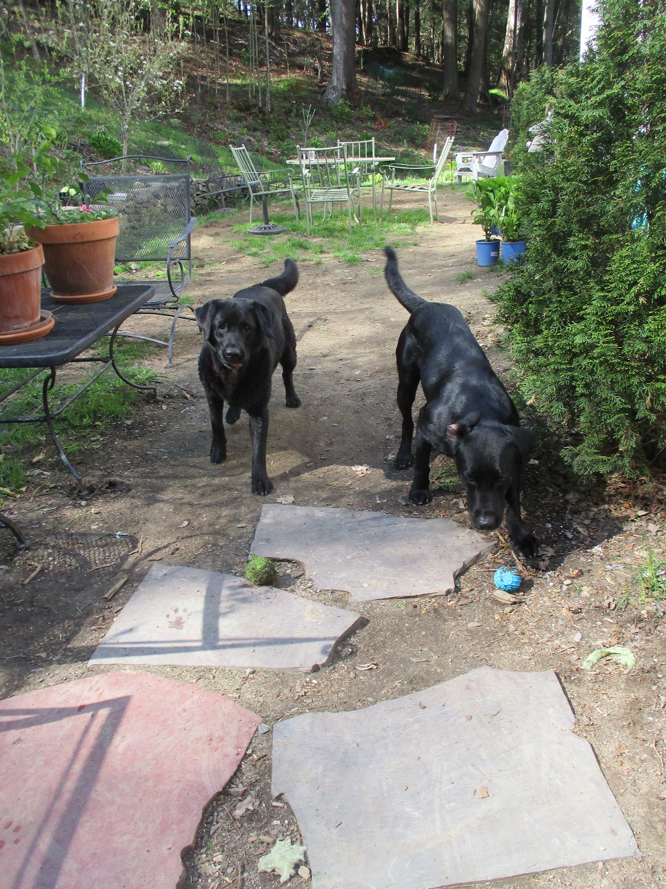
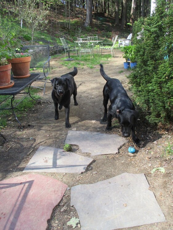
We have almost no flat ground at the house. If we were to eat outside it would likely be around the corner in the rose garden. This is the worst the lawn has been. It is a combo of very poor soil in this stretch, the dogs obsession with playing fetch, and possibly grubs. The soil barely drains water- I think it was largely waste fill that the prior owners put in when building. I plan to dig out the top 4 inches or so and replace it. I have tried to amend what is there but it hasn't worked. You can see the path the dogs run around the table to get tennis balls thrown over the table. I would complain but they have done a great job weeding parts of the yard as they make their paths.
-
KFS knew. The below is my yard this afternoon, it is not Kevin's- I fear he would have a heart attack if his grass looked like this, two of the big reasons why it is in this state are pictured.
-
This months argument about installs and dews is brought to you by Lennox. When it comes time to install, Lennox can meet your cooling and heating needs. Whatever your needs, remember Lennox. cue a jingle.
-
They have combined for 278,000 posts. How else is that possible? (And I love that they post this much)
-
5.13 inches here, that would wash my gullies.
-
So just another day in Norwell?
-
It looks like it was moving really quickly in the video. How long did you get to actually see it? Very cool for you!
-
We get it, you really like severe but did we need this much detail???
-
Where do you get that fertilizer? Is is a local product?
-
Weird, they have been out here for at least a week, maybe even 10 days
-
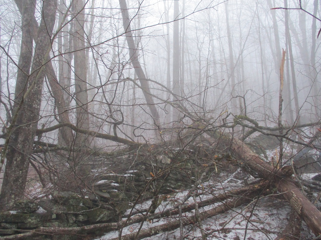
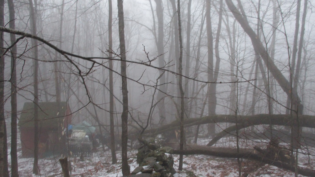
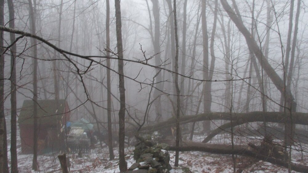
We lost power again overnight - it was about for 10 hours. I haven't ventured out into most of the woods yet but we had a decent tree down right near the road. More importantly two big trees on the neighbors land came down onto our stone wall and the pile of odds and ends I have behind one of our out buildings. The building looks okay but I could only look at the back from a distance due to all the branches by it.

-
This is the biggest reason we only let my son by the small 3 oz syrups (and no fake syrup).
-
We take turns pushing a wheel to generate it.
-
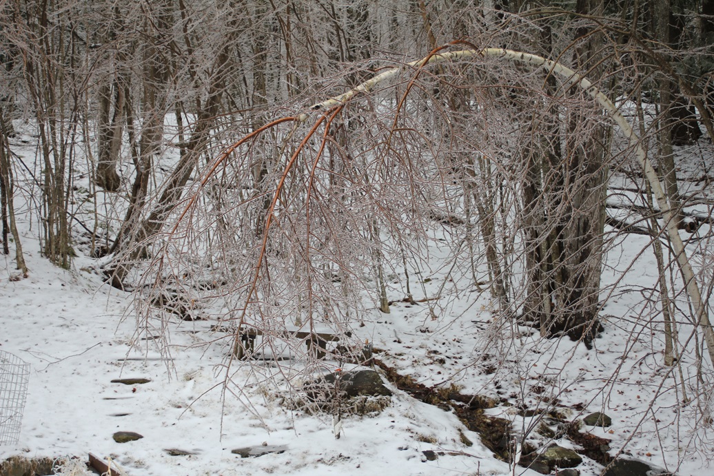
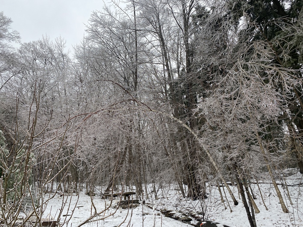
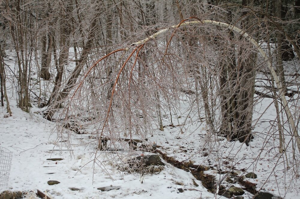
Better shot of one of the bent birches, I had not noticed the red branches before
-
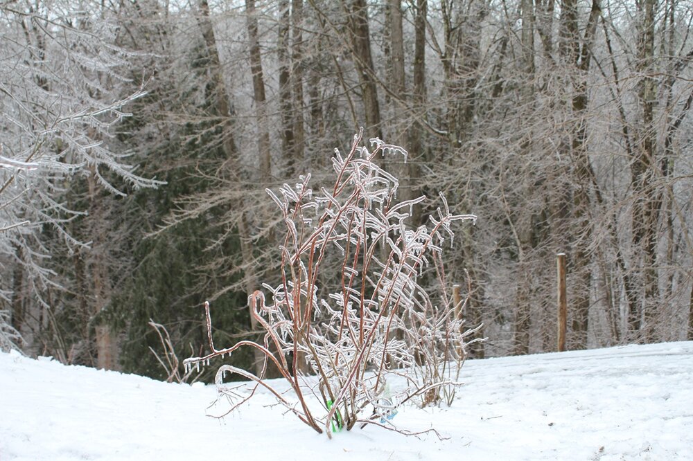
artsy blueberry stot
-
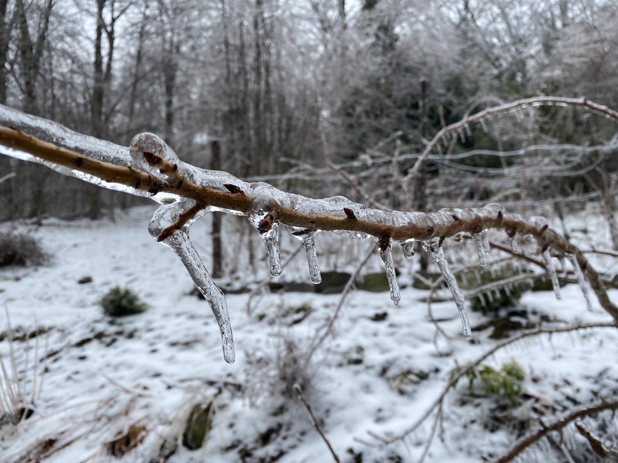
artsy ice shot

-
Power is back for now, still hearing popping in the woods. Birches bent

-
Of course we do, we’re not Tolland! (I assume the power grid is just permanently down there)
-
Internet and phone are out too so maybe later, cell coverage here is very minimal
-
And now I am out of power.
-
I am pretty surprised I still have power. I put the dogs out about half hour ago and heard 3 branches come down in 5 minutes. Just shy of 10k without power in Vermont.
-