

Paleocene
-
Posts
1,030 -
Joined
-
Last visited
Content Type
Profiles
Blogs
Forums
American Weather
Media Demo
Store
Gallery
Posts posted by Paleocene
-
-
Just now, SnowDreamer said:
We are at nearly optimal range for a completely unrealistic NAM'ing tho
-
 1
1
-
 5
5
-
-
Just now, NorthArlington101 said:
18z NAM actually is better lol. Looks a bit colder - might be picking up on at least some light WAA snows as the system moves in too.
Falls apart really fast. Mountains will hate it. But likely better for DC.
"South and very weak" scenario.


-
Come on NAM!
-
4 minutes ago, NorthArlington101 said:
It's over
I just want to be able to walk around while it's snowing in the daytime saturday .... please
-
12 minutes ago, caviman2201 said:
FWIW, the 12z GEFS surface low track is still ~75mi or so SE of the GFS op.
Op seems to go from Norfolk to Cape May while GEFS goes Nags Head to 150mi E of Chincoteague
-
1
-
-
Maybe some more front end action next tues:

that storm is quite productive with precip:

-
1
-
-
1 minute ago, Kmlwx said:
For those of you that want to nailbite even more about elevation - this is the Maryland LiDAR viewer
https://geodata.md.gov/topoviewer/
Cool tool if nothing else - REALLY high-res data there. I think @mappy might have been the one to post it a long while ago. For map geeks, can get lost for hours in just scrolling around.
Gonna use all of my 98 meters!
-
1
-
-
Just now, osfan24 said:
Wasn't a bad run by any means. Certainly keeps me interested. Could have been better, could have been worse.
Agreed, we are still alive on I-95 corridor.
-
Light snow into DC metro area by 15z Saturday.

Holds thru 18z as snow, temps in the 32-34 range along 95.
This thing races through -- precip out of the area by 00z Sun
-
3
-
-
I'm getting wishcasty, but the decent cold push Thurs- Friday overnight should help cool down the ground to help white rain/front end thump accumulate. Below freezing down into the carolinas.

-
Can always count on RGEM or NAM to have a juicy snow output at this range.
-
NAM'D

-
10
-
-
1 hour ago, CAPE said:
lol thanks. I'm good. If this winter goes as expected, the last 6 weeks or so of met winter should make most in this region happy. Otherwise, I chase. Kinda thinking about hanging out in Gettysburg this weekend.

Nice. If you want want to get out of town, the hills NW of Gettysburg are beautiful. Head out route 234 thru arendtsville then up to pine grove furnace. great state park there in the same little mountain ridge zone that makes up catoctin/camp david.
-
3 minutes ago, TinGTown said:
Hello All!
I posted a similar question on the Penn sub forum but wanted to ask here as well. I have a freshman kid at Penn State in State College, PA.
I am going to drive from DC to State College on Sunday. I have never driven to SC in winter conditions. Can anyone give me an idea of how much snow to expect in central PA? Do any of you know how the roads hold up traveling to State College?
Thank you for Amy information you can share with me!
I am not a meteorologist so take what I say with a grain of salt and pay attention to the forecast in the coming days. The storm will be out of the area by sunday mid-day, but roads may still be icy. 22/322 are major roads in central PA so they will get priority treatment. Check traffic cams before you leave: https://www.511pa.com/cameralisting.aspx
-
1
-
-
Not a big fan of this panel for MBY, it's following the GFS 12z

-
-
Love the location of the 0° C line on that valid 06z sunday panel!
-
Just now, MN Transplant said:
CoD has me at 15" 10:1, 10" Kucera, and 2" snow depth. LOL
Yeah, the temp maps verbatim have most of the region (east of the blue ridge) above freezing during the bulk of the heavy snowfall.
-
-
Here's the surface of the 18z ICON at 120 hours (18z sat):

versus 12z run (valid 18z sat):

The low is right on the SC/NC coastal border, instead of hanging back in GA. ICON also has a stronger high up top on the newer run by a few mbs
-
5
-
 1
1
-
-
Just now, osfan24 said:
Was not saying this is the final solution but that is definitely suppressed. I don't even think the heavy snow bands reach 95 unless the GFS is just not correctly showing how expansive precip would be on the northwest side.
I hear you, I just love seeing this solution versus the low running through Charleston WV, lol. We've got the high and low in the right place with this run... time cross fingers that it sticks to the canonical track off of the OBX/VA coast over the next two days worth of runs.
-
2
-
-
Just now, osfan24 said:
Looks suppressed to me.
dude the low is due east of the NC/VA border at 144 hours... a hundred miles further NW and we rain in the 95 corridor. This thing is gonna jump around a lot in the next two days
-
2
-
-
LP center is WAY further east versus 06z and 00z for the early morning hours sunday - great for us.
-
2
-
-
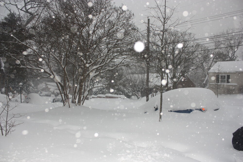
Digging up some photos to get us in the spirit with these runs. This was my old front yard in Takoma Park during the 2016 storm. It can snow here!
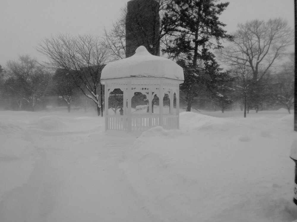
And further back into the archives --- this is on the campus of Gettysburg College during the second February 2010 storm. Legendary!
-
6
-
1
-


January 2024 Banter
in Mid Atlantic
Posted
I have a friend who is a fed who works in the PGH region; with people in this region. At a virtual all hands yesterday, he said people in the DC region were honking about a "major winter storm" this weekend which would lead to closures on Monday. Hilarious, but man, the proliferation of bad analysis of models/snow maps is problematic.