

Paleocene
-
Posts
1,023 -
Joined
-
Last visited
Content Type
Profiles
Blogs
Forums
American Weather
Media Demo
Store
Gallery
Posts posted by Paleocene
-
-
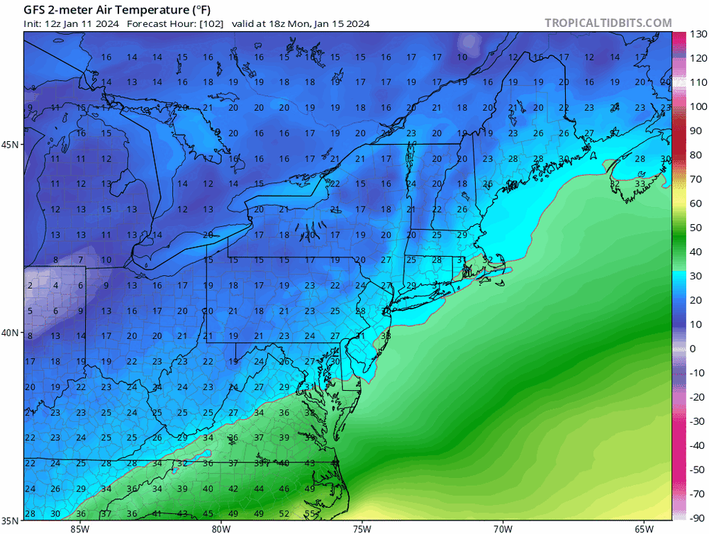
Surface temp profile as precip moves in/out. Pretty good. 850s better.
-
 1
1
-
 1
1
-
 1
1
-
-
-
Just now, high risk said:
For clarification, I just want to note that the NBM is not a model like the GFS, HRRR.... It's the National Blend of Models which blends and calibrates guidance from actual models. It accounts for the solutions among deterministic runs and ensemble members from numerous modeling systems around the world and is designed to capture signals of consensus. So, it's pretty nice to see it show a healthy signal for next week at this range.
Thanks. Is there a document/link somewhere that explains what the % shares that make up NBM are? Are those temporally consistent or do they shift?
-
Credit to @Terpeast here, the presentation of what happens to the saturday-sunday cutter has changed dramatically over the last 48 hours on the GFS. TPV further east, no low spinning backward over the hudson, etc. I buy in to the "models need to see what's coming next" theory... chaos theory etc
-
Where's @NorthArlington101's cycle? We're BACK BABY
-
1
-
-
1 minute ago, WEATHER53 said:
Pepco extreme tree trimming did wonders.
We had a lot of flickers in the 20910 zip code in the afternoon yesterday, but no outages. I have been impressed with Pepco reliability in my nhood (where I have been since 2020). Knock on wood.
-
Just now, CAPE said:
Where is WW?
Snow maps haven't looked this good on a mean for awhile.
Pivotal free gives snow depth for EPS:

-
1
-
-
Please (yeah yeah 150 hour OP)

-
3
-
-
4 minutes ago, stormtracker said:
Yes. And then the next storm cuts to our west. It would be a morale killer around here if it played out like that.

-
 8
8
-
-
4 minutes ago, 87storms said:
We're a professional precipitation town...all we need is cold. I'm looking forward to next week's snow event.
I'm here to chase cold, and at least the GFS is consistent with that.
-
3
-
-
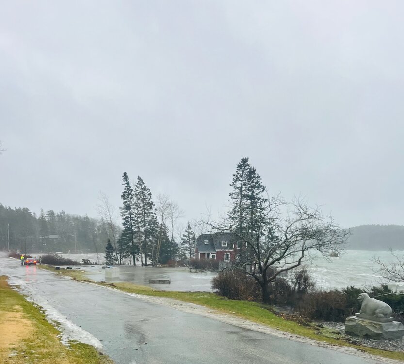
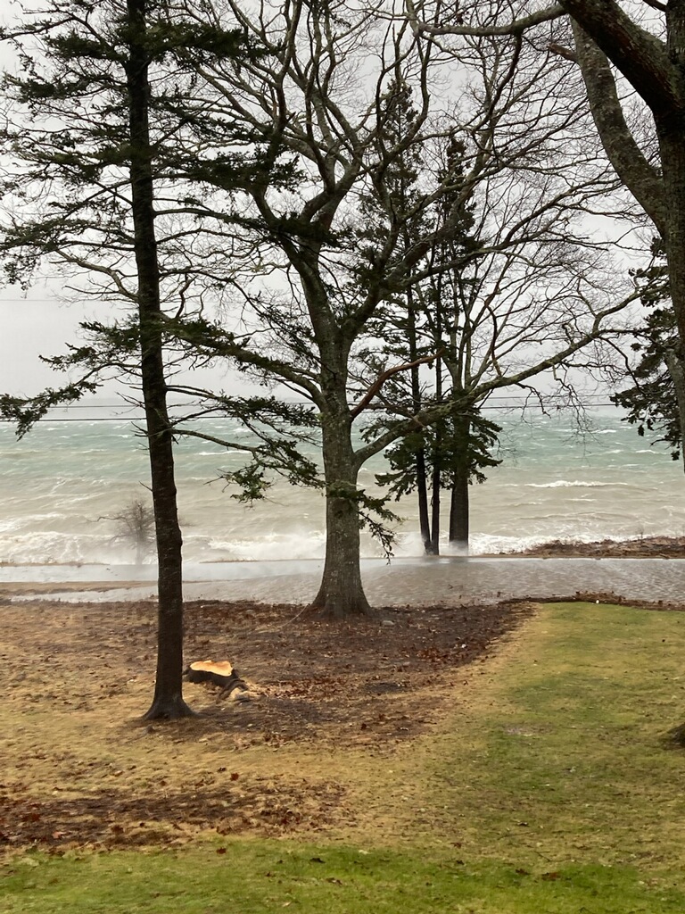
From Sorrento, ME (across the bay from Bar Harbor). The red house is a former captain's house on a now nonexistent pier, it is about 5' above high tide at mean level usually.
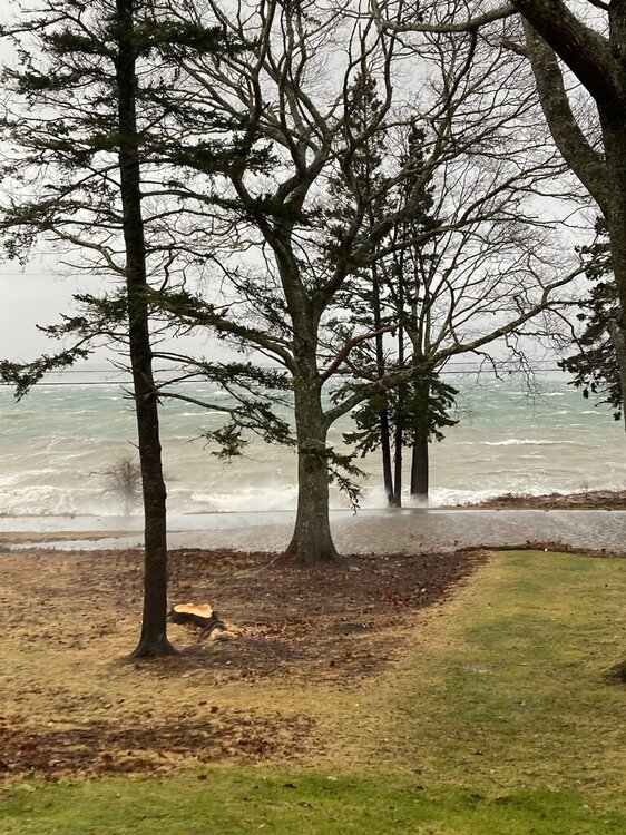
this is a pic of a road in the same town that follows the coast; those trees on the other side of the road are also usually about 5-6 feet above mean high tide.
-
5
-
-
-
This storm did not hit the Pepco service area too hard. only 0.1% of customers have an outage.
-
I like rain
-
WTOP says the bay bridge is closed. Edit: sorry, been that way for a while apparently
-
Parts of the backyard converting to pond status here in silver spring. Wind getting a bit gustier.
-
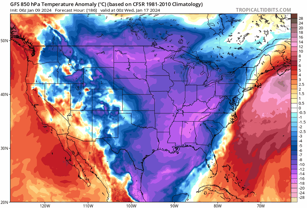
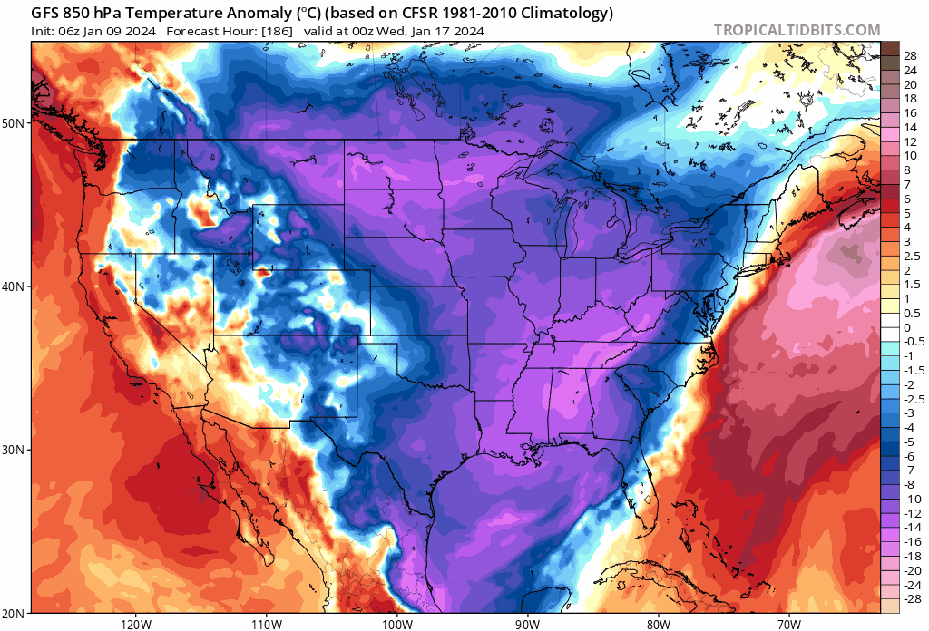
The chase for modeled cold is looking good though:

-
6
-
-
1 minute ago, North Balti Zen said:
Growing up in southwestern and then central Ohio I will confirm for you that the same excruciating misses on the margins occurs for midwest cutters as it does for us. So many times in the mid-80s forecast 6-10 inch snows for me just east of Columbus would end up two counties north. We just don't notice for the reasons you said.
As for whether the presence of cutters in the longer term is more stable, maybe? But there is a huge difference in a cutter at 7 days that is modeled through north dakota and at game time ended up in eastern Ohio - but we don't follow those swings that closely either
TL/DR - WxUSAF is right.Agreed wholeheartedly; we have enormous expectations for models in winter. We aren't sitting here in May and June sweating the position of a low +/- 100 miles off Ocean City MD. Or whether it's going to be 65 and rain or 61 and rain. Or whether we're getting 0.5" of liquid or 0.8" of liquid. Unfortunately for us, we sit in the error range a lot of the time in these setups.
-
3
-
-
I work from home most of the time so the 2.5 hour early Moco dismissal is NBD... but feeling for those elementary parents who get notice of a dismissal at 120pm. They just let us know about 30 minutes ago!
-
5 minutes ago, Ji said:
2010-2016 was epic. We are just in a bad 7 year stretch which has happened numerous times in the past 100 plus years
I find my self on team PSU suspecting the elephant in the room. However, I cling to memories of 1997-2001 being a pretty bad (albeit shorter) stretch up in Harrisburg where I grew up. I think '00 might have had a winter saver or two.
Anyone have a good site that gives you annual snowfall totals by airport?
-
At least it's imaginary cold after our 3rd rainstorm in a row:

-
Yeah, 00z had the transfer to the coast happen much further south.
-
Monster block traps the big low that runs through the lakes next weekend.... it goes over toronto then retrogrades back to SW of the hudson bay
-
Latest NAM suggests an inch+ for most of the area.


Jan Medium/Long Range Disco 2: Total Obliteration is Coming
in Mid Atlantic
Posted
It loves to do this when digital snow is on the digital ground. Maybe it's a sign it really believes in the snowpack.