MAG5035
-
Posts
6,078 -
Joined
-
Last visited
Content Type
Profiles
Blogs
Forums
American Weather
Media Demo
Store
Gallery
Everything posted by MAG5035
-
Central PA Winter 25/26 Discussion and Obs
MAG5035 replied to MAG5035's topic in Upstate New York/Pennsylvania
To their point about the pressure rises, this bombing low is progged to track NE through the central Lakes. A more ideal track for a C-PA high wind warning type event in this type of a bombing Lakes low scenario would be up through Lakes Erie and Ontario. They did opt on going high wind watch earlier today for the Laurels counties as well as here and down in Bedford County. In terms of CTP’s coverage area, I personally think high wind criteria may only be reached on the main Allegheny ridgeline (Cambria,Somerset) with a general wind advisory elsewhere, perhaps up to 55mph gusts just off the Alleghenies and 50mph in the Sus Valley. This is progged to bomb out to a very strong low (perhaps into the 970-975mb range), so it will be quite windy area-wide in the wake of it either way with LES and upslope lighting up in western PA later Monday into Tuesday. Another thing to keep an eye out for tomorrow in the late-morning/afternoon timeframe is some freezing rain at the onset of an initial area of WAA precip that noses up through C-PA. Focus of that seems to be north central around IPT but some guidance is showing trace ice down as far as AOO/UNV to a tad north of MDT. Only takes a T to throw up an advisory for ice so don’t be surprised if those advisories up north get expanded a bit further down this evening. -
Central PA Winter 25/26 Discussion and Obs
MAG5035 replied to MAG5035's topic in Upstate New York/Pennsylvania
I’d just return back with this haha. It sure looks chilly the 7 days following the frontal passage Monday, which could bear some similarities to the strong frontal passage last Friday. In this case though, it looks like it will be reinforced holding colder temps for a longer period and perhaps setting up some kind of follow up wave later next week. We shall see. At any rate, things are pretty well wrapped up here. Still messy but winds have mixed down warmer temps and now i have KRUIN beat with a temp of 36ºF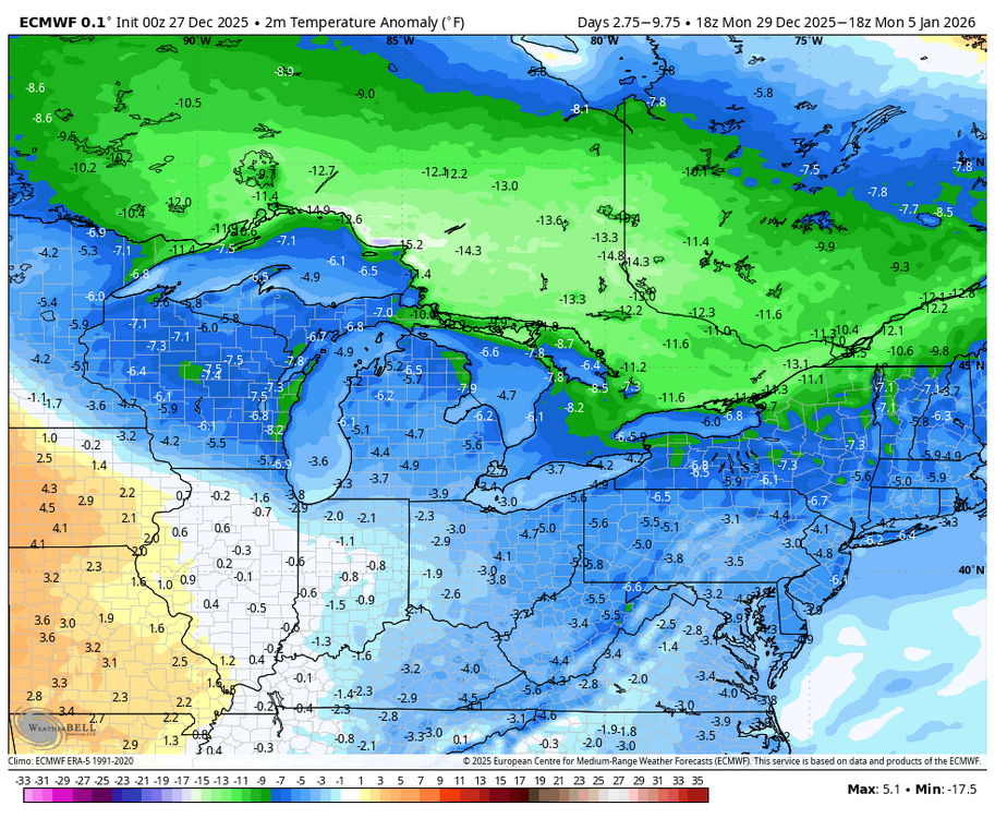
-
Central PA Winter 25/26 Discussion and Obs
MAG5035 replied to MAG5035's topic in Upstate New York/Pennsylvania
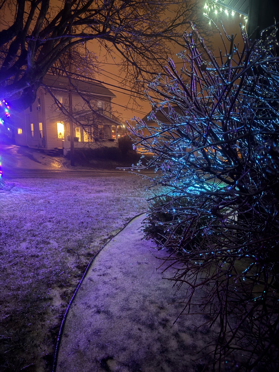
Right around the quarter inch ice mark here.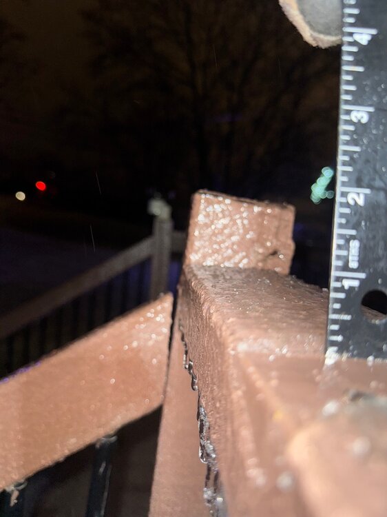

-
Central PA Winter 25/26 Discussion and Obs
MAG5035 replied to MAG5035's topic in Upstate New York/Pennsylvania
Up to 30 here with a steady light freezing rain, the kind that accumulates the most efficiently. Starting to be noticable in the trees. I’d look for lingering freezing drizzle a good part of the overnight after the main precip moves out in the next couple hours, something CCX radar might not necessarily see down that way. -
Central PA Winter 25/26 Discussion and Obs
MAG5035 replied to MAG5035's topic in Upstate New York/Pennsylvania
I typically put heavier stock on stuff like the 3k NAM and the HRRR when we get into the short and near term range with these mixing events. They just handle the finer mesoscale details and thermals a bit better than the globals, which can broadbrush things like accums in our area when it comes to CAD, terrain effects, downsloping etc. I think the big thing in this situation might be that the mid level features ended up a bit further NE and we ended up more towards what the NAM suggested. Like I said in a post response a page or two ago, the big warm air intrusion is above 850mb.. up nearer to the 700mb level but mainly around 750-800mb. If your looking at the typical maps to determine snow (850, 925, even 700mb temps), you might think things are good for an all snow column. Soundings of the full column were/are important for this one. I think NYC still has a chance to do okay because when the low jumps to the coast later it will cool that warm nose a bit and they may hold on to mostly snow even if they mix early. But we’ll see. On the line there is the biggest snowfall since 2022. -
Central PA Winter 25/26 Discussion and Obs
MAG5035 replied to MAG5035's topic in Upstate New York/Pennsylvania
There’s literally not a single weather station in or around the Harrisburg area that is anywhere near 30, much less above the freezing mark. -
Central PA Winter 25/26 Discussion and Obs
MAG5035 replied to MAG5035's topic in Upstate New York/Pennsylvania
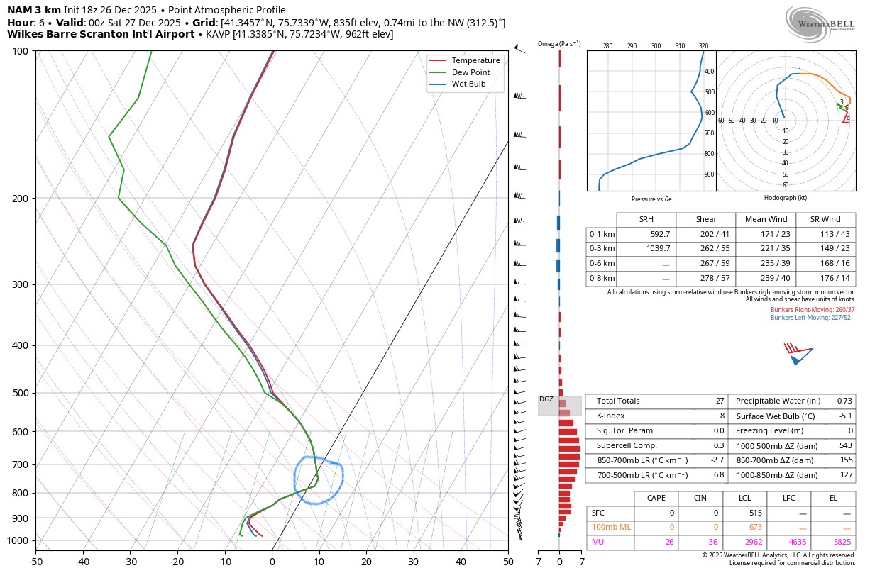
I’ve been wondering what this was going to end up doing in NE PA in terms of snow and if the sleet was going to make inroads into the areas that were supposed to get the heaviest snow out of this. The biggest warm push aloft with this system is actually up above 850mb between there and the 700mb level.. or roughly 7-8k feet or so aloft. Looking at the near term/high res model soundings, the HRRR appears to be too cold (modelling the whole column below freezing at KAVP around this current time) while the 3k NAM seems to be more accurate to your obs with the warm nose above freezing centering just above the 800mb level. 3k NAM sounding (KAVP)
-
Central PA Winter 25/26 Discussion and Obs
MAG5035 replied to MAG5035's topic in Upstate New York/Pennsylvania
Glaze update from about 20 min ago. Been all light freezing rain for a little bit with some heavier stuff on the doorstep, which is likely the steadier stuff that ends up in the Sus Valley closer to 0z per the HRRR’s take. Temp here has been floating between 27-28ºF so ice is having no trouble accumulating on the non treated surfaces. Lot of accidents being reported around town and on I-99 this afternoon.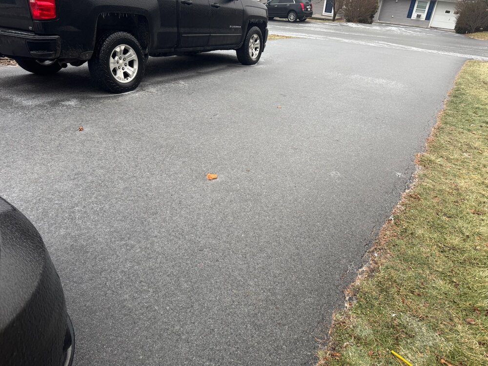
-
Central PA Winter 25/26 Discussion and Obs
MAG5035 replied to MAG5035's topic in Upstate New York/Pennsylvania
HRRR seems to suggest the period of steadiest/heaviest precip in the Sus Valley occurs from approx 7-10pm, with it being more scattered and in brief waves before then. We can debate QPF and it probably ending up a bit less than it otherwise looked like a couple days ago. But to the point others are making in here, it really doesn’t take much in a freezing rain/sleet scenario to make roads icy. This isn’t a setup where the cold eventually gets routed during the storm in eastern PA, as surface/low level CAD is anchored in place and the air mass supplying it is quite cold. Ice accrual happens more readily at 29-30ºF than it would nearer to freezing.. and that should be where most folks are later on during that few hour period where the HRRR is suggesting best precip. -
Central PA Winter 25/26 Discussion and Obs
MAG5035 replied to MAG5035's topic in Upstate New York/Pennsylvania
The last burst had mainly pingers, but already a pretty decent glaze on most surfaces. Temp 27ºF/Dew 22ºF.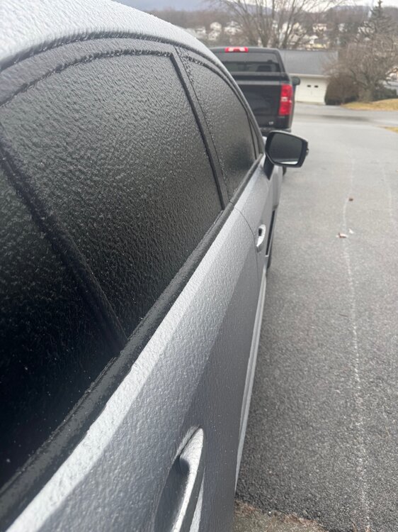
-
Central PA Winter 25/26 Discussion and Obs
MAG5035 replied to MAG5035's topic in Upstate New York/Pennsylvania
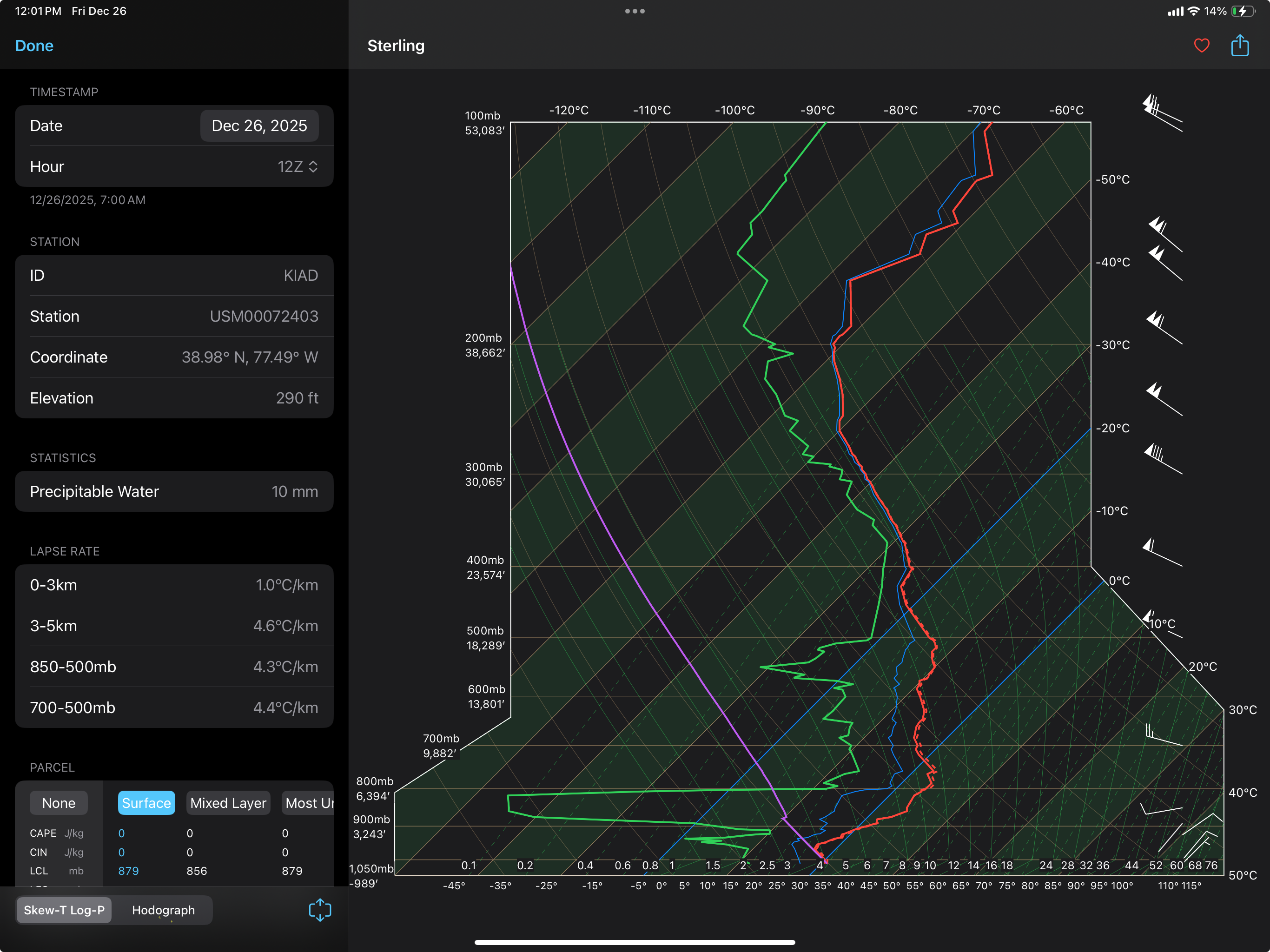
This was the 12z sounding at LWX (Dulles) this morning at 12z, which was similar to PIT’s. One heck of a dry layer between 900-800mb at that time. There will certainly be some dynamic cooling to be had as this event gets going but also that dry layer is going to need to be overcome as well. Precip is already hitting the ground in a lot of C-PA spots though looking at mPING obs, but also could remain more scattered for awhile like the near term guidance has been hinting.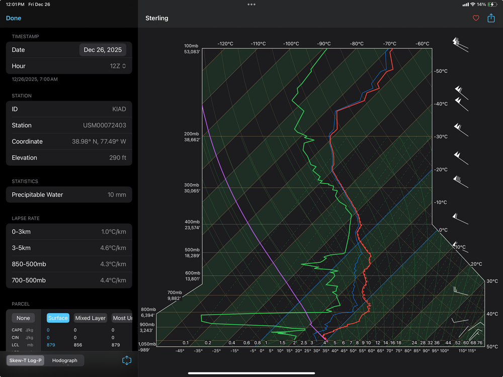
-
Central PA Winter 25/26 Discussion and Obs
MAG5035 replied to MAG5035's topic in Upstate New York/Pennsylvania
Precip starting here, ZR and some pingers. 28.6/16.0ºF -
Central PA Winter 25/26 Discussion and Obs
MAG5035 replied to MAG5035's topic in Upstate New York/Pennsylvania
Follow up on this part of my earlier post. All the regulars in here know if there’s snow showing anywhere on model guidance that Blizz is on it. And in the case of this potential event Fri/Sat, here’s multiple receipts courtesy of him… as far back as the 14th! Yea guidance has been inconsistent and all over the place, but this potential event/setup didn’t completely come out of nowhere. -
Central PA Winter 25/26 Discussion and Obs
MAG5035 replied to MAG5035's topic in Upstate New York/Pennsylvania
What’s jumping out to me with the initial look into this is surface and 925mb (3000ft) are very cold in central/eastern PA on most guidance. The difference between the Euro and GFS camps right now look to be centered up a little higher at the 850mb (5000ft) level where the Euro is warmer, which lends to it’s more predominant freezing rain p-type vs the prolific pinger fest the GFS has in the central counties. On the other hand, the Euro never seems to portray sleet very well with its p-type algorithm. It certainly still looks supportive of a lot of sleet despite warmer 850 temps because of how cold surface and 925mb is. So as it looks right now, I would lean towards sleet being a more dominant p-type with the significant freezing rain threat in the Laurels. Then of course figuring out the front end snow threat as well. The eastern third of so of PA is definitely in play for a thump, will have to see if any of the central third can get some snow as well. -
Central PA Winter 25/26 Discussion and Obs
MAG5035 replied to MAG5035's topic in Upstate New York/Pennsylvania
More often than not models don’t do well handling features with NAO blocking in the medium range, which isn’t necessarily anything new. So they’re now responding to what is looking to be a bit stronger of a -NAO block. Its high stakes with the changeability because our area is on the fringe between a surge of record warmth in the central US and still a decent source of cold air in Canada, which the -WPO (Bering Strait ridge) is providing despite the variable EPO and negative PNA. The northeastern US was never supposed to really warm up, at least for very long because of the -NAO holding off/muting the torch pressing from the central US, something I touched upon in a post a couple days ago. Now that we have a feature and high pressure suddenly lined up with plenty of cold available to bleed down, we have our setup for a mess instead of a day that looked like was heading for 55-60 a couple days ago. I know I did a double take yesterday when I saw that guidance went over to this. Funny thing is, this system has shown up in some fashion off and on in that 12/26-28 timeframe on deterministic guidance basically since it’s gotten within the range of it. -
Central PA Winter 25/26 Discussion and Obs
MAG5035 replied to MAG5035's topic in Upstate New York/Pennsylvania
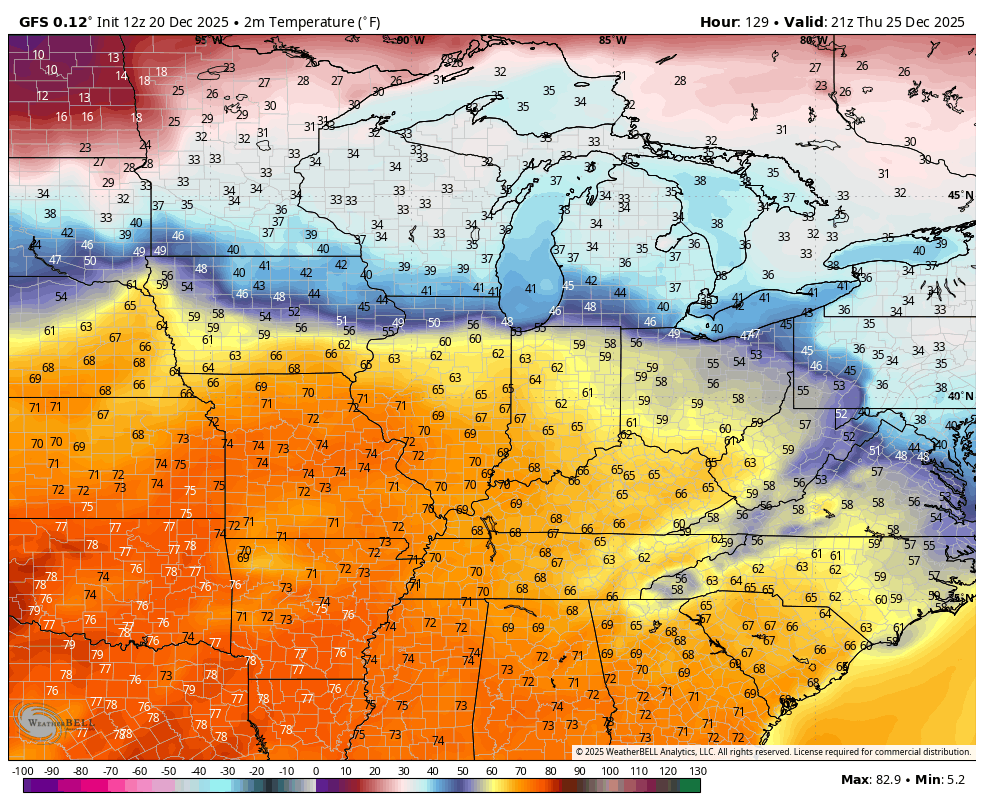
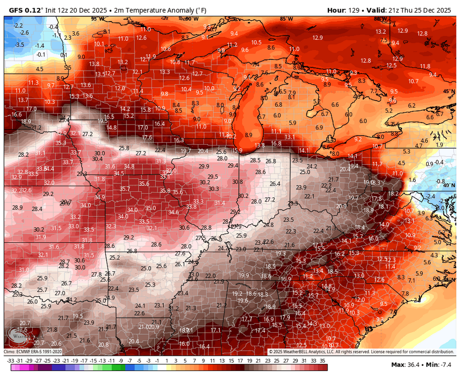
Maybe in western PA, cool air has a good chance of holding in the rest of the state east of the Alleghenies Christmas Day. GFS a bit cooler than the Euro (actually slightly below average in eastern PA), but even the Euro only has MDT getting into the low 40s or so. Even if it did bust 50 degrees the +5 to 10 departure that would make high-wise is pretty tame compared to where the real torch is centered. + Anomalies Christmas Day in the central plains are bananas, in the realm of 30-40 degrees above average. We may have a couple fairly warm days on or just after Christmas, but the -NAO blocking is likely going to keep us from being overrun with any kind of warmth like that. 12z GFS temps/anomalies
-
Central PA Winter 25/26 Discussion and Obs
MAG5035 replied to MAG5035's topic in Upstate New York/Pennsylvania
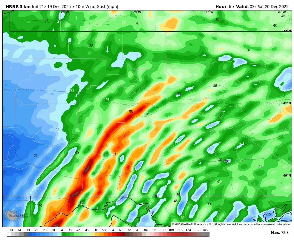
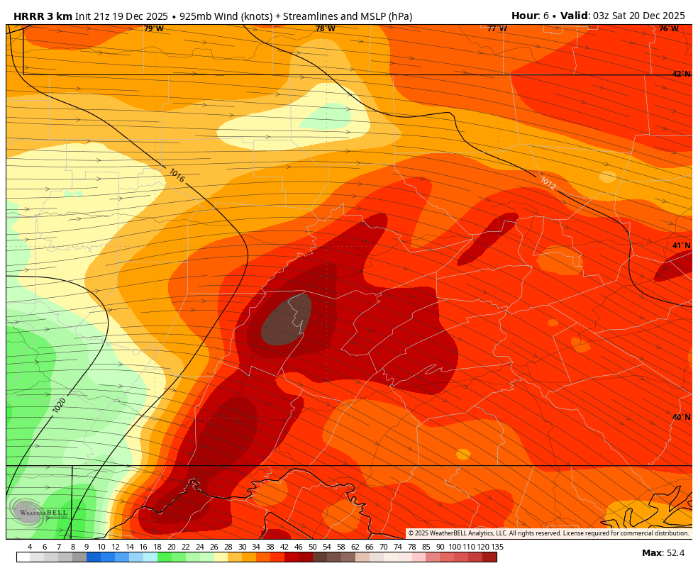
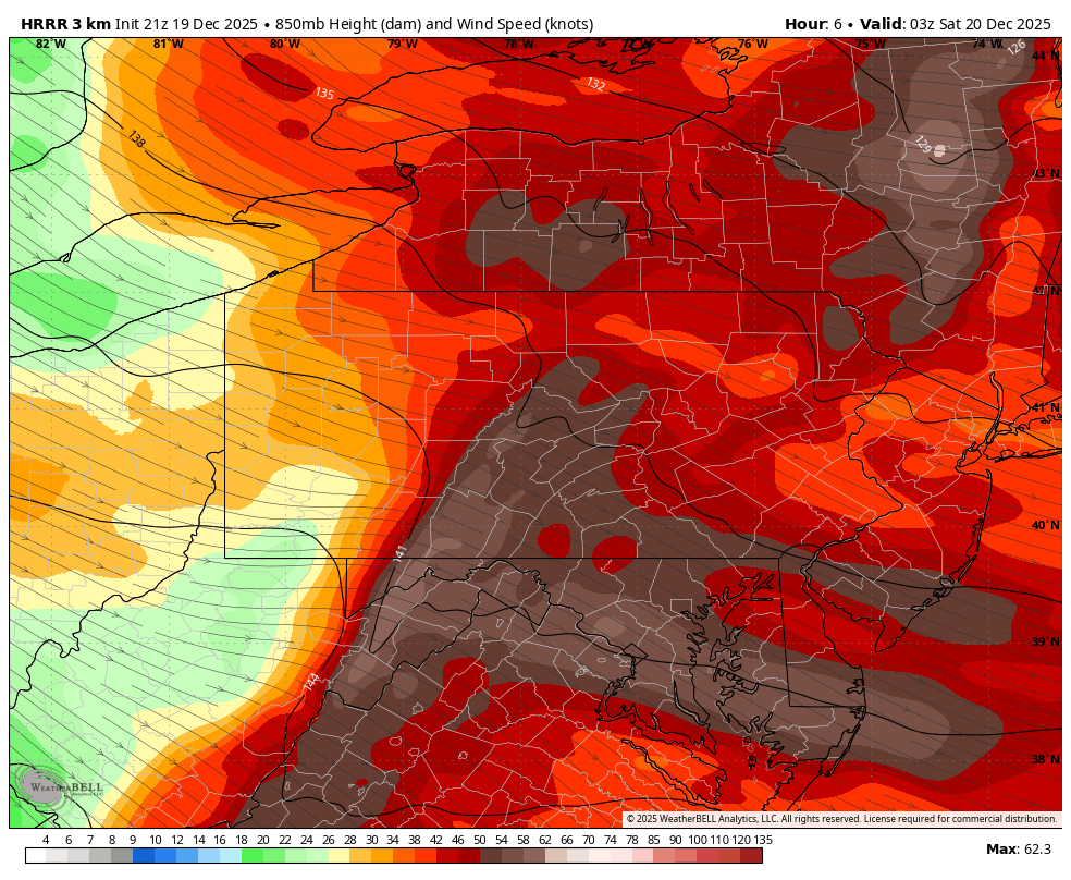
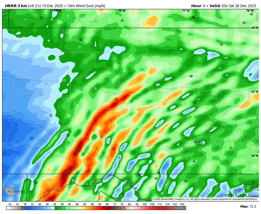
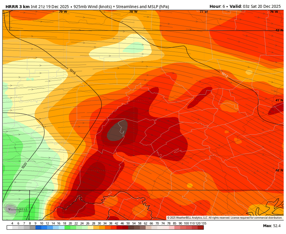
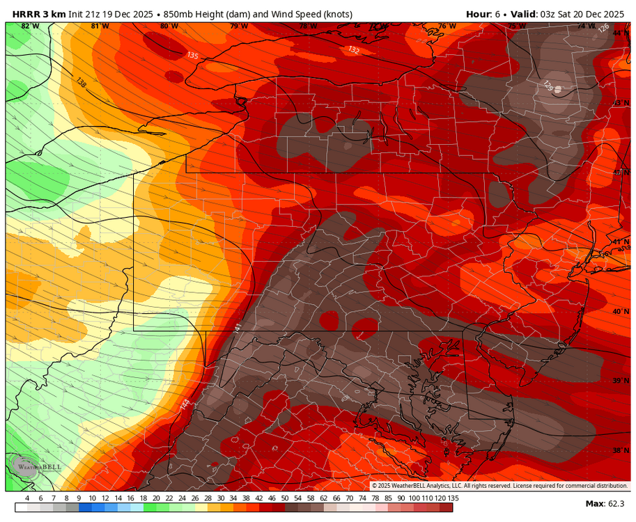
Somewhere in the ballpark of an inch of wind blown snow. There’s also been several snow squall warnings around as well with one currently stretching across I-99 from just north of Bellwood to Tyrone and extending over towards Lewistown The high wind warning worthy gusts in the actual warned counties may occur during the next several hours as near term guidance showing an enhancement of winds on and just east of the Allegheny Front centering on roughly the 7pm-midnight timeframe. Some HRRR images for 10pm Surface wind gusts (mph) 925mb winds (knots) 850mb winds (knots)
-
Central PA Winter 25/26 Discussion and Obs
MAG5035 replied to MAG5035's topic in Upstate New York/Pennsylvania
It hasn’t been crazy windy here, so far. Only have like a 33mph high gust on my station. But it has been snowy the last couple hours with some pretty robust upslope snows ongoing in the wake of the frontal passage. Have at least a half inch or snow on all non paved surfaces.Temp down to 25ºF. Official station high gusts around here so far have been 52 mph at KAOO and 56 mph at KJST. -
Central PA Winter 25/26 Discussion and Obs
MAG5035 replied to MAG5035's topic in Upstate New York/Pennsylvania
Agreed, I know I’m not going to nitpick what constitutes a “torch period” regarding the weather from about yesterday thru the first half of tomorrow or so. Given how potent of a southerly flow this system has that is going to tracking well north of PA, it could definitely be warmer out ahead of it here. LSV might briefly climb into the high 50s prior to FROPA tomorrow morning before a brief but potent return to some below average temps later tomorrow. With that said, we do have an actual torch period setting up through at least the Christmas to New Year’s period… centered on the central US. Really about the only teleconnection we have going for us in this timeframe is a developing negative NAO.. which acts to keep significant warm anomalies at bay in the northeastern US. The degree of which is what modelling is back and forth about. I think in play here in Central PA are a couple of waves that may have enough cold in place to produce some kind of a wintry mix type scenario. But overall looking like more of a transient/brief cold enforcement vs the kind of persistent cold temps we had the first half of the month. I’m overall kind of pessimistic about this period, as I feel the mostly +EPO and now significantly -PNA are going to be a stronger teleconnection influence vs the -NAO/neutral AO. Keeps very cold anomalies bottled up in western Canada and storm track continues to be northern branch dominated with little southern stream action as evidenced here by a very dry southeastern US. GEFS v Euro EPS temp anomalies (10 day avg centered beginning of Christmas week to New Year’s Day)
-
Central PA Winter 25/26 Discussion and Obs
MAG5035 replied to MAG5035's topic in Upstate New York/Pennsylvania
2.2” was the total snowfall here. Some of the LES/upslope stuff starting to roll in here now. Temp down to 16ºF. -
Central PA Winter 25/26 Discussion and Obs
MAG5035 replied to MAG5035's topic in Upstate New York/Pennsylvania
I can’t resist sharing this lol, 1pm Christmas Day GFS vs Euro 0z run tonight. Literally a 50 degree difference in temps. -
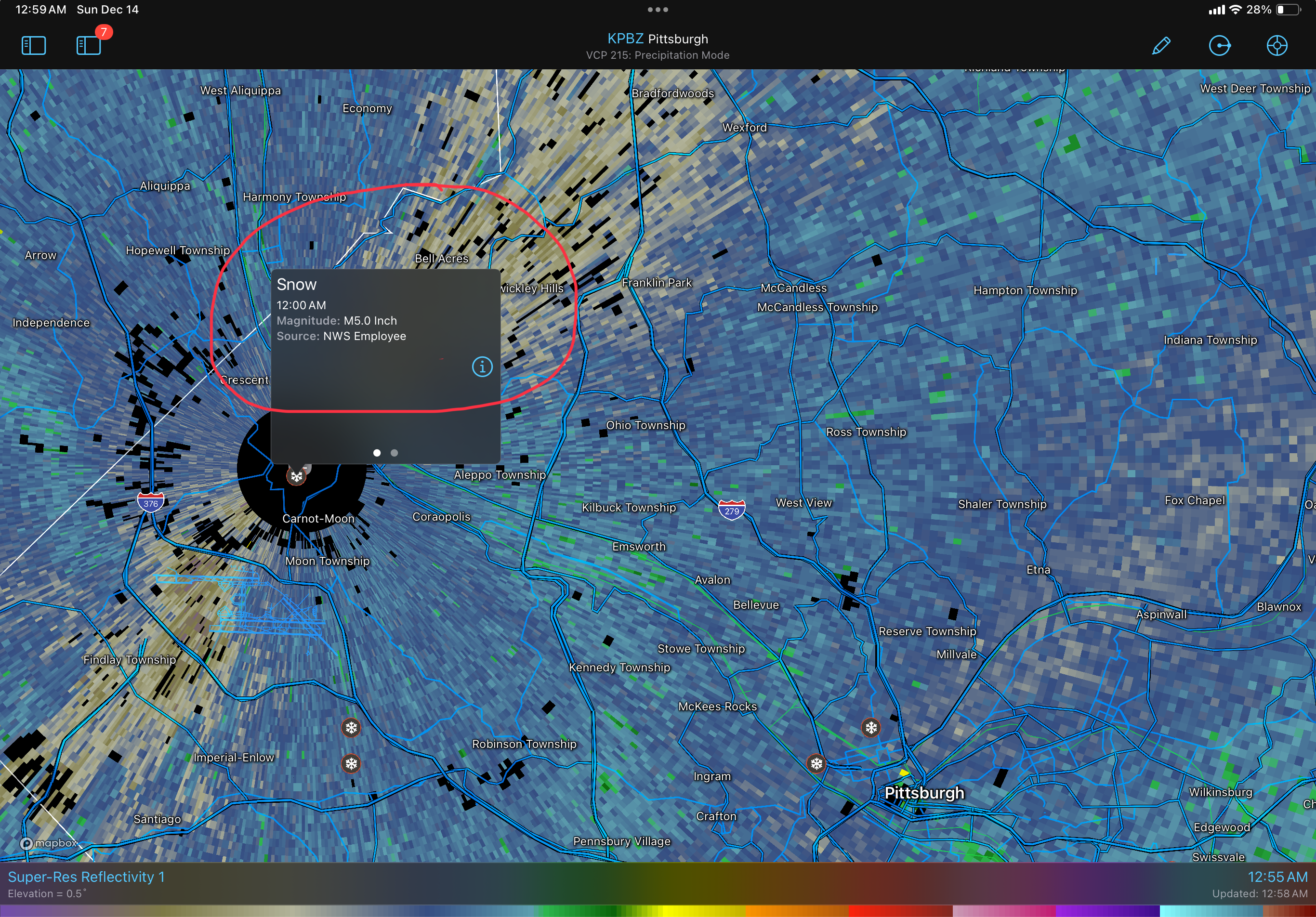
Pittsburgh/Western PA WINTER ‘25/‘26
MAG5035 replied to Burghblizz's topic in Upstate New York/Pennsylvania
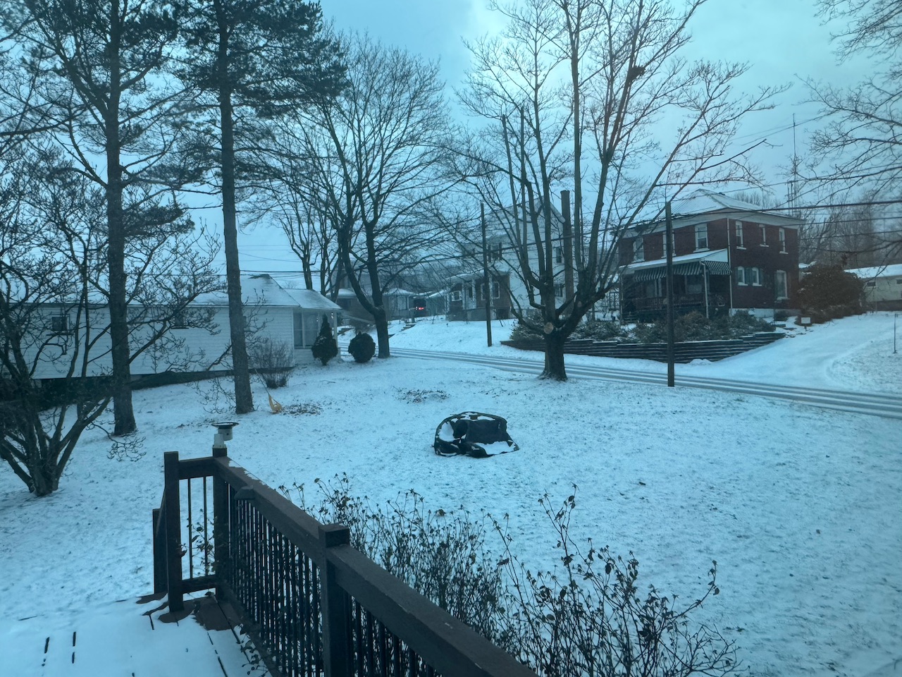
As of midnight.
-
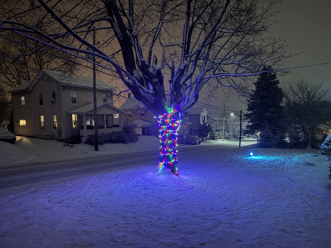
Central PA Winter 25/26 Discussion and Obs
MAG5035 replied to MAG5035's topic in Upstate New York/Pennsylvania
I’m a little over 1.5” here with still some more to go. Been pretty steady since this started around 4pm this afternoon but it’s largely been the pixie dust variety so I don’t really have as much to show as I probably could with it essentially snowing for the last 8-9 hours. Temps have started to fall steadily in the last hour or so, down to 24ºF from about 27ºF at midnight.
-
Central PA Winter 25/26 Discussion and Obs
MAG5035 replied to MAG5035's topic in Upstate New York/Pennsylvania
Passing an inch here with steady light to moderate. Roads covered and 29ºF. Next couple hours are going to make or break the event here I think in terms of whether I can score a solid advisory event. Some of the better enhanced banding over Pittsburgh should translate over this way in that timeframe. Downsloping hasn’t been too much of an issue so far here being right against the Allegheny Front. Should also note starting to see the enhancement of the precip in the Sus Valley as well on CTP and LWX radar. -
Central PA Winter 25/26 Discussion and Obs
MAG5035 replied to MAG5035's topic in Upstate New York/Pennsylvania
Snow has started here, 32ºF.