
BooneWX
-
Posts
1,326 -
Joined
-
Last visited
Content Type
Profiles
Blogs
Forums
American Weather
Media Demo
Store
Gallery
Posts posted by BooneWX
-
-
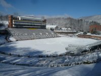
My bad boys, hadn’t been paying attention to the slope reports. Saw some pics from a few days ago and it looked meh, but those pics were probably deceiving.
-
Man I feel so bad for ski resorts. They’ve had several good winters so I guess they were bound to have a dud before long. This torch is going to kill snowmaking - unless it’s Beech where they’ve installed machines that can generate snow at 50 degrees.
-
 1
1
-
-
1 hour ago, eyewall said:
This is a long duration torch too. This is definitely painful. I will be back afterwards likely pulling up a chair in the sanitarium.
Don’t fret. This pattern is 100% guaranteed to break
in April.
-
 2
2
-
-
Need this in my life again:
-
8
-
-
Pattern looks good in the long range but let’s see if it can stay that way… a ridge over the Rockies would be a humongous win for the east coast.
-
1
-
-
56 minutes ago, SnowDawg said:
Very jealous of Northern Alabama today. Still holding out hope for later but very skeptical of being able to overcome 30+ point dewpoint depressions.
Nobody’s thrived more than the Tennessee Valley region these past 3 years. I’m not hating on them, but I certainly wish the pendulum would swing to the Apps and eastward for once.
-
1
-
-
Did anyone try asking Santa for a Miller A with a track that goes over Savannah and Myrtle Beach with a 1040 high over Ohio? I thought about it too late.
-
3
-
 2
2
-
-
Single digits again down in the foothills. Last 3 mornings were: 7, 5, 7. Extremely impressive for being at around 1,100 ft - a true winter rarity.
-
2
-
-
To my absolute shock, I took the pup out one last time for the night and there are flurries dancing in the porch light.
-
3
-
-
Don’t mind me. Just a southerner living vicariously through all of you.

-
3
-
-
8.8 first time seeing single digits on my Tempest.
-
4
-
-
25 minutes ago, wncsnow said:
Down to 10 here. Think we end up at 4 or 5 if the wind doesn't pick back up.
It’s become really gusty again here. I was dropping quick but stalled at 12.
-
1 hour ago, PackGrad05 said:
EPS is showing 66 for New Year's Day. GEFS showing 69.
Cool down after that.
Climatologically, timeframe around MLK Holiday is always good for us.
Hopefully the Pacific becomes kinder next cold shot. It looks like the Nina is showing signs of decaying in the coming weeks.
-
3
-
 1
1
-
-
GSP mentioning the potential for some extra flow tonight with a shortwave swinging through.
-
1
-
-
41 minutes ago, Tyler Penland said:
Where you at? Pretty calm over here in Foscoe. I live more or less in a hole though just a quarter mile off the Watauga River so we are decently protected from wind.
Sent from my Pixel 5 using Tapatalk
I’m just down the mtn in Burke these days! For some reason it won’t let me make a new profile name. I need to make a new account soon and start from scratch since it’ll likely be years before I have a high elevation place again.
-
1
-
-
These sw winds are absolutely ripping
-
1
-
-
3 minutes ago, Met1985 said:
The moisture feed from the gulf looks great and the orientation from the front looks much better.
We’ve got an overachiever on the way
-
2
-
-
Radar looks way way more impressive than what the short range models had depicted.
-
3
-
-
It’s so close.
-
2
-
1
-
-
Completely unrelated to our area but the short range guidance for Buffalo and the Southtowns is borderline apocalyptic.
-
1
-
-
Anybody with a glaze? My DP rose quickly last night and stalled temps at 35.
-
36 minutes ago, GaWx said:
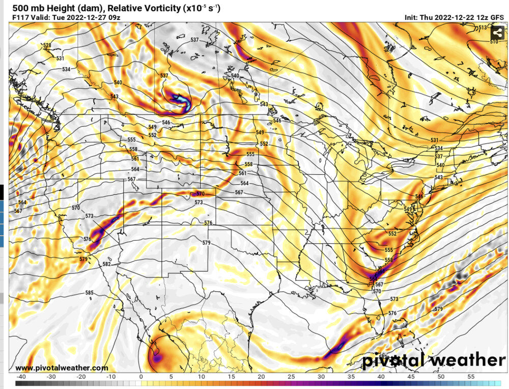
Fwiw regarding the first post frontal upper level disturbance, the 12Z GFS has on 12/26 snow virga over far S MS at 6Z, S and C GA at 12Z, and at the NC/SC border near the coast at 18Z. This is the first run doing this. Is this a sign that this disturbance could do more over land in future runs ~12/26 being that this is still 5 days out in a complex/highly anomalous pattern? FYI, this run has a 1067+ mb high over MT on 12/22. The alltime record is 1064. It is very likely overdone somewhat, but even so we're still looking at a good chance for the strongest lower 48 Arctic high since 12/1983. Any opinions?
Although we have fleeting cold air, that timeframe has been a signal on the models for a week now. It seems like it has some merit. Like I said the other day, you know what they say about the tail end of patterns

-
1
-
1
-
-
If there ever was a cold chasing moisture scenario that should work out to a degree, it would be this one. Otherwise I’m convinced it’s not possible in the Lee. Short range guidance is showing a nice little thump of snow pivoting through tomorrow morning. Not gonna hold my breath but with the temps crashing so dramatically above our heads, you could probably get snow at the surface even if you were in the low 40s.
@wncsnow let’s reel it in!
-
1
-
-
You could take a gander at the whole southeast radar and convince yourself easily that we’re about to get a big surprise. I know it’ll get a more west to east orientation soon but that moisture over Alabama and Mississippi would have me salivating if I didn’t know better.
-
2
-

Mid to Long Range Discussion ~ 2022
in Southeastern States
Posted
We’re going to initiate our own pattern change via snowpack next weekend.