
BooneWX
-
Posts
1,328 -
Joined
-
Last visited
Content Type
Profiles
Blogs
Forums
American Weather
Media Demo
Store
Gallery
Posts posted by BooneWX
-
-
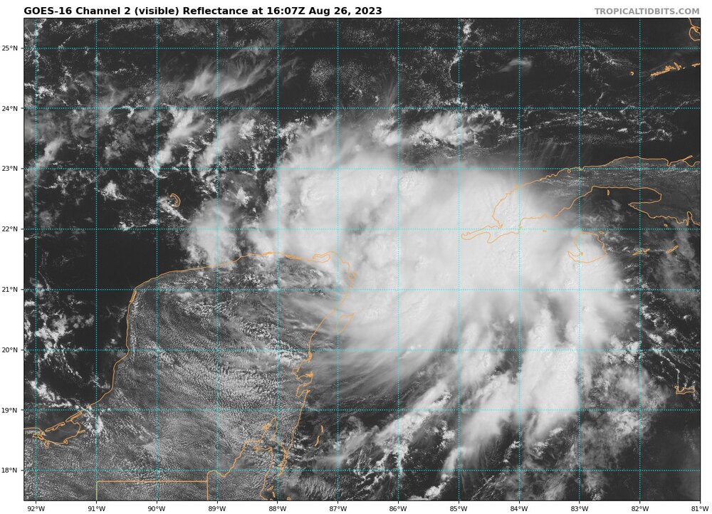
Looking upstream - If it stays on this path, I imagine coastal Georgia can anticipate significant impacts from surge.
-
Outflow is really impressive in all quadrants. We’ve seen named storms with a much worse structure than this.
-
 2
2
-
-
2 minutes ago, cptcatz said:
Michael?
Thank you. That’s it. The forgotten 5. I recall Michael not earning much attention early on and then absolutely going nuclear in the last 24 hrs when the shear was in a more favorable orientation.
-
1
-
-
1 minute ago, GaWx said:
Ian formed in the C Caribbean and became a H way down below the Caymans 2.5 days before SW FL landfall.
Yea not sure which storm I’m thinking of. The setup is giving me deja vu and not in a good way for some reason.
-
Someone correct me if I’m wrong but is the synoptic setup eerily similar to Ian? If I remember correctly, we spent a day or two projecting a modest storm with Ian at best and then it became clear that it would tap into a jet streak and warm waters.
-
3
-
-
Juicy atmosphere. May dynamics with August heat. Buckle up!
-
221 is shut down near Linville Falls due to a sink hole. I’m afraid it’s a sign of more issues to come. Y’all be safe.
-
2
-
-
1 hour ago, Met1985 said:
This weekend has been absolutely perfect though.
Can’t argue that!
-
3
-
-
53 minutes ago, WinstonSalemArlington said:
Best June ever

I’m in a steady state of complaining about the rain but also knowing we need it. I think the biggest bummer is that 90% of the weekends this whole year have sucked. It’s making me extra bitter, especially considering we couldn’t even drum up a dusting of snow this winter.
-
3
-
-
the setup is different but the fetch of moisture, orientation and duration will be the same. This event reminds me a lot of the June 2019 flooding. We’ve been dry but it could be a long week here - I suspect even the models with 6-10 inches may be too conservative since they struggle with upslope enchantment.
Summary:
-
2
-
-
1 hour ago, wncsnow said:
Models are shifting south fast. Some give me very little already. To much northwest flow around the upper low
Delayed but not denied! Don’t forget that rainfall here is only allowed on the days of Saturday and Sunday. She scoots back north just in time to make next weekend a washout.
-
2
-
-
15 hours ago, wncsnow said:
Glad we got almost got half an inch the past 24 hours because this don't look promising

And somehow, even those few tenths will find a way to fall on the weekend.
-
1
-
-
Coming soon to a theatre near you!
-
4
-
 5
5
-
-
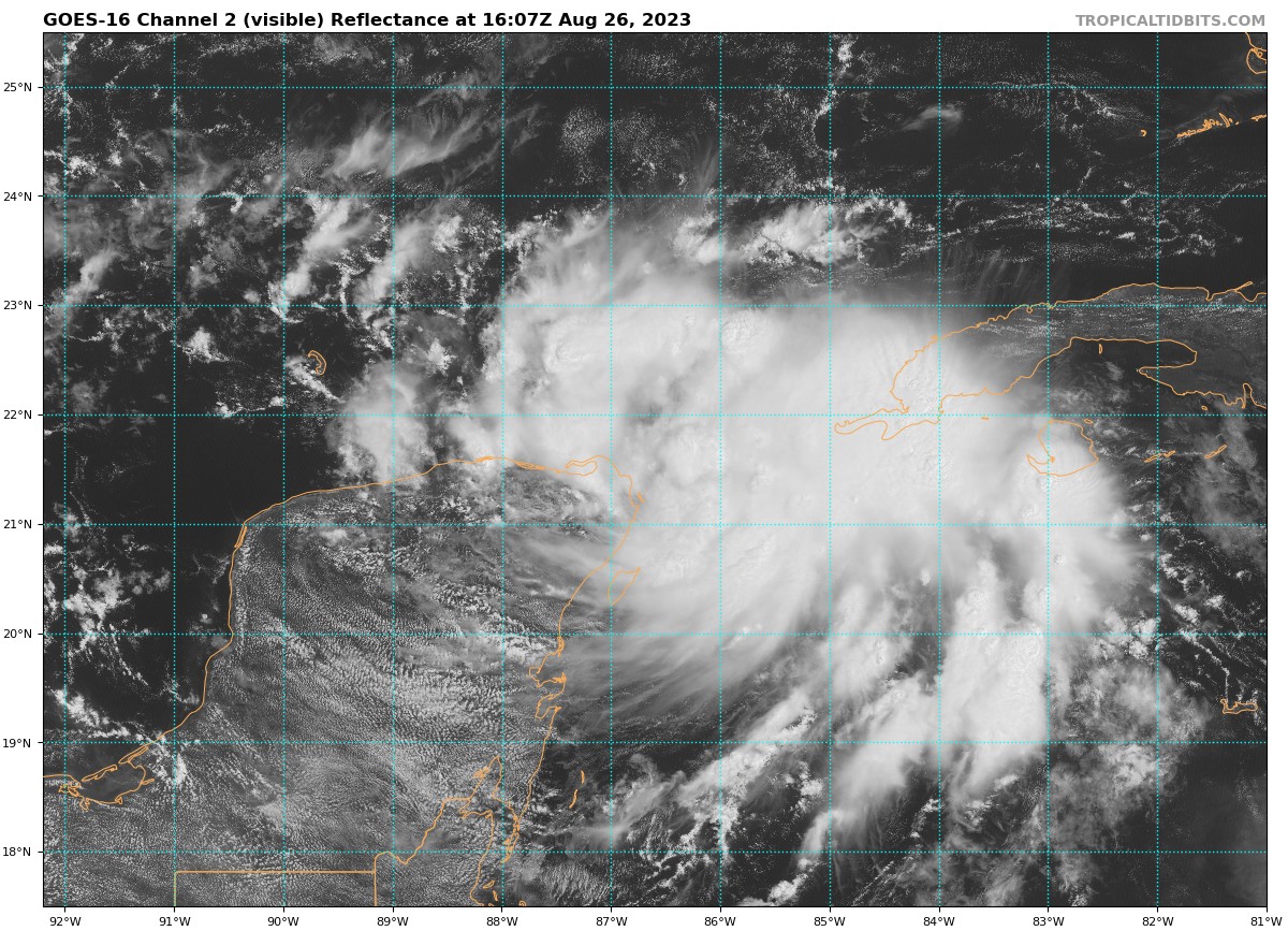
Just now, Tyler Penland said:
This is one of the stranger satellite looks I've ever seen. That hole over GA is almost perfectly square.
The low looks better than many hurricanes through the years
-
2 minutes ago, Met1985 said:
It's beautiful.
I guess beauty is in the eye of the beholder lol.
My second favorite time of year weather-wise is afternoon thunderstorm season. So I’m a tad bummed that the pattern won’t be so supportive. On the bright side - trout season is here to stay.
-
2
-
-
Ain’t gonna lie… I’m a big fan of seasons and I know many will rejoice with the heat being delayed but the 10-14 day outlook… ouch.
-
1
-
-
1 hour ago, nchighcountrywx said:
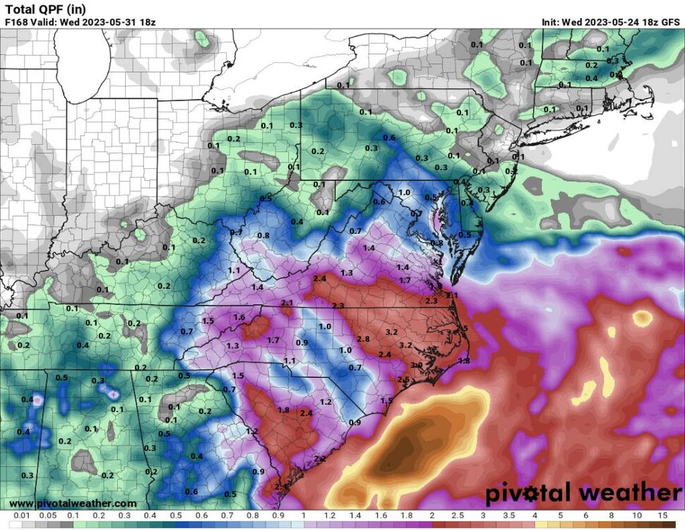
STORM TOTAL QPF HAS FALLEN BELOW AN INCH WITH THIS PACKAGE OVER THE SOUTHERN HALF OF THE AREA, AND LESS THAN 1.5 INCHES ACROSS MUCH OF THE NC PIEDMONT. HOWEVER, GIVEN THE LONGER DURATION OF RAIN AND GREATER CONVECTIVE COMPONENT DEVELOPING SUNDAY, WE RETAIN 3 TO 5 INCH TOTALS ALONG SOME OF THE NORTHERN ESCARPMENT. WITH MUCH OF THAT DRAINING INTO THE CATAWBA BASIN, ELEVATED RIVER LEVELS COULD DEVELOP IN THE CATAWBA RESERVOIR CHAIN WHICH COULD HAVE LASTING EFFECTS INTO MONDAY
Guess I ain’t taking the boat out Monday lol. Saw rumblings that we may be repeating this type of event next weekend…. Sheesh.
-
47 minutes ago, Met1985 said:
18z gfs.
Sent from my SM-G998U using Tapatalk
Sizeable shift north from just one run ago. We may not be done. Wouldn’t be the first time a high hit the road too early to lock in a storm

-
15 minutes ago, Buckethead said:
I've been meaning to mention that, but I've been stuck on fishing my creek lately. Everytime I've gone in the past month, I catch at least 2 over 16-18". I haven't even seen the S. Toe yet this year!

Sent from my SM-S908U using Tapatalk
That’s a beauty! I know that fight was fun.
-
1
-
-
38 minutes ago, wncsnow said:
Same here plus I have company coming that day. I do hope we get a good soaking rain to get the water levels back up and fish moving. Low water equals an early end to trout season.
I’ve been on a bass binge of late. When I discovered the thrill of catching smallmouth on a fly, it changed my summers. We could definitely use some water though - I wouldn’t mind hitting a blue line for brookies soon.
-
2
-
-
28 minutes ago, wncsnow said:
And of course the euro came in south and slower again with most of the rain falling in our area after 8 pm Saturday.
Kinda hope it keeps trending that way a bit. The way I see it, right now the weekend is a wash 3/3 days, but if we could slow this thing down a bit, we might could salvage a Saturday in the 70s before clouds and rain takeover.
-
1
-
-
Be neat if we could get a snow event to lock in as much as a rain event this far out
-
2
-
-
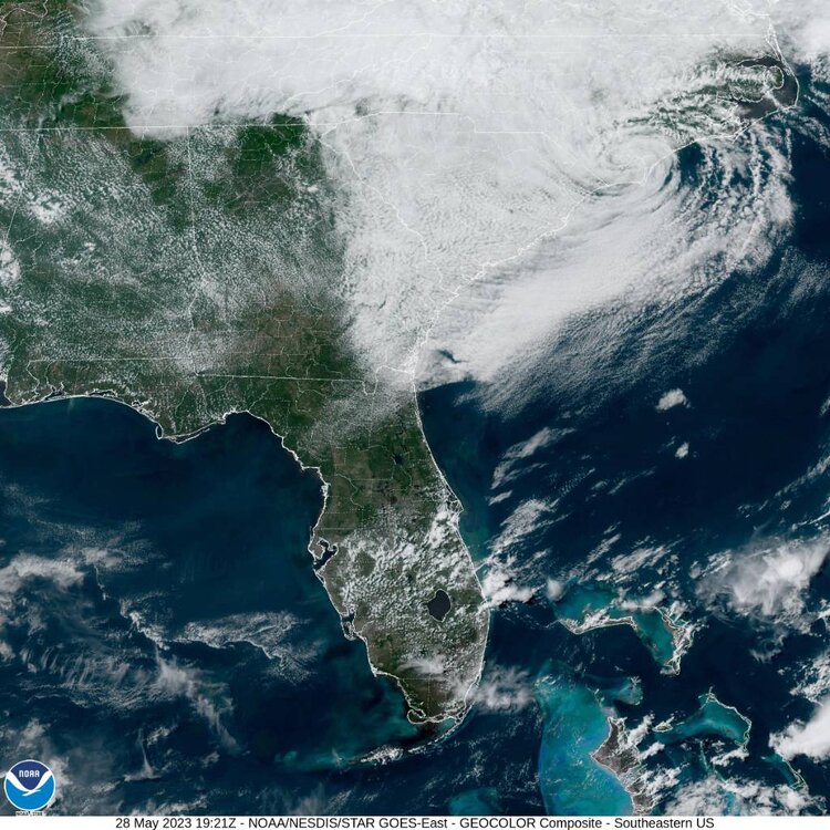
The windshield wiper effect probably isn’t done. Regardless of the tropical low, that upper low is going to make any outdoor holiday weekend plans toast.

-
1
-
-
Quite the spread. I don’t have access to the 6z euro and Canadian, but all 3 are wildly different. The Canadian has a wedge on Friday but absolutely zero storm anywhere close to us this weekend - it advertises glorious weather into next week.
selfishly rooting for that solution but I know we need some rain.
-
2
-


Hurricane Idalia
in Tropical Headquarters
Posted
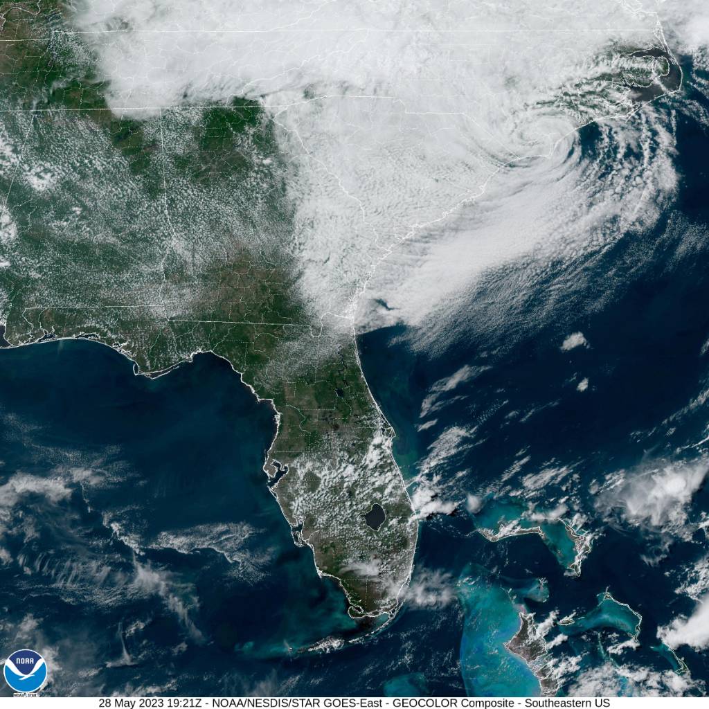
The visible satellite just continues to look more and more symmetrical by the minute. COC still hugging 85W.