hlcater
-
Posts
2,686 -
Joined
-
Last visited
Content Type
Profiles
Blogs
Forums
American Weather
Media Demo
Store
Gallery
Everything posted by hlcater
-

Pre-Christmas (Dec 21-23rd) Winter Storm Part 2
hlcater replied to Chicago Storm's topic in Lakes/Ohio Valley
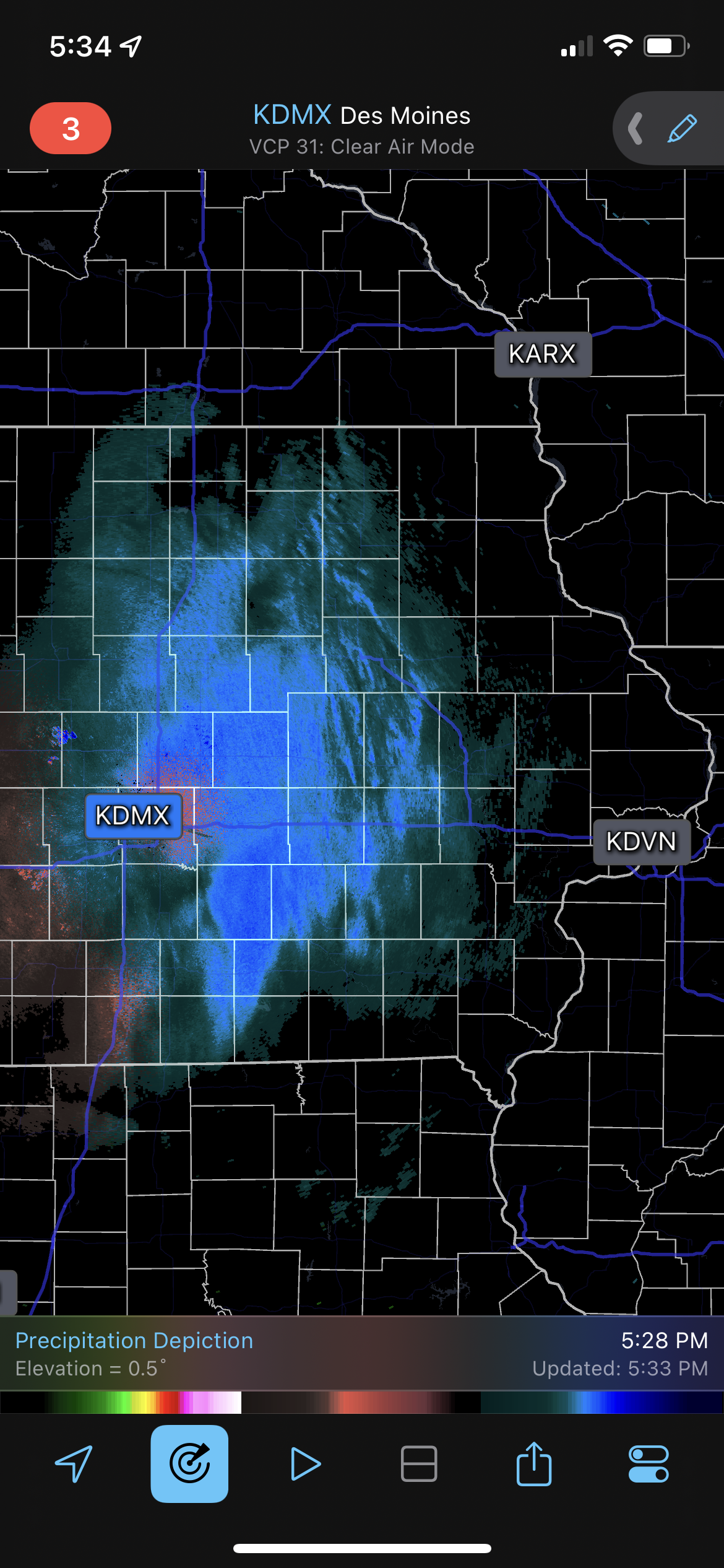
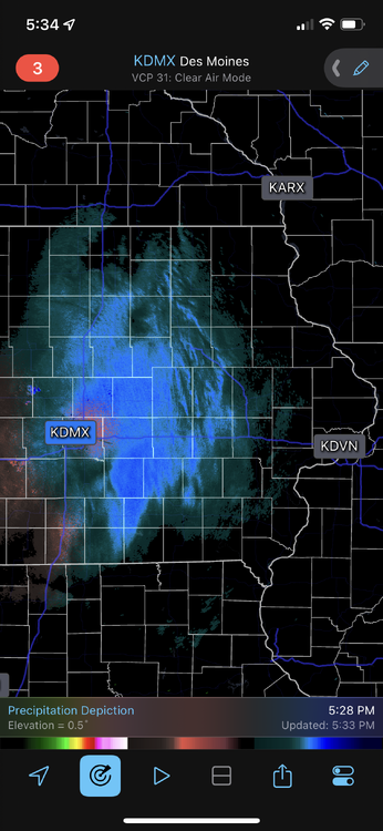
Visibility down to 0.38 miles imby just outside of Cedar Rapids. It’s really blowing out there. -
Pre-Christmas (Dec 21-23rd) Winter Storm Part 2
hlcater replied to Chicago Storm's topic in Lakes/Ohio Valley
2.2" from the first wave slightly outperforms guidance. -
Pre-Christmas (Dec 21-23rd) Winter Storm Part 2
hlcater replied to Chicago Storm's topic in Lakes/Ohio Valley
Looking at the guidance tonight, receiving most of our snow from FGEN and not the primary low may end up being a blessing in disguise. -
Pre-Christmas (Dec 21-23rd) Winter Storm Part 2
hlcater replied to Chicago Storm's topic in Lakes/Ohio Valley
GFS is a tick back west and a little wetter. -
Pre-Christmas (Dec 21-23rd) Winter Storm
hlcater replied to Chicago Storm's topic in Lakes/Ohio Valley
Euro is a glorified frontal passage out here. Good lord. -
Pre-Christmas (Dec 21-23rd) Winter Storm
hlcater replied to Chicago Storm's topic in Lakes/Ohio Valley
We still may see blizzard conditions with the arctic front, but anything truly noteworthy (like that is still talked about years later) for our area is probably off the table. What is interesting is that the low track actually ends up being quite favorable, it's just that on these runs tonight, the surface low is hardly existent as it transits IL. -
Pre-Christmas (Dec 21-23rd) Winter Storm
hlcater replied to Chicago Storm's topic in Lakes/Ohio Valley
Trends pretty terrible for those west of the lakes tonight. Hard to get a good storm if your low doesn't deepen until E MI. First call 3-5" with some wind afterward. (I'll clarify by saying at this juncture I am confident in at least 3-5", not that we cant potentially get more) -
This is a bit of an overperformance. 1/2” down and perhaps 1-2 more to go.
-
Pre-Christmas (Dec 21-23rd) Winter Storm
hlcater replied to Chicago Storm's topic in Lakes/Ohio Valley
Regardless of eventual placement, the trend to wrap up slower likely prevents Iowa from cashing in on something truly special. -
Pre-Christmas (Dec 21-23rd) Winter Storm
hlcater replied to Chicago Storm's topic in Lakes/Ohio Valley
Holy mother of god this run -
Pre-Christmas (Dec 21-23rd) Winter Storm
hlcater replied to Chicago Storm's topic in Lakes/Ohio Valley
Could see much of the sub under blizzard warnings with this one. Recent snowfall (or ongoing snow?), combined with single digits above and below zero and 50-60mph winds is gonna create life threatening travel conditions region wide. All at the worst time of year. -
Pre-Christmas (Dec 21-23rd) Winter Storm
hlcater replied to Chicago Storm's topic in Lakes/Ohio Valley
Anytime hoss -
Pre-Christmas (Dec 21-23rd) Winter Storm
hlcater replied to Chicago Storm's topic in Lakes/Ohio Valley
You seem pretty invested for someone that is “not invested” -
Pre-Christmas (Dec 21-23rd) Winter Storm
hlcater replied to Chicago Storm's topic in Lakes/Ohio Valley
Probably also the fact that the cold side of this system is (very) cold. There is 0.30 of 6H QPF falling behind the arctic front with wind gusts of 40-50mph. It really reminds me of that system a few years ago with the flash freeze and snow falling behind the crashing front which was admittedly some of the worst winter wx conditions we've seen in recent years, despite only getting 4-5" of snow. -
I will say what a refreshing pattern running up to Christmas. Consistent cold, multiple snow chances one of which could be significant, and these conditions are fairly widespread across the sub. Something we really haven't seen in the past decade.
-
Winter 2022/23 Medium/Long Range Discussion
hlcater replied to Chicago Storm's topic in Lakes/Ohio Valley
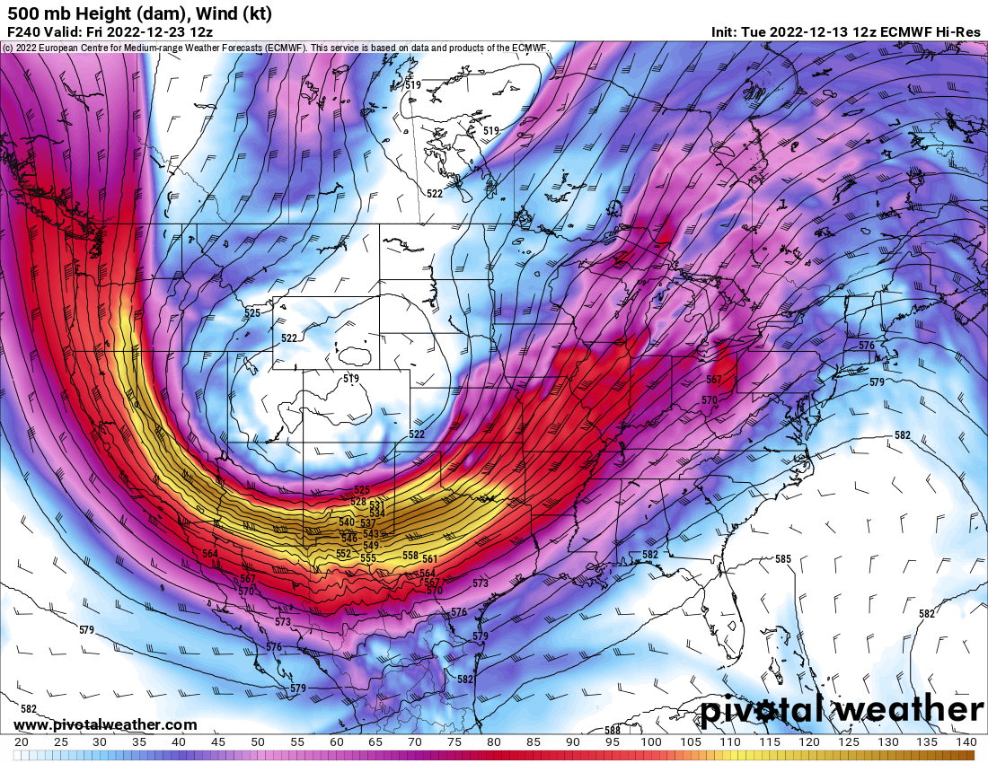
That low in Arkansas was about to go ballistic. Probably a historic bomb if the end of the run was allowed to play out -
Winter 2022/23 Medium/Long Range Discussion
hlcater replied to Chicago Storm's topic in Lakes/Ohio Valley
Yea the euro was about to go ultra giga at 240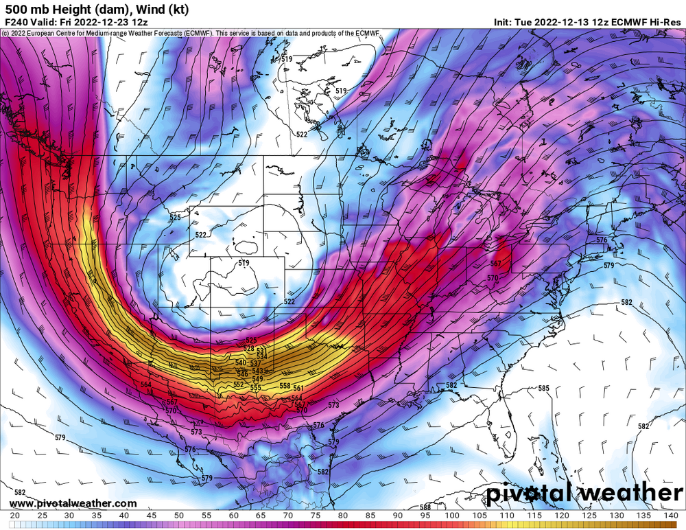
-
What is your favorite weather day of all-time?
hlcater replied to Hoosier's topic in Lakes/Ohio Valley
8/10/20 -
There were a few flakes mixed in as well. I estimated it to be something like 70/30.
-
First flakes of the season here
-
Finally kooch map szn
-
Nah we’ll get more when we’re clocking 4”/hr in the death band
-
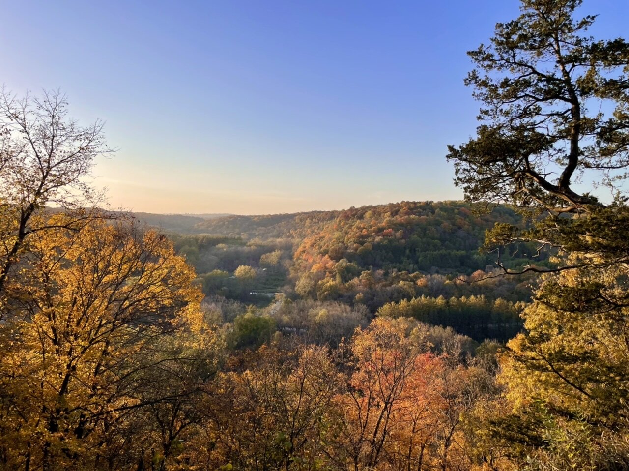
Fall colors are really vivid this year. Paint Creek in NE IA

-
Julia | 85 mph 982 mb peak | EPAC Crossover #2
hlcater replied to Iceresistance's topic in Tropical Headquarters
GEFS likes this one as well -
Incredible watching an obviously sheared cyclone intensify anyways. Especially one that just finished an EWRC in the face of that shear. I really wasn’t 100% certain it’d be able to stabilize the core after the EWRC, let alone intensify at a fairly rapid pace.