KeenerWx
-
Posts
866 -
Joined
-
Last visited
Content Type
Profiles
Blogs
Forums
American Weather
Media Demo
Store
Gallery
Everything posted by KeenerWx
-
To my dusty cobwebbed eyes, it looks like the threat may have modulated downward for much of LOT CWA. Window for recovery is fairly brief after morning to early afternoon convection.
-
Maybe can score a short “chase” again.
-
Nice. D2 Moderate.
-
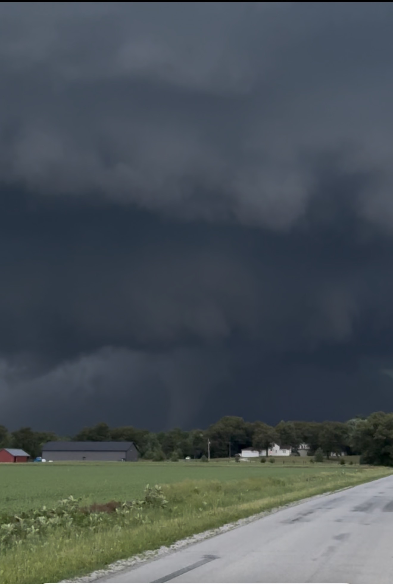
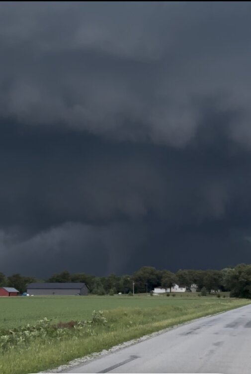
Video - Certainly could have gotten closer for better shots, but didn’t care to. Was a beautiful storm to watch.
-
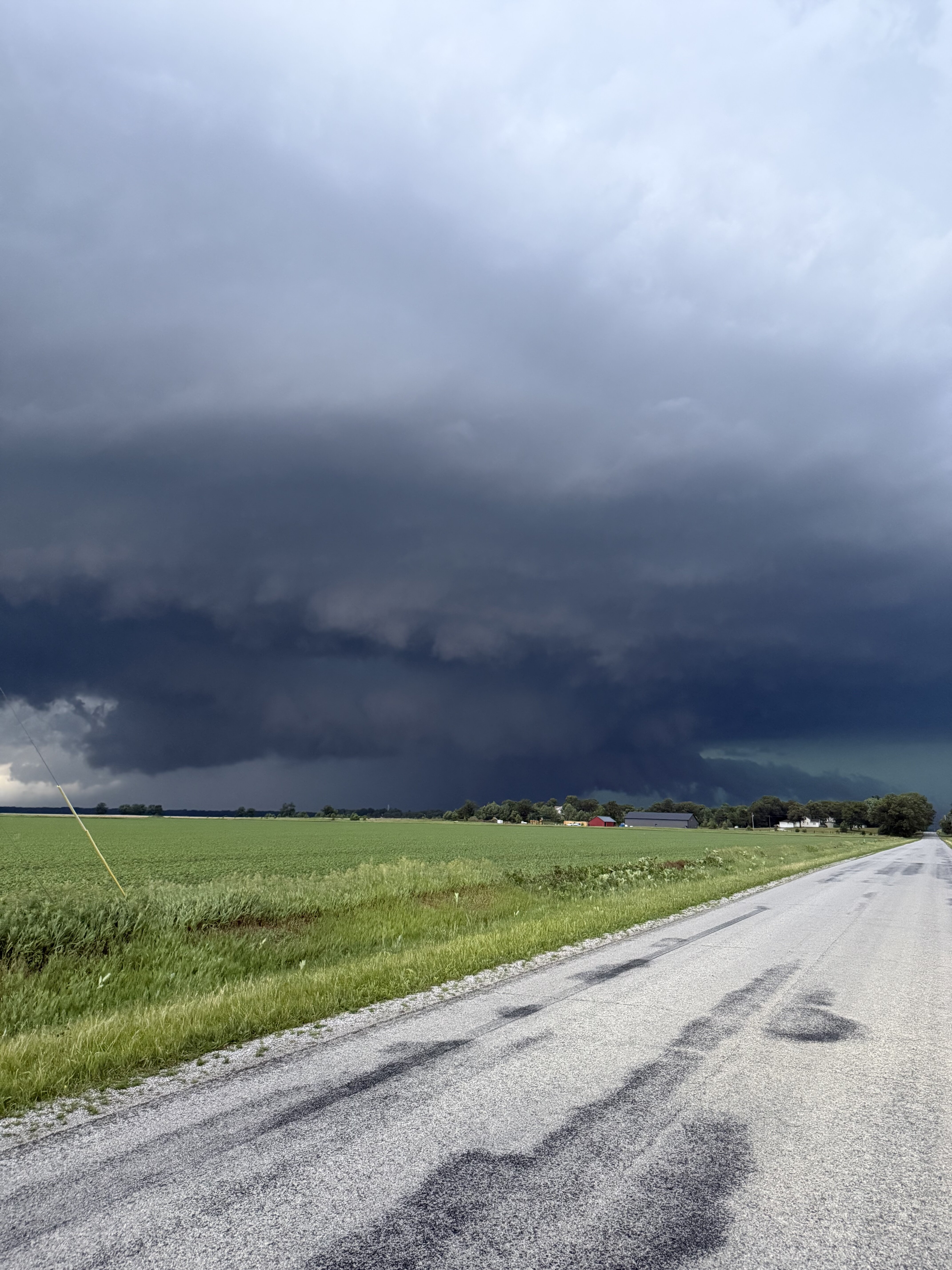
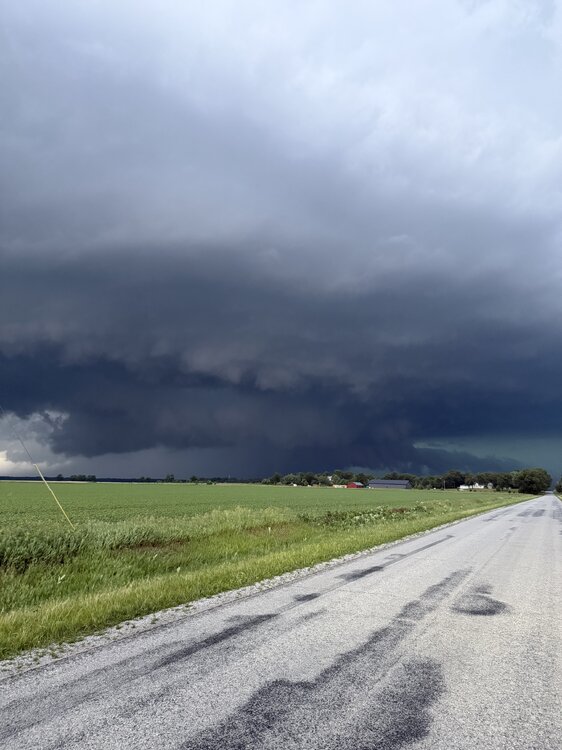
Looking north at roughly the time of this radar scan. It’s from a video I took on my phone lol. Quick “chase” today as I just had to hop to an area of fields just north of my house
- 260 replies
-
- 11
-

-
Similar experience. Had a solid light & sound show for about an hour.
-
May locally grab 6th SVR watch of the season.
-
Expansion of slight risk today into portions of the sub. Suppose the possibility of mildly spicy storms makes up for the blowing dust we have to contend with today.
-
Watching the line come in on the screened in porch. Lovely breeze and a chorus of crickets, frogs & rolling thunder. S tier entertainment.
-
Probably about an hour to hour and a half until arrival here. Shall see if it still can throw some punches.
-
Yeah, we should be able to squeeze a decent late night storm. Despite being outside of the main action area(s) these past few days, has been nice to grab consistent chance at thunder.
-
Should get a round two of boomers late tonight. Not counting on anything svr, but perhaps some enjoyable night time acoustics. House windows have been opened the past couple of days and it’s been wonderful.
-
Not a drop, but watched a good light show to the north. Palatable bust.
-
Warm season with boomers & threat of severe cannot be beat. While the hotter action will be displaced north, still should get shot(s) at quality storms.
-
Thought today and tomorrow was gonna be miss north for anything exciting, but looks like a healthy storm about to run through.
-
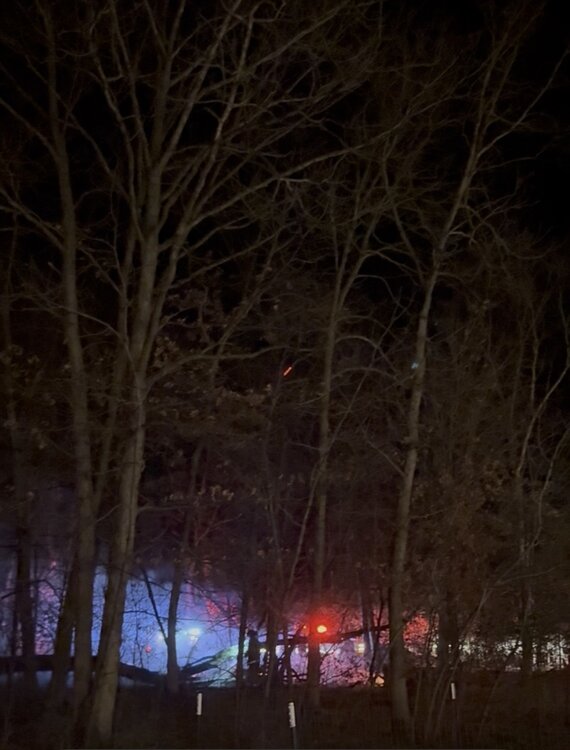
Yep! Nothing structural was damaged. Only charred up some brush and wooded sections.
-
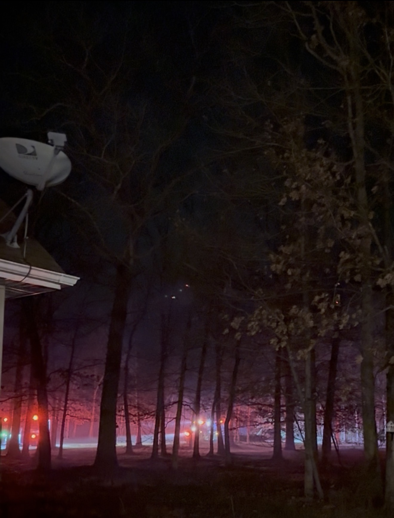
Winds threw an “exciting” curveball here tonight. I’m not sure of all the details but a fire quickly started spreading from my neighbor’s property into the heavily wooded section of my own. Between the very narrow tornado miss in March & this, sure making for a memorable spring.

-
Wonder what the pacing is compared to 2023-2025. This multi-year run has been exceptionally wild…
-
I already see our future punishment. High & dry summer. Excitement delegated to the next dust storm or smoke filled sky from wildfires out west. Kidding. Sort-of.
-
A bit unsure locally of threat for SVR, but nonetheless waves of storm chances will keep things pretty enjoyable throughout the next couple days.
-
Love these types of mornings. Low 70’s and stormy.
-
Pulled this from IEM for LOT, 1/1-3/31. Looks like most active start by a good margin in the last 20 years when considering all modes. 2026: 5 watches, 59 warnings, 135 storm reports 2025: 4 watches, 36 warnings, 92 storm reports 2024: 2 watches, 32 warnings, 80 storm reports 2023: 1 watch, 16 warnings, 25 storm reports 2022: 2 watches, 18 warnings, 23 storm reports 2021: 0 watches, 0 warnings, 0 storm reports 2020: 2 watches, 4 warnings, 4 storm reports 2019: 1 watch, 16 warnings, 16 storm reports 2018: 0 watches, 1 warning, 1 storm report 2017: 3 watches, 45 warnings, 62 storm reports 2016: 2 watches, 11 warnings, 12 storm reports 2015: 0 watches, 0 warnings, 0 storm reports 2014: 0 watches, 0 warnings, 0 storm reports 2013: 0 watches, 3 warnings, 3 storm reports 2012: 1 watch, 6 warnings, 8 storm reports 2011: 0 watches, 6 warnings, 5 storm reports 2010: 0 watches, 0 warnings, 0 storm reports 2009: 1 watch, 14 warnings, 16 storm reports 2008: 2 watches, 17 warnings, 4 storm reports 2007: 3 watches, 8 warnings, 4 storm reports 2006: 4 watches, 7 warnings, 25 storm reports Keep saying this, but March has been incredible when you consider all the svr action, warmth, & yes - snow for some.
-
A couple solid boomers but nothing noteworthy. Pretty satisfied that we continue to get an at-bat shot for interesting weather!
-
March def shaped up to be most exciting month since Nov, locally. Ready for boomtown tomorrow.
-
Through first half of the month: 2 SVR Watch, 1 TOR Watch, 1 SVR Warning, 1 TOR Warning & 2 High Wind Warnings. Suppose an alleged cherry on top would be some winter headline, but I’m done with snow tbh. Am entertained.