KeenerWx
-
Posts
866 -
Joined
-
Last visited
Content Type
Profiles
Blogs
Forums
American Weather
Media Demo
Store
Gallery
Everything posted by KeenerWx
-
11/8-11/10 First Snow and Lake Effect Event
KeenerWx replied to Geoboy645's topic in Lakes/Ohio Valley
Band dropped another 1.2” on its march back east. Three day total now at 8.3”. Most significant November event, locally, in my lifetime. Top tier lake event, too, but I don’t immediately know where it lands. Crazy that we’re already like 60-70% of the total seasonal snowfall for each 23-24 and 24-25. Hope the curse is lifted and there’s more fun to be had this winter. -
11/8-11/10 First Snow and Lake Effect Event
KeenerWx replied to Geoboy645's topic in Lakes/Ohio Valley
100%. Especially as you are outside of the typical zone to cash in on lake snow. This was pretty much the perfect scenario and outcome for your area. Absolutely incredible. -
11/8-11/10 First Snow and Lake Effect Event
KeenerWx replied to Geoboy645's topic in Lakes/Ohio Valley
Yeah. Lowell in Lake County (IN) has reported 10” and the best returns seemed to have been slotted west of them towards the Momence area. Wild event nonetheless. Even with the localized totals, quite a spread the wealth scenario across the southern Lake Michigan region. Now up to 5” overnight with event total at 7.1”. Seem to be about finished at this point. We’ll see what else the lake will provide as the primary moves back east over the next few hours. -
11/8-11/10 First Snow and Lake Effect Event
KeenerWx replied to Geoboy645's topic in Lakes/Ohio Valley
What have you grabbed so far? -
11/8-11/10 First Snow and Lake Effect Event
KeenerWx replied to Geoboy645's topic in Lakes/Ohio Valley
Hot damn. Report of 12” from Momence in Kankakee County. Not surprising giving radar presentation. Still going. At this point basically sealed as an all time lake event for them. -
11/8-11/10 First Snow and Lake Effect Event
KeenerWx replied to Geoboy645's topic in Lakes/Ohio Valley
Pessimism got the best of me. Ended up adding another 3.5” tonight. With last night’s 1.8” and an additional 0.3” in the morning, event total is up to 5.6”. Depth ~ 4.9” with the melt earlier today. Bottom inch or so is quite iced. Tonight reminded me more of deep winter rather than early to mid November. Between the meso swinging south and the dominate band shifting back east through Monday, it’s feasible to pick up another inch. Locally “historic”. Will surpass the 2004 Thanksgiving storm totals at least. Perhaps most interesting tonight is that we had steady to heavy snow even without much or any radar presentation. Nothing too crazy but ~ 1” per hour based on measurement. Can’t imagine what it was like under the heavy returns. -
11/8-11/10 First Snow and Lake Effect Event
KeenerWx replied to Geoboy645's topic in Lakes/Ohio Valley
Someone(s) in Lake, Porter, La Porte, St Joe counties will likely net 14-18” based on available reports and what is left with this event. Likely top tier lake driven event for Kankakee county and points southward as well. Less knowledgeable about their local history with LES but I have to imagine it’s limited on noteworthy events. -
11/8-11/10 First Snow and Lake Effect Event
KeenerWx replied to Geoboy645's topic in Lakes/Ohio Valley
DAB+ vibes now locally as trajectory and upscale radar trends are not promising. Still an awesome event to watch unfold. -
11/8-11/10 First Snow and Lake Effect Event
KeenerWx replied to Geoboy645's topic in Lakes/Ohio Valley
Looks like it will be a relatively short punch here downwind in Jasper County. Not bought into the deterministic output for snow accumulation. But that’s just experience talking vs any science applied. Still think there’s a shot of an inch or so. Looking forward to seeing what comes of this further north and west into the city. -
11/8-11/10 First Snow and Lake Effect Event
KeenerWx replied to Geoboy645's topic in Lakes/Ohio Valley
Incredible How much have you gotten from the lake so far? -
11/8-11/10 First Snow and Lake Effect Event
KeenerWx replied to Geoboy645's topic in Lakes/Ohio Valley
Took a tour through some cams across Porter County. Looks like perhaps a RA/SN mix along the 94 corridor. But down towards Valparaiso, snowing heavy & accumulating nicely. -
11/8-11/10 First Snow and Lake Effect Event
KeenerWx replied to Geoboy645's topic in Lakes/Ohio Valley
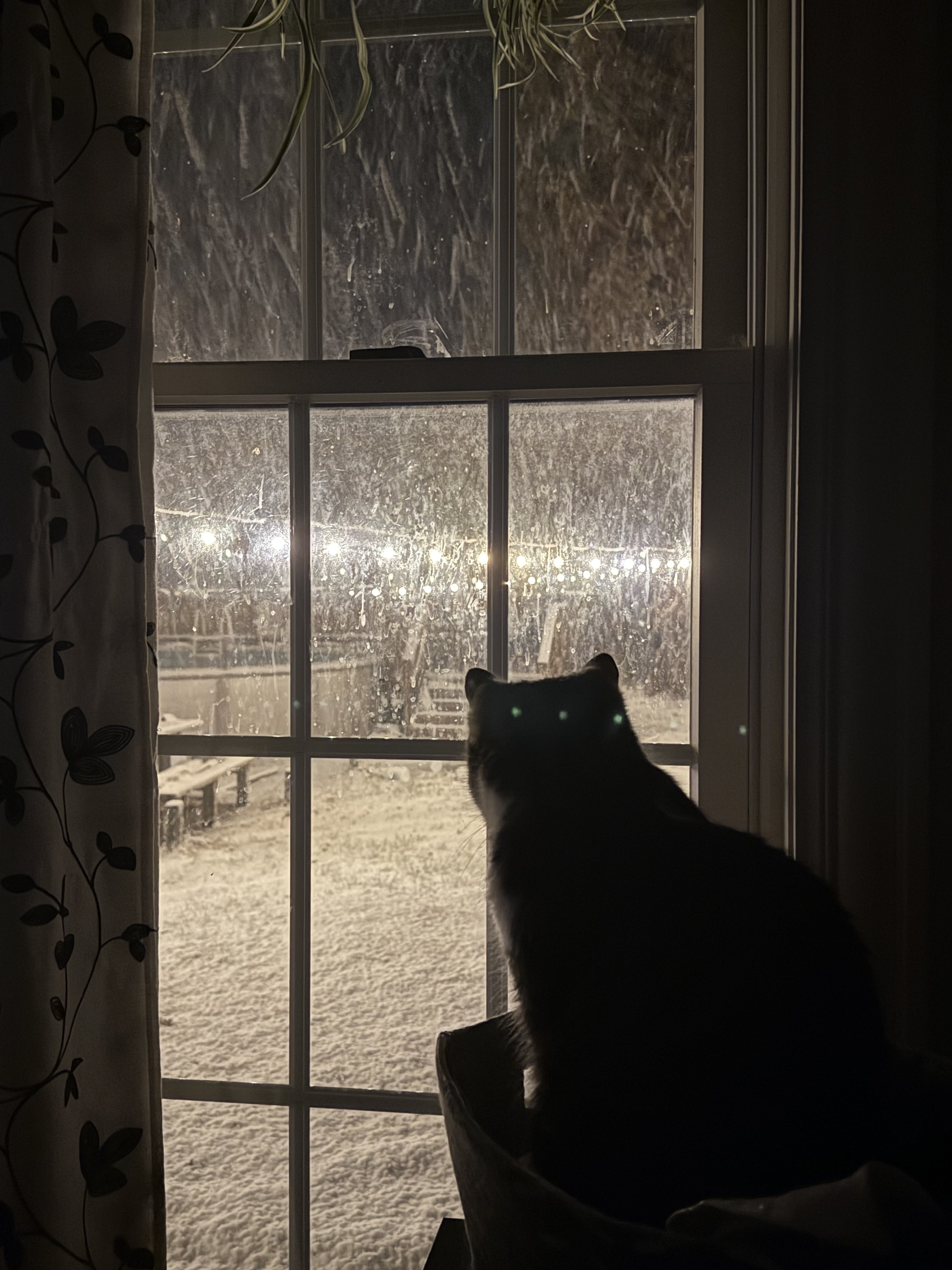
Picked up 1.8” so far. We shall see how the rest goes. But here’s one of my cats enjoying a view as the intensity of snowfall started to increase.
-
11/8-11/10 First Snow and Lake Effect Event
KeenerWx replied to Geoboy645's topic in Lakes/Ohio Valley
Results TBD, but the early morning AFD from LOT is…quite -
11/8-11/10 First Snow and Lake Effect Event
KeenerWx replied to Geoboy645's topic in Lakes/Ohio Valley
Switch to snow was late but not denied. Surprisingly efficient at covering the ground thus far. First flakes & measurable snowfall booked Edit 1 Hour Later: This defo band is serious business. It is ripping. Complete coverage of ground and pavement. Would certainly accumulate better with more favorable antecedent conditions. But wow - exceeding my own expectations. -
11/8-11/10 First Snow and Lake Effect Event
KeenerWx replied to Geoboy645's topic in Lakes/Ohio Valley
This map is so goofy. I get the uncertainty with lake effect. And that this map is generated with probabilistic inputs. But while technically accurate, the labels for Elgin, Joliet and Kankakee just don’t make sense with the corresponding color regions. -
P&C is up to ~2” here for whatever that’s worth. Expectations low for anything that meaningful given source. But pretty good shot at first snowfall/measurable snowfall, which is exciting itself.
-
Pretty wicked non-severe cracks and strobing.
-
2025 Short Range Severe Weather Discussion
KeenerWx replied to Chicago Storm's topic in Lakes/Ohio Valley
About 3/4” of much needed rain so I’m not complaining. -
On the flip side, over here we can't seem to squeeze out any precipitation lately. Rather brown & crunchy; doesn't look like any strong chances of relief in the short-term.
-
Been getting absolutely stiff armed. Over past several days have missed popcorn to the N, S, E & W by single digit miles. Some rain would be nice...
-
Haven't had much luck cashing in on the popcorn. Brief neighborhood sized shower yesterday. Trying to keep a bunch of plants happy - very least free of stress - and could use a little help from mother.
-
Pretty spicy locally. Pockets of widespread tree damage. I lost a medium tree. Neighbor across the street lost a couple. Another had large tree hit their garage.
-
LOT hasn't yet warned the counties immediately in front of the line. Definitely weird presentation haha.
-
Could miss just east but hanging onto hope for a solid boomer.
-
Storms will miss just north. Shame.