Eskimo Joe
-
Posts
24,701 -
Joined
-
Last visited
Content Type
Profiles
Blogs
Forums
American Weather
Media Demo
Store
Gallery
Everything posted by Eskimo Joe
-
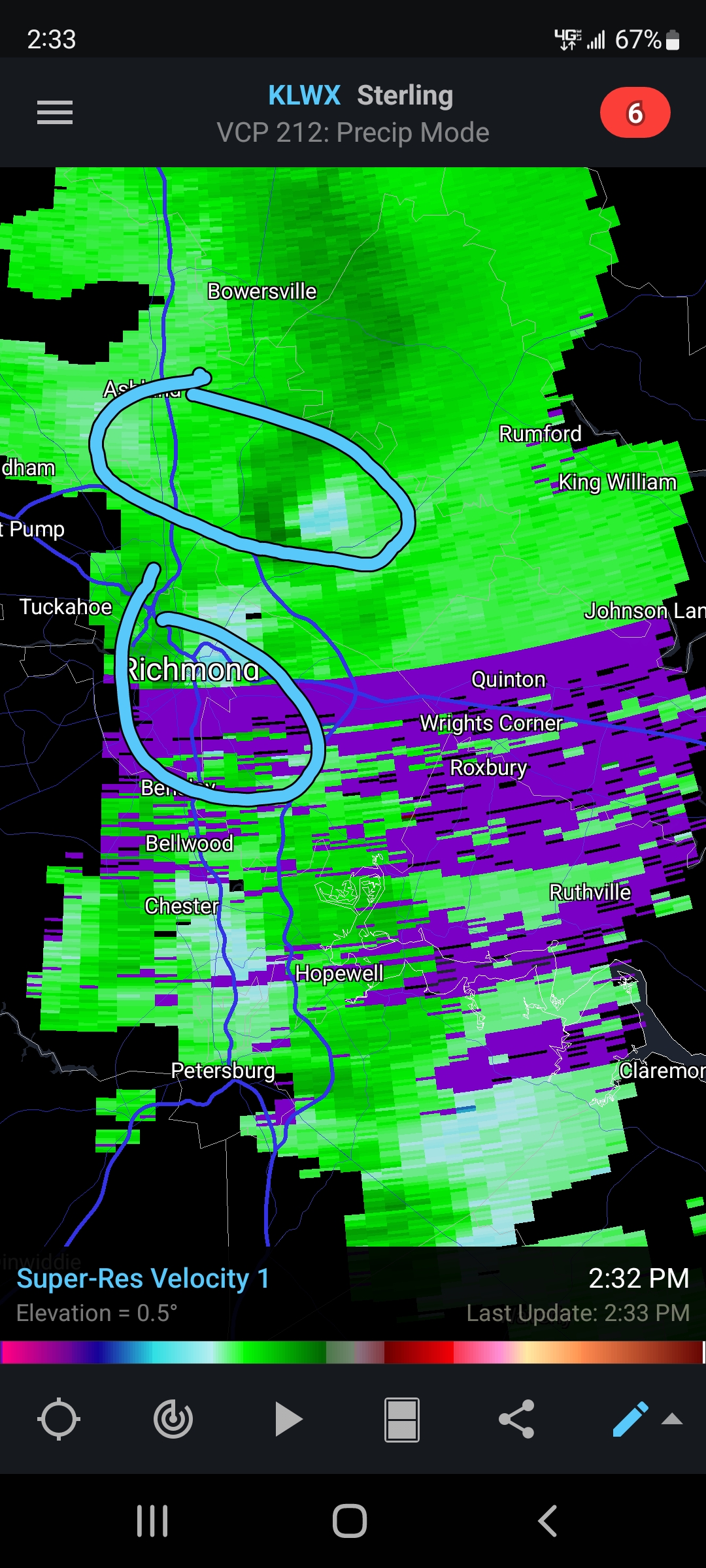
Will the CCB be enough to save I-95 though?
-
Interesting line to our south
-
Wouldn't shock me to see a Tornado Watch closer in to the metros this afternoon
-
KY gets snow before DC. Impressive.
-
@brooklynwx99 I love your posts. Thank you for giving hope to us low landers.
-
Heads up for those of us south and east of I-95 tomorrow
-

-
Bless
-
-
Would like to see the track shift a bit east over MD and slow down a tad. Would probably mean more rain.
-
From a WPC met on Twitter:
-
November is the new September in these parts it seems.
-
-

Some Thoughts On The Next Couple Months
Eskimo Joe replied to OHweather's topic in Weather Forecasting and Discussion
Appreciate the write up and the graphical explanation of how the various indexes play out. -
68 degrees at 7pm. Reallllly gonna need those rates the NAM has been advertising for this to work out.
-
Me too. Would just love to have a nice 14 to 17 period near Christmas where we get climo snow and cold.
-
82 for a high yesterday in Reisterstown.
-
Totally normal
-
BWI: 19" DCA: 10" IAD: 12" RIC: 8" Tiebreaker (SBY): 10"
-
-
Hey anybody can point me to a portal where I can do a quick map of daytime surface T anomalies? I want to compare how the Ts for one day (of my chosing) in one region (S. America) compare with the climatological values.
-
Yes
-
Map needs work. The numerical values on the contours have awkward jumps.
-
As long as it isn't 70+ degrees on Thanksgiving, it's a win.