dWave
-
Posts
1,955 -
Joined
-
Last visited
Content Type
Profiles
Blogs
Forums
American Weather
Media Demo
Store
Gallery
Everything posted by dWave
-
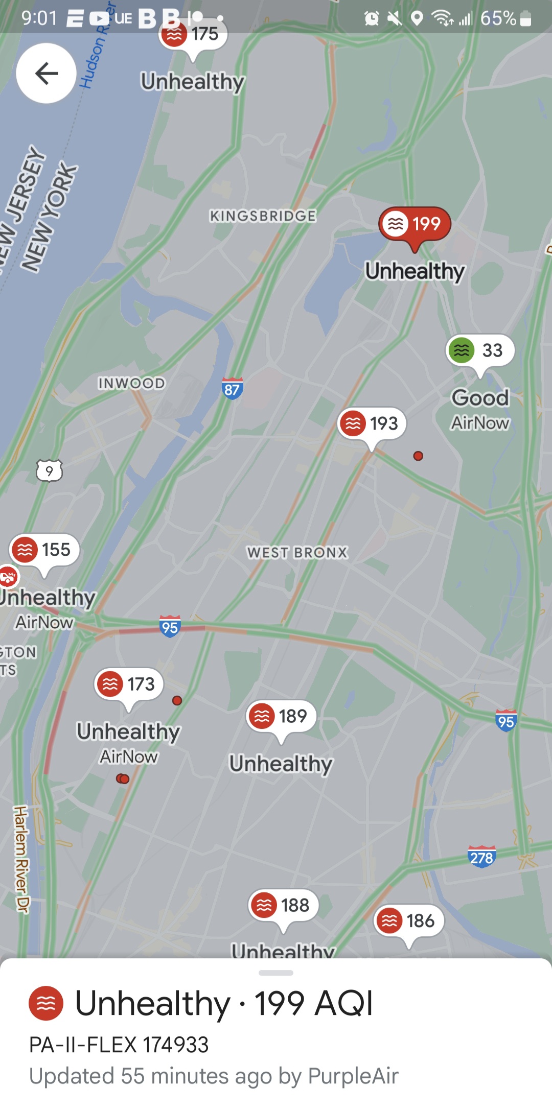
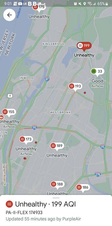
It updated. NYC air quality is now the worst of major cities in the world. 193 aqi
-
Still rising too. Except some sort of mystery fresh air bubble over the Botanical Garden
-
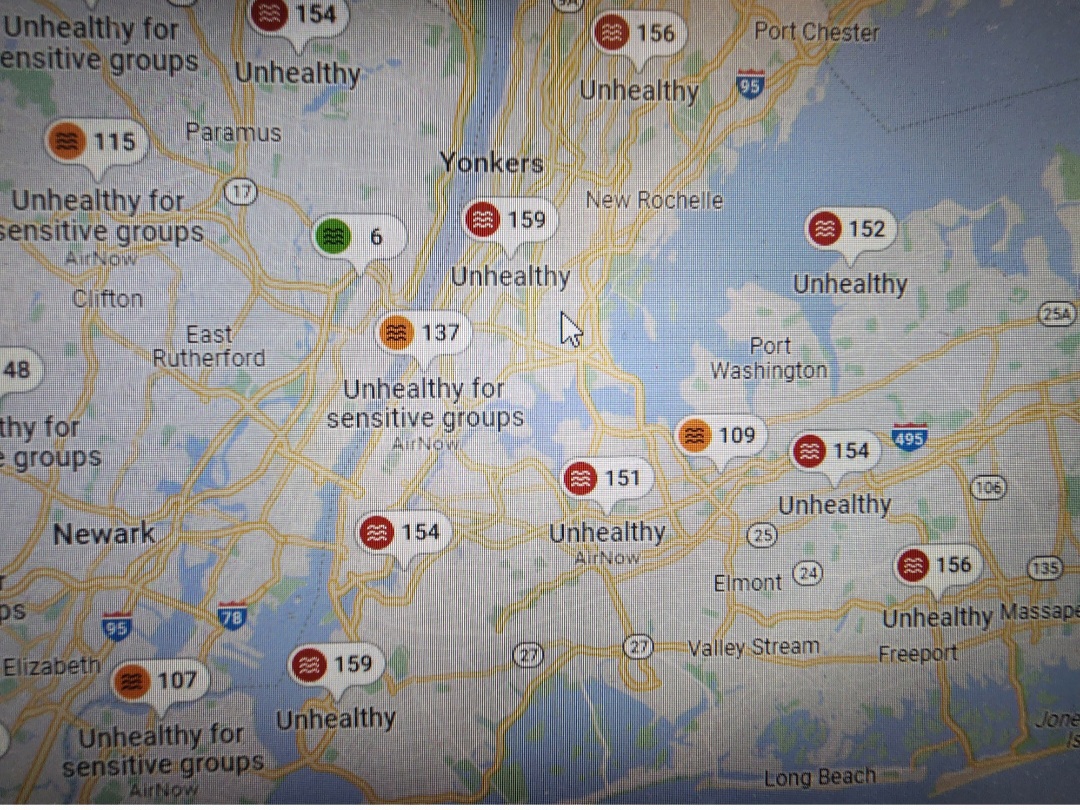
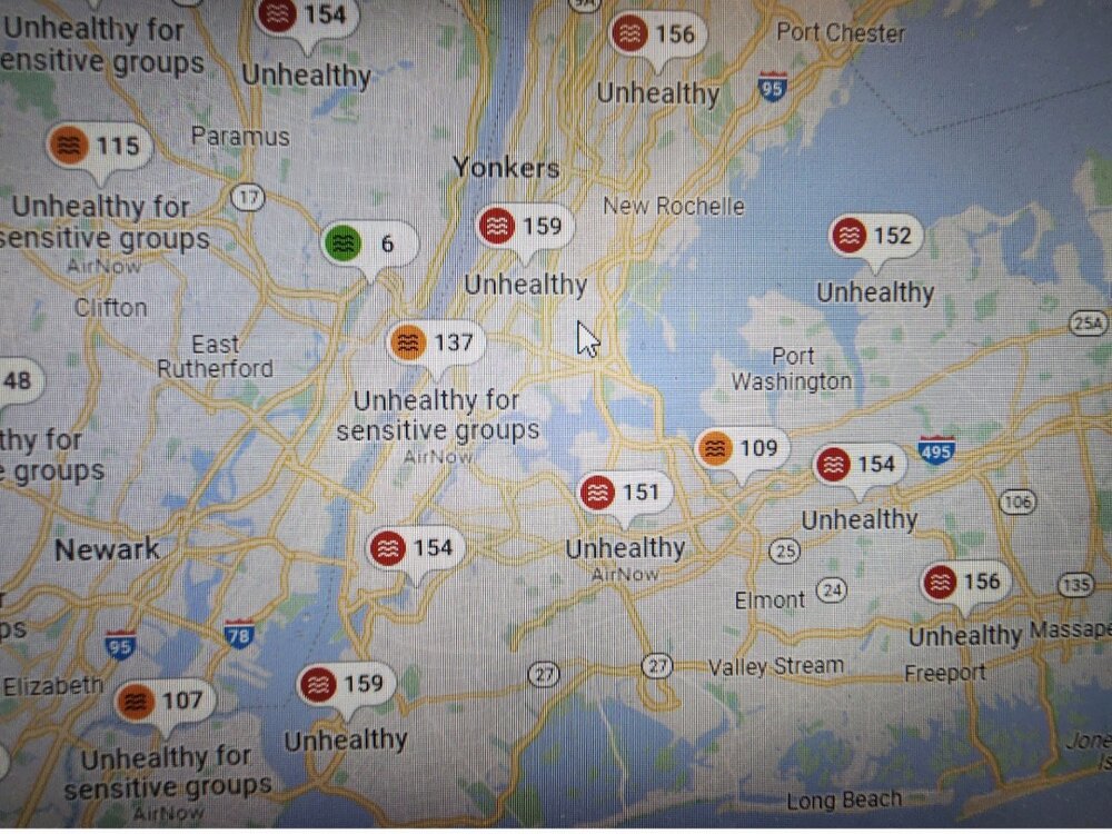
AQI levels have jumped this evening even higher than mid day levels. Lots of 170+. Nearing 200 in NW NJ and Orange county.
-
Some pretty high readings, into the unhealthy for all category, not just sensitive groups.
-
Got down to 50*. Coolest June low in recent memory. Can't say I'm a fan. Don't want to have to wonder..."will I need a jacket if I'm out late" by June.
-
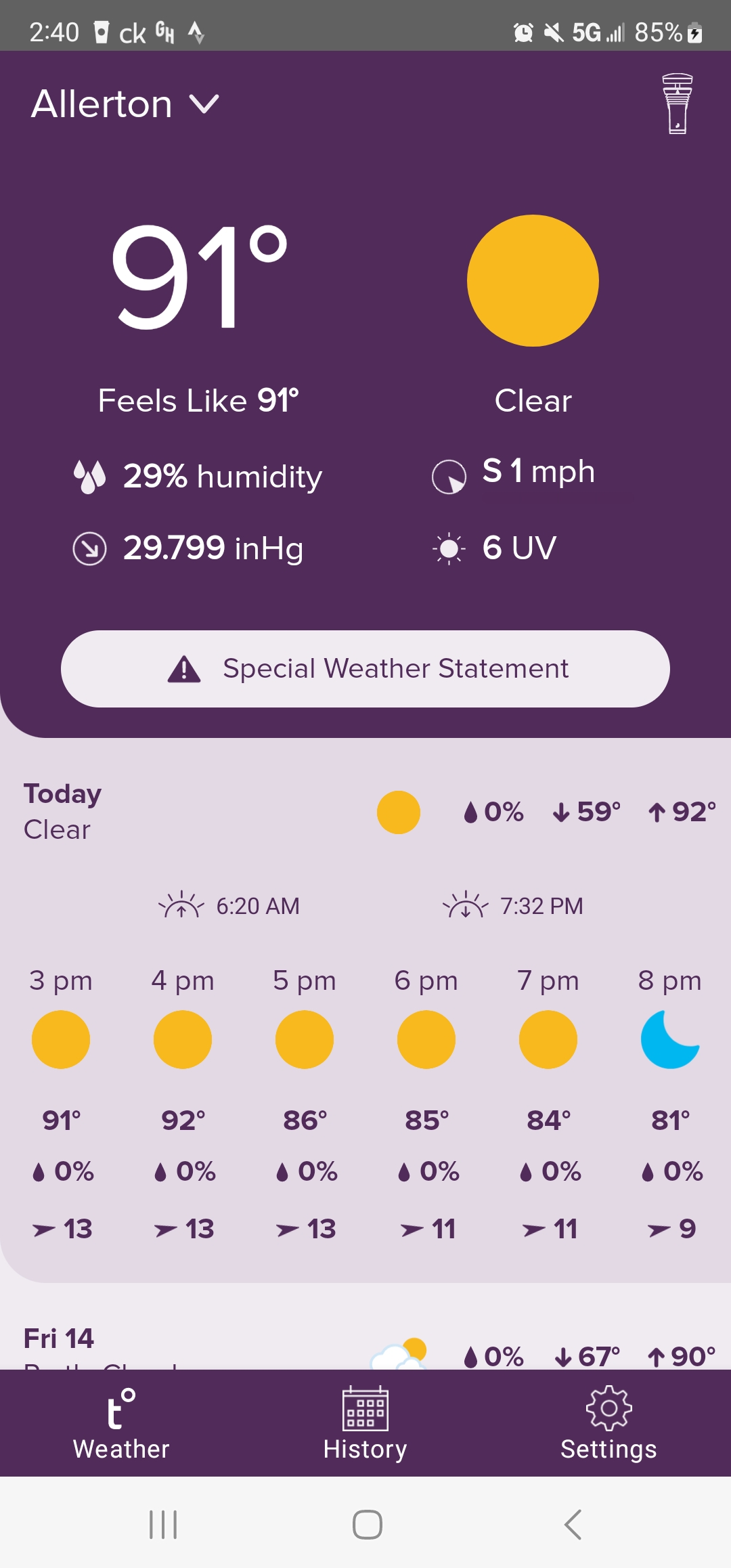
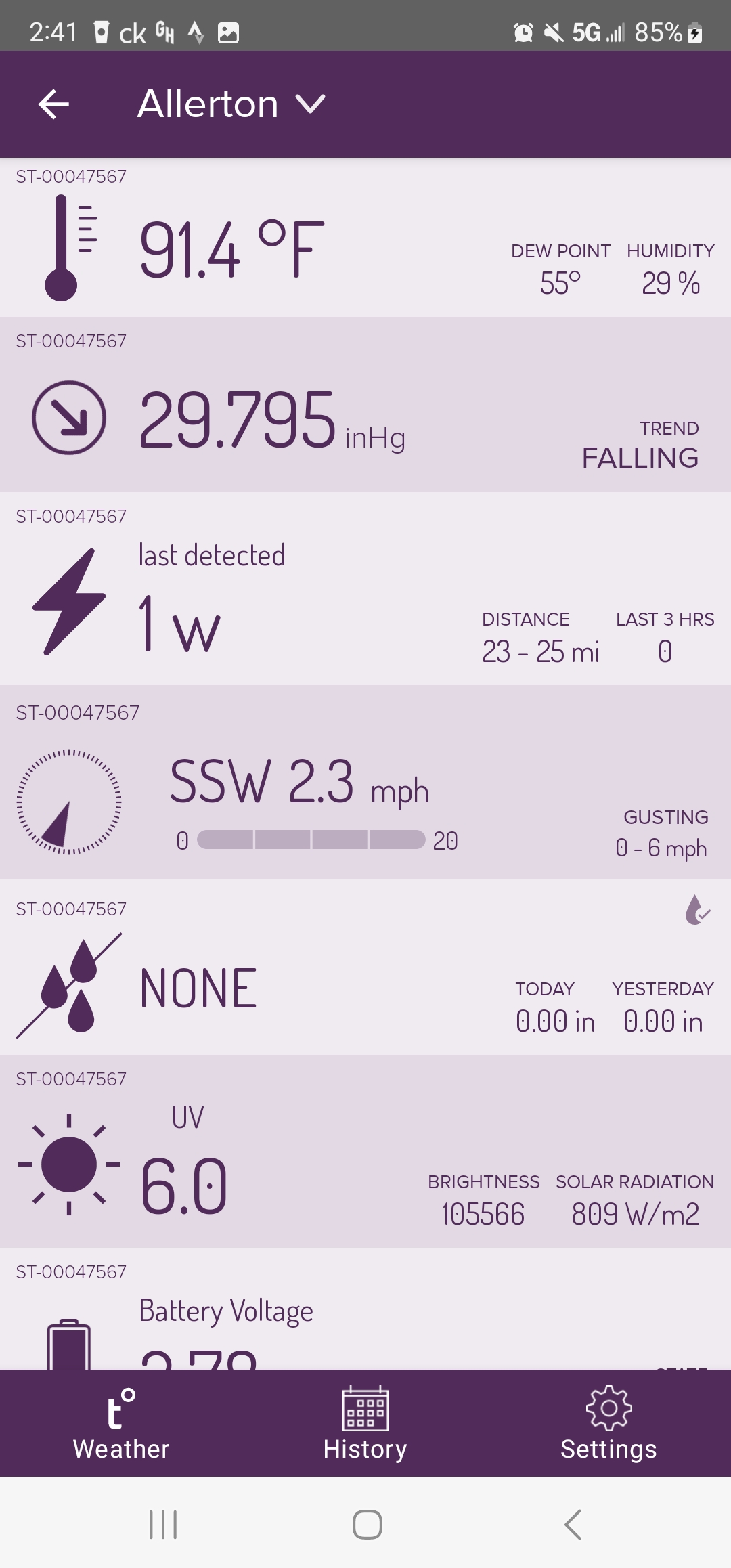
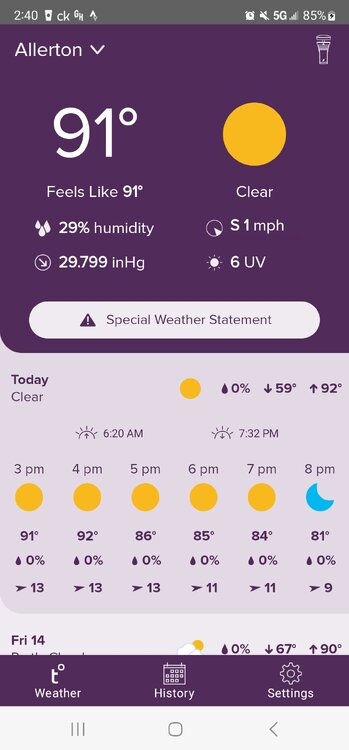
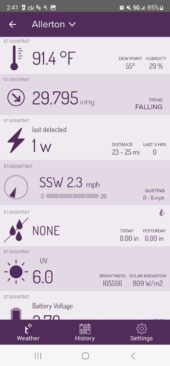
At 91 3rd of the year
-
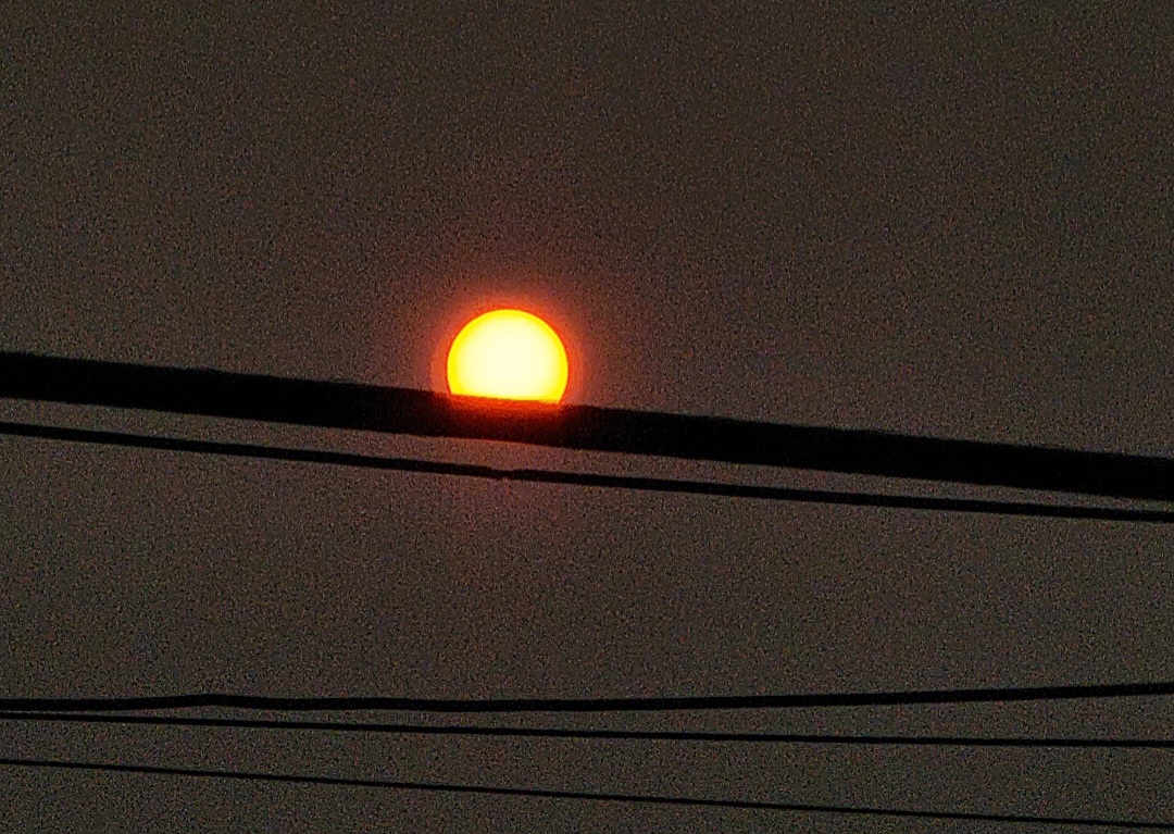
Its here now..burns my eyes actually
-
I go uptown to the Bx and the sky is blue and no perseivable smoke..but how if it's coming from the NE, or is it sweeping around from the south? Or is it because it more breezy here?
-
Took a walk outside and you def can smell it and see it from street level.
-
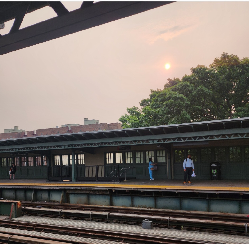
I heard some mets say it's possible, since this time it can mix down to the surface and affect air quality. I noticed the haze in the sky around 1pm. Sitting in a Manhattan high rise I can make out it lowering now to near ground level and in between buildings like fog.
-
Sunny 68 and windy. The NE wind is strong
-
Wasn't today supposed to be warmer? Instead of mid to upper 70s it remaining steady in the mid 60s, windy and mostly cloudy from time to time.
-
Yeah I got an alert of a flood warning for the Bronx River. There's new buildings right along the river just south of the Zoo, I suspect that's what the E Tremont reference is for. The usual suspects already have closures, Bx River, Saw Mill Pkwy.. https://water.weather.gov/ahps2/hydrograph.php?wfo=okx&gage=bbgn6
-
What's up with this flood advisory? Looks like flash flood warning levels to me. Plenty of flooded streets, stalled out cars and some flooded basements. NWS is slipping
-
2" of rain since yday, light rain still falling.
-
Big range though with the easterly flow. 74 in the Park, 63 at LGA.
-
Yeah I fell 5 degrees the last hr to 88
-
Still rising, 93. How far has the sea breeze reached?
-
Time to wake up the 90 degree day thread..
-
Off to the races, after low of 63, now 79. NWS now forecasting 90
-
Ha...Frost Advisory tonight for Bronx, Staten Island, Nassau and a little of NE NJ 339 PM EDT Sun Apr 2 2023 ... FROST ADVISORY IN EFFECT FROM MIDNIGHT TONIGHT TO 8 AM EDT MONDAY... * WHAT, Temperatures as low as 34 will result in frost formation. * WHERE, In New Jersey, Hudson, Eastern Essex and Eastern Union Counties. In New York, Bronx, Richmond (Staten Island), Northern Nassau and Southern Nassau Counties. * WHEN, From midnight tonight to 8 AM EDT Monday. * IMPACTS, Frost could kill sensitive outdoor vegetation if left uncovered. PRECAUTIONARY/PREPAREDNESS ACTIONS... Take steps now to protect tender plants from the cold.
-
Yeah I'm not a fan of the super low humidity. Its not as bad as yday though. Might be an asthma thing but when humidity gets down to 15% or 10% it feels like breathing knives. There's some brush fires in NJ suspending train service between Penn Station and Trenton
-
Sunny and 64. The bone dry dew point still leaves a little chill to it in the shade or breeze. 12* dp, 15% humidity