MattPetrulli
-
Posts
1,736 -
Joined
-
Last visited
Content Type
Profiles
Blogs
Forums
American Weather
Media Demo
Store
Gallery
Everything posted by MattPetrulli
-
Clover leaf appearance in the eye. Meso vortices gonna meso vortices
-
FYI, Key West Naval Station still in tropical storm conditions as of last METAR update. Pretty sure that's around 12-ish hours of TS conditions, could be a little off though. Still really impressive.
-
Also seems to be slowing down just a little bit.
-
REALLY trying to clear the eye, curious about how much more intensification occurs before landfall in about 6ish hours imo. Also meso vortices evident on radar/satellite. That SE side of landfall is likely going to be a very populated area regardless of due east wobbles and will receive one hell of a surge. Awful man.
-
Curious if NHC ups the surge estimates for Ft Myers area at 11 PM, because of the EWRC expanding size.
-
No need to be rude. Just presenting the idea, accounting for east wobbles.
-
With continued NNE motion, it may come in AT Cape Coral instead of a little north. Hard to tell though.
-
I thought maybe concentric eyewalls too, but want to wait for recon to make a pass.
-
Little bit of a moat after the southern eyewall. Thinking maybe a little dry air? Everyone free to chime in of course
-
Hurricane Ian landfall location/intensity prediction thread
MattPetrulli replied to Hoosier's topic in Tropical Headquarters
Just south of Sarasota, 8 PM Wednesday, 110 Knots -
I want Ldubb's thoughts on this
-
that area is super super low lying. I don't think a lot of evacuations are ongoing there based off traffic but could be wrong. They could be in for a really bad time
-
Last pass adjusting for flight levels and SFMR supports 110-115 MPH on 11 AM advisory
-
It's not, it's virtually identical Edit: Sorry, after the LF point it is north and west. My bad.
-
It'll come in a different area than Irma, but the satellite appearance, last minute shifts, expansion of the wind field after Cuba, and the angle of approach remind me a lot of Irma. Of course, east coast probably won't be hit as hard since Irma was massive, but think it's a valid comparison.
-
Trying to clear out a stadium effect eye right after Cuba lol
-
Some evacuees on I-4
-
Ft Myers area is just as surge prone, gonna be really bad down there assuming the angle on the NHC forecast happens
-
No meant, the spike before the eyewall which thought represents a potential EWRC but seems not true Also we likely have a major
-
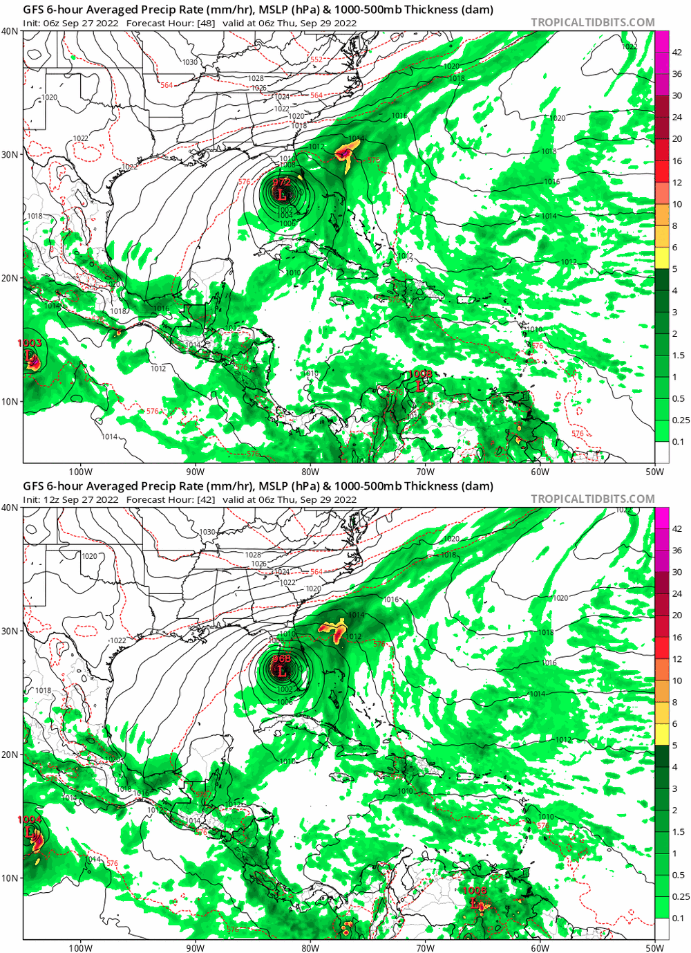
00z GFS battling west coast at 00z Thursday. A little east.
-
Also, yes Cuba may temporarily disrupt intensification. However, HMON, HWRF, HAFS (not sure how good it is but it's a hurricane model) all show a dramatic expansion of the wind field post Cuba.
-
Next pass will be from SW to NE within the hour. Expecting them to find 110-115 MPH storm. IR appearance improving each frame
-
Curious about the second spike. Anyone wanna chime in?
-
The shift from a miss to the west to a Wednesday Night Florida Landfall potentially has been pretty insane the past 24 hours.
-