

HillsdaleMIWeather
-
Posts
3,725 -
Joined
-
Last visited
Content Type
Profiles
Blogs
Forums
American Weather
Media Demo
Store
Gallery
Posts posted by HillsdaleMIWeather
-
-
From the new MD
 In addition, VWP data from KOUN and KVNX depict a notable increase
   in low-level flow over the last hour, with some modest backing of
   surface winds noted in recent Oklahoma Mesonet data. 0-1 km SRH of
   around 200 m2/s2 was noted in the 21Z OUN sounding, with values
   expected to increase above 300 m2/s2 into this evening. The
   combination of strengthening low-level shear and strong to extreme
   instability will support a rapid increase in potential for strong
   and possibly long-tracked tornadoes as storms spread
   east-northeastward this evening.
-
Southern extent of the supercells looks a little less than expected rn maybe
-
 1
1
-
 2
2
-
-
Northern Indiana upgraded to enhanced for 10 sig tornado
-
1
-
-
Looks to be a seasonal start to the month with frequent chances for rain and storms but with lotsa nice days too.
-
1
-
-
That once cell in NE Indiana really tried to drop a tornado but got choked out by the rain around it
-
That enhanced was such a screw up, there's been more Tor Warnings in the marginal areas down south
-
3
-
-
2 hours ago, Floydbuster said:
The NWS says the severe risk is highly dependent on lingering rain and clouds through the day. I think this has a high bust potential.
Kinda like the last two days where they went too high and busted
-
2
-
-
Skies look to be clearing from Kentucky into Central Ohio
-
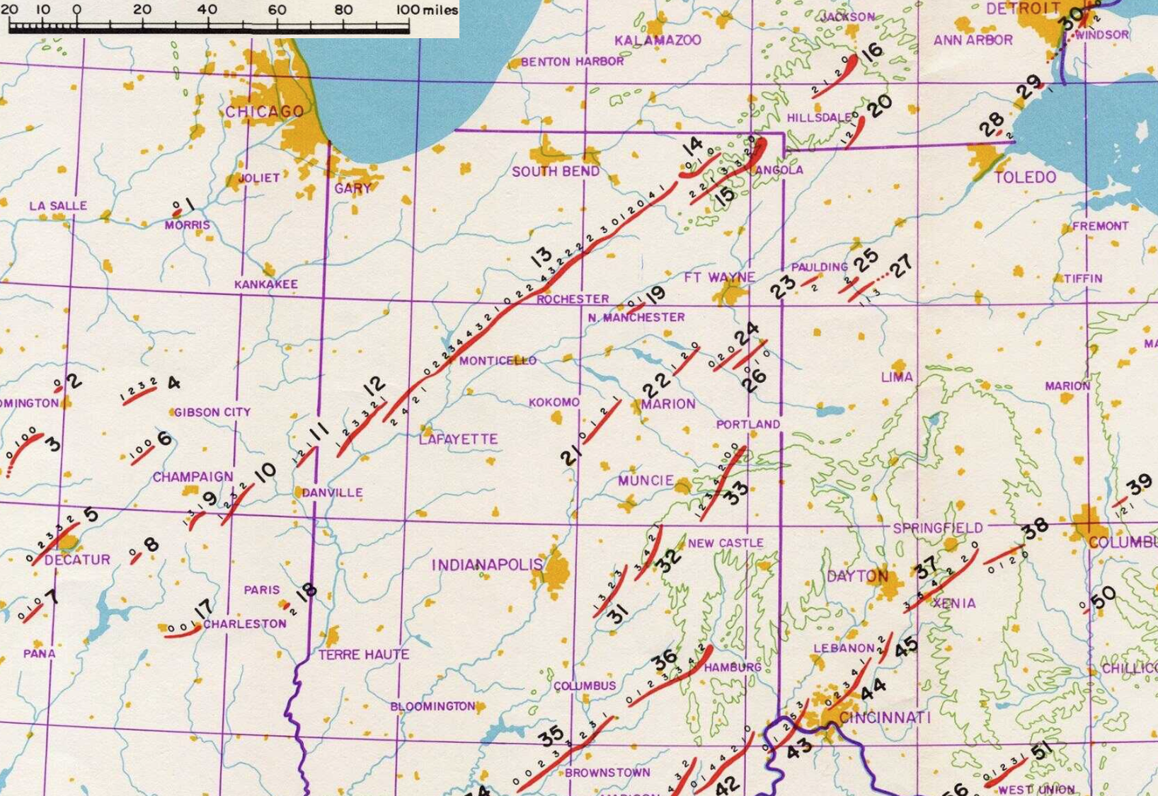
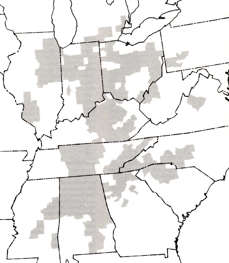
Areas affected by Tornado Warnings between April 3rd and 4th 1974
Share any memories and stories you all have here
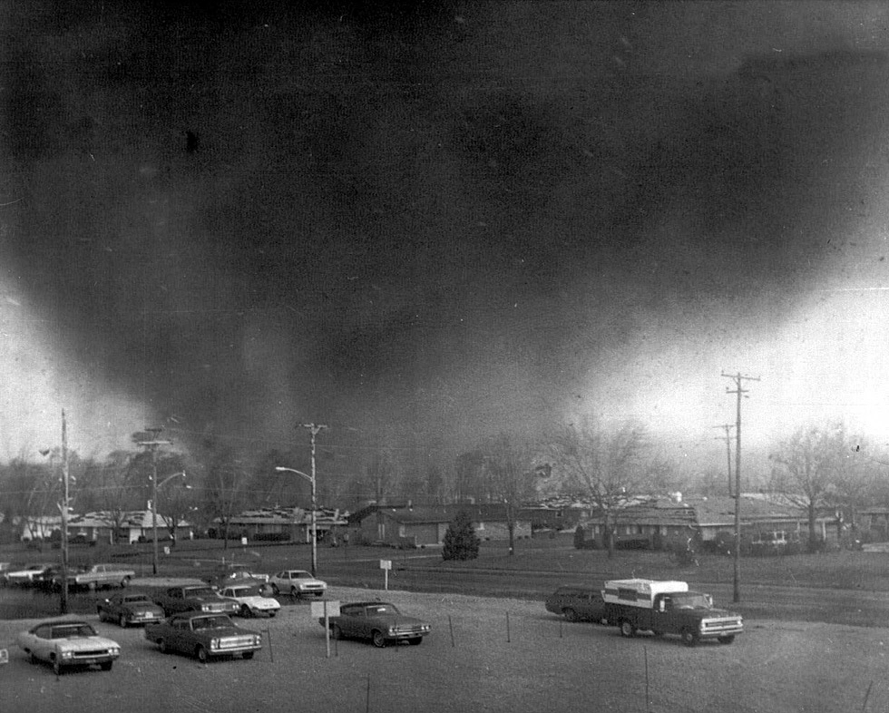
Mine is that I've heard from many locals, is that the EF-2 Tornado that hit Hillsdale sent the statue outside the Big Boy restaurant flying through the air and it landed over a half mile away on a house that wasn't even hit by the tornado.
-
1
-
-

2% TOR and 15% WIND for Central MI, Northern IN and Extreme NW OH
-
C-
Noth said
-
Just now, CoachLB said:
Closer than I thought. My neighbors ring camera.
We're all super glad it missed you
-
1
-
-
I know it's kinda the thing everyone says lately but the SPC really dropped the ball this evening when it was obvious the event was uptrending, they didn't even increase the areas that got hit by likely violent tornadoes to a slight risk until the 9PM update.
-
3
-
-
Cleveland area getting some nice LES
-
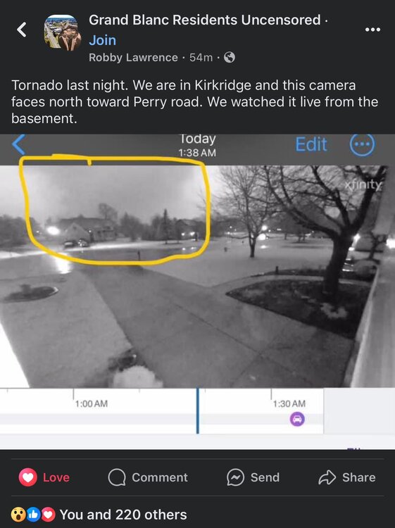
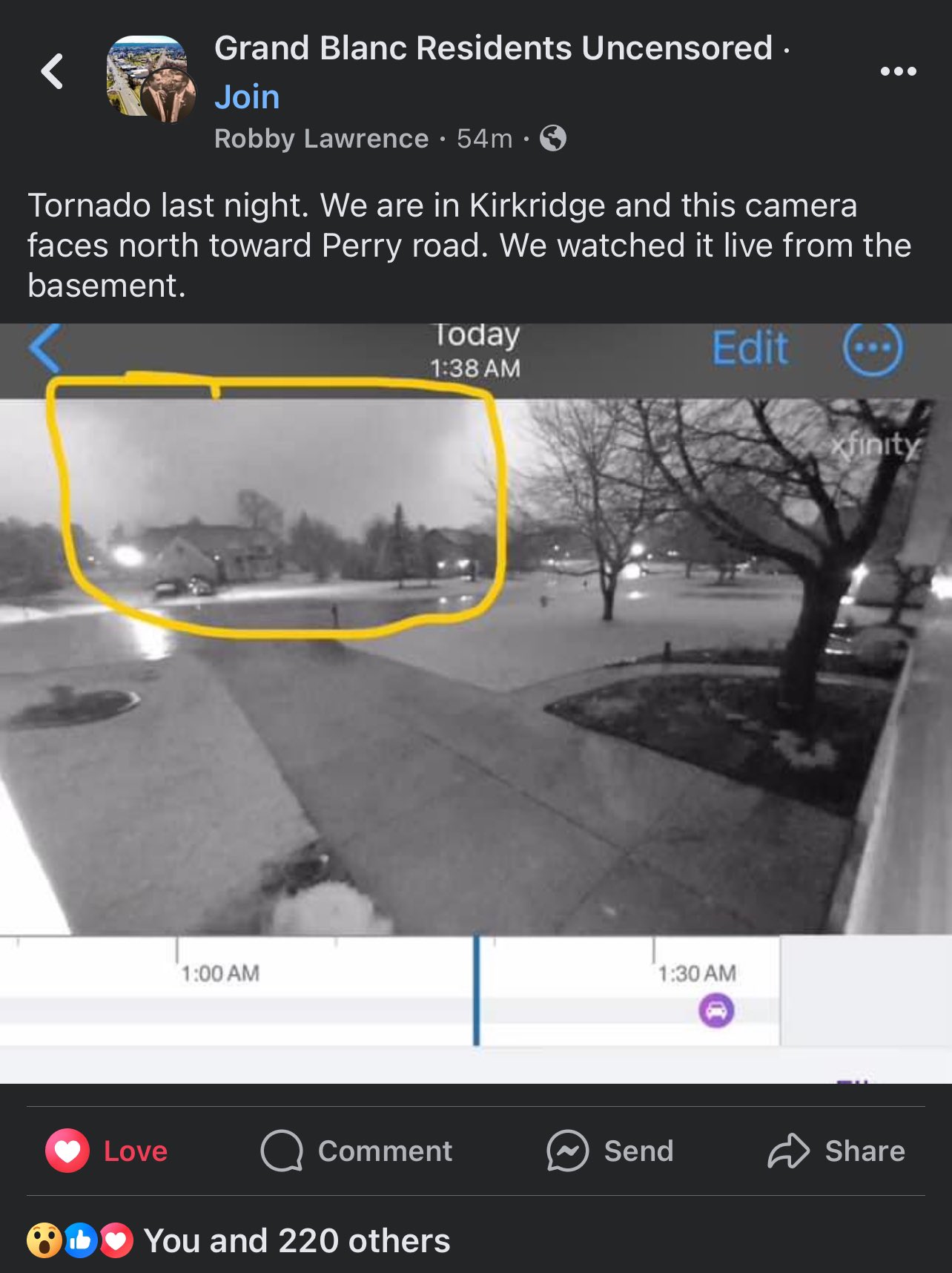
Reed posted a Facebook screencap of it
Was pretty damn big, especially for MI
-
2
-
 1
1
-
-
Looks to quickly go back to a much warmer than normal pattern with lots of chances for rain and storms.
Morch incoming?
-
Right turner heading into Kalamazoo
-
1
-
-
Southern Lower MI is in prime position to get slammed from this LEWP
-
Tornado otg on the La Salle storm too on Reeds stream
-
Storm motion is going way more easterly than forecast which will be more tornado producing
-
That supercell that went up in the Quad Cities CWA has to be one of the fastest formations to SVR Warnings I've ever seen, around 10 mins
-
1
-
-
Initiation going in NE Illinois
-
10% sig tor introduced for South of Chicago into NW Indiana
-
1
-
-
Mesoanalysis looking spicy
Severe Weather 5-6 through 5-9-24
in Central/Western States
Posted
Off to the races now with extra initiation happening