Metasequoia
-
Posts
785 -
Joined
-
Last visited
Content Type
Profiles
Blogs
Forums
American Weather
Media Demo
Store
Gallery
Everything posted by Metasequoia
-
Extreme Cold, Snow & Sleet: SECS 1/24 - 1/26
Metasequoia replied to TriPol's topic in New York City Metro
6 to 10 inches of snow topped with a couple inches of sleet, followed by days below freezing... sounds good to me. -
Extreme Cold, Snow & Sleet: SECS 1/24 - 1/26
Metasequoia replied to TriPol's topic in New York City Metro
Would the 18Z Icon be snow to sleet for NYC? -
Extreme Cold, Snow & Sleet: SECS 1/24 - 1/26
Metasequoia replied to TriPol's topic in New York City Metro
If this storm underperforms regarding snow, I feel like the March 11ish 2017 storm ( Miller B also ) might be a decent analog. 12 to 20 inches of snow was initially forecasted for NYC, but the City received about a half foot of sleet because the upper low tucked in just east of the Jersey Shore and south of Long Island. Obviously this weekend's storm impacts a much larger portion of the US... -
Extreme Cold, Snow & Sleet: SECS 1/24 - 1/26
Metasequoia replied to TriPol's topic in New York City Metro
Impressive model to model and run to run consistency, a few days out. Gives me some realistic hope... -
Extreme Cold, Snow & Sleet: SECS 1/24 - 1/26
Metasequoia replied to TriPol's topic in New York City Metro
We are all loving the overnight trends, but we are still five days out from the first flakes. The more robust phasing seems to add extra complexity (and upside) to the forecast. How far north can this system get? -
Storm potential January 17th-18th
Metasequoia replied to WeatherGeek2025's topic in New York City Metro
FWIW, NAM 3K doesn't look as warm for the coast. -
Storm potential January 17th-18th
Metasequoia replied to WeatherGeek2025's topic in New York City Metro
Sticking to streets and sidewalks in Battery Park City... -
Storm potential January 17th-18th
Metasequoia replied to WeatherGeek2025's topic in New York City Metro
I wonder if the heavier than expected snow in NYC improves the chances of tomorrow's snow accumulating. Colder atmosphere and ground? -
Storm potential January 17th-18th
Metasequoia replied to WeatherGeek2025's topic in New York City Metro
FWIW - Latest RAP model run has the region catching most of both waves of snow this weekend... half a foot or so. -
It's been all snow in southern Manhattan from the start.
-
Judging by the current temps and dewpoints around NYC, temps should drop to around freezing fairly quickly once the steady snow moves in.
-
...and eventually less snow. Not that anyone on this forum cares about that...
-
Canadian has something interesting during this time frame. Storm signal on multiple models.
-
That ULL looks so close to phasing on the NAM.
-
Yeah, seems like modeling has improved a lot in 14 years.
-
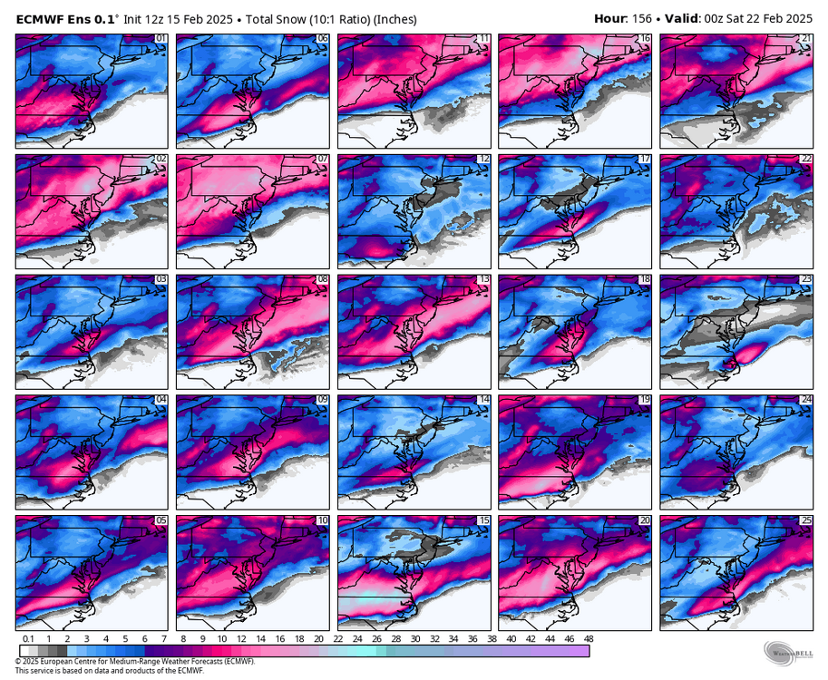
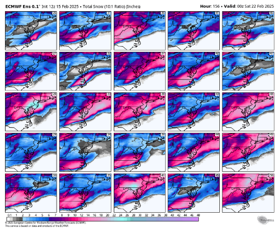
2nd eps panel
-
A compromise between the Euro and Ukie would make everyone happy.
-
Doesn't look like the models have lost it or neccearilly are about to. They all show a potent snowstorm for the midatlantic with varying tracks... giving warning level snow for the metro.
-
As SeyMourSnow (NE forum) says... DC to Philly does really well with many of the differing storm evolutions. I think NYC does well too... maybe not as consistently, though. Kinda reminds me of the 2016 blizzard four days out.
-
Post hour 135 woild be telling, yeah?
-
Yeah... about perfect. Has that slow moving firehose off the Atlantic. Of course, wouldn't mind a 50 plus mile shift southeast though.
-
12Z Ukie courtesy of Rjay from the subforum next door.
-
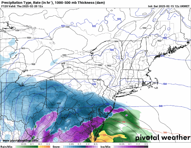
CMC depicts a storm riding up the coast, but the pressure isn't that low. Interesting...