

Metasequoia
-
Posts
785 -
Joined
-
Last visited
Content Type
Profiles
Blogs
Forums
American Weather
Media Demo
Store
Gallery
Everything posted by Metasequoia
-
I would love to know Snowman19's latest thoughts.
-
Plus... Forky thinks 20 to 30. That carries weight.
-
The short range models (HRRR,RAP, 3K NAM) have extreme amounts. Am I missing any?
-
-
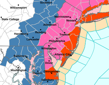
That's one ugly map... yet it's so lovely.
-
I don't think the rain at the front end is about a close approach. It's about a marginally cold airmas coupled with light precip.
-
For much of this forum, there's room for more tuck without mixing issues... and we are within 48 hours of go time.
-
18Z NAM looks a lot like much of WeatherGeek2025's weather porn.
-
Probably every other zonked weather weenie on Twitter X
-
For Boston. Agreed.
-
Well... the storm is certainly impactful enough to be ranked on the NESIS scale... and likely at least 3... I agree. If that's the definition of a KU... sure. I have never thought there was a hard and fast standard for KU delineation... it's kind of a you know it when you see it. Am I wrong?
-
NYC got about a foot... granted with about 1.8 qpf... just feels not quite enough. Do others classify this storm as a KU? I would be interested to know.
-
NYC has had KUs in 1996, 2006, and 2016. What are the odds we add 2026 to the list...
-
I was hoping the 18Z Euro and its AI brother would "cave" to the GFS, but didn't really think they would... at least not yet. Having said that... we are still 3 days away. Need to see more model support and run to run consistency...
-
That's quite a gpf for five days out.
-
Negligible changes in pressure. Not important at this stage, regardless.
-
18Z GFS wasn't east of 12Z, it was a bit weaker. Could be more noise than signal at this point.
-
Regular Euro vs. the world... as of right now.
-
Per Noaa - Watches are issued up to 72 hours in advance with forecaster confidence around 50%. So... if things look really good on Thursday, Winter Storm watches will be hoisted.
-
This is a really strong signal for five days in advance... and the models have noted the potential for several days now. Let's hope the signal is still here in a couple days after at least one preceding storm has cleared and model error is down. There was pretty good model to model and run to run consistency about five or six days prior to January's storm... gives me some hope.
-
12Z GFS is an improvement over 6Z... stronger and more tucky.
-
That's beautiful. Looks like textbook KU.
-
Post wherever you want. Just know that many on this forum are anonymous (anonymity makes some a bit too blunt) and some get annoyed too easily. Anyone who's not a met or doesn't have a great track record, is naturally going to catch some Hell for posting overly precise forecasts a week out or calling for two feet of snow without decent model support. Sounds like you don't like blunt critiques from triggered people (who does?)... then stick to three day forecasts that are less based on wishcasting.
-
The old windchill figures always seemed overdone, but the modern figures seem underdone...
-
January 30th- Feb 1st ULL and coastal storm obs
Metasequoia replied to JoshM's topic in Southeastern States
Raleigh went from snow hole to being crushed. Awesome! Y'all are going to do pretty well... not Outer Banks well, but well.


