
*Flash*
-
Posts
931 -
Joined
-
Last visited
Content Type
Profiles
Blogs
Forums
American Weather
Media Demo
Store
Gallery
Everything posted by *Flash*
-
Saw this posted earlier today on the TN Wx Forum. Hope seems meager at best these days. What's interesting is that these toasty falls resulted in subpar winters at least in Middle TN. That said, we're dealing with a unicorn setup this go around...

-
For those looking for some hope to cling to, I wouldn't sleep on 2009–10 as at least a partial analog. Obviously, the magnitude isn't comparable if 2026 continues toward the upper end of current forecasts, so I'm not arguing these are ENSO twins. But there are some interesting similarities in the evolution. 2009 transitioned fairly quickly out of La Niña/neutral conditions into a developing El Niño, with the atmosphere increasingly coupling during late summer/fall. By September 2009, we were seeing suppressed convection around Indonesia, anomalous convection farther east, and increasingly established low-level westerly wind anomalies. There are some similarities to what we're seeing now in the atmospheric response, even though 2026 is running much hotter. What interests me more than matching Niño 3.4 numbers is where the forcing ultimately establishes itself and what kind of North American response we get from it. 2009–10 ultimately produced a very favorable southern storm track along with a much more cooperative high-latitude pattern. For those of us in the Tennessee Valley, that combination delivered a legitimately cold, snowy winter. Obviously we can't analog the NAO/AO in September, and 2026 could evolve into something structurally quite different. But if the eastern-Pacific warmth becomes less dominant relative to continued central/east-central Pacific warming, and the tropical forcing/convection begins consolidating farther west, I think 2009–10 becomes increasingly interesting as a pattern/evolution analog, even if it's a poor magnitude analog. So no, I'm not calling for a repeat of 2009–10. But I wouldn't toss it because this Niño is stronger, either. Analog the evolution and atmospheric response, not just the ONI. There may be more there than the raw ENSO numbers suggest. Then again, hope floats.
-
This might be the easiest winter for DT WxRisk. He can just leave the Heat Miser as his profile pic the whole winter.
-
Can't believe I'm saying this on day 3 but alas...
-
Grrr. This just ticks me off .

-
Good morning, all! Long time, no talk. I'm going to share more specific thoughts as we get closer to DJF, but for now I want to offer a reminder for those newer to the forum. When we start talking super ENSO, you're inevitably going to hear about the climatology-backed warm biases—and understandably so, given precedent. But speaking strictly as a layman with more than 30 years of lived weather experience in Middle Tennessee, I've learned not to equate the seasonal mean with our ability to capitalize on a winter-weather window. Those windows may be fewer or shorter in a super ENSO regime, but every super ENSO winter I've experienced here has still produced at least one notable storm to hang a hat on. Are we overdue for a dud? Absolutely. But some of the best winter-weather windows I've experienced have been sandwiched inside otherwise meh winters on paper. Give me a highly amplified, mobile, extreme pattern with radical variables in play, and I'll take my chances.
-
Officially in the hatched risk zones for tonight. We'll see what Dickson County gets out of all this. Should be a wild ride with little to no sleep! Also, it will be interesting to see what damage survey teams obtain in their assessments with so much of the mid-state plagued by severe drought post-ice storm. That's the sneaky fly in the ointment in all this. 50-60 mph winds may have more of a 60-70 mph effect.
-
Exactly. I get that primary cluster was overperforming into the mid-state but there was still time to issue a watch. SPC did issue a MD highlighting counties, though by then, the deck had been reshuffled and those established risk zones were obsolete. 99.9% of people aren’t paying attention to those discussions unless they’re promoted by a local weather authority. Bottom line: The now-casting reluctance is a tad concerning. Hopefully, SPC isn’t as gun-shy next time.
-
I'm confused as to why a Severe Thunderstorm Watch wasn't issued for parts of Middle Tennessee last night. We had plenty of warnings west of town and trees/power lines down throughout Dickson County (among others). IMHO, a watch should have been set based on ground truth coming out of Kentucky. I know SPC works with the local offices on these things. Certainly, OHX did their job on the warning side. I'm sure pro mets can speak to this better than I could, but either way, I got to think it's not a great look when you have warnings plastered on a RVA grid without the watch backdrop.
-
I'll take any pattern change at this point. I can't recall the last time we were this warm and dry so early with little to show in the moisture/severe weather potential departments. The past month has been like 2007 and 2012 hooking up. No bueno.
-
Need the plateau to score just once before spring arrives. A 4-6" pure snow event would be icing on the cake.
-
TennesseeWx peeps are throwing the towel on winter and posting their grades already. I'm still a month away from doing any sort of recap.
-
Pretty wild to think BNA just went above average on its CF6, a testament to the air mass behind Winter Storm Fern. Lows still a degree below normal as of today.
-
After last year, I'm tempted to move from TV to OV. Would be nice to not be so multi-favorable teleconnection dependent. If you can't beat 'em, join 'em. On a separate note, that 0z GEM run fits Carver's narrative well. Seems like March might come in like a lion one way or another.
-
True, but it’s for the love of the game. I embrace my limitations as long as the kiddos are maxing on fun.
-
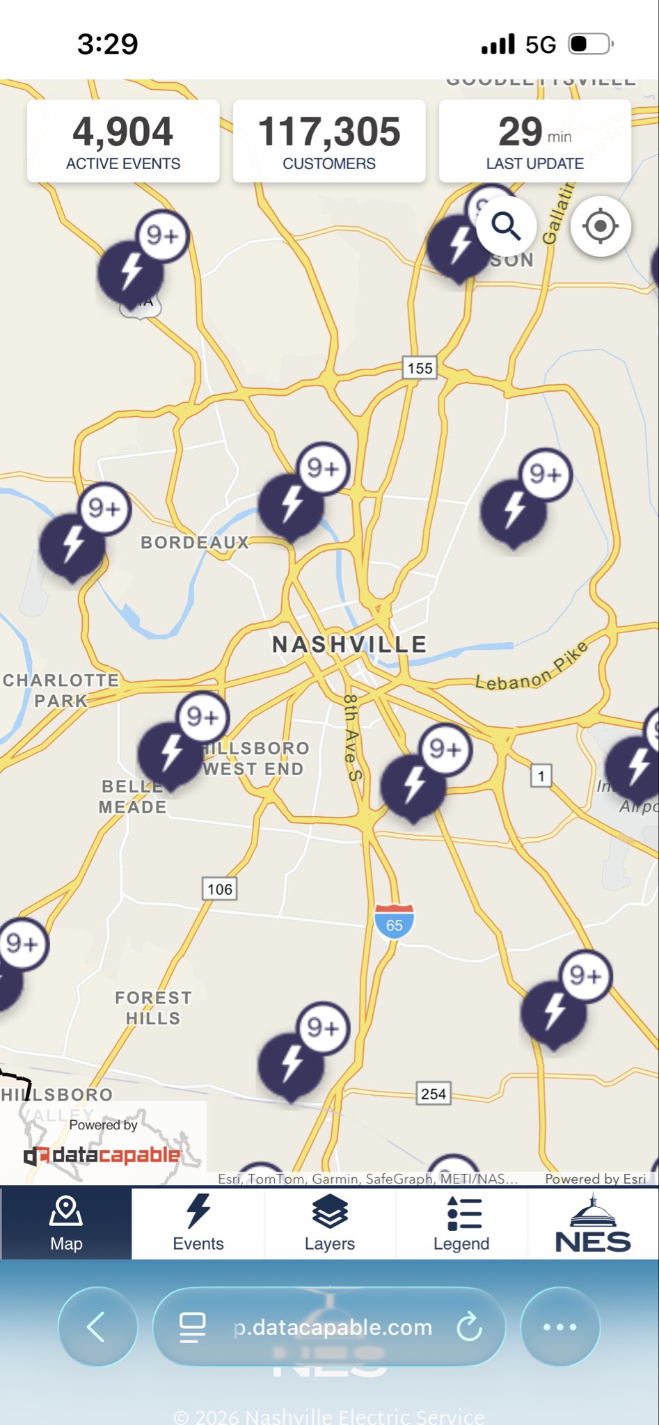
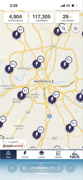
Yeah, to Jax's point, much of metro and points south has looked like a warzone in recent weeks. Almost as if an EF-0 tornado the size of a county swept through. Definitely an historic storm that no one will miss. Hopefully, next year we'll be able to secure more fond winter memories. Wish more people could have had my outcome in the sense we didn't lose power against a better sleet/freezing rain ratio.
-
Doesn't look great rest-of-the-month. Hopefully, we can have one more forum-wide storm to track before spring. I'm enjoying the winter break for sure, but not ready to say goodbye entirely.
-
A cumulative ice + snow map might be more interesting, though that won't make most in Middle TN any happier. Glad I somehow got in the blue.
-
Total snow since 1/19/26…

-
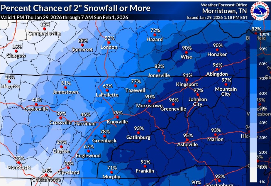
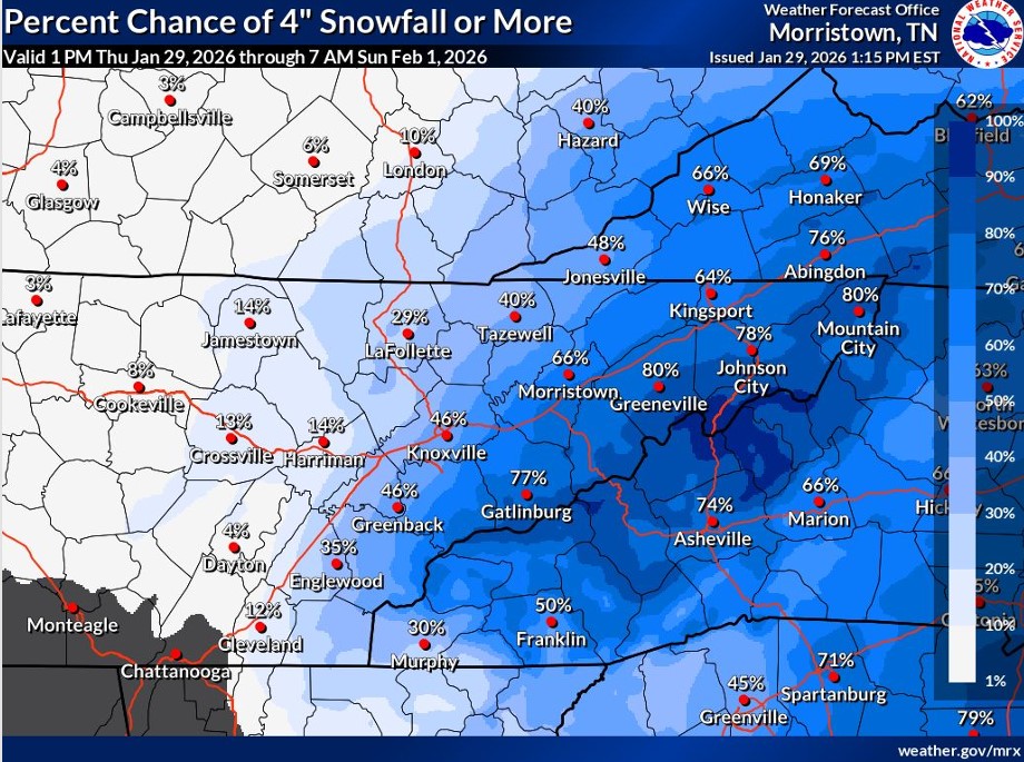
I mean, it’s an east TN special. The threat is far from forum wide.
- 782 replies
-
- 2
-

-
- extreme cold
- snow
- (and 1 more)
-
Is the RGEM still showing the most snow for the plateau?
-
Could be worse. Could be last night's version of Kentucky.
- 782 replies
-
- 2
-

-

-
- extreme cold
- snow
- (and 1 more)
-
Middle TN needs a prayer. No kidding!
- 782 replies
-
- 1
-
-
- extreme cold
- snow
- (and 1 more)
-
Agreed on the RGEM. I honestly didn't think Middle TN would be in this game at all. I take it the UL is cutting further west?
-
*Sigh*. 6z NAM giveth, 12z NAM taketh away.