*Flash*
-
Posts
925 -
Joined
-
Last visited
Content Type
Profiles
Blogs
Forums
American Weather
Media Demo
Store
Gallery
Everything posted by *Flash*
-
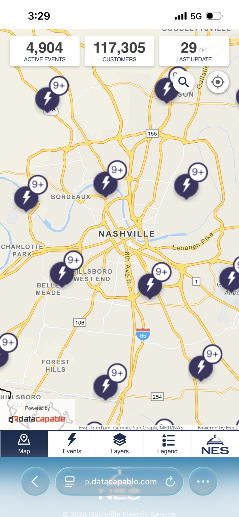
Officially in the hatched risk zones for tonight. We'll see what Dickson County gets out of all this. Should be a wild ride with little to no sleep! Also, it will be interesting to see what damage survey teams obtain in their assessments with so much of the mid-state plagued by severe drought post-ice storm. That's the sneaky fly in the ointment in all this. 50-60 mph winds may have more of a 60-70 mph effect.
-
Exactly. I get that primary cluster was overperforming into the mid-state but there was still time to issue a watch. SPC did issue a MD highlighting counties, though by then, the deck had been reshuffled and those established risk zones were obsolete. 99.9% of people aren’t paying attention to those discussions unless they’re promoted by a local weather authority. Bottom line: The now-casting reluctance is a tad concerning. Hopefully, SPC isn’t as gun-shy next time.
-
I'm confused as to why a Severe Thunderstorm Watch wasn't issued for parts of Middle Tennessee last night. We had plenty of warnings west of town and trees/power lines down throughout Dickson County (among others). IMHO, a watch should have been set based on ground truth coming out of Kentucky. I know SPC works with the local offices on these things. Certainly, OHX did their job on the warning side. I'm sure pro mets can speak to this better than I could, but either way, I got to think it's not a great look when you have warnings plastered on a RVA grid without the watch backdrop.
-
I'll take any pattern change at this point. I can't recall the last time we were this warm and dry so early with little to show in the moisture/severe weather potential departments. The past month has been like 2007 and 2012 hooking up. No bueno.
-
Need the plateau to score just once before spring arrives. A 4-6" pure snow event would be icing on the cake.
-
TennesseeWx peeps are throwing the towel on winter and posting their grades already. I'm still a month away from doing any sort of recap.
-
Pretty wild to think BNA just went above average on its CF6, a testament to the air mass behind Winter Storm Fern. Lows still a degree below normal as of today.
-
After last year, I'm tempted to move from TV to OV. Would be nice to not be so multi-favorable teleconnection dependent. If you can't beat 'em, join 'em. On a separate note, that 0z GEM run fits Carver's narrative well. Seems like March might come in like a lion one way or another.
-
True, but it’s for the love of the game. I embrace my limitations as long as the kiddos are maxing on fun.
-
Yeah, to Jax's point, much of metro and points south has looked like a warzone in recent weeks. Almost as if an EF-0 tornado the size of a county swept through. Definitely an historic storm that no one will miss. Hopefully, next year we'll be able to secure more fond winter memories. Wish more people could have had my outcome in the sense we didn't lose power against a better sleet/freezing rain ratio.
-
Doesn't look great rest-of-the-month. Hopefully, we can have one more forum-wide storm to track before spring. I'm enjoying the winter break for sure, but not ready to say goodbye entirely.
-
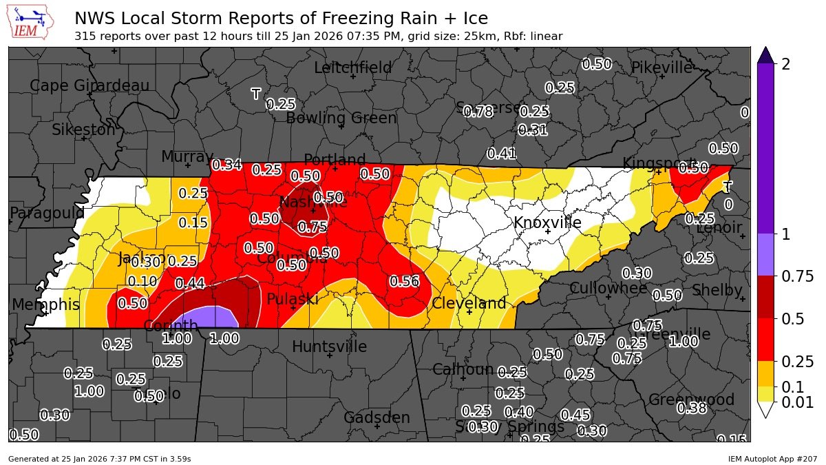
A cumulative ice + snow map might be more interesting, though that won't make most in Middle TN any happier. Glad I somehow got in the blue.
-
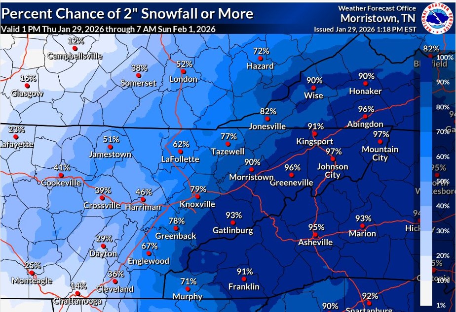
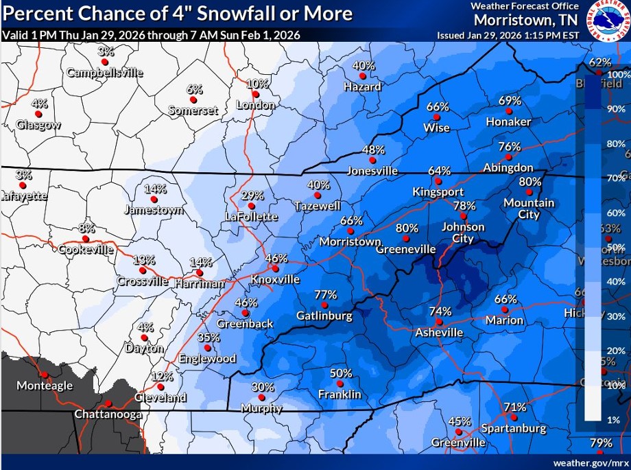
Total snow since 1/19/26…

-
I mean, it’s an east TN special. The threat is far from forum wide.
- 782 replies
-
- 2
-

-
- extreme cold
- snow
- (and 1 more)
-
Is the RGEM still showing the most snow for the plateau?
-
Could be worse. Could be last night's version of Kentucky.
- 782 replies
-
- 2
-

-

-
- extreme cold
- snow
- (and 1 more)
-
Middle TN needs a prayer. No kidding!

- 782 replies
-
- 1
-
-
- extreme cold
- snow
- (and 1 more)
-
Agreed on the RGEM. I honestly didn't think Middle TN would be in this game at all. I take it the UL is cutting further west?
-
*Sigh*. 6z NAM giveth, 12z NAM taketh away.
-
BNA just went below by half a degree. Crazy tale of two halves.
-
 Closing things out with a new time lapse! Hopefully, next time that 18-24" 5-day forecast will stick...
- 618 replies
-
- 3
-
-

-
- observations
- obs thread
- (and 1 more)
-
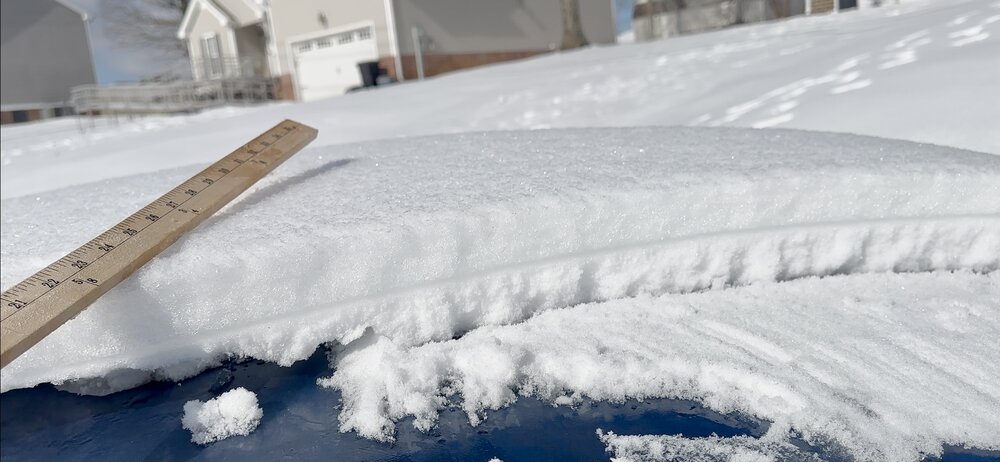
Storm evolution as noted from the top of my car. About 2” of snow, 1” of sleet, and 0.50” of freezing rain. You can clearly see the two waves here.
- 618 replies
-
- 11
-
-
- observations
- obs thread
- (and 1 more)
-
Ended up with ~3.5 inches of snow/sleet/freezing rain in White Bluff. Yesterday was definitely the day to enjoy the snow. Now it's like walking on an ice shelf. No fun! Like others, I'm also concerned about the drought continuance, but I will say this. Maybe the NW trend will be out friend just one time before the winter is over. I'm perfectly fine playing the role of the Ohio River should another Fern emerge to our south/southeast on modeling.
-
But for the entire state, we’re living’ on a prayer, one way or another. Whoa ohhh… Side note: Jeff, could the colder trend lead to a longer period of sleet at BNA before the freezing rain?