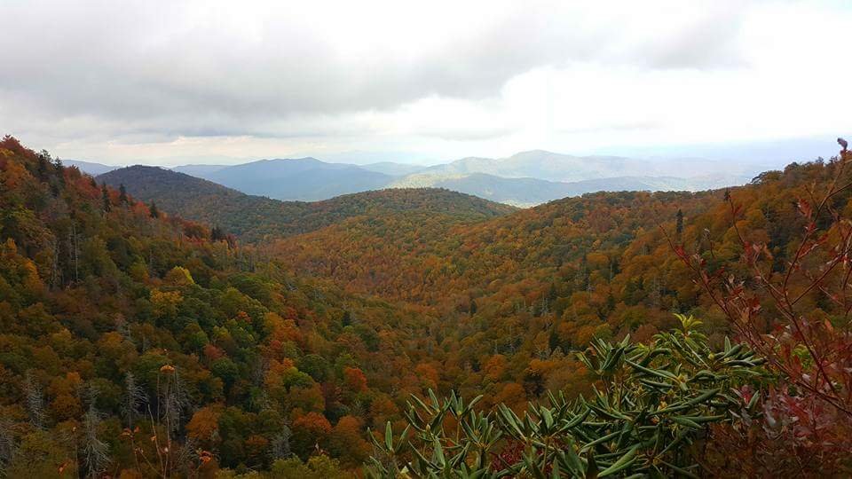

BlueRidgeFolklore
-
Posts
725 -
Joined
-
Last visited
Content Type
Profiles
Blogs
Forums
American Weather
Media Demo
Store
Gallery
Everything posted by BlueRidgeFolklore
-
 If you're asking a New Yorker, compared to Sandy, this storm was a bust.
-
Video from Southport. https://twitter.com/bucksabound/status/1040594886137991168
-
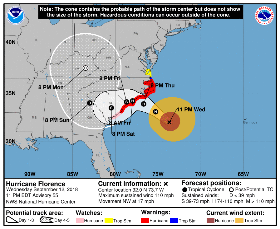
Major Hurricane Florence: STORM MODE THREAD
BlueRidgeFolklore replied to stormtracker's topic in Tropical Headquarters
City of New Bern is updating the flooding on their arcGIS site. http://newbern.maps.arcgis.com/apps/View/index.html?appid=158479a2afec4529836b67f7b91d2111&extent=-77.0694,35.1080,-77.0283,35.1238 -
https://twitter.com/StormVisuals/status/1040253237616619520
-
I am a mountain boy so please pardon if this is a stupid question but do the beaches of Brusnwick County's E to W orientation dampen, enhance or have no impact on the effects of storms like this?
-
Major Hurricane Florence: STORM MODE THREAD
BlueRidgeFolklore replied to stormtracker's topic in Tropical Headquarters
-
2018 Mountains and Foothills Spring/Summer thread
BlueRidgeFolklore replied to FlatLander48's topic in Southeastern States
Met! Good to see you. You heading this way anytime soon? -
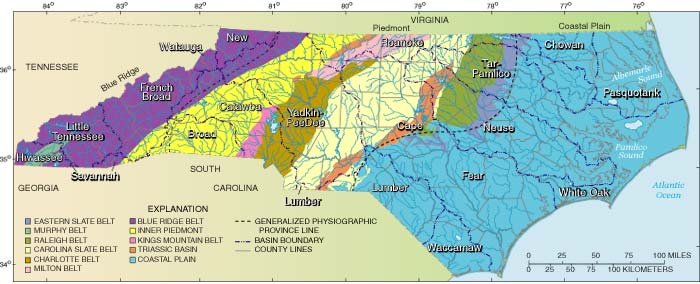
You do realize that nearly all of ENC is essentially just a large coastal pain, river basin, right?
-
You obviously don't understand how vulnerable Eastern NC is with these storms. Matthew hit as a Cat 1 and killed 26 people in NC and $1.5 billion in damages. If even half of the total rain projections verify, this could end up catastrophic for SE NC and SC.
-
2018 Mountains and Foothills Spring/Summer thread
BlueRidgeFolklore replied to FlatLander48's topic in Southeastern States
Can anyone lay their hands on any projected win probabilities for our area, based on the latest runs? -
2018 Mountains and Foothills Spring/Summer thread
BlueRidgeFolklore replied to FlatLander48's topic in Southeastern States
That was my biggest fear. That mirrors the totals from Hurricane Frances and Hurricane Ivan over that one week period back in September of '04. It got ugly around here. -
2018 Mountains and Foothills Spring/Summer thread
BlueRidgeFolklore replied to FlatLander48's topic in Southeastern States
Foliage is the least of my concerns. Mudslide city is my main concern. -
2018 Mountains and Foothills Spring/Summer thread
BlueRidgeFolklore replied to FlatLander48's topic in Southeastern States
Welp! Now is about the time we start the fall and winter speculation! It's good to be back. Watch out for the rain this week! -
Mid to Long Term Discussion 2018
BlueRidgeFolklore replied to Cary_Snow95's topic in Southeastern States
Photoperiod plays a larger role in seeing plants sprout, than weather. I've noticed the sun hanging higher in the sky in the last week. -
Mid to Long Term Discussion 2018
BlueRidgeFolklore replied to Cary_Snow95's topic in Southeastern States
I honestly wouldn't mind a warm up. We've been dealing with snow, ice and cold in the MTNS since late October. Give me a warm Feb to get the boat and camper in order before Spring fishing. -
Mid to Long Term Discussion 2018
BlueRidgeFolklore replied to Cary_Snow95's topic in Southeastern States
We have guys here that haven't seen in a measurable snowfall in years. In Asheville we got 14" just last month. We got nearly a foot last year and a foot and a half the year before that. Our winters are have been doing pretty good as of recently in terms of getting a good snowstorm or two. Count your blessings. -
https://twitter.com/AggieFootball/status/938954075521081344?s=17 https://twitter.com/AggieFootball/status/938951483462168576?s=17
-
Yea, from Henderson to Macon will see a good hit I think.
-
Southeast Sanitarium - A Place to Vent
BlueRidgeFolklore replied to Jonathan's topic in Southeastern States
We've driven this road many times. It still may surprise all of us however. -
Southeast Sanitarium - A Place to Vent
BlueRidgeFolklore replied to Jonathan's topic in Southeastern States
Dutch Cove is just south of Canton, NC, in Haywood County. -
Southeast Sanitarium - A Place to Vent
BlueRidgeFolklore replied to Jonathan's topic in Southeastern States
Very unwise, especially considering it's already been snowing in those areas. It's already getting slick and you haven't even decided if you're leaving yet. -
Southeast Sanitarium - A Place to Vent
BlueRidgeFolklore replied to Jonathan's topic in Southeastern States
Good question but I would assume it's because they're AI. They have to be programmed to reason, whereas we just understand it based on past events. -
Southeast Sanitarium - A Place to Vent
BlueRidgeFolklore replied to Jonathan's topic in Southeastern States
We heard this last week too and 3 days later we had something to keep an eye on.


