shaggy
-
Posts
7,696 -
Joined
-
Last visited
Content Type
Profiles
Blogs
Forums
American Weather
Media Demo
Store
Gallery
Everything posted by shaggy
-
https://x.com/ReedTimmerUSA/status/1793091049566675245?ref_src=twsrc^google|twcamp^serp|twgr^tweet
-
DOW recorded winds over 200mph with the greenfield tornado
-
I think he took it down but was watching when he transported that wounded family to the hospital. That was tough to listen to. I bet his adrenaline was through the roof.
-
Might be one of the biggest pressure drops in history. Anyone have the stats on that?
-
The ATL has had its fair share of majors as well
-
Dang https://www.tropicaltidbits.com/sat/satlooper.php?region=15W&product=vis_swir
-
Guam and Rota dodged a bullet as blohaven has exploded after passing by the islands. https://www.tropicaltidbits.com/sat/satlooper.php?region=15W&product=ir
-
Should see it drop fast as the winds rotate to the SW. Couldn't have come quick enough as they were approaching major flood stage downtown with a 6.69 foot level......major starts at 7 feet
-
Been gusting into the 40s for 5 or 6 hours with maybe a few touching 50.
-
Need that center to tuck a little west under that convection
-
Hi res are all more cape fear to lookout globals more over bogue banks to obx
-
Seems to be 2 camps. Hi res models are much stronger and show a stronger capture with the west turn before releasing it north. All show a potential hurricane. Globals don't show as much of a capture or as strong of a system
-
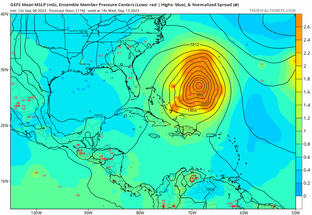
I believe Gustav 2004 also quickly developed as it moved onshore SC. Nothing suggest anything similar here though
-
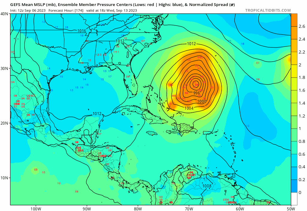
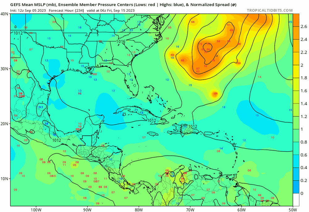
In this situation the hybrid or ST will likely bring bigger impacts to larger areas of the coast versus a true TD/TS. Gfs has a decent area of gale force winds up the southeast coast far away from the center
-
Icon coming in the furthest east at 12 with a weak low with the strongest winds displaced far to the north. Certainly not a fully tropical look to it was
-
Had a few flirting with the OBX

-
0z Hafs-A is coming in south of 18z by a good but. At 18z it was just about to hit 23N and now at the same time frame its just about to hit 22N so almost 1 whole degrees.......if my tired eyes are reading it right
-
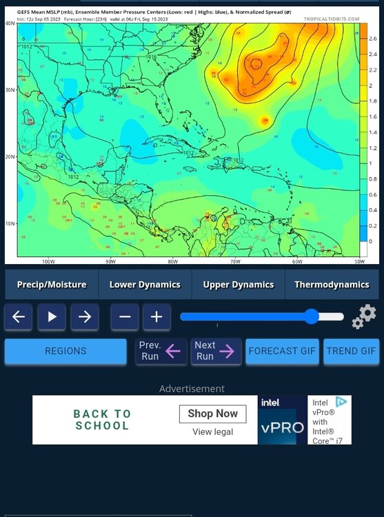
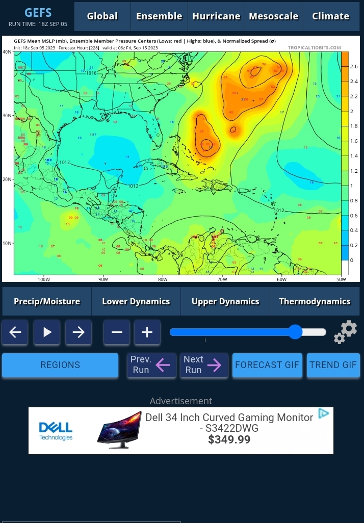
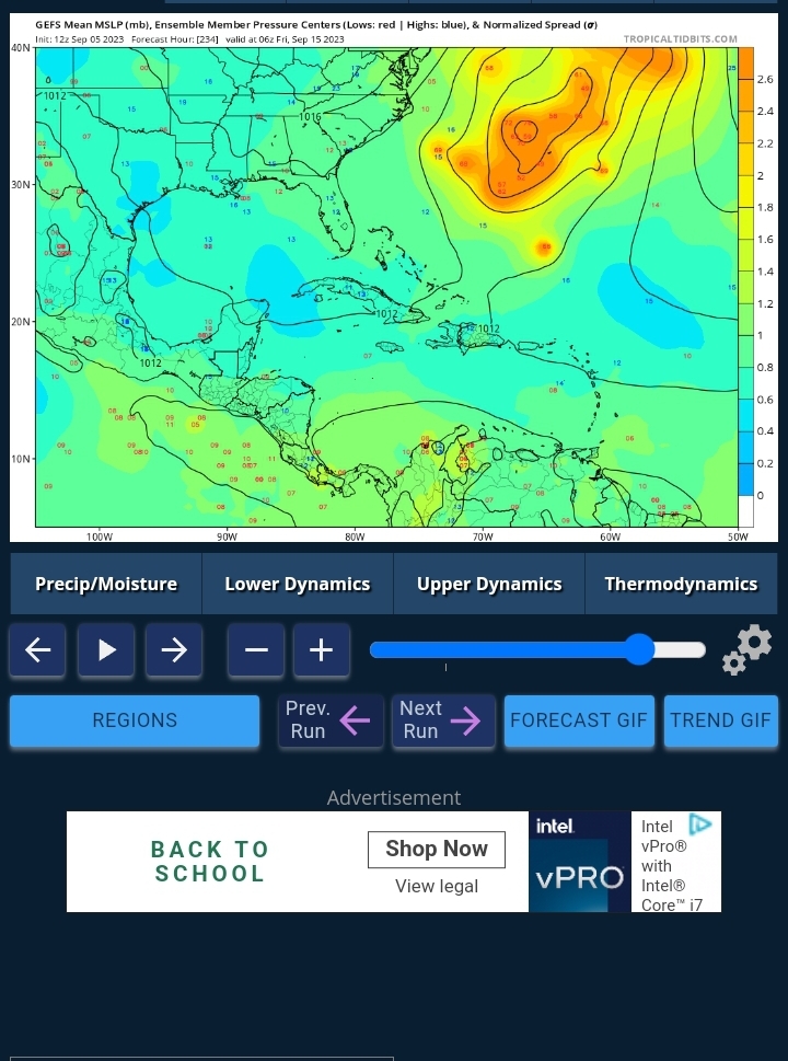
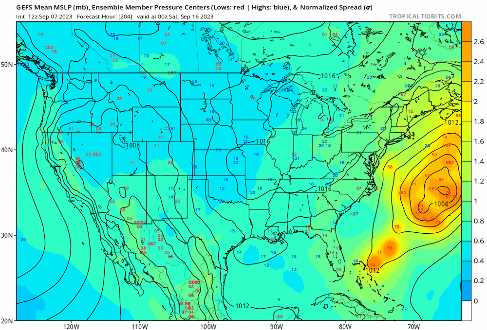
Gefs spread really opened up again threatening the NE even more again. Also did I see the hafs-A jump almost an entire degree south at 0z out to 75hrs
-
Until the turn is made NE needs to watch this one
-
Well then
-
Still such a huge spread and enough run to run inconsistency to be patient and cautious at the same time
-
How anyone cN take a look at the gefs at 11z with the huge differences in timing spread and location spread and say what the deal is right now is funny to me. It could be off Nova Scotia or that one member doing an Irma track
-
Not necessarily. 1996 is a good reference in regards to a strong recurving cane followed by a east coast hit a few days later
-
Intriguing
-
Am I wrong in thinking this is a major shift in the ensembles? EDIT