burgertime
-
Posts
11,230 -
Joined
-
Last visited
Content Type
Profiles
Blogs
Forums
American Weather
Media Demo
Store
Gallery
Everything posted by burgertime
-
For everyone watching we need that ridge in the northwest to act as the highway to to the south. The energy in the NE to play the perfect game of suppression/relief and for the 00z GFS to work out some northern energy to drop down and juice our system.
-
Bingo. It's hilarious to me a model made specifically for Germany who europeans mainly use for short range is used so often here. (me being the worst offender of course)
-
It's trending towards the GFS
-
Someone needs to show the individual EPS panels of the Euro I'll bet a lot of them are total crush jobs.
-
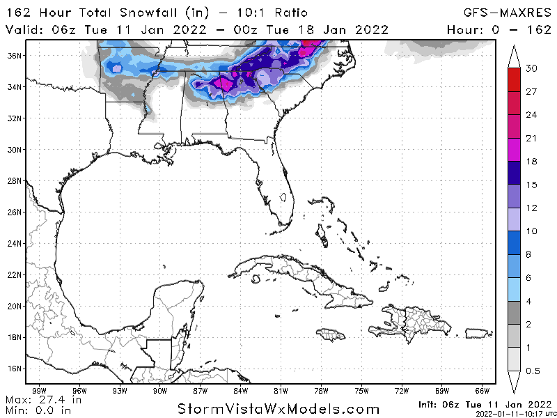
6z EPS again goes towards the GFS. Not the monster GFS is but a nice low track with an I-85 special. RDU east across much of the state is 4+. Not so far east with that 4+ as the 00z. Sorry @ILMRoss
-
6z EPS has the look you want.
-
6z EPS is gonna look good. Energy is digging more. Better look in the NE compared to the 00z.
-
There's spread but the overall setup is there which is the key. Also it appears the Euro keeps taking more steps towards the GFS. Gut feeling is we see some consolidation at 12z...but a long with the others the GFS looks too amped.
-
It's really either wanting to make your day or be a huge let down. Hope this keeps it up cause what a wild storm with possible mountains to coast snow.
-
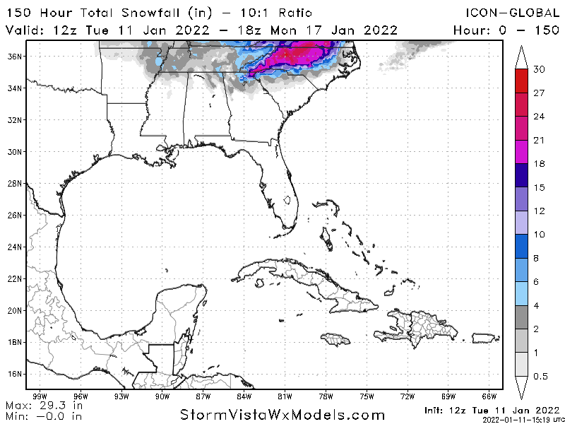
Here it does extremely well in the 84 - 100 hour range but is a bit useless beyond that. 6z looked to me like it's starting to cave to the GFS too just doesn't know it yet lol.
-
Reminds me of my old profession
-
6z Euro run looks better at 500mb compared to the 00z run. Is a little faster and doesn't have as much separation with the northern stream.
-
I can see that haha. Still come on man, you surely have learned something to give a little bit of perspective. I want you to be better!
-
I've got one too...but if you came here you'd have to sleep on the roof.
-
Damn @Brick Tamland how you been here for this long and still copy and paste the same responses?
-
Agree. GFS overamping and Euro pushing south right now means a solution in the middle will be good for everyone.
-
You gotta free room and a tour guide
-
GEFS see's the system further south than the 00z run. Also has a stronger low off the coast. Can't wait to see what the 12z Euro has to say. I'll bet it makes a jump today.
-
It's likely it could be colder IF of course the 00z and 6z are right. Too good to be true all that..
-
Also this is just pure speculation but I've found with these big wound up storms you tend to get a low tracking behind it as nice little bonus a day later. So we could see two rounds. Something to look for a day or two before the storm.
-
Yep, always when we're on the outside looking in....but hey you got sun and waves. All I got is cold barren trees to look at.
-
With this setup you'd see thundersnow across much of the state. Again grain of salt all that but if this is a solution then a large swath of the state would be under heavy snow and blizzard warnings. Given the cold air in place and the placement of that low RDU west would be getting some big ol heavy flakes. If only I didn't have a business to run and had an extra 3k in the bank for an emergency flight
-
These storms usually get the job done for the coastal areas at it pulls away. My guess would be the GFS starts moving further south each run and the Euro meets in the middle. So this could be a run that might pan out. This is THE look you want for everyone in the state. Lots of other states get in on the action as well.
-
Cut totals in half that's still an 8-12 inch snow storm for much of the state. If the GFS was correct I think these numbers would be higher. That is a storm and and a half there. Now we need the Euro to catch on.
-
Wow.