

burgertime
-
Posts
11,230 -
Joined
-
Last visited
Content Type
Profiles
Blogs
Forums
American Weather
Media Demo
Store
Gallery
Everything posted by burgertime
-
@39 heavy precip is moving in and temps are crashing. Matching up close to the GFS and Euro.
-
This is weird run...LP is further south and slower. Temps rise, but then it looks like a good CAD setup is gonna reinforce and save the day. It's at hour 34 and outside of far western NC, much of NC hasn't seen any real precip yet.
-
This run of the NAM looks like it's slower with the LP system as well. Def a lot less wet for the I-85 corridor out to 27.
-
18Z NAM out to 24 it's a touch colder than the 12z run.
-
NAM isn't as wet with the onset of snow compared to 12z. Still has precip breaking out but stays around GSP. Out to 21 hours.
-
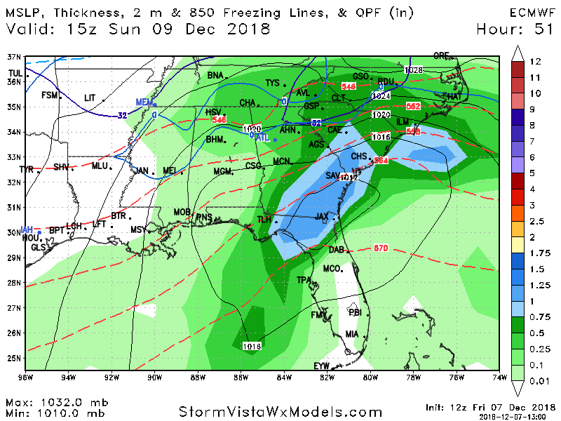
Just playing devil's advocate but this would likely be one huge sleet storm for those south of I-40 in NC. That thickness level is conducive for sleet and in CLT I would even bet it would be mixing a lot with ZR. Of course this is just reading this map verbatim so take it with a grain of salt. NAM/RGEM are** going to be a better guide from here on out. **Edit - 850's are between 0 and -4 on the Euro, I would feel more comfortable if NC was on top of that 546 line.
-
On the torchyness I guess not lol....this is what I get for trying to do this while out in public.
-
Euro looked pretty torchy to me but just glancing at it.
-
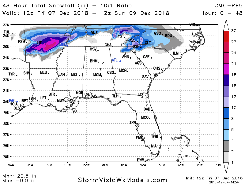
So 1 inch of snow for CLT?
-
GFS out to 18 is a little bit colder. Good trends happening.
-
Maybe it's on crack? I have no clue since I just have accumulation maps. Very strange indeed but usually RGM is money.
-
Have limited maps on SV so have no clue how it got there.
-
Very good point!
-
This looks damn good. 12z RGM at 48 hours.....well before the storm is over. By the way I can't stress enough how SV is only $20 a month. Well worth the cost.
-
I want to see the RGEM. I'm betting that the models keep creeping that cold further down into Canada to help usher in colder air. My guess is it'll get better.
-
Congrats you might deserve this the most
-
Looking in great position based on the NAM! AVL might be the place to be.
-
For folks along I-85 GSP to CLT as usual it's gonna be a battle between sleet and snow but if we can get just enough cold air those totals could easily be higher.
-
To Wow's point if you look at hi-res precip type you can see now it's more of a rain/snow battle then flips to sleet for most. I still think this trends colder and you get snow creeping further south. Plus with so much moisture and again thickness right on the edge it should flip it to snow for the most part.
-
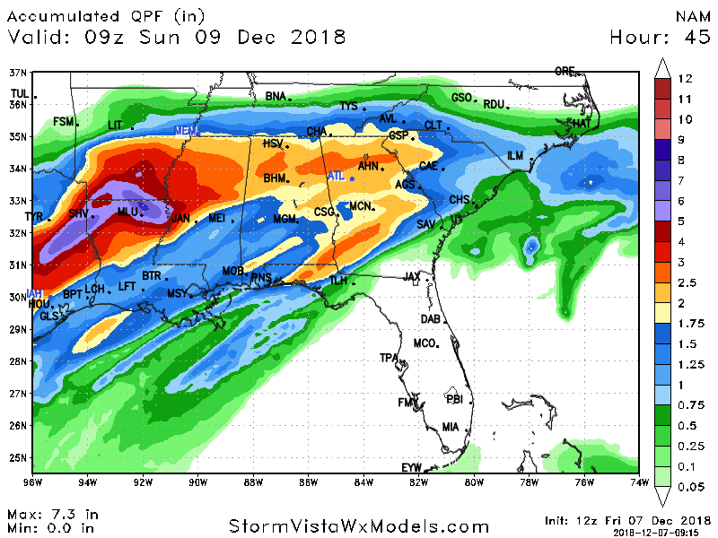
Go home NAM you're drunk. This run is bonkers...just bonkers. Backs up FV3 too...just insane. Guess my gut was right
-
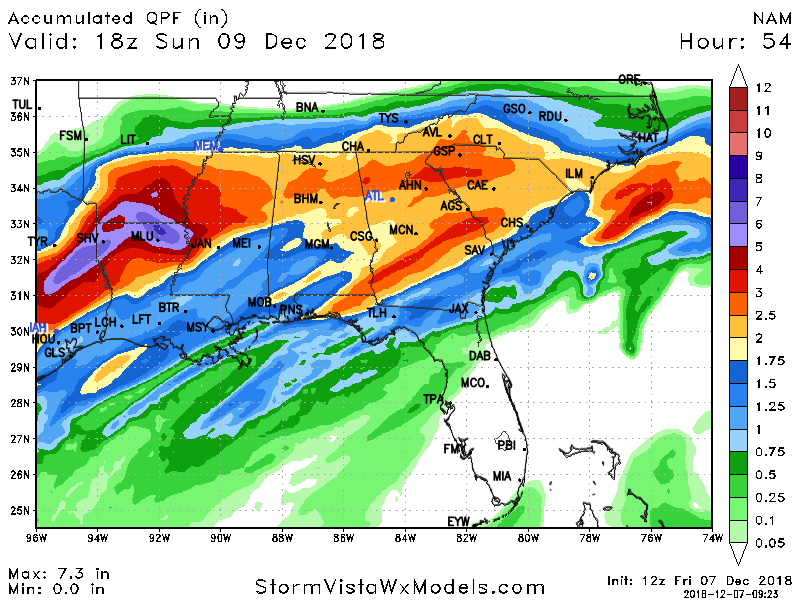
@51 .75 QPF falls across much of WNC/CNC and upstate all snow.
-
If NAM verifies this would be a once in a lifetime storm whether it be ice or snow. There is a TON of QPF with this.
-
This is at hour 48 with more on the way. GSP in the heat of this has low enough 850's and thickness is good enough to keep it all snow until someone digs through the sounding data.
-
GSP cashes in like crazy on this NAM run...gonna be a big BOOM there! Jesus.
-
Gut tells me the 12z suite is gonna get back to glory.


