Random Chaos
-
Posts
908 -
Joined
-
Last visited
Content Type
Profiles
Blogs
Forums
American Weather
Media Demo
Store
Gallery
Everything posted by Random Chaos
-
Dang, they have a coastal flood advisory up too. Guess no snow. Time to write off winter. Bust. I’ll be back in 2023. *end sarcasm*
-
6 hours ago we were saying: "It's the NAM, don't trust it." now we're saying "It's back on board, storm happening!" How I long for the days when all models were this bad I'll take my 14" and run! -- On another topic, COBB output from GFS was indicating 12:1 ratios on average, with some insanely high 22:1 ratios at times. Any chance that will occur? Typically we see 8:1 around here. Also gale warning on the bay. This is going to be fun!
-
Where is CRAS when you need something to make the NAM look good? At least NAM is on its own for now, but I do worry with these systems where we sit on the northwest side being a cutoff forecast challenge. SREFs look good
-
-
-
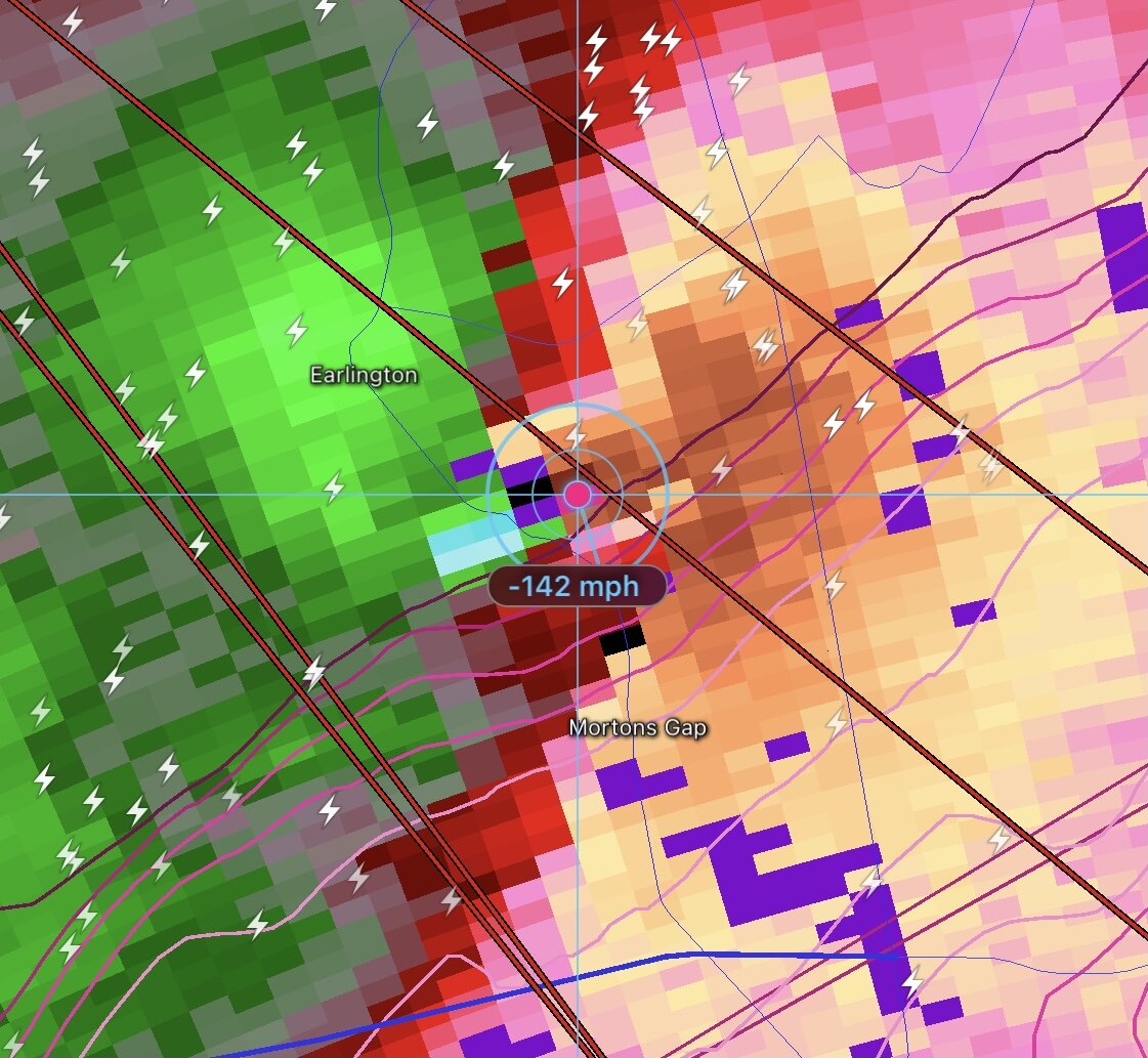
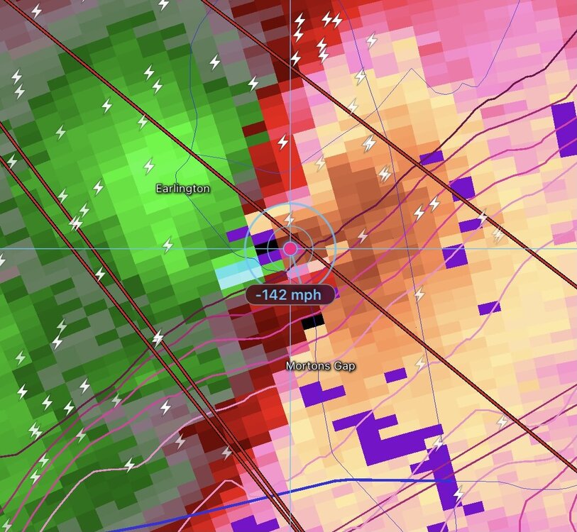
Incredible. This -142mph is right next to a +130mph on radar:
-
I wonder, NOAA Tides and Currents indicates the height was based on high water mark and NWS report on isabel (think it was the SLOSH analysis) indicated Solomons Island guage failed, might be the previous record used by AHPS and LWX is pre-failure height and not the high water mark based height?
-
Not seeing anything close to this on official guages: https://tidesandcurrents.noaa.gov/inundationdb/inundation.html?id=8577330&units=standard&bdate=20211029&edate=20211031&timezone=LST/LDT&datum=MLLW&interval=6&action= Max today MHHW 3.33 ft Isabel MHHW 5.18 ft
-
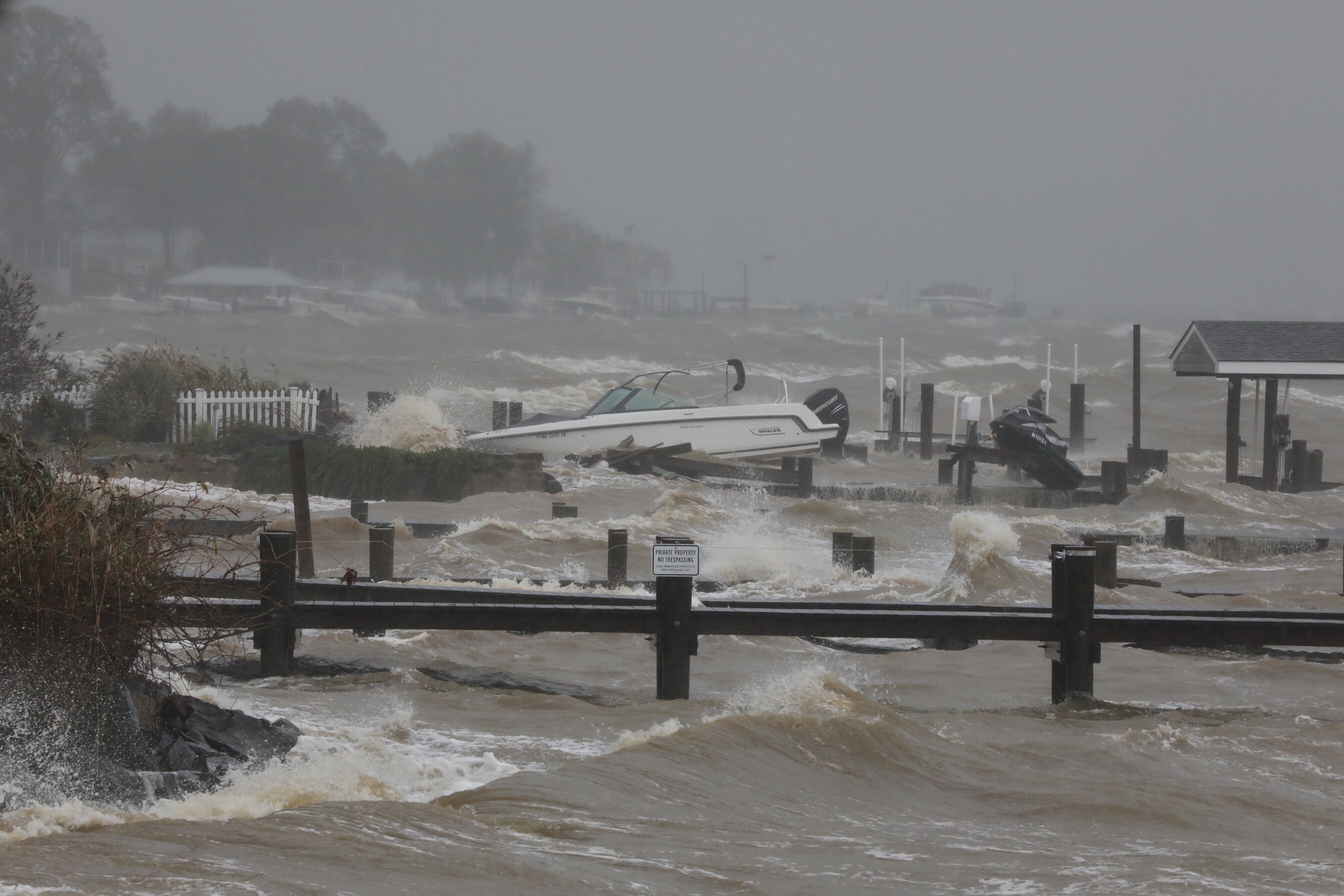
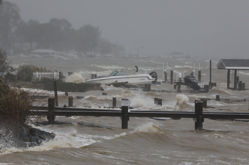
Anne Arundel County, near Chesapeake Bay Bridge:
- 536 replies
-
- 14
-

-

-
2.11" and managed to miss the tornado by a few miles.
-
Here’s some helicopter footage: https://www.wbaltv.com/article/skyteam-11-video-of-aftermath-of-ida-in-annapolis-maryland/37457104
-
Not liking the track of that Annapolis area tornado. Way too close to home. Good couplet, debris ball signature.
-
162kt (186mph) maybe 100m above the surface.
-
132mb vortex message: URNT12 KNHC 291215 VORTEX DATA MESSAGE AL092021 A. 29/11:56:10Z B. 28.47 deg N 089.57 deg W C. 700 mb 2519 m D. 932 mb E. 230 deg 34 kt F. CLOSED G. C20 H. 104 kt I. 059 deg 12 nm 11:51:30Z J. 159 deg 138 kt K. 059 deg 10 nm 11:52:30Z L. 105 kt M. 295 deg 10 nm 12:01:00Z N. 018 deg 133 kt O. 298 deg 12 nm 12:02:00Z P. 9 C / 3038 m Q. 23 C / 3052 m R. 3 C / NA S. 12345 / 7 T. 0.02 / 1 nm U. AF305 1409A IDA OB 11 MAX FL WIND 138 KT 059 / 10 NM 11:52:30Z
-
Frictional effects often pull hurricanes right of their extrapolated track just before landfall. Doesn’t always happen though, and that part of LA is extremely low and flat. Hoping not with Ida as that would be worse for NOLA.
-
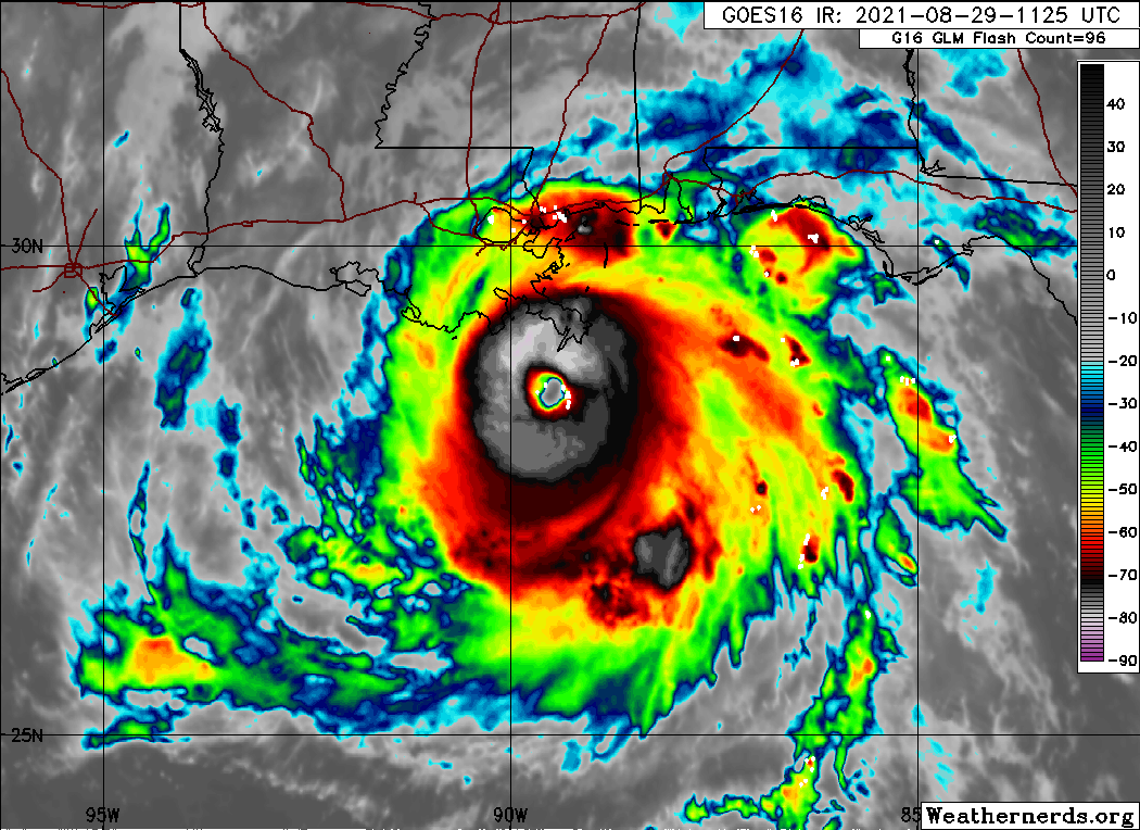
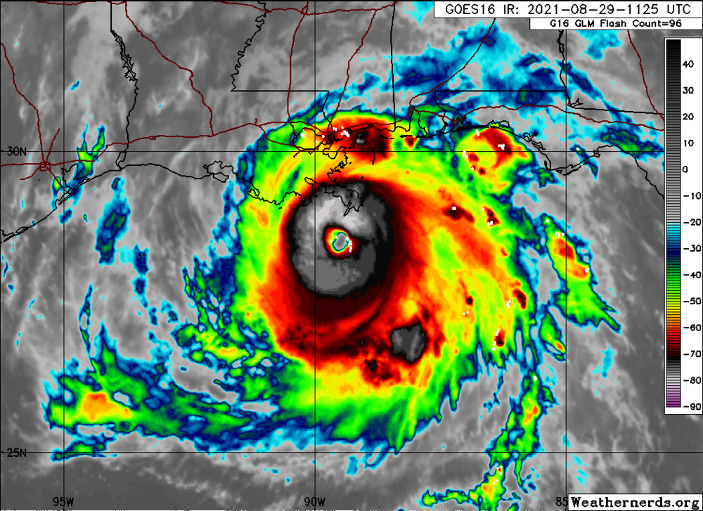
Seeing lightening in the eyewall again:
-
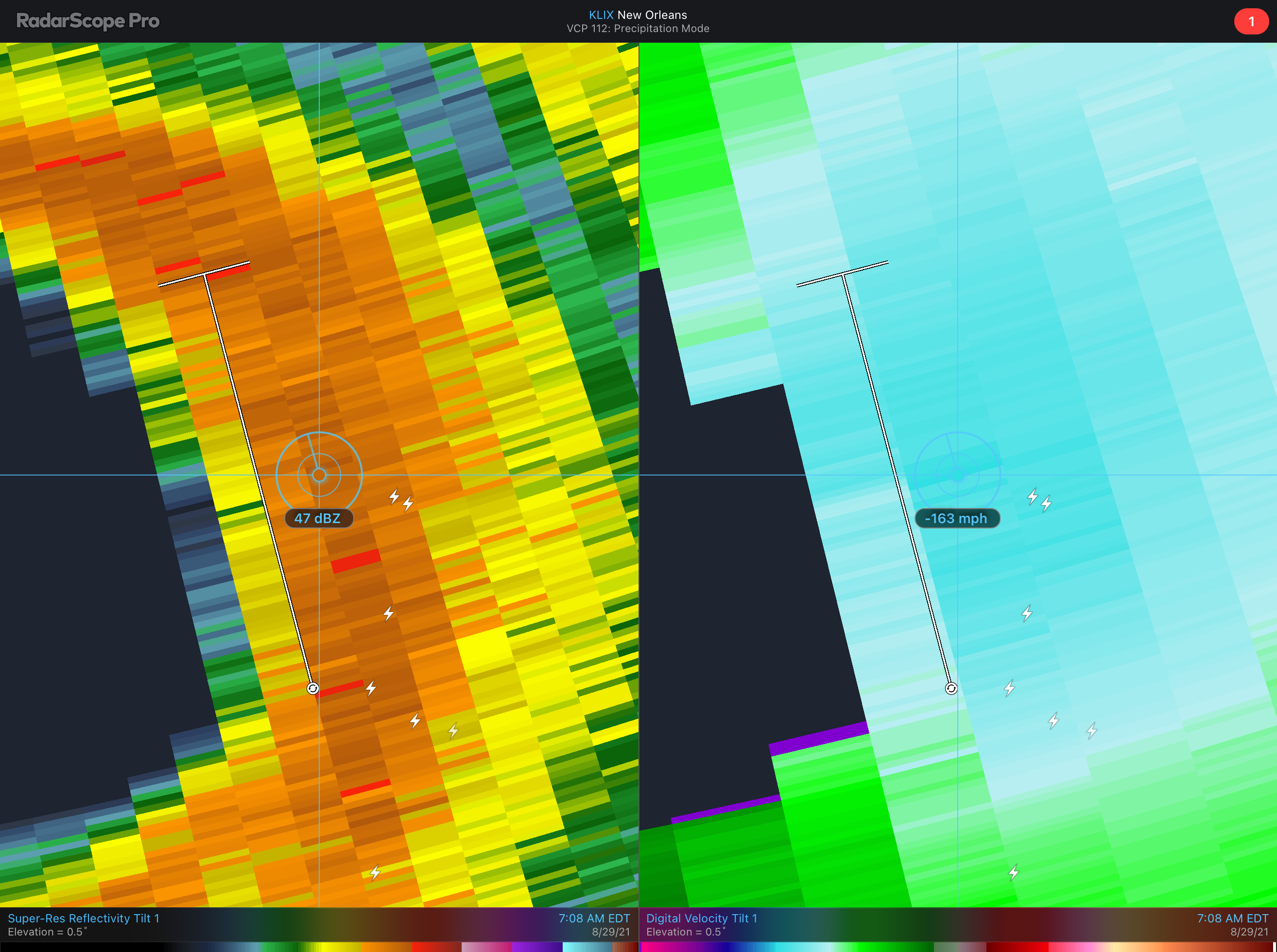
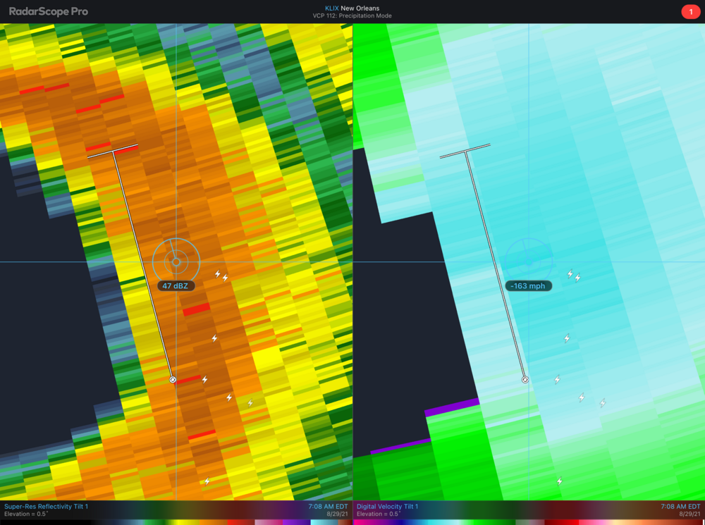
163mph radar indicated at 15k feet.
-
28.2 / 17.6
-

Jan 31st - 33rd Storm Obs and Disco like it's 1979
Random Chaos replied to Bob Chill's topic in Mid Atlantic
Yes, they can use it. -
Jan 31st - 33rd Storm Obs and Disco like it's 1979
Random Chaos replied to Bob Chill's topic in Mid Atlantic
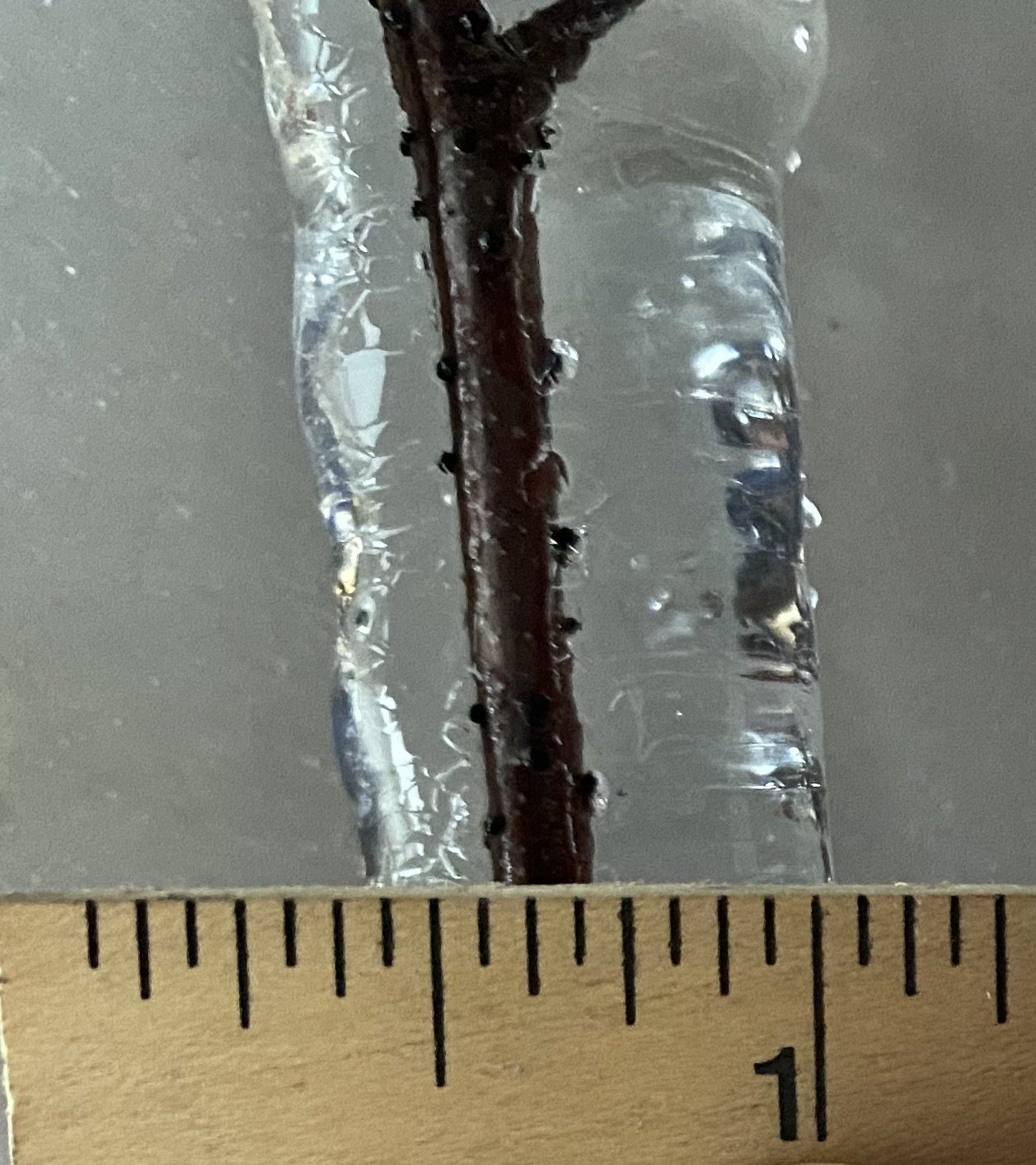
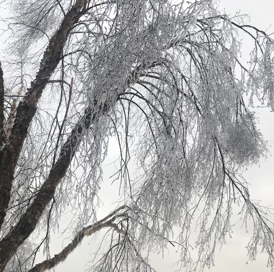
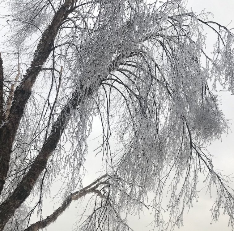
Turned into a major ice storm here outside Annapolis. Looks like around 1/3" accretion.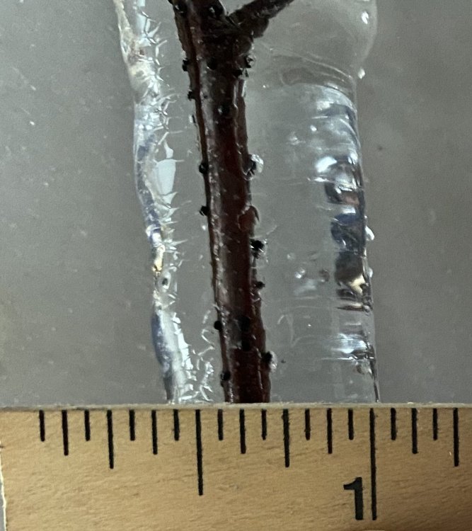
-
Jan 31st - 33rd Storm Obs and Disco like it's 1979
Random Chaos replied to Bob Chill's topic in Mid Atlantic
Freezing rain and temperatures have dropped back below freezing.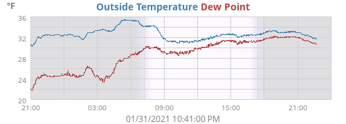
-
I'm ready for Sunday!
-
December 16-17, 2020 Winter Storm Obs/Nowcasting
Random Chaos replied to WxUSAF's topic in Mid Atlantic
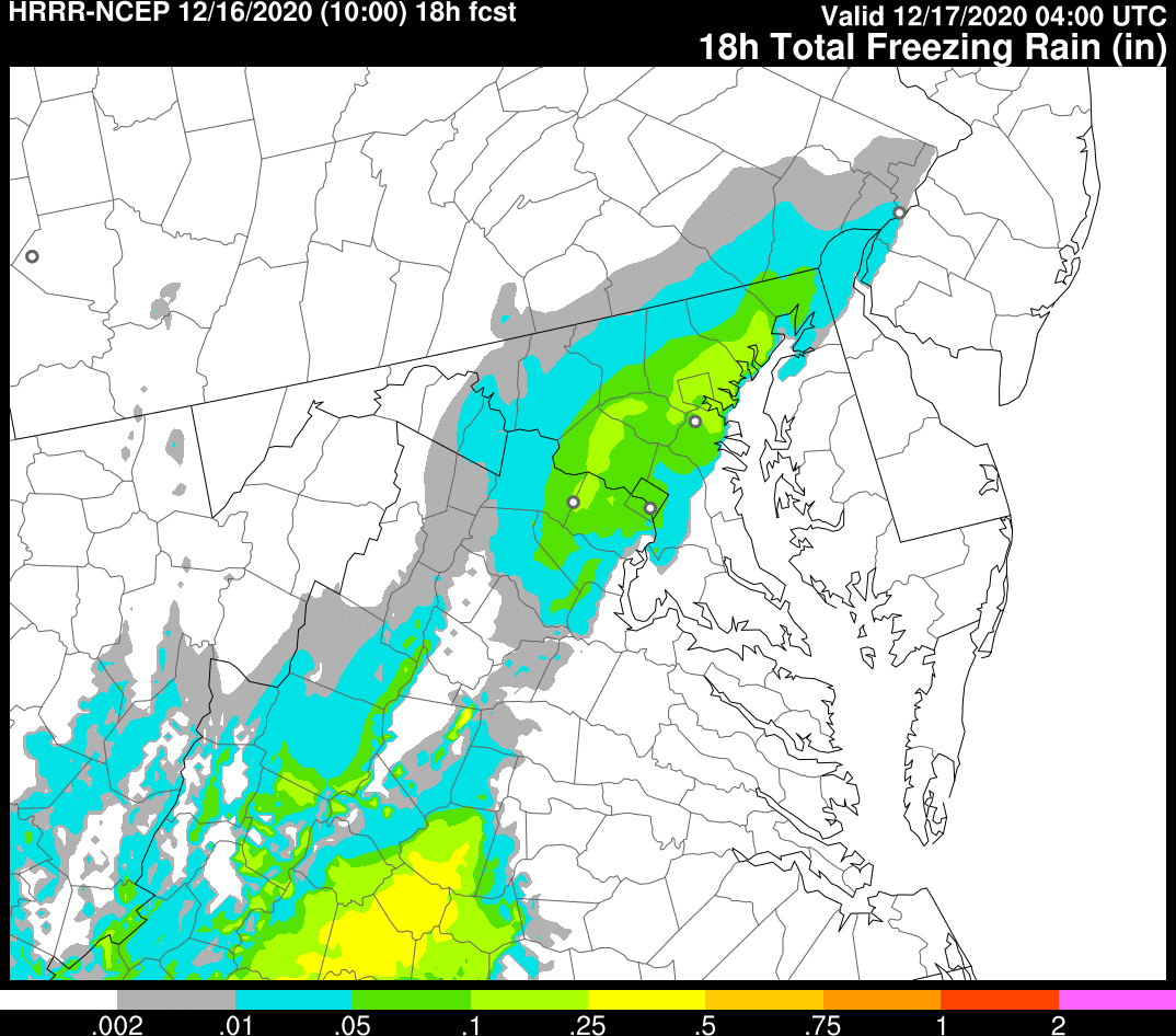
This looks ugly from HRRR (via https://rapidrefresh.noaa.gov/hrrr/HRRR/Welcome.cgi?dsKey=hrrr_ncep_jet )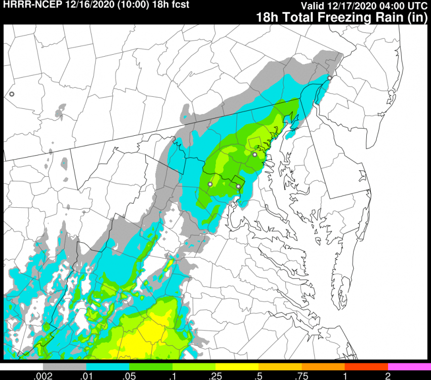
-
Most likely the cruise line will divert and/or go around the storm. The storm is moving at only 8mph which gives a cruise ship plenty of room to maneuver. But still a bit of a head scratcher.
-
One thing that could be preventing an ERC is what appears to be a light consistent easterly shear, which is most evident by the continually reduced convection on the western side. If you think about the properties that make an annular hurricane (and I am by no means saying that Dorian is annular), these are typically light persistent shear, cooler water than what should typically support the system (though not always required), and a lack of banding. This results in a lack of ERCs. With the exception of the cooler water, Dorian has the other properties, and isn't undergoing an ERC (nor does recon indicate any secondary wind maxima developing).