Chinook
-
Posts
10,674 -
Joined
-
Last visited
Content Type
Profiles
Blogs
Forums
American Weather
Media Demo
Store
Gallery
Everything posted by Chinook
-

Mountain West Discussion- cool season '23-24
Chinook replied to mayjawintastawm's topic in Central/Western States
The forecasts for this snowfall continued to be shifted westward. I saw there are blizzard warnings in the area. So, I guess this is happening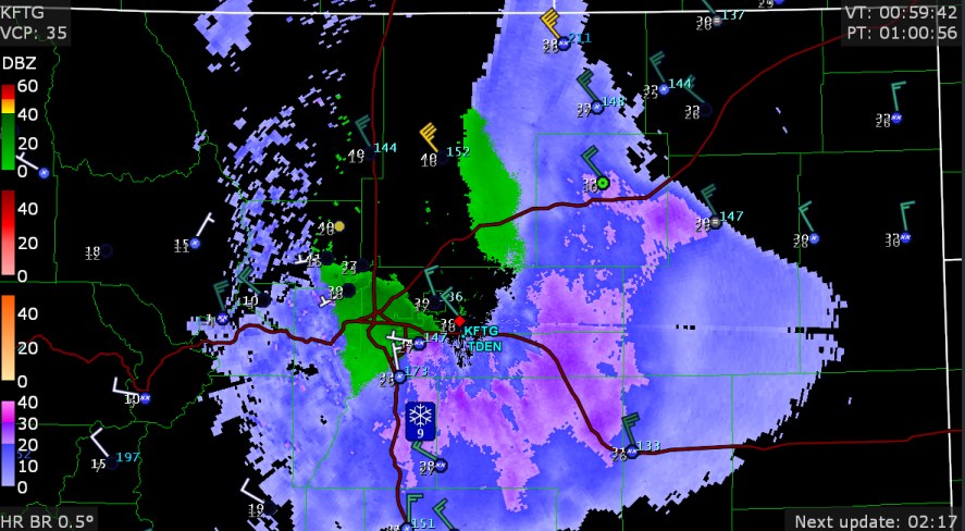
-
yikes
-
59 deg yesterday
-
some people say, "cut-off low, weatherman's woe."
-
Mountain West Discussion- cool season '23-24
Chinook replied to mayjawintastawm's topic in Central/Western States
expanding level of winter storm information / blizzard warnings for the northern Plains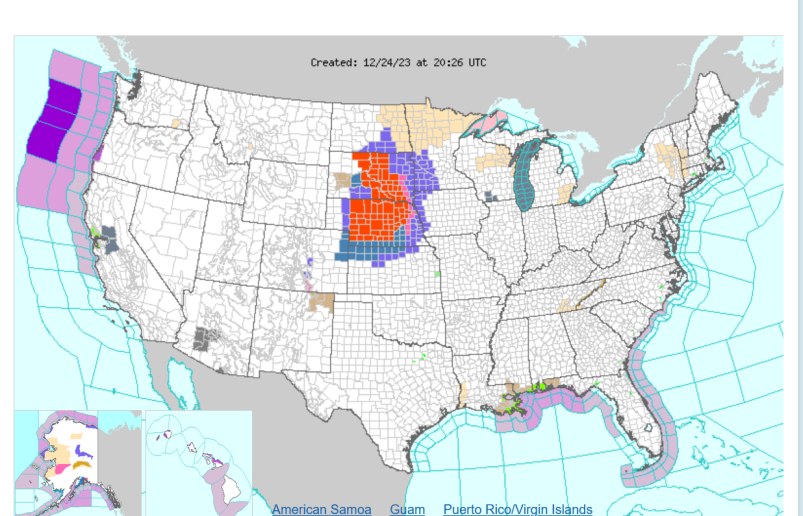
-
Mountain West Discussion- cool season '23-24
Chinook replied to mayjawintastawm's topic in Central/Western States
The NWS is broadbrushing this snow event for Christmas Eve, which seems right. The current models have pretty much zero for Weld County, though.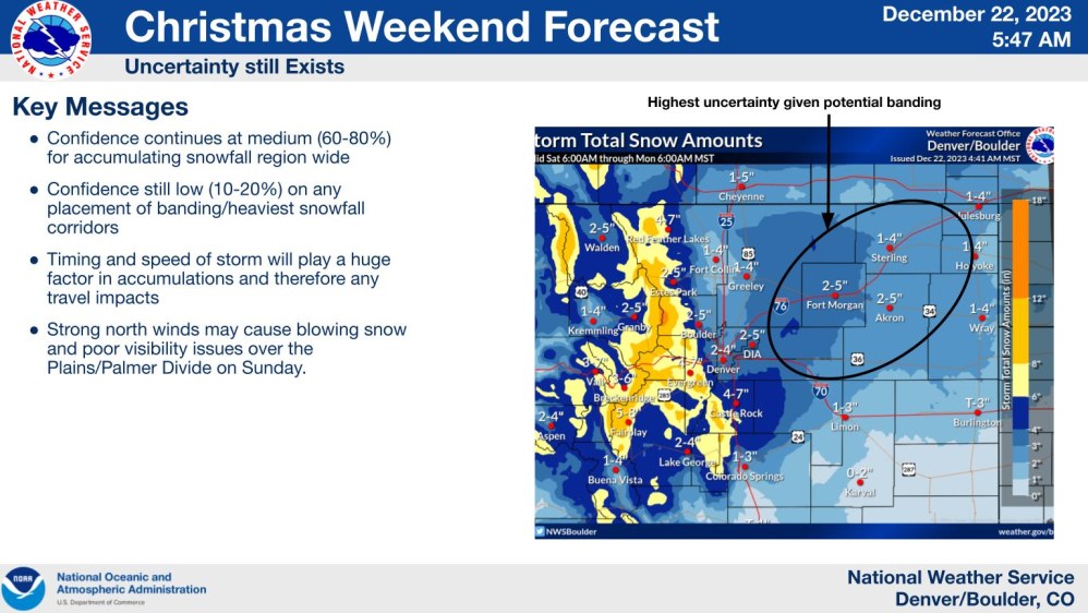
-
New loops https://great-lakes-salsite.web.app/Dec_1_10_2023_250mb_loop.html https://great-lakes-salsite.web.app/Dec_11_20_2023_250mb_loop.html loop specific to our combination storm of the last few days. I find it just fascinating that storm elements combine in wintertime scenarios. https://great-lakes-salsite.web.app/Dec_15_20_2023_500mb_loop.html
-
Mountain West Discussion- cool season '23-24
Chinook replied to mayjawintastawm's topic in Central/Western States
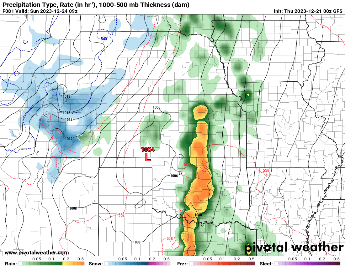
The 00z models are still showing a lot of variations as to how the Christmas Eve snow event will happen. The GFS says that some snow will come in to the Front Range cities as early as 12/23 at 8:00 in the evening. Here is the GFS for 09z, which is 2:00AM on Christmas Eve. Some areas of heavy snow will be in the southwestern portion of Colorado, with southerly flow on the San Juans. There should be varying amounts in the rest of the mountains. The Plains/cities will have a more challenging forecast for snow amounts throughout the entire 24-hour period on Christmas Eve. The models will try to figure out the snowfall rates and maybe try to decide if the temperature will be below freezing, or something helpful like that.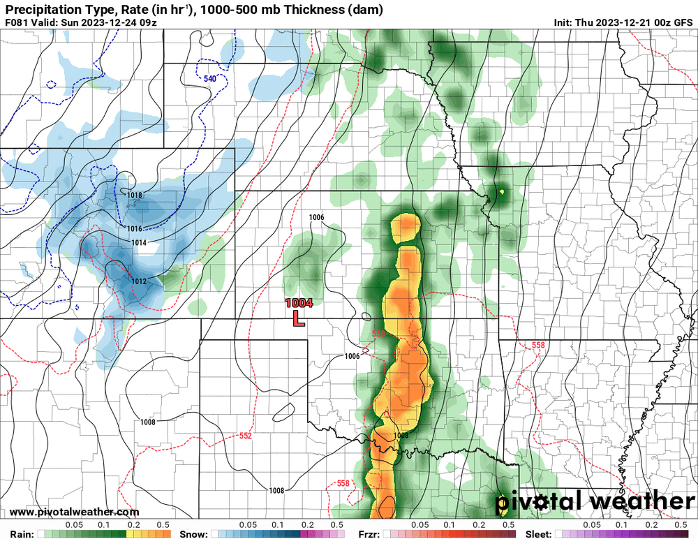
-
this ridge is 99th percentile
-
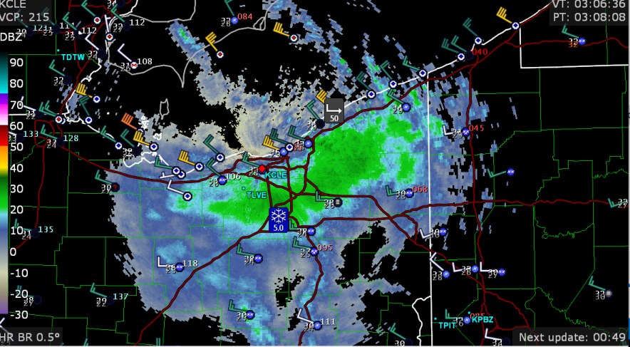
constant lake-effect snow band onshore, with little offshore
-
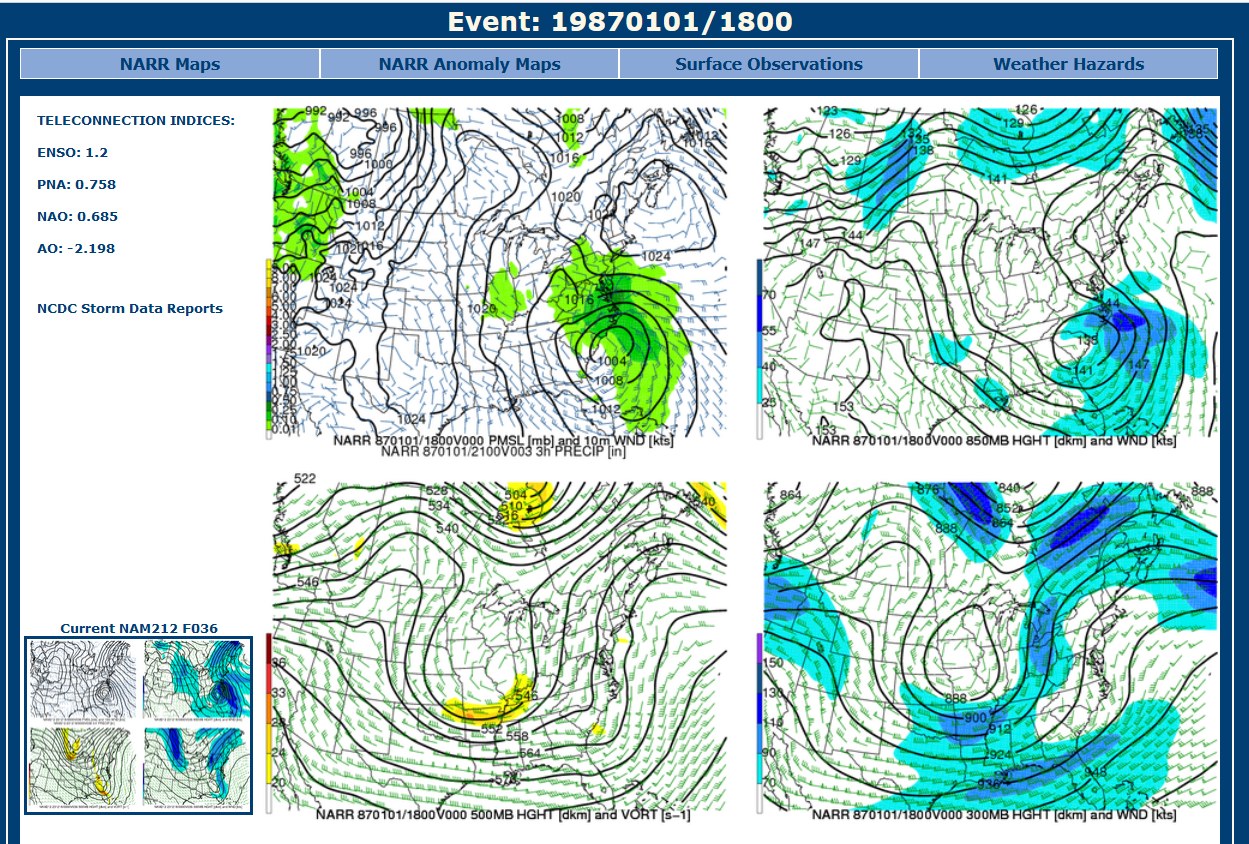
Here's something kind of neat. This storm's top analog for this evening's charts is 1/1/1987, also an El Nino winter. Would've been a washout for maybe New Years eve celebrations like it was a washout for Florida this morning

-
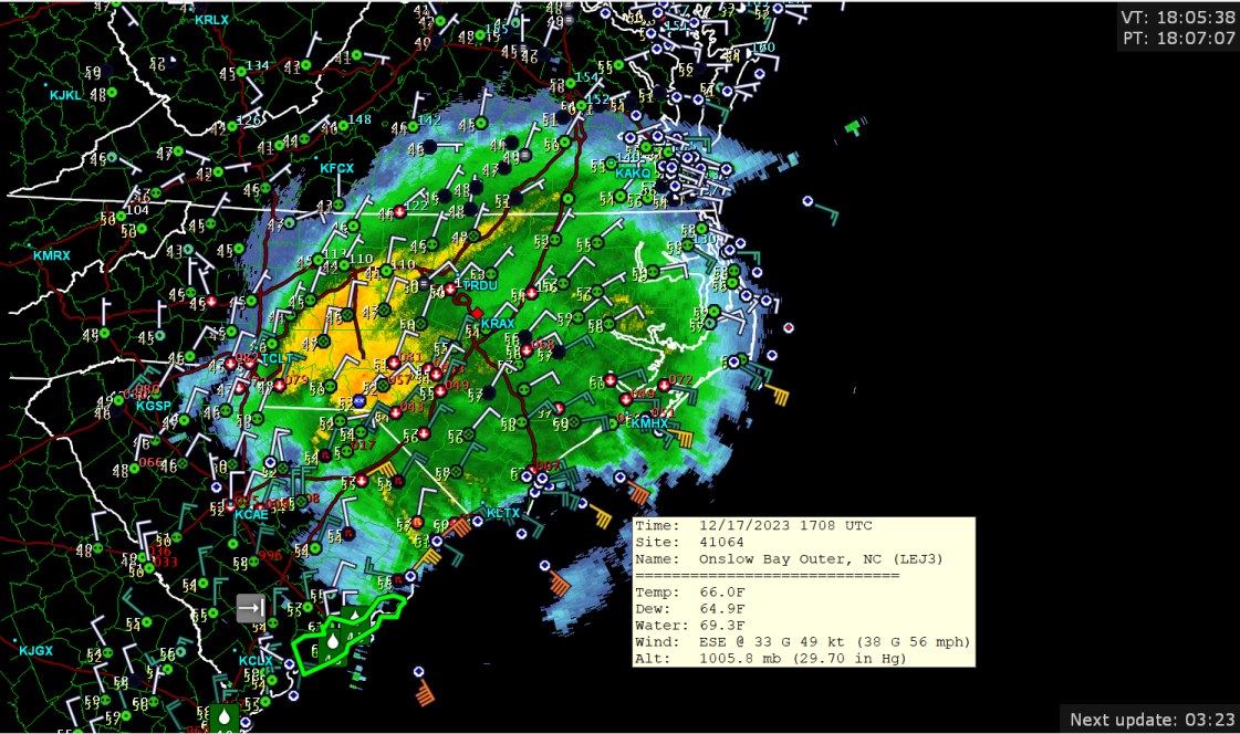
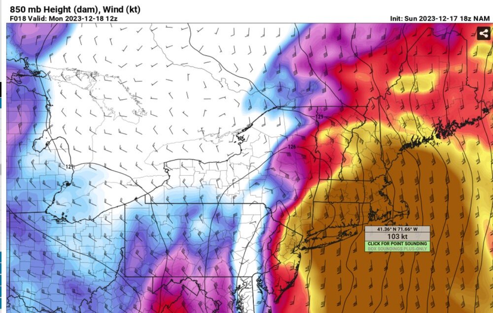
there we go we have a category 3 non-surface wind non-hurricane, but impressive nonetheless. I wonder if the NWS wind warnings for such areas as Rhode Island will be too low with values of 60mph mentioned. Edit: the latest HRRR has around 60kt for parts of New England, max gusts, and that is over 60mph, but also, probably overdone a bit.
-
what is 103 knots on the Saffir-Simpson scale (which doesn't apply)? I forgot.
-
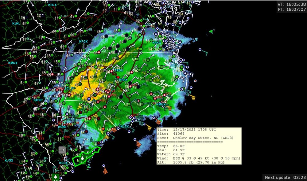
Now that's what you all filling the radar scope with rain, and with 56mph wind offshore
-
yeah, no cold air mass to really work with. No cold air mass to power up that ever-elusive "cold conveyor belt," one of my favorite terms.
-
Sure, rain.
-
Mountain West Discussion- cool season '23-24
Chinook replied to mayjawintastawm's topic in Central/Western States
this is neat.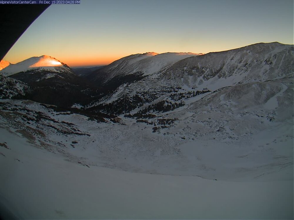

-
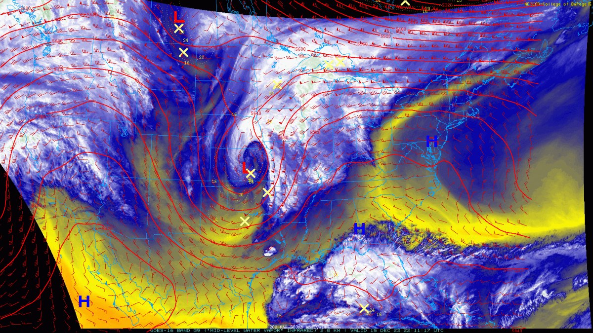
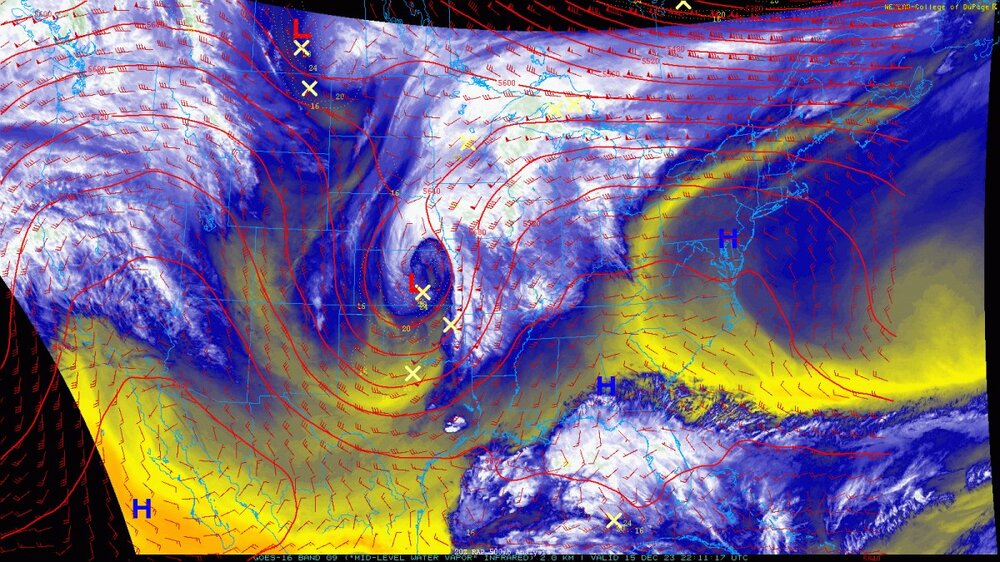
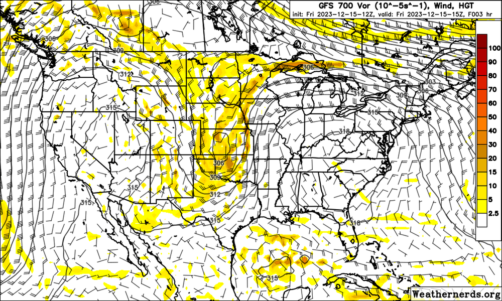
basically three areas of low pressure are going to combine
-
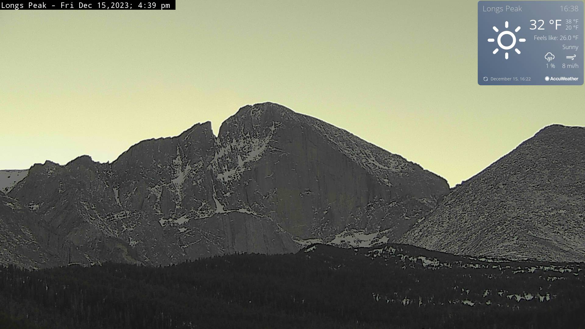
yeah with a million severe weather reports, 2 years ago today! Ouch! Up to 58 degrees here, with dew point of 28, not too much wind. I am starting to believe I'm back in Colorado with wintertime warm days. It's a blue sky with some cirrus clouds, much like a lot of ridge-days in Colorado. I'm walking outside, thinking I'll see a lenticular cloud over Longmont or something, then I remember I'm not there. Thanks, Mr. El Nino! to commemorate our really nice day--

-
Mountain West Discussion- cool season '23-24
Chinook replied to mayjawintastawm's topic in Central/Western States
More of the upcoming El Nino
-
Mountain West Discussion- cool season '23-24
Chinook replied to mayjawintastawm's topic in Central/Western States
this rain and snow is starting to resemble ... something from EL NINO? WHAT?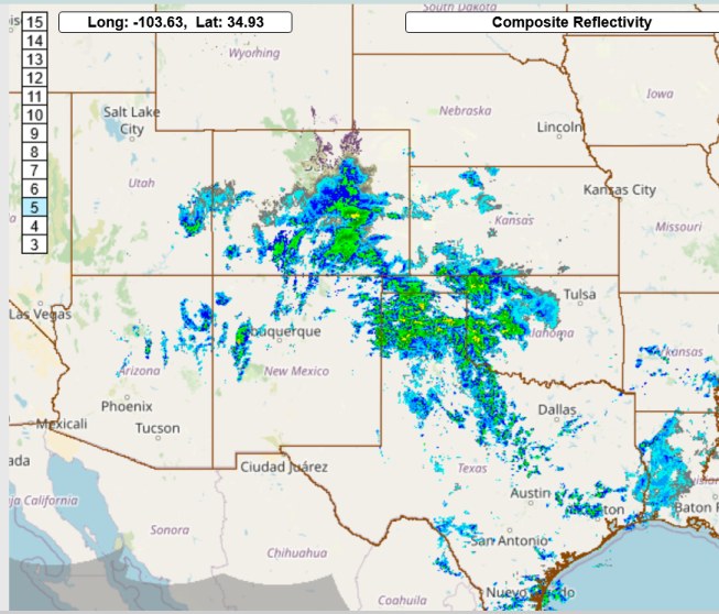
-
Mountain West Discussion- cool season '23-24
Chinook replied to mayjawintastawm's topic in Central/Western States
Moderate snow at Colorado Springs, moderate to heavy snow at Pueblo for a while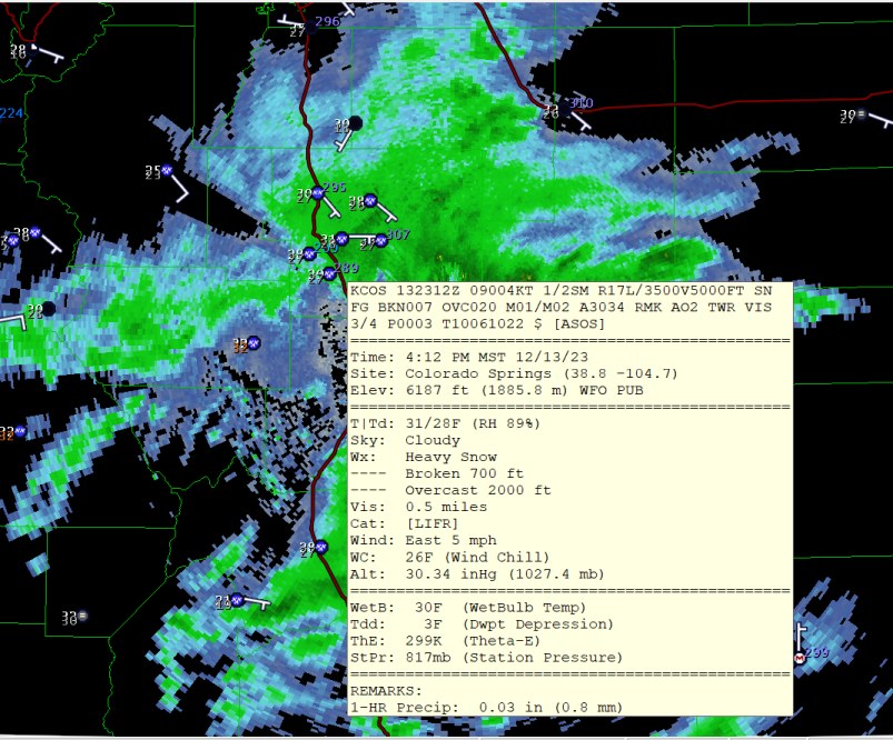
-
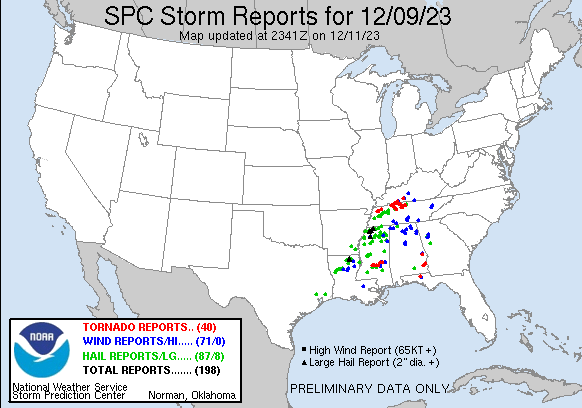
There have been several surveyed EF-1 to EF-3 tornadoes. I believe some news sources say 6 fatalities in Tennessee. The SPC web site says 62 injured at Woodlawn Tennessee. A lot more preliminary tornado reports on the SPC list are not showing any type of EF indicator
-
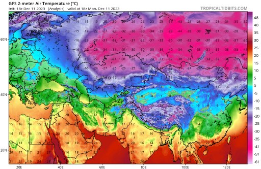
Be glad you are not in Kazakhstan/Russia/Mongolia/China. I think this extremely cold air mass has been developing for 1-2 weeks. Surgut to Omsk had -20F to -40F for their low temps, with high temps nearly the same. It was -30F temperatures in Kazakhstan. Nearly all of the rest of the world (not including Russia) was at or above normal temperatures from Dec 3-9 according to reanalysis plot.
-
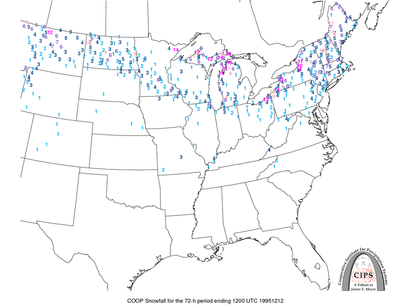
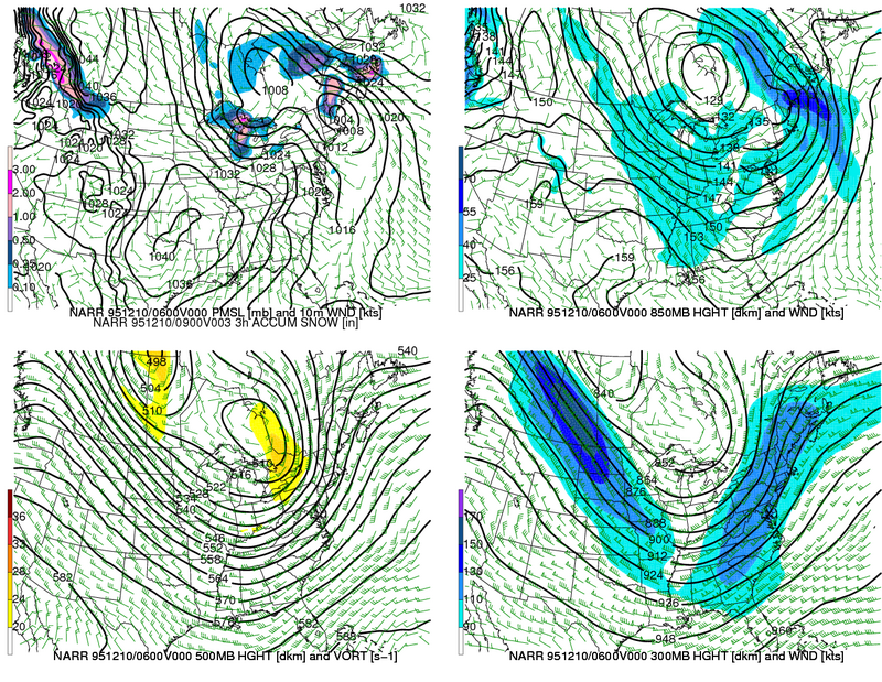
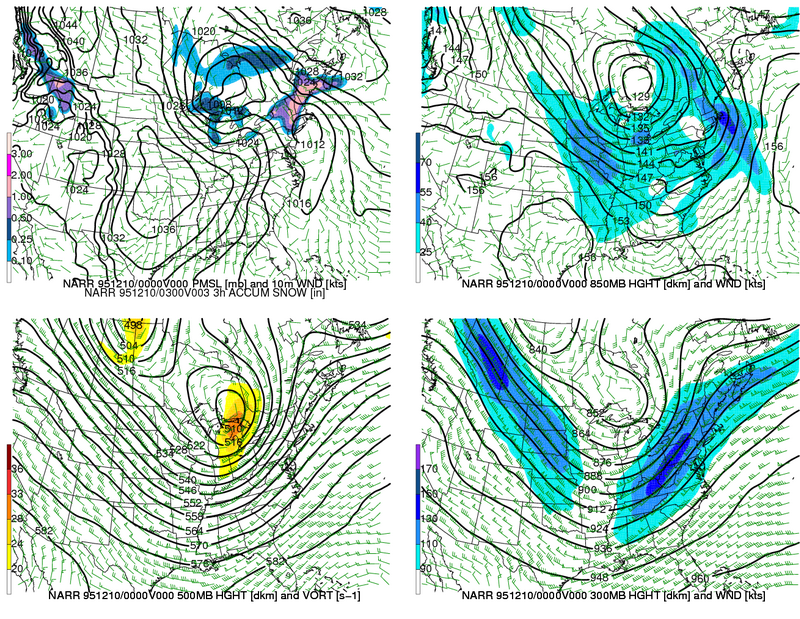
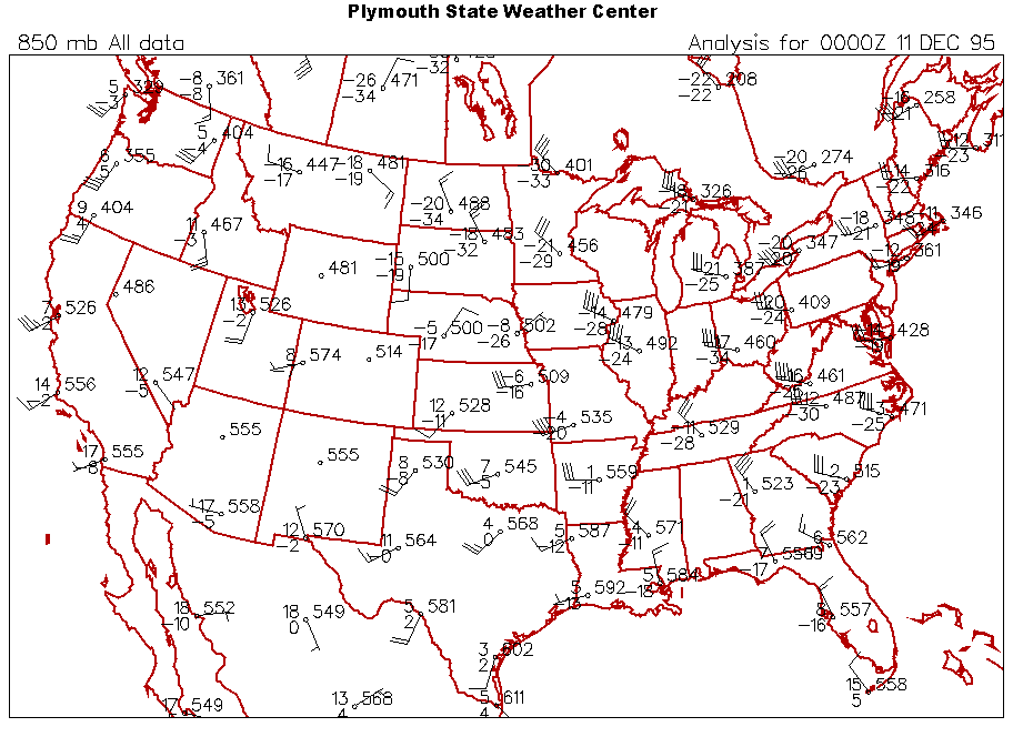
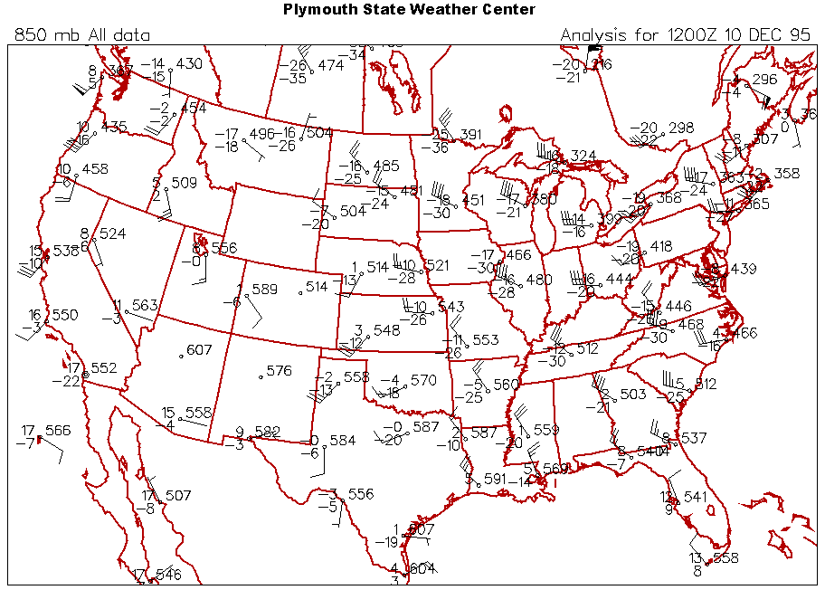
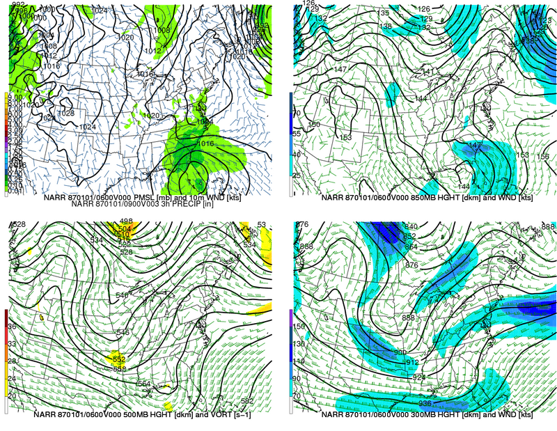
Two years ago today: Mayfield tornado outbreak back on 12/10/1995, an arctic cold front came through the Great Lakes, along with this mini-polar vortex at 500mb leading the way. The combination of synoptic/lake effect snow events gave Sault Ste Marie 56.5" of snow and the snow depth jumped up by 31". Near Lake Erie and Lake Ontario, over 30" of snow happened. As you can see on here, the 850mb temp dropped to -20C with 40 knot winds at Buffalo.