Chinook
-
Posts
10,674 -
Joined
-
Last visited
Content Type
Profiles
Blogs
Forums
American Weather
Media Demo
Store
Gallery
Everything posted by Chinook
-

Plains States Observations and Discussion Thread
Chinook replied to lookingnorth's topic in Central/Western States
small squall-line tornado at Crane MO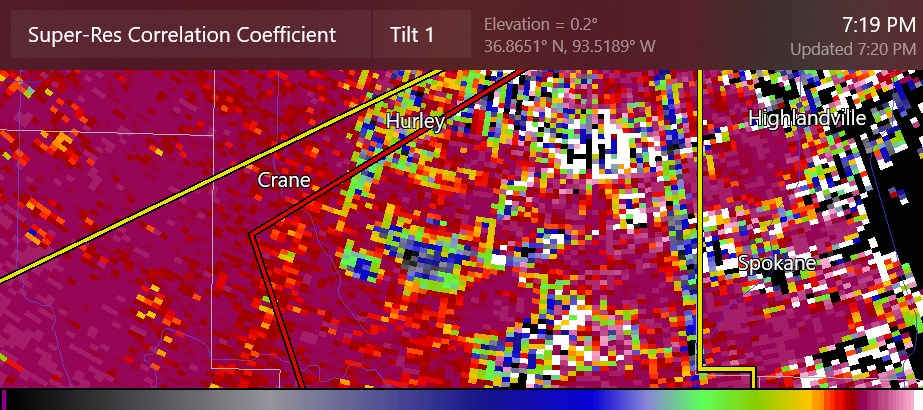
-
Plains States Observations and Discussion Thread
Chinook replied to lookingnorth's topic in Central/Western States
This report icon is actually a funnel cloud, by Branson Missouri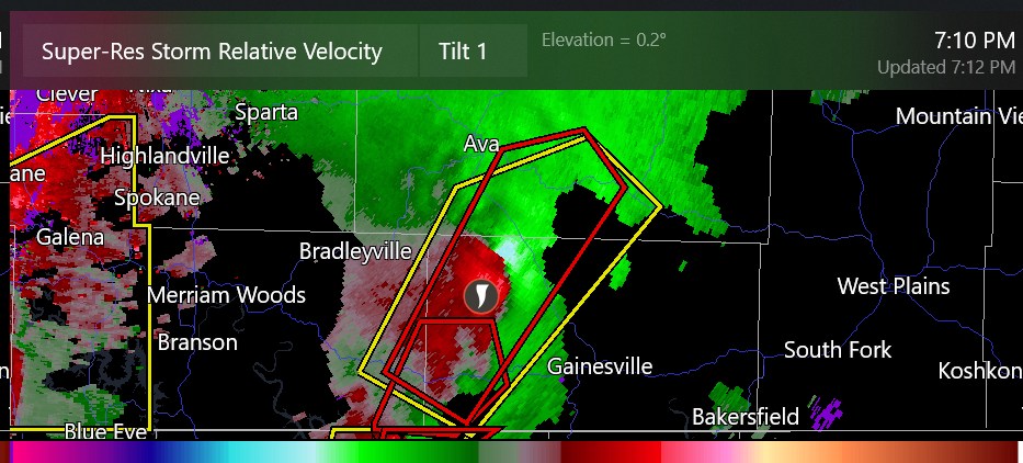
-
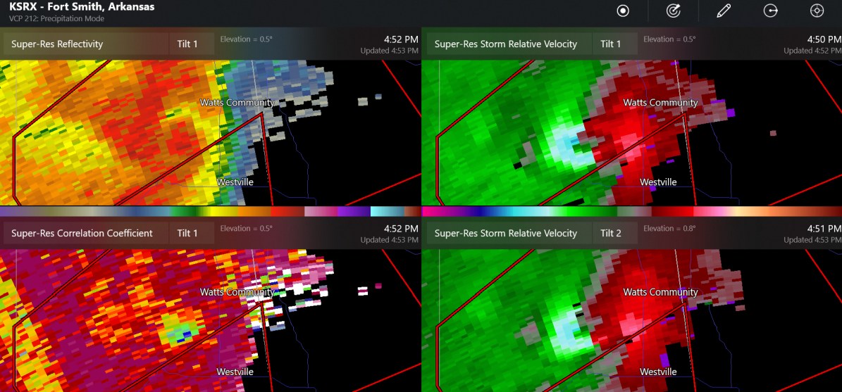
Plains States Observations and Discussion Thread
Chinook replied to lookingnorth's topic in Central/Western States
now this is showing a large debris, with easy to see 70-80mph storm relative winds on the west side
-
Plains States Observations and Discussion Thread
Chinook replied to lookingnorth's topic in Central/Western States
this tornado has tracked maybe 10 miles in eastern Oklahoma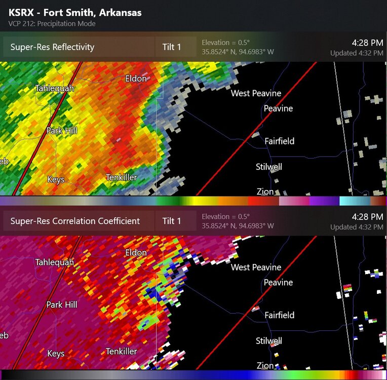
-
with all apologies to Phil Collins of Genesis... here's the next DenverBoulder forecast dicussion. Note NWS-WPC has 1"-3" total QPF in the next week from Denver to the southeastern portion of Colorado
-
Plains States Observations and Discussion Thread
Chinook replied to lookingnorth's topic in Central/Western States
Dallas Fort Worth on the boundary of the 5% tornado outlook (slight risk)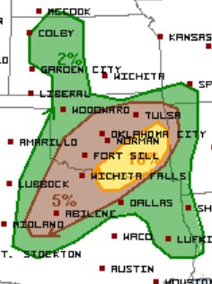
-
multiple models have a 500mb low at the Four Corners. Here is the new GEFS individual models showing significant total snow accumulations for the mountains (and maybe more) from generally 48hr-120hr (2days-5days)
-
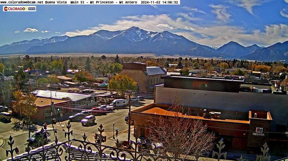
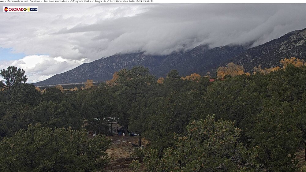
a few days ago this web cam had much more yellows on the trees, much like my yard here in Ohio. You wouldn't tend to think that the peak colors at 7000 ft would be at the same time as some of the Midwest... but it must have been warm.. you know like 8 deg above normal.
-
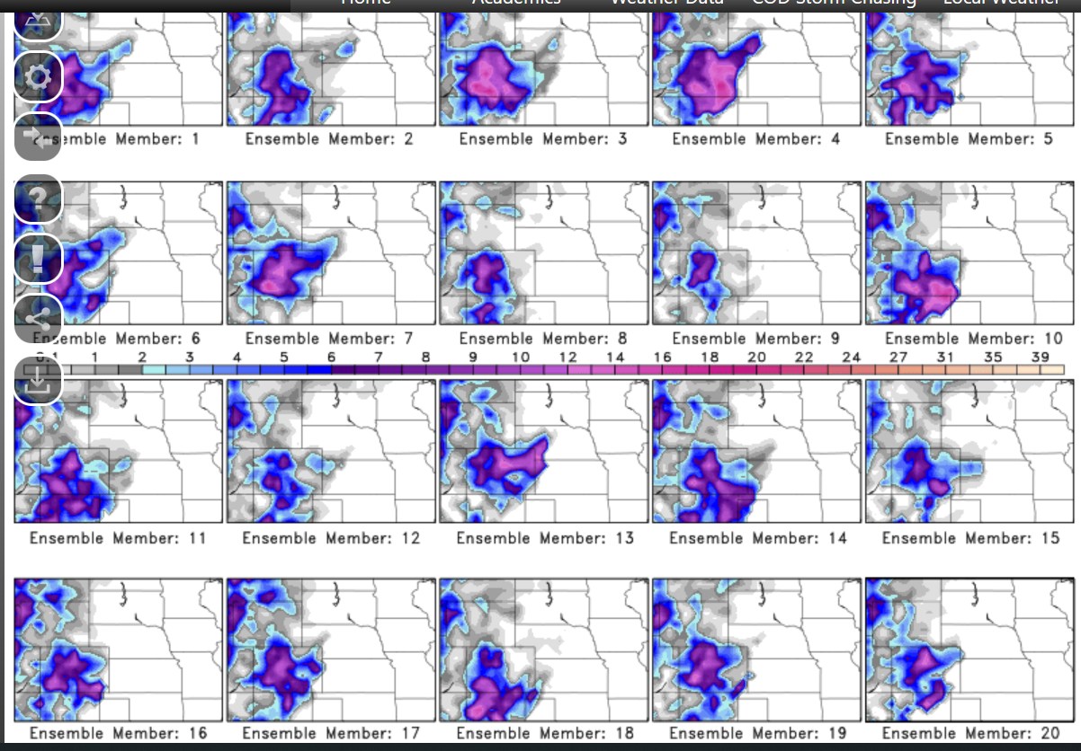
Plains States Observations and Discussion Thread
Chinook replied to lookingnorth's topic in Central/Western States
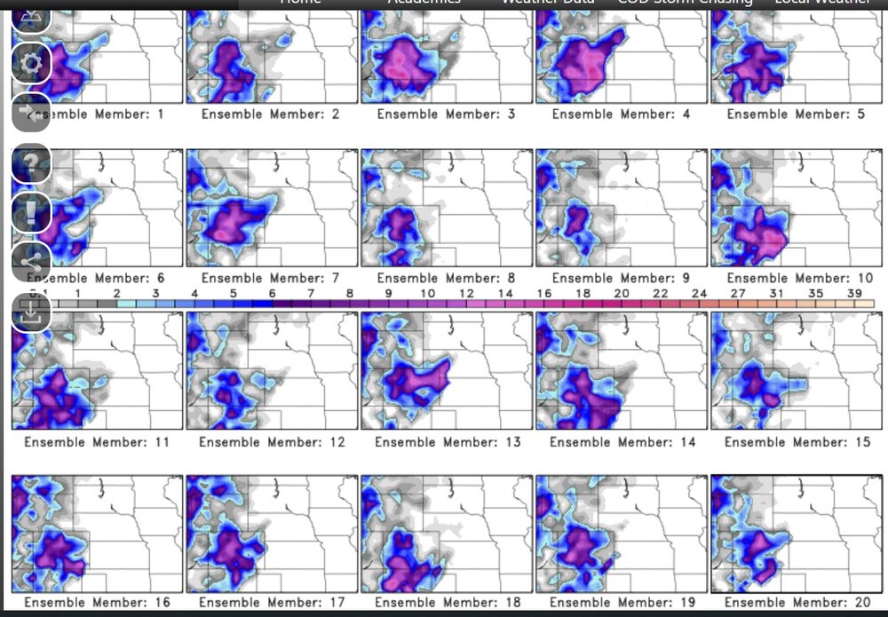
Sunday night. The convective allowing models have, perhaps a mess of a squall line, perhaps a number of supercells. There should be with higher storm-relative helicity available with a chance of significant tornadoes.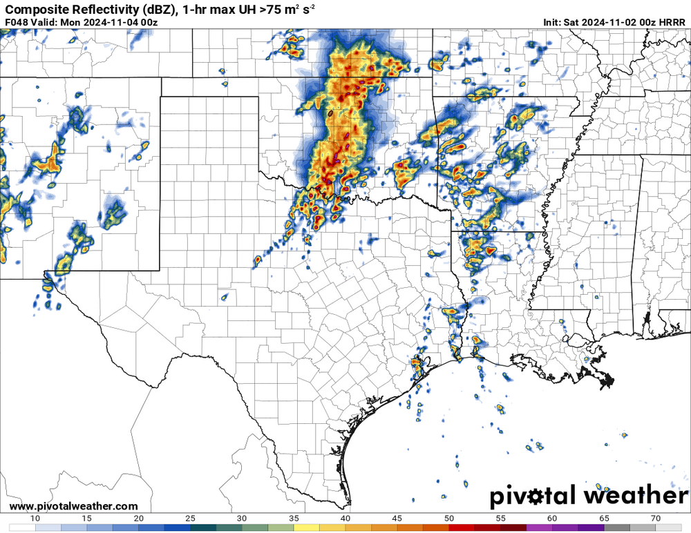
-
Plains States Observations and Discussion Thread
Chinook replied to lookingnorth's topic in Central/Western States
three slight risk effective outlooks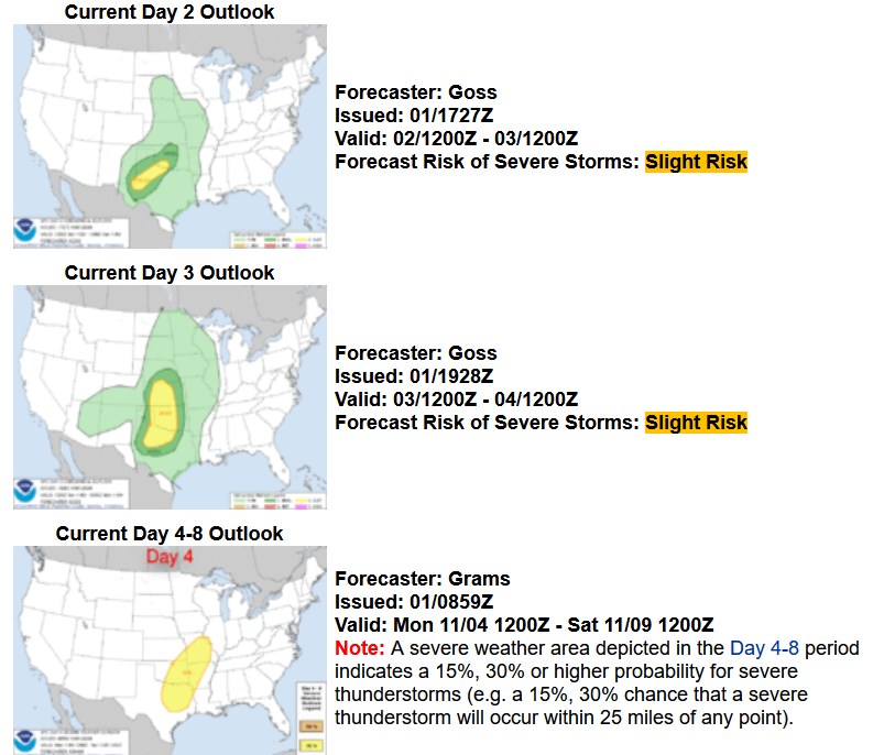
-
the Crestone Baca looking north (apparently), the west side of the Sangre De Cristos. According to that, then it's near "the Crestones," two peaks that I never got to but I sort of imagined myself climbing
-
I found some more web cams
-
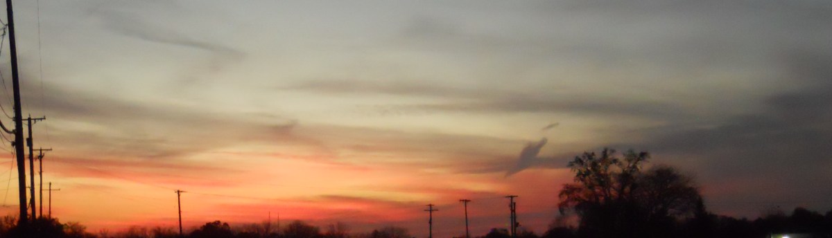
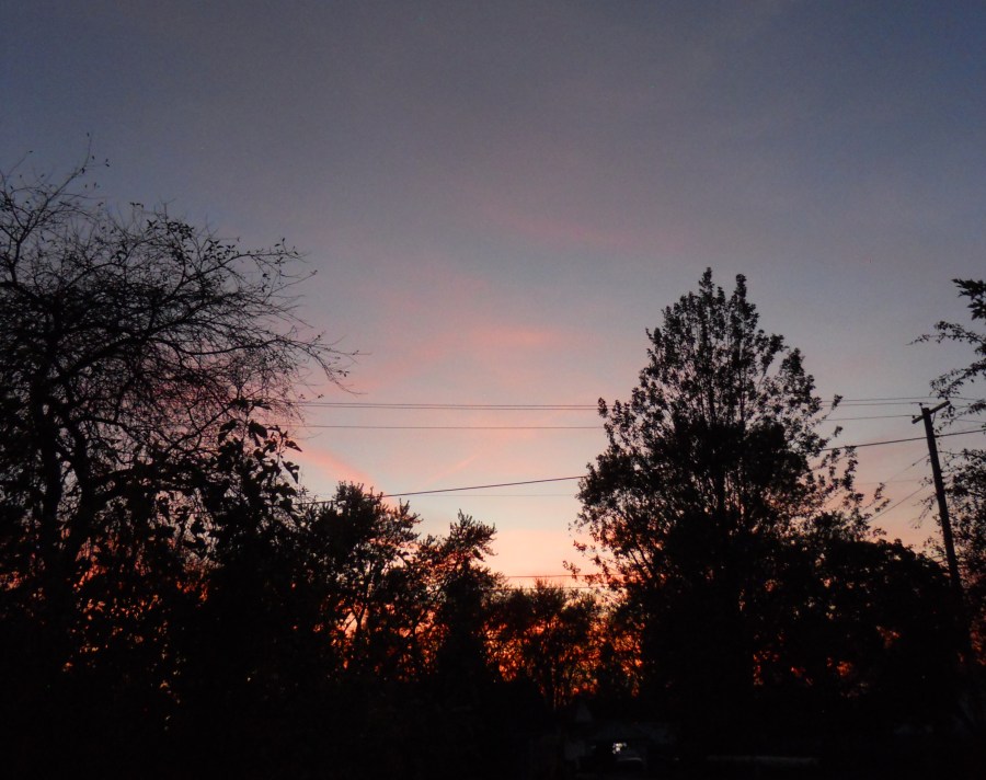
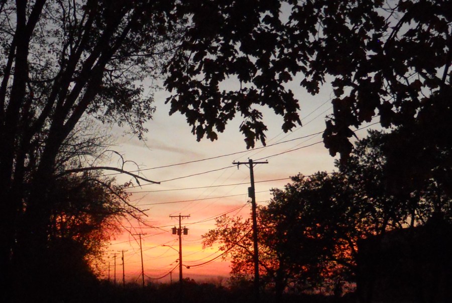
I tried some sunset pics yesterday. Perhaps this symbolizes the end of the summertime weather. It feels like October was 80% clear skies.

-
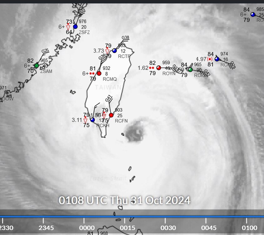
I think RCFN in Taiwan will see some stronger winds soon!
-
Plains States Observations and Discussion Thread
Chinook replied to lookingnorth's topic in Central/Western States
Not a whole lot is going on yet. It might be that this is a fairly weak severe weather outbreak, despite the enhanced risk for tornadoes/wind and decent S.T.P. radar 6:25 central time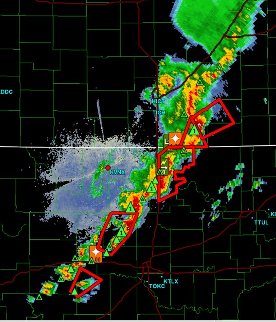
-
Plains States Observations and Discussion Thread
Chinook replied to lookingnorth's topic in Central/Western States
A tornado watch will be issued fairly soon (Wichita, Oklahoma City) -
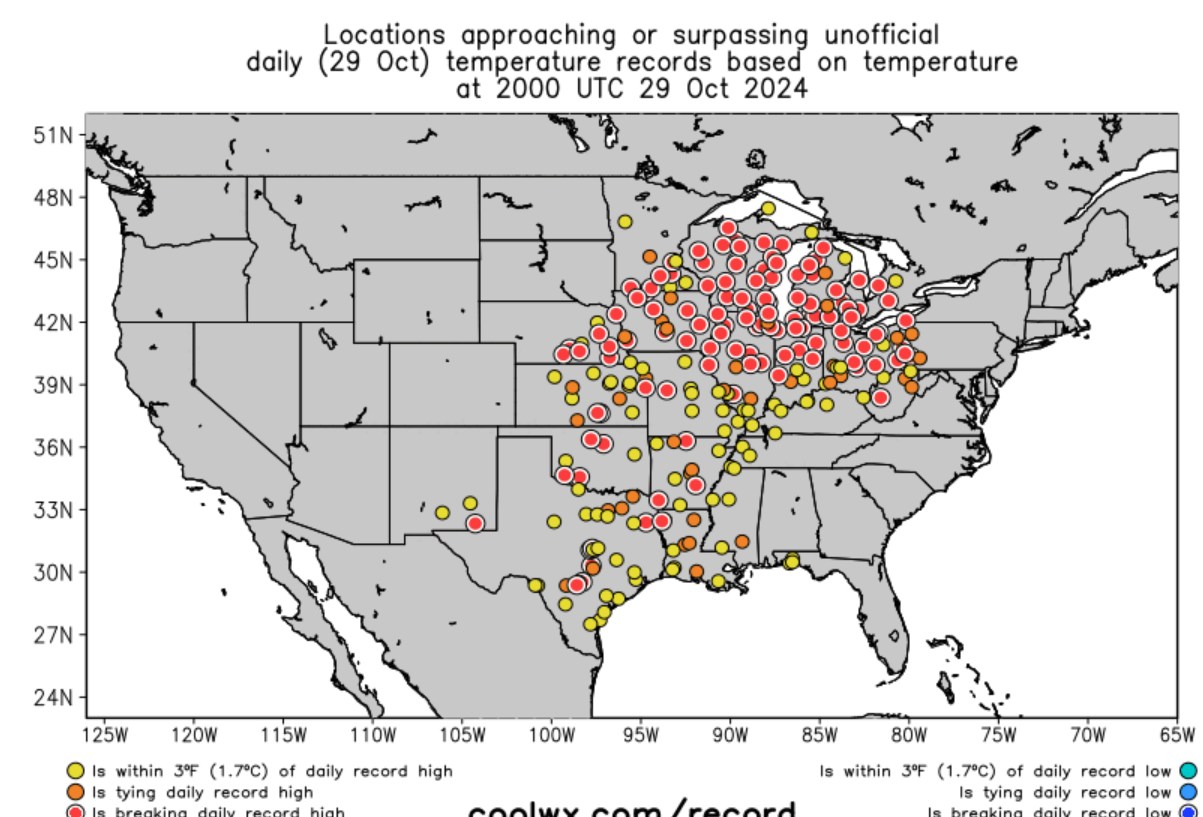
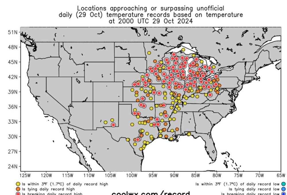
these were record highs
-
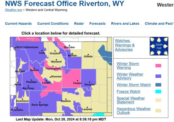
There are some winter weather advisories for UT/CO, and also winter storm warnings for limited areas of Wyoming.
-
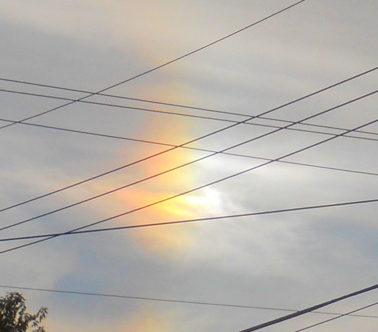
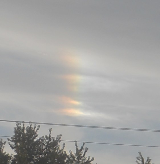
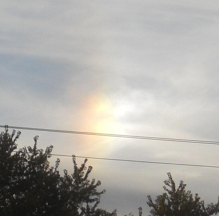
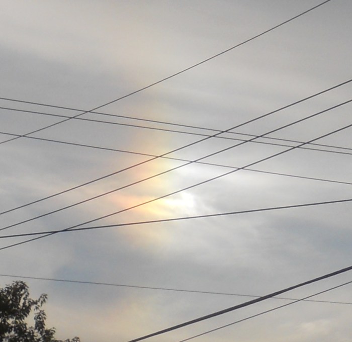
When there's no weather, look for optical effects. (maybe?) I did a bit of color enhancing and/or contrast de-enhancing.
-
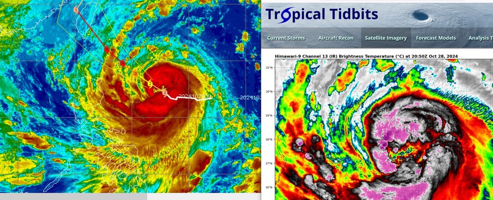
Typhoon Kong-Rey in the Pacific is forecast to be up to 115kt (category-4) before it comes close to Taiwan and perhaps makes landfall on Taiwan.
-
Here is the discussion from Minneapolis, about record high temperatures.
-
I wonder if there's a way to find the average land-temperature of the earth, or perhaps, average land-temperature by continent. Whether that would be a simple number or perhaps a graph involving time (with regard to global warming.) Like, say for example, what's the average land-temperature excluding Antarctica?
-
I spotted the comet on three out of four days (not today). It was nice to see a rare phenomenon with binoculars. It's kind of cool to see something change a bit every day (other than the moon.)
-
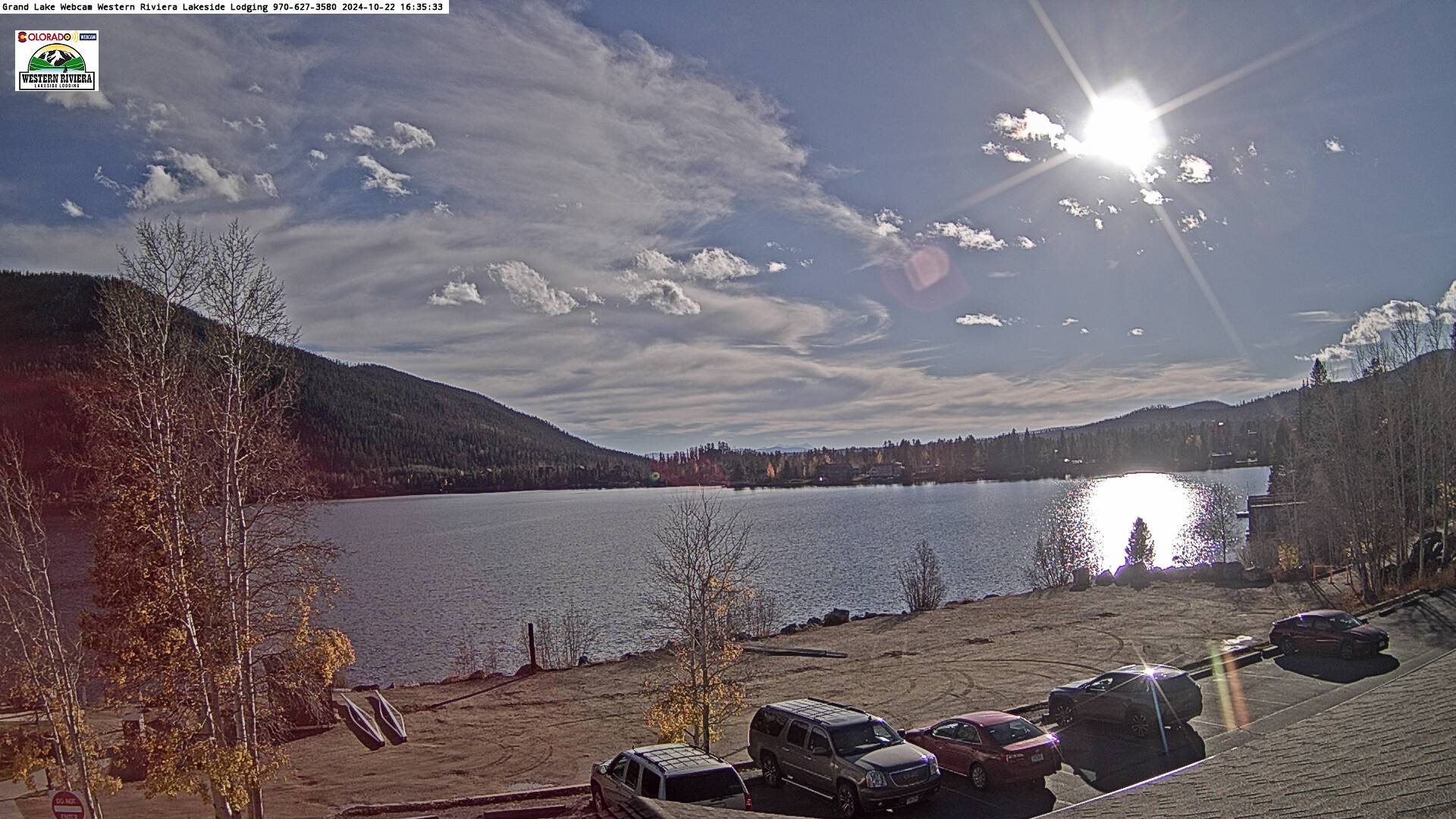
I was looking for some more fun web cams. Grand Lake, apparently facing SW

-
It will be a record-breaking warm October if: Denver gets above 59.9F monthly, 56.2 for Fort Collins, 58.2 for Colorado Springs, 61.0 for Pueblo, 54.4 for Cheyenne